Reno
Road Trip
Going
the slow way
to see the
sights
20150608-16
Back to Bill Caid's Home Page.
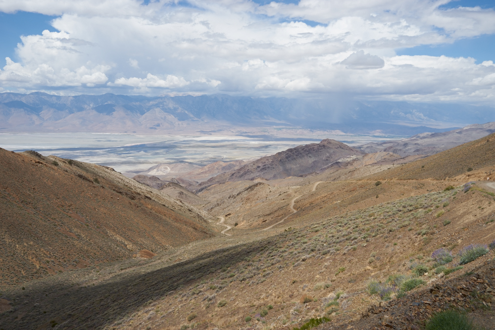
Rain
Squalls Pelt
the Flanks of
the Owens
Valley as seen
from Cerro
Gordo
Ghost Town.
All photos copyright, Bill Caid 2015. All rights reserved.
The Trip
Tracking Our Location Via The SPOT
Some years ago, after a scary mechanical failure in the canyons and mesas of southern Utah, we decided that we need a better way to advertise our position and call for assistance if needed. Kathleen found out about the SPOT which is a GPS locator that transmits your coordinates via satellite so that others can see your location. The location is plotted on Google maps and a "bread crumb" feature is available for an additional fee. We have the enhanced service, so you can see our historical path back 50 updates or so. See our current location plotted on Google Maps in Real-Time via SPOT satellite geo-locator device. This page is "book-markable" and is updated approximately every 15 minutes, but may miss updates due to inability of our transmitter to reach the satellite. The communication is "open loop" so the device never knows if it's messages are actually going anywhere, it just keeps trying until the next update is available. If we are in a congested urban area with high buildings (like Manhattan) or in deep canyons, the position may not update. We try to send an "OK" message once a day just to let everyone know that we are, in fact, OK.Connecting and Contacting Us While on the Trip
Because of internet connectivity issues on a previous trip, we purchased a MiFi cell phone modem that allows us to connect nearly anywhere there is 3G service via cell phone (which is most of the cell phone service area available today). But, as we all know, cell phones are useful many places, but not everywhere has coverage, particularly in the remote areas of the western U.S. Our phones and the modem are enabled daily so you may contact us, although it may take a few days for us to respond. But, we will respond. My email, spelled out, is "bcaid at yahoo dot com".Trip Details
The
link table
below contains
links to the
photos and
dialog
for each of
the days of
the
expedition.
This table
will be
updated as the
trip
progresses.
| Part | Dates | Adventure Locations |
|---|---|---|
|
1
|
20150608
|
San Diego, CA to Trona
Pinnacles |
| 2 |
20150609 |
Trona Pinnacles
to Cerro Gordo Ghost Town |
| 3 |
20150610 |
Cerro Gordo
Ghost Town to White Mountains |
| 4 |
20150611 |
White Mountains
to Reno |
| 5 |
20150612-14 |
Sigma Phi
Epsilon Reunion |
| 6 |
20150615 |
Reno, NV to
Bishop, CA |
| 7 |
20150616 |
Bishop, CA to
San Diego, CA |
Conclusions and Advice to Travelers
The Mojave Desert is a very big place and frequently not that
hospitable to travelers. The weather can go from very hot
to very cold and back in one day. The upper reaches of the
Mojave have very high peaks that approach some of the highest in
North America (14,000 feet) and of course the Mojave also has
Death Valley which is the lowest. As a consequence, the
range of temperatures can be extreme. Plan accordingly and
understand the expected temperatures, particularly in the summer
when heat can be life-threatening.Water is in very short supply and unless you are staying at locations that are known to have water, you will need to be self-sufficient. Services can be few and far between, so plan ahead on fuel to insure that you are not hiking when you were expecting to be driving. High winds and dust are common in this area and attempting to tent camp in high winds can be an exercise in futility.
Back to Bill Caid's Home Page.
Copyright Bill Caid 2015