Our
mission for the day was to get from Bishop in the eastern Sierra
Nevada mountains to San Diego: about 400 miles or so. In
Thor, this is a pretty full day and the trip was made longer by
some of the large mountain grades that we encountered on our
path.
The
photos of the eastern Sierra were taken with my old 6mp Epson
RD-1 rangefinder camera with Zeiss Biogon 35mm manual lens
pointed out the window of Thor while we were rolling at highway
speed.
Our
path took us south along the axis of the Owens Valley along
US-395. The Owens Valley is a case study in feast and
famine. "Back in the day" (before the water was "stolen")
the OV was rich in farms and orchards. But, Los Angeles
bought water rights and took the water south. This much
contested action resulted in civil insurrections, murders and
general discontent for more than 50 years. And it is still
a sore subject with the locals today. If interested, read
"Cadillac
Desert" by Mark Reisner. It is a great history
of water in the west. And trust me, there is NO commodity
that is more precious than water.
The photos below are what we saw.
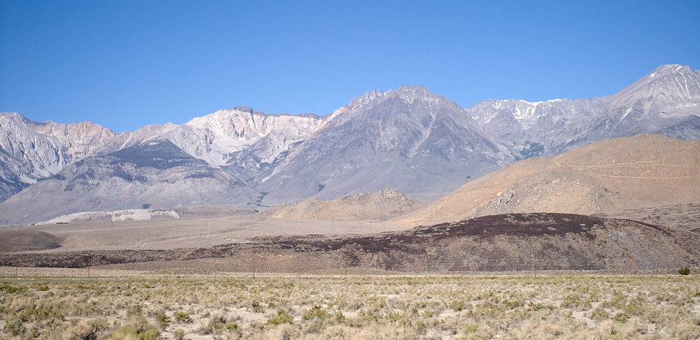
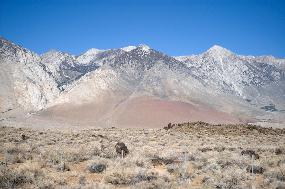
The
morning sun illuminated the eastern slopes of the Sierra Nevada
during our drive south. The photo above is noteworthy
because it shows some of the interesting geology of the
area. Note the dark brown lower hills -- this is
lava. The upper cliffs of the mountain expose lighter
color rock and have a darker cap rock. The upper cliffs
still have some snow on them despite warm temperatures in the
valley floor.
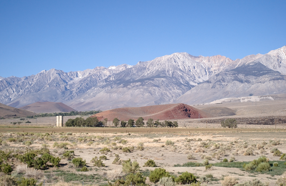
Note the
volcanic crater behind the trees. There is another crater
just above the storage silos at the left of the photo
above. The eastern slopes are part of the Owens Valley and
have a number of small farms. The Los Angeles Municipal
Water District (MWD) purchased most of the water rights in the
Owens Valley back at the turn of the (previous) century thus
starving most of the valley ranchers for water. The water
flows south via a much-contested aqueduct to serve both LA and
San Diego.
The side
canyons are the only areas that have water. The output of
these canyons is siphoned into the aqueduct and shipped south.
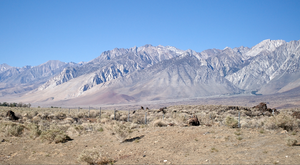
These
are rugged mountains and the foothills were frequently covered
in lava from nearby volcanic craters. Note the lava rock
at the base of the foothills and the crater near the left edge
of the photo.
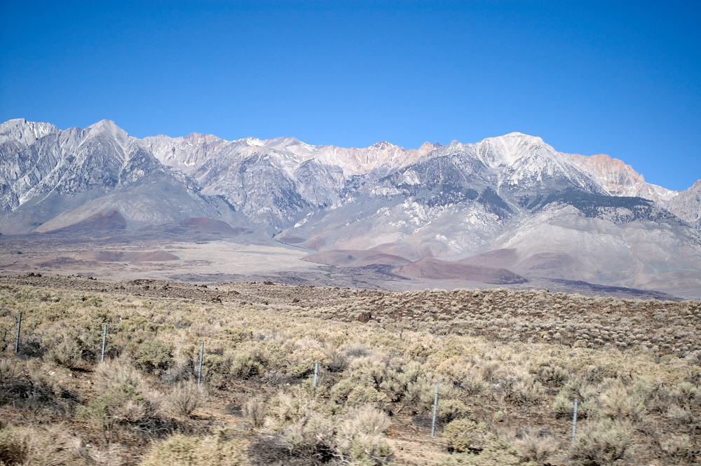
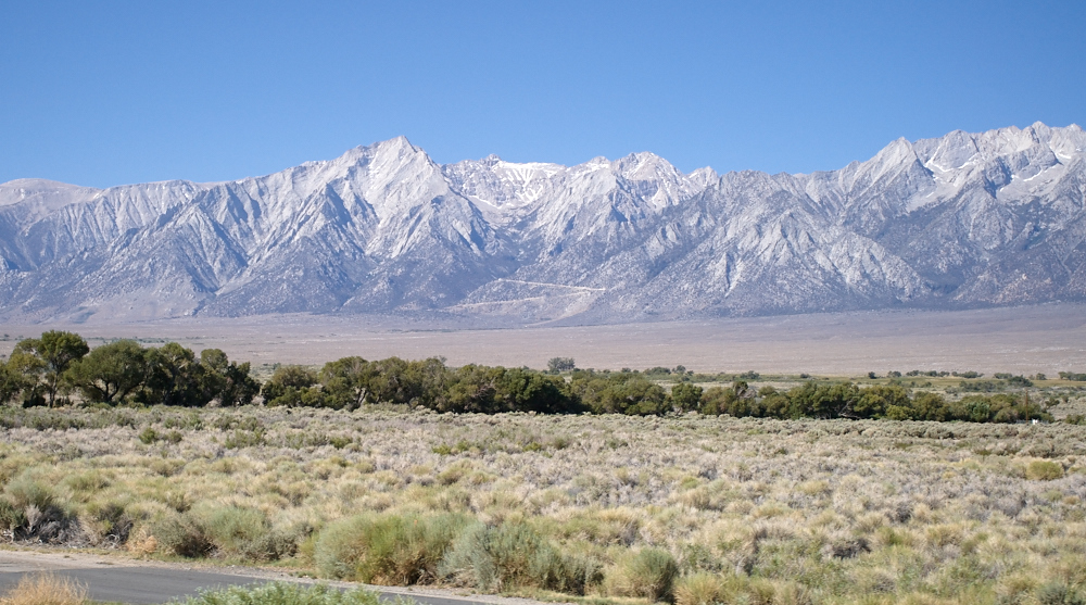
The
Sierra Nevada is a high, rugged range that was a nearly
impassable barrier to early travelers. It is still a
challenge today and the southern Sierra (the highest part) only
has a few passes in several hundred miles of mountains.
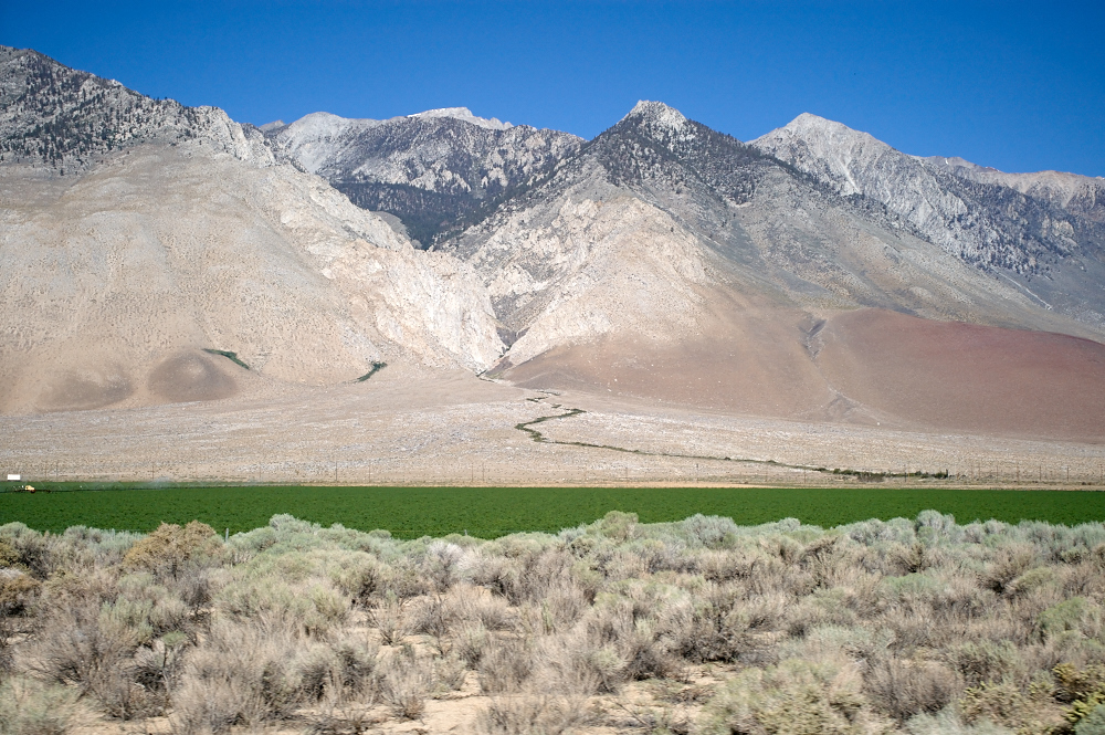
This
photo shows the truth about the arid west: if you don't water
it, it does not grow. The small stream that comes out of
the steep canyon allows the fields to be verdant green.
The adjoining terrain is scrub brush.
Further
south, we got into higher terrain that still had snow at the
peaks. There is a small creek near the center of the photo
which supports the trees that can be seen there.
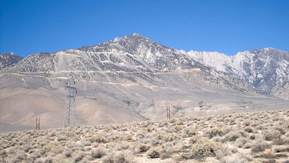
A big
portion of the infrastructure in the eastern Sierras was built
in support of the aqueduct that supplies Los Angeles.
These power lines are part of that infrastructure. Note
the intense road up the side of the mountain face.
We had
studied maps and Google Earth before our departure from
Bishop. There was a point of interest near US-395 at the
southern end of the Owens Valley called "Fossil Falls".
Fossil Falls is the remnants of an ancient water fall that was
active during the last ice age. The river bed was cut
through a volcanic lava flow resulting in an interesting
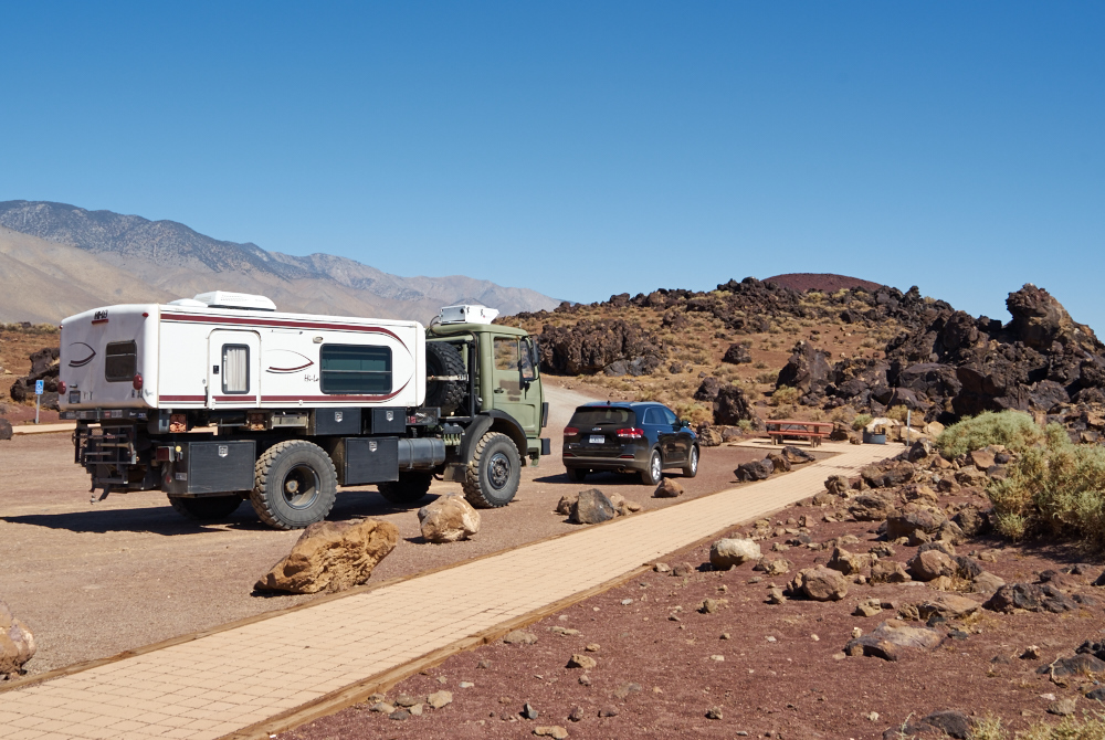
canyon. Since we were driving right past it, we decided to
check it out. Above, Thor dwarfs a regular SUV in the
parking lot at Fossil Falls.
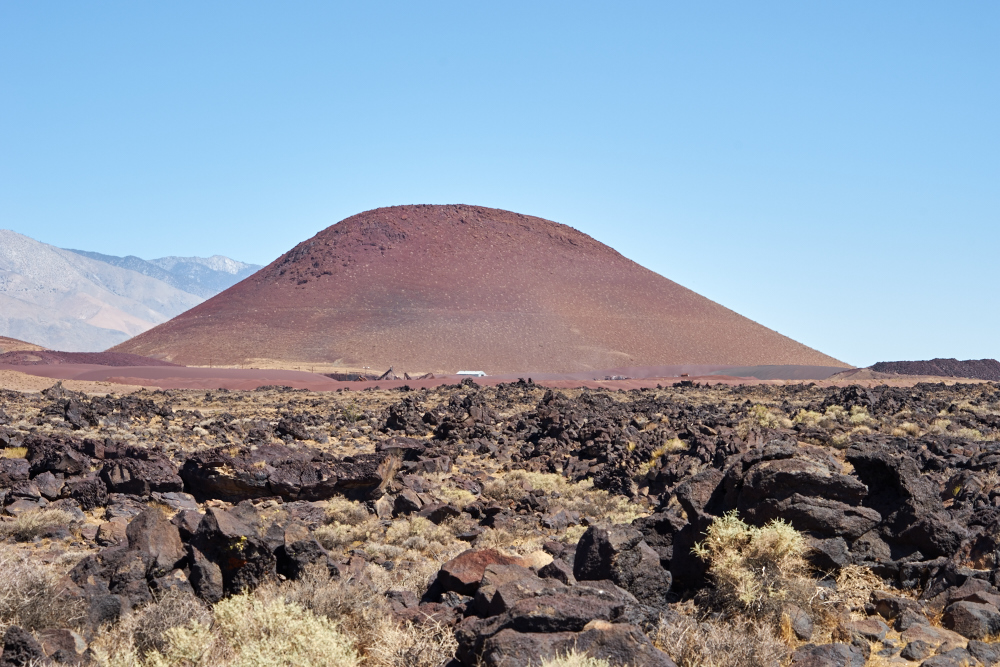
To the
north of the parking lot is a large cinder cone. The cone
is being mined for cinders that are likely put into BBQs as part
of the heating surface. Some of the mining equipment is
visible at the base of the cinder cone. Note the gnarly
lava rocks in the foreground. These are sharp, very hot in
the summer and difficult to walk on.
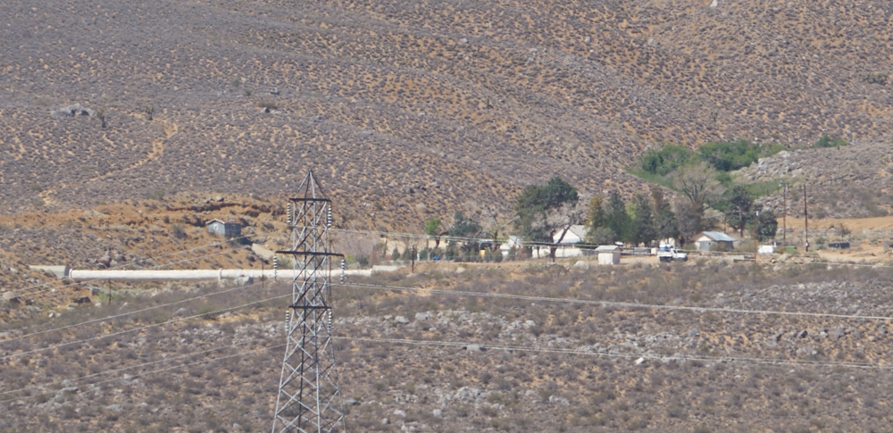
To the
far west of our position at the base of the mountain is the
aqueduct. A portion is exposed at the left of the photo
above. The power lines carry energy generated by the water
coming through the pipes as it loses altitude during its travel
south in the Owens Valley. The structures are part of the
pipeline caretaker's residence.
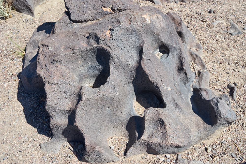
At
Fossil Falls, this rock shows "fluting" that is the result of
hydraulic action on the rock. The rock has been polished
smooth by the sand and grit carried in the water. Eddies
in the current produce the flutes.
Once you
realize what you are looking at, the flutes were everywhere.
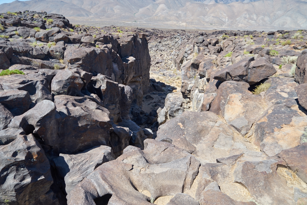
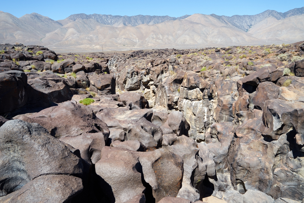
This
canyon was the main water course and was a roaring stream during
the last ice age. Notice the fluting on the rocks on the
left bank. Given the barren, arid terrain today it is hard
to imagine a large river flowing here.
Water,
when armed with an abrasive like sand, acts like a cutting tool
and can erode the hardest stone given enough time and strong
enough flow rates. The deep flutes in the canyon wall
provide visual proof of this power.
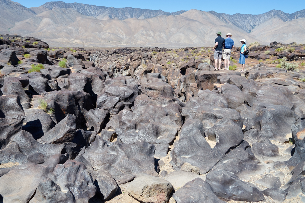
These
tourists were from Germany and were marveling at the
sight. The flutes were everywhere.
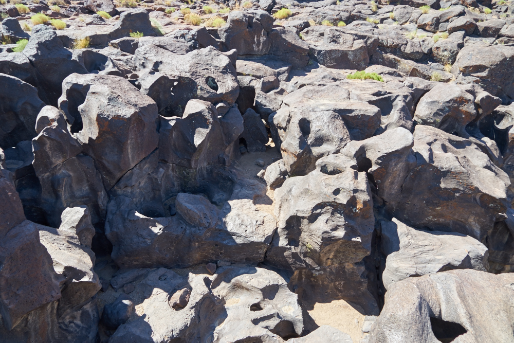
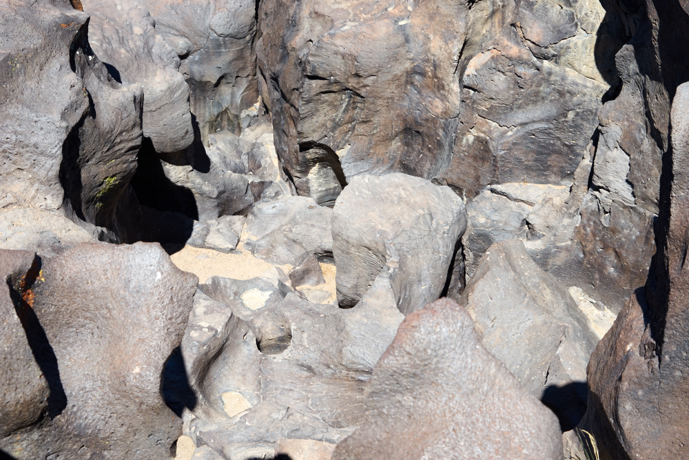
The
narrow crack in the lava channeled the water and increased its
speed and cutting power.
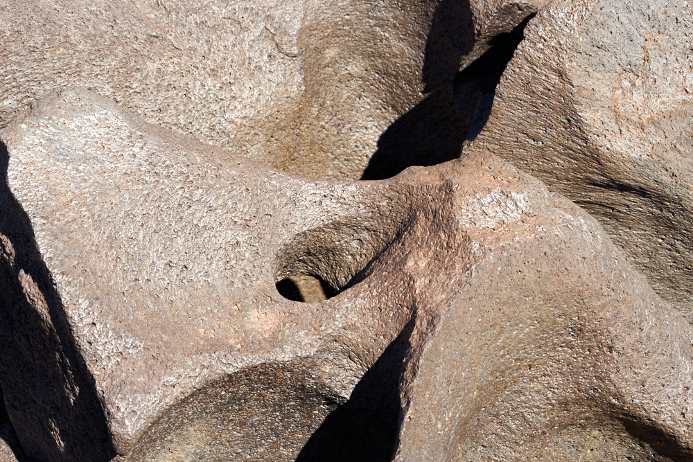
Here the
hydraulic action cut loops and eyes into the volcanic rock.
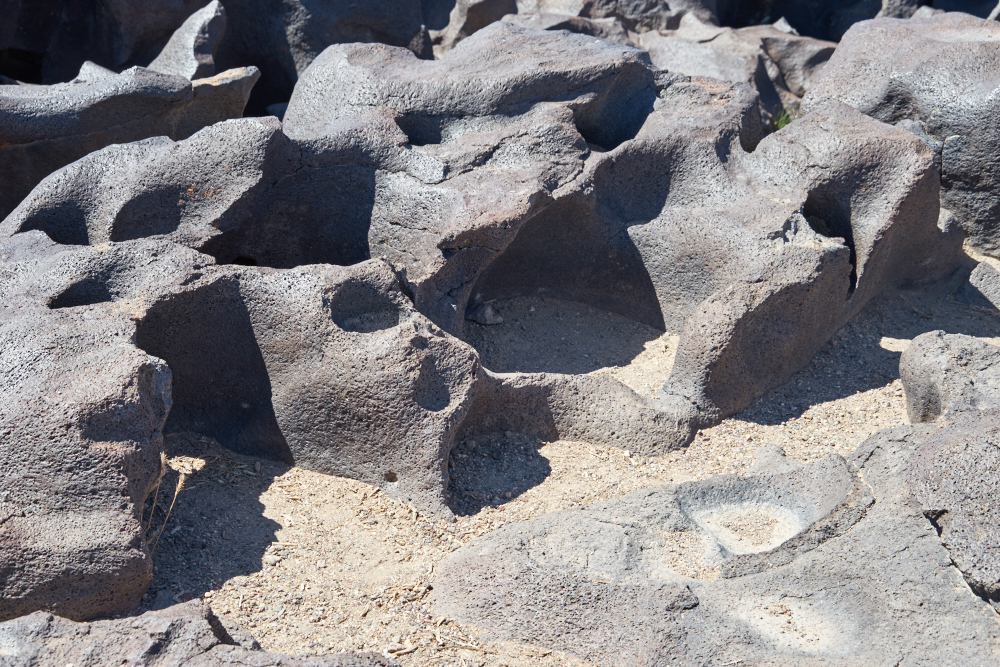
Near the
base of the falls the powerful hydraulic action combined with
abrasive sediment in the water cut deep pockets into the rock.
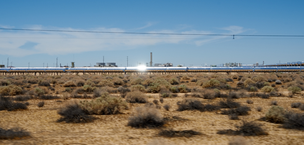
Near
Boron, we passed a large solar collector in operation. The
sunlight is captured as part of what is called "thermal
solar". Collected heat us used to make steam to run a
turbine generator. This is opposed to "photovoltaic solar"
which turns sunlight directly into electricity.
| Previous Adventure | ||
| Trip Home Page |
Photos and Text Copyright Bill Caid 2015, all rights
reserved.
For your enjoyment only, not for commercial use.