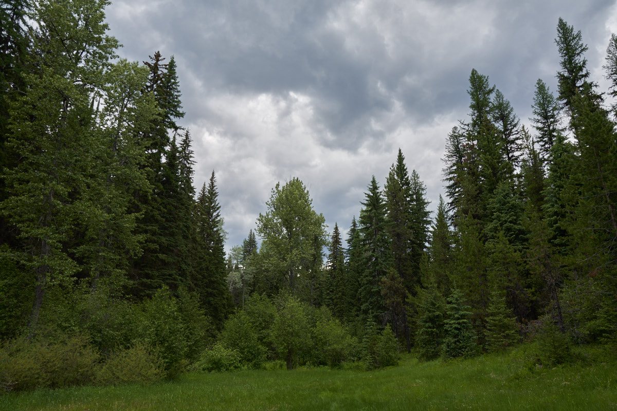
We
spent the night at a Forest Service camp called Tuchuck on Trail
Creek. The following morning we broke camp and headed
further up the canyon with the intention of fully crossing the
mountain range. Fate would deal an alternate outcome.
The photos below are what we saw.
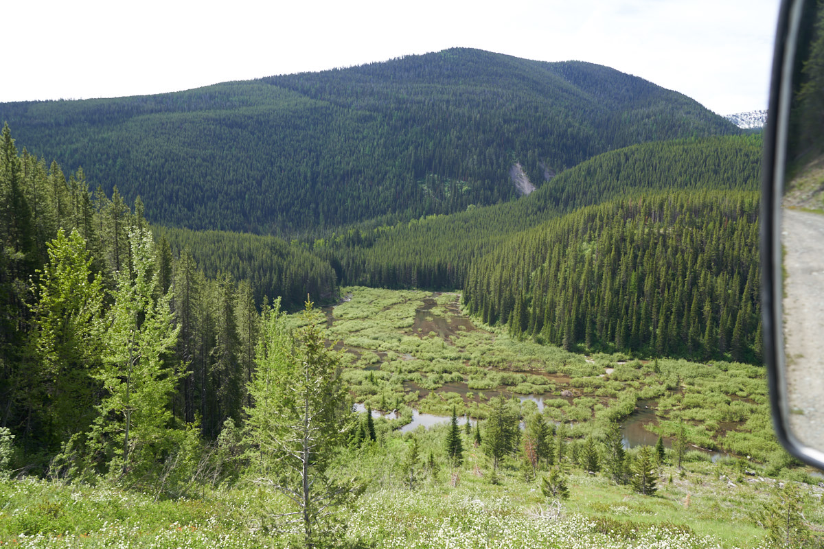
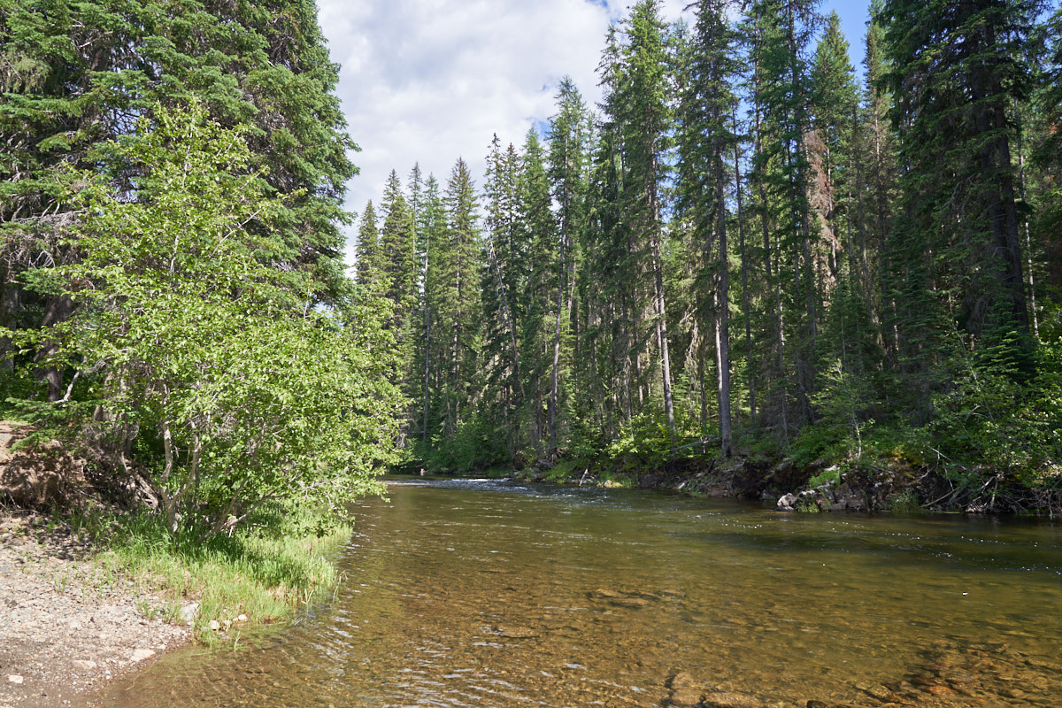
As we
started up the trail we hit an exposed section that gave us a
view of the river valley below.
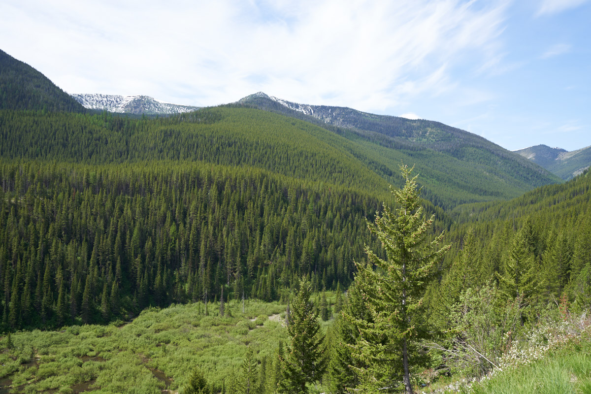
Looking
southwest from the trail we could see persistent snow on the
peaks on the nearby ridge.
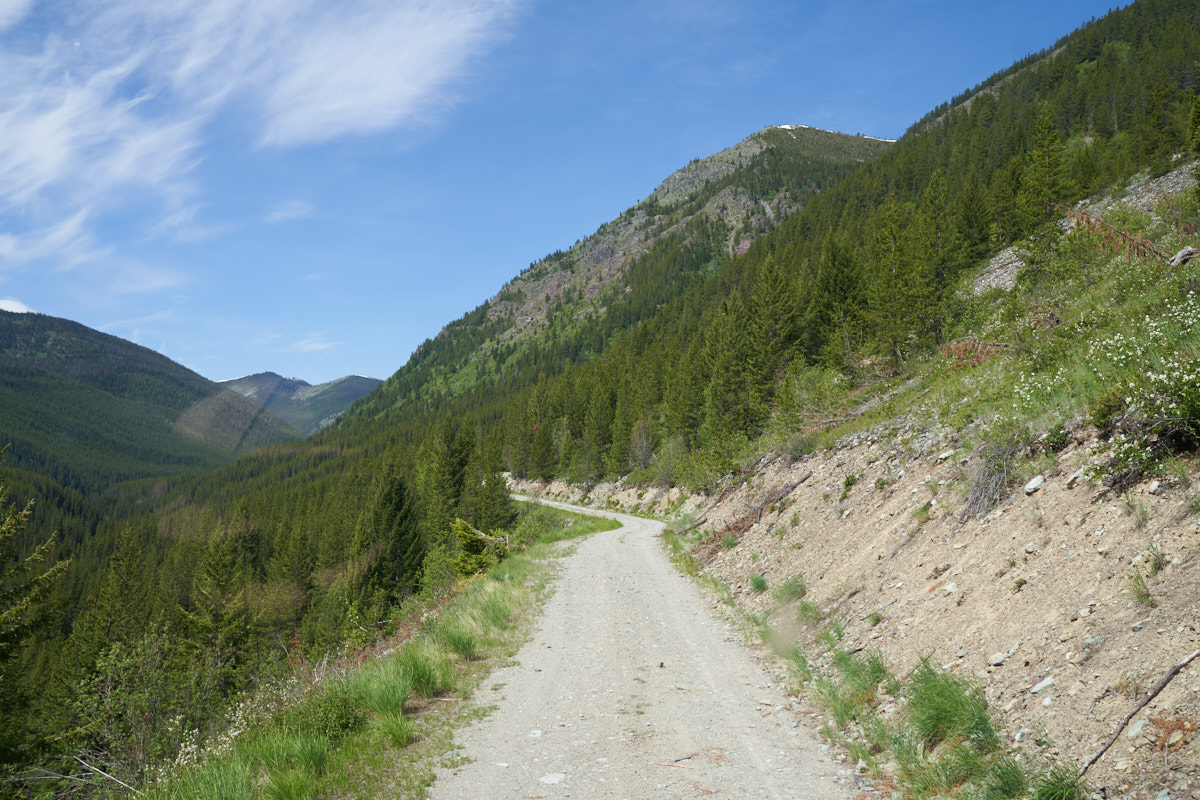
The
trail generally followed the contour lines of the topography but
our side of the canyon had multiple slides resulting in rocks on
the trail. The bright spot at the left-center of the photo
above is a reflection from the windshield as I was too busy to
dismount for a photo.
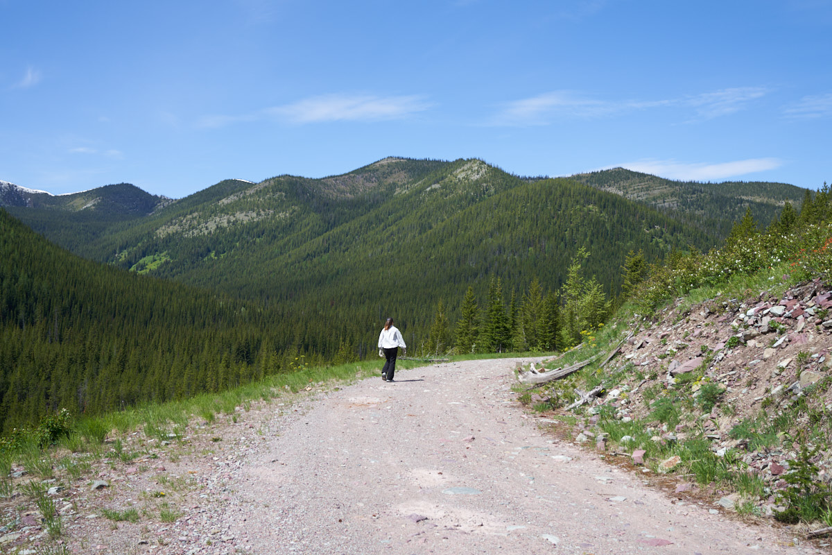
Kathleen
dismounted and walked ahead clearing loose rocks out of Thor's
path.
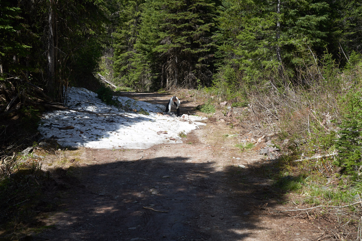
After
dodging large rocks in the trail we came to a real
obstacle. Having battled snowbanks with my mog and gotten
stuck twice at the same place, we treated this situation with
respect. Kathleen and I were both concerned; not about the
snow, but rather the bog at the right side of the trail.
Swinging wide would put Thor's passenger wheels in the muck, so
we planned to stay out of that area. Thor passed this snow
bank with ease, but a surprise was waiting ahead. Earlier,
we encountered a civilian in a pickup that told us that he
turned around at a snow bank and that he doubted that we could
pass it, even in Thor. After this obstacle, we had to
wonder if it was THIS snow bank that he described.
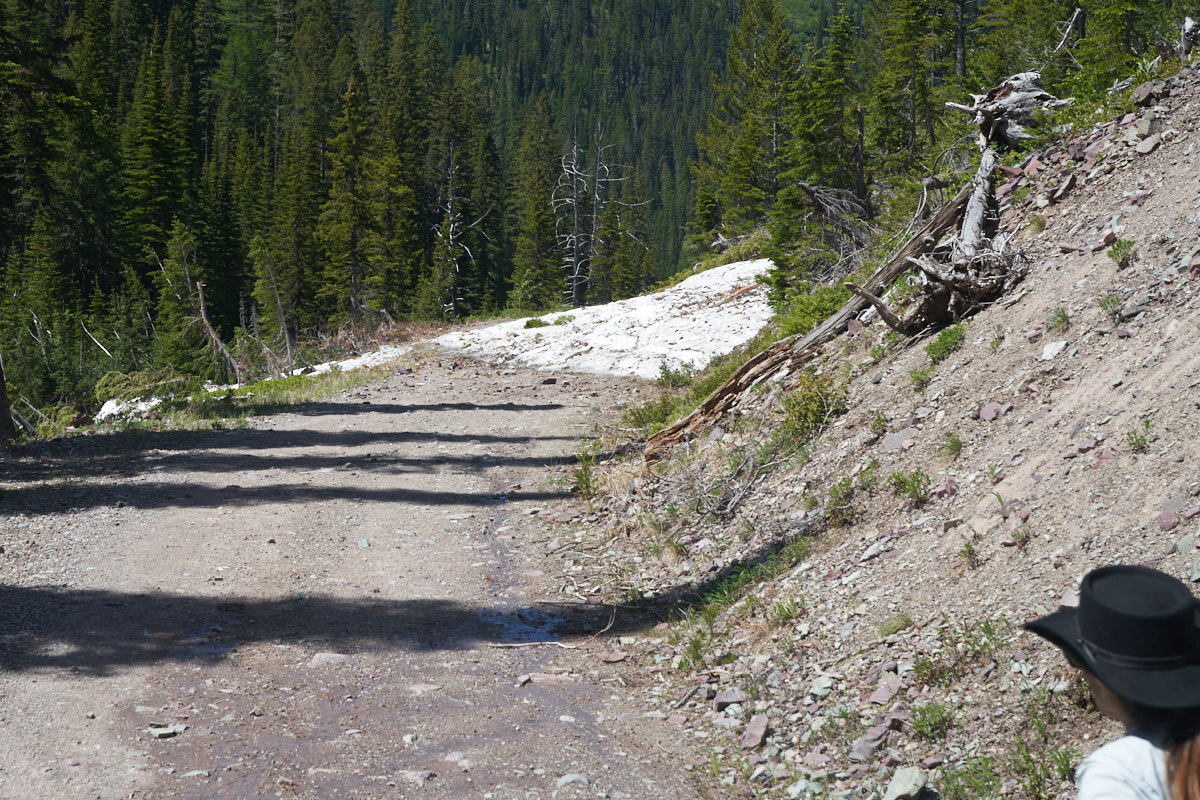
We
traveled another few miles and encountered a much bigger snow
bank, perhaps a meter deep. This bank was underlain by a
landslide that brought large boulders with it. So, for us,
this was the end of the trail. This was, in fact, the snow
bank the pickup dude had described. Tragic that we were
only a few miles from our objective and would now have a full
backtrack in our future.
End of
the road for us. I had to back Thor for a couple hundred
meters on the steep, narrow trail to get to a place wide enough
to turn around. But with Kathleen spotting it was easy.
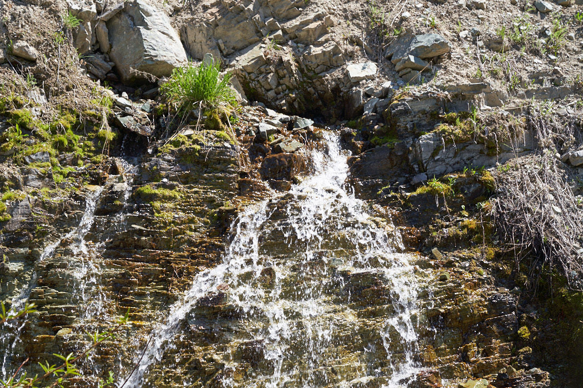
On our
way down the canyon we noticed a spring gushing out of the face
of the cliff.
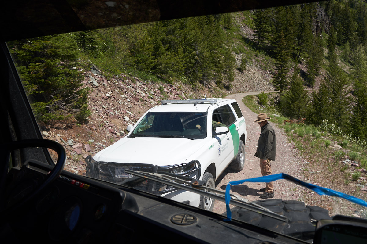
A bit
further down the canyon we encountered a DHS guy (Border Patrol)
that was running this trail as well. Above, I told him
that without a winch and a buddy with a winch he would likely
not be able to pass the snow bank. He drove up to check it
out, but was in my rear view mirror within 15 minutes after
having concluded that our assessment was correct. We let him pass us
and we went our separate ways.
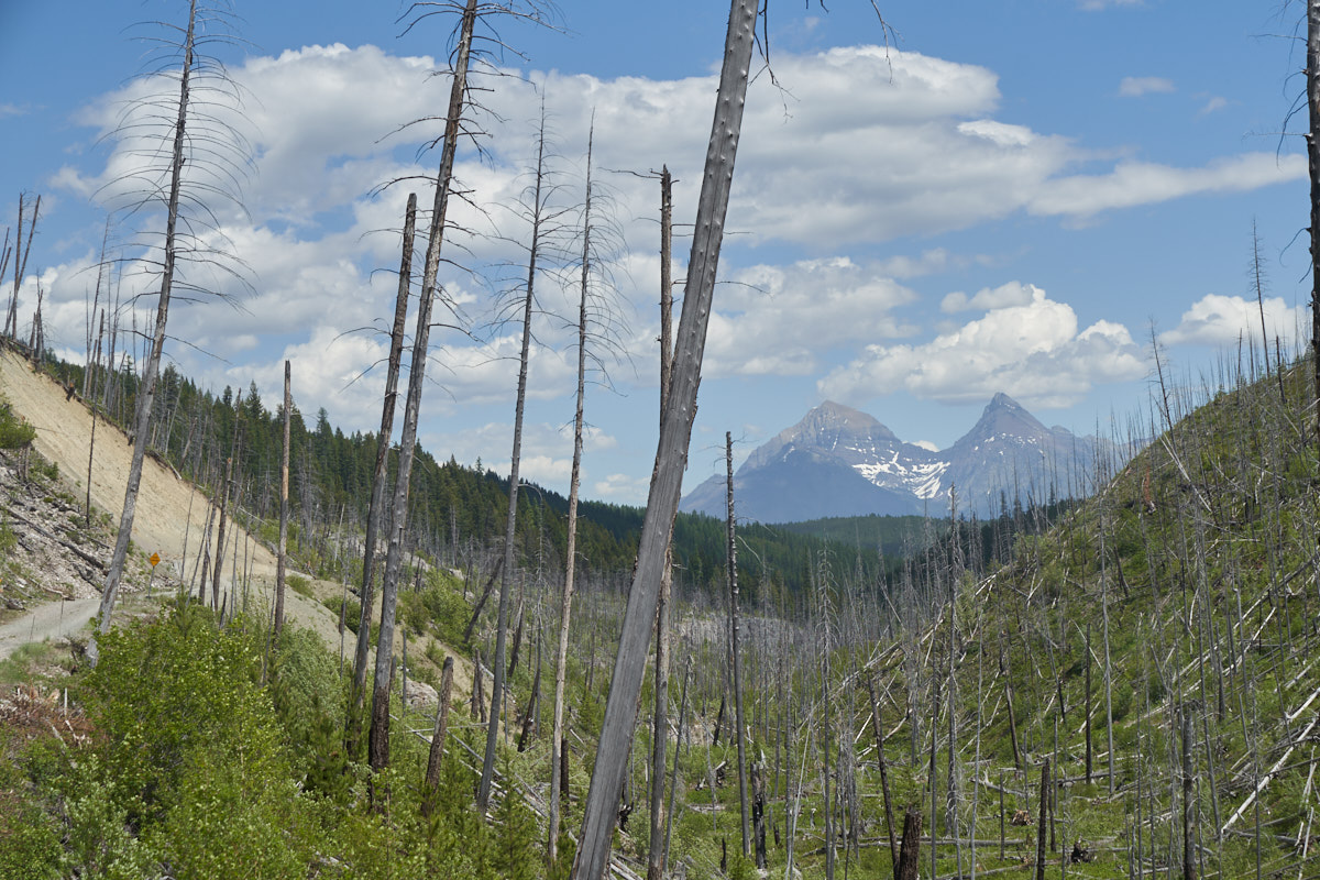
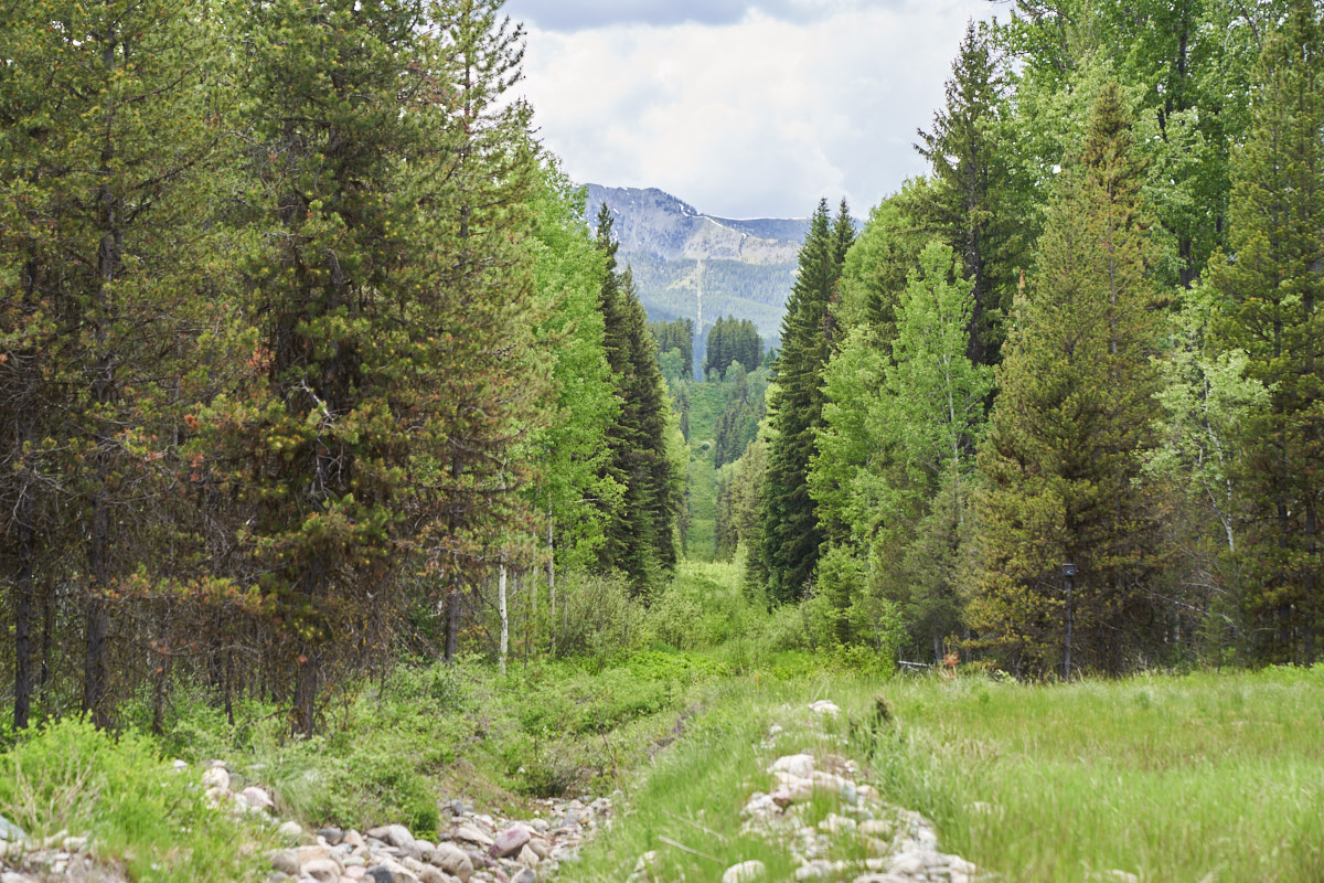
As we
approached one of the slide areas (the bald area on the cliff on
the left of the photo above) we were treated to an awesome view
of the peaks in Glacier Park to our east.
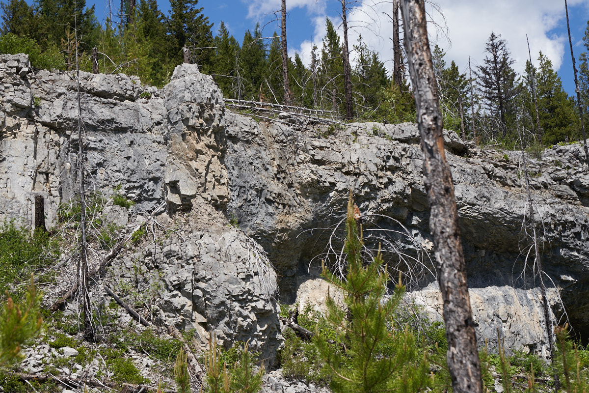
The
trail passed through an area that appeared to be volcanic and
the lava flows resulted in small hoodoos and caves.
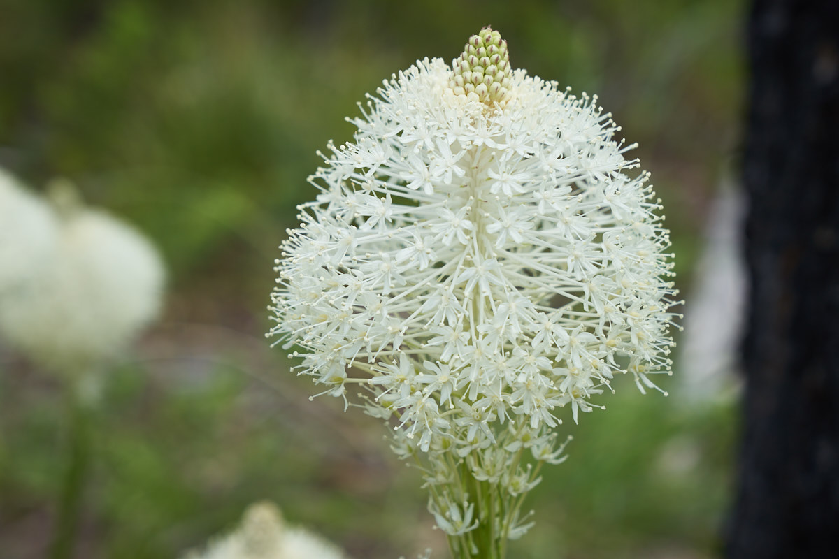
Near the
bottom of the canyon we encountered a stand of interesting flowers.
These blooms are huge with the flower being about the size of a
fist.
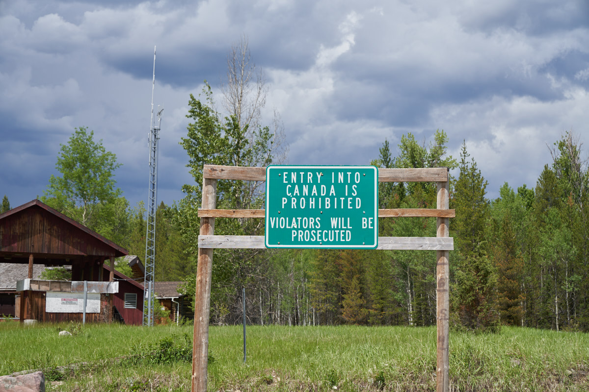
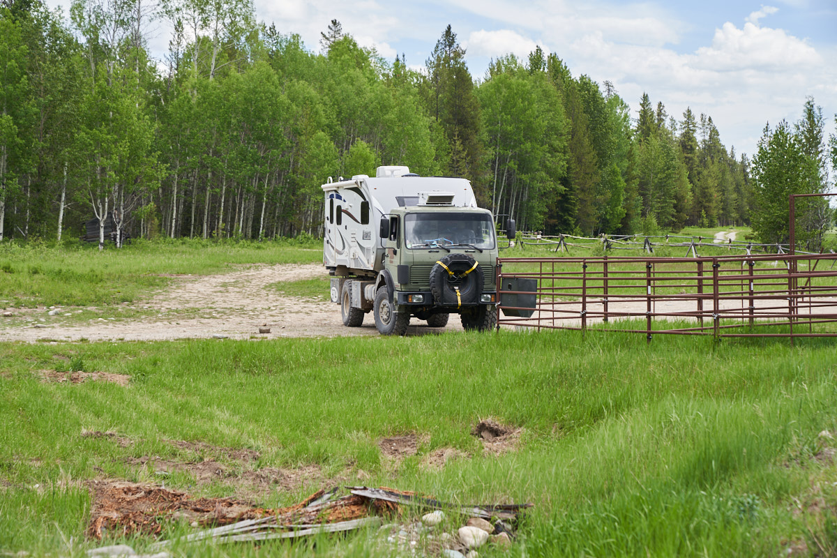
Since we
were skunked on our trail of choice and now had a 60+ mile backtrack
(excluding the rough trail we did up and back), we settled for a
consolation prize. We hit the county road and turned north
to go to the 8 miles to the Canadian border to see what is
there. This border checkpoint was closed after 9/11.
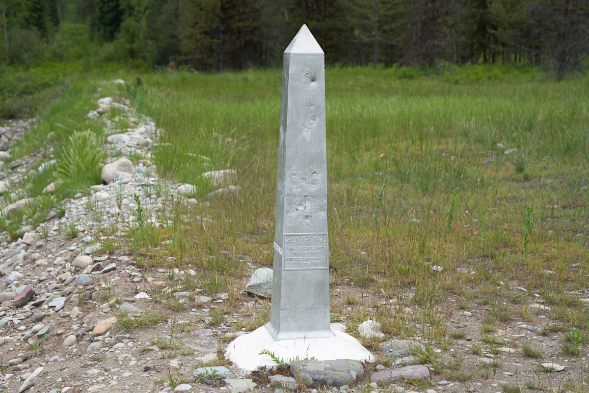
Like our
border with Mexico, the actual line is marked by a series of
obelisks. The plaque states that the border is the result
of the Treaty of 1846.
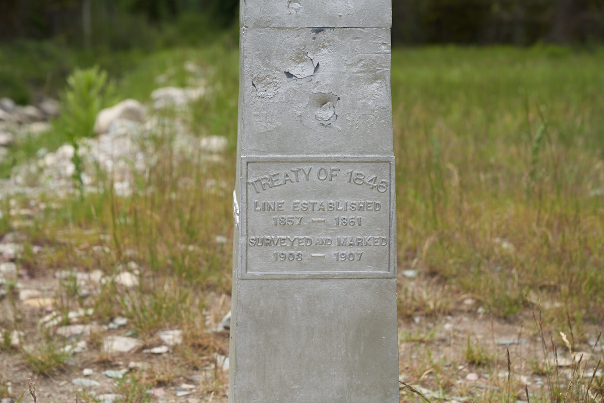
And, as
a plus, these steel obelisks make convenient targets for gunfire.
Looking
west from the Flathead checkpoint, the border is marked by
trimmed brush.
To the
east, the same except for a wimpy gate and shallow ditch to deter
illegal border crossings. Too bad that strategy does not
work on the Mexican border.
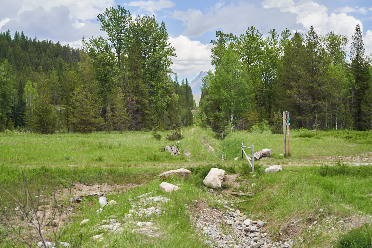
The
corrals are for the Border Patrol mounts when they run horseback
patrols.
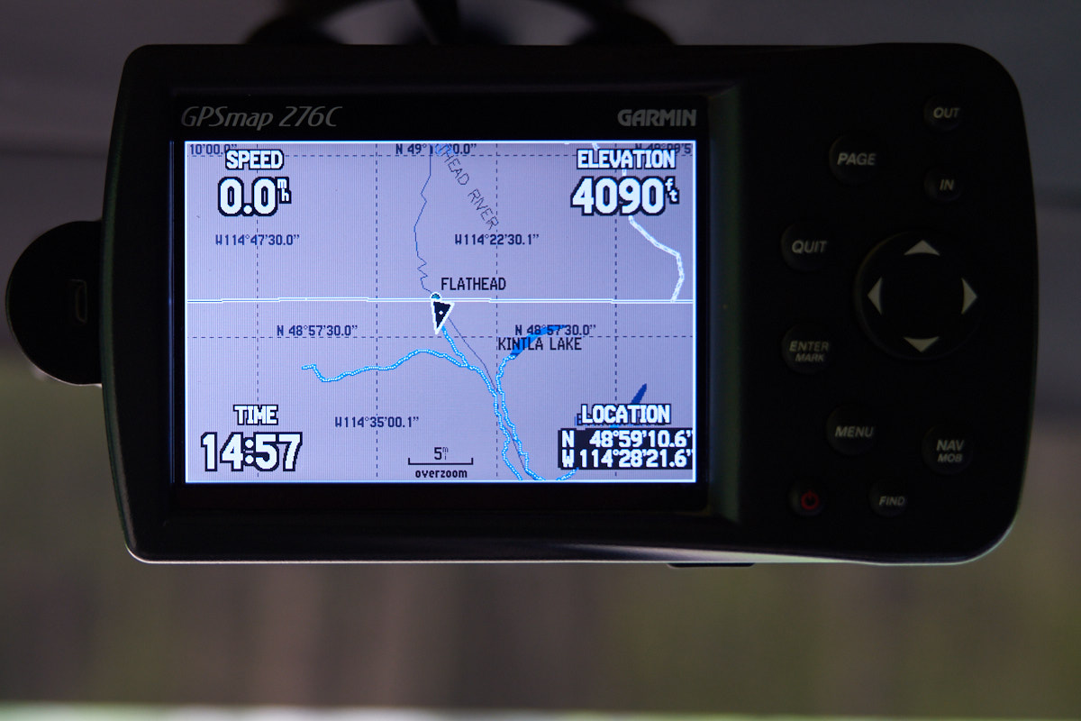
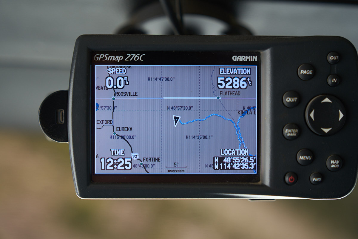
Just
south of Flathead I took this photo of the GPS.
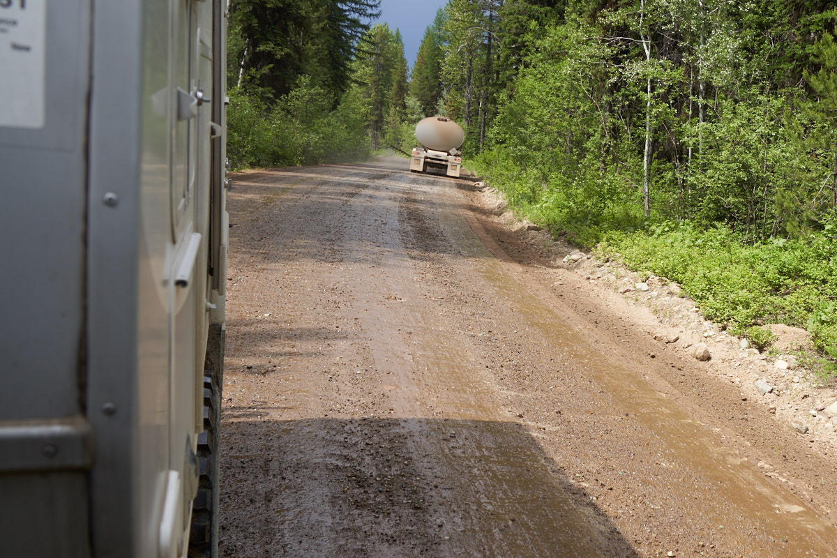
Bad news
here. That tanker has been spraying oil on the dirt road
for dust control. Too bad most of that went on Thor's
underside. The oil, combined with the wet, clay-based mud,
made a huge mess.
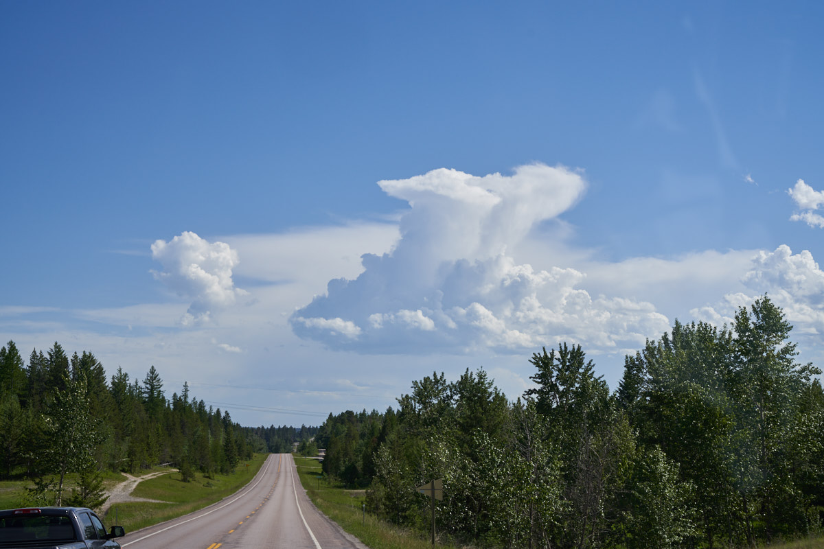
We were
heading back to Columbia Falls RV park that we left 3 days prior
when we spotted this anvil-shaped thundercloud to our south.
When we arrived in Columbia Falls, we discovered that there was
a street fair in progress. Kathleen always needs "fair
stuff" so we hiked to the fair and then had dinner. On our
way back to the RV park, the local police approached us with his
cruiser at high speed and did a slide stop next to us.
Since we were on foot, we had no idea what was
transpiring. The officer spoke rapidly telling us we could
not get back to the RV park because a large Black Bear had been
spotted in the neighborhood. We acknowledged him and we
sped off to warn other pedestrians leaving the street
fair. Meanwhile, the owner of the RV park was tooling
around town in his side-by-side quad. We flagged him down
and he drove us back to the park. We spent the night and
did not see the bear but the owner said that one of his
customers barbecues regularly and that is the dinner bell to the
bears. The following morning we broke camp and headed
north to Eureka.
Ouch.
We tagged the back corner of the Lance on a roof overhang when
we stopped for lunch in Eureka. Now, Lance is no longer a
virgin. And we got brush scratches too.
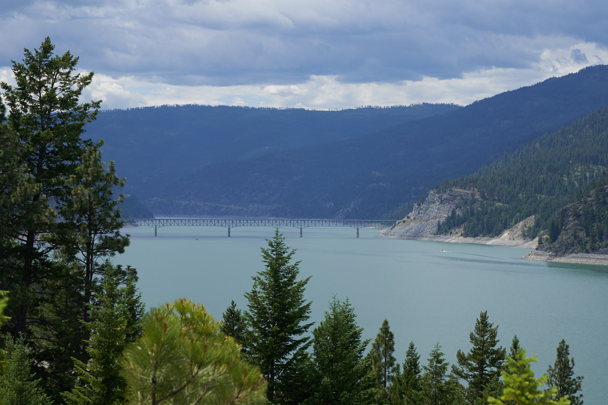
We
turned west at Eureka and headed for the bridge over the
Koocanusa Reservoir. Koocanusa is quite long and extends
north well past the Canadian Border. We crossed to the
west side and then headed north.
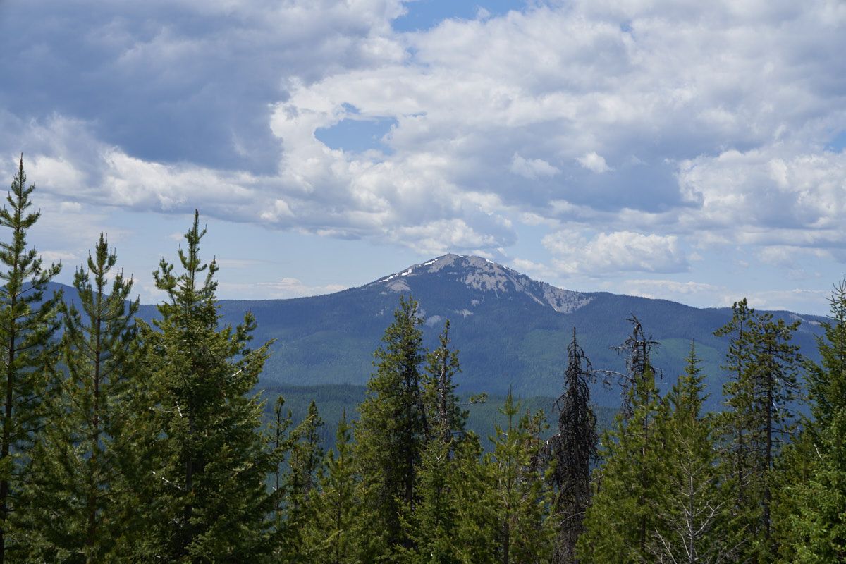
Our path
was steep and narrow but it was paved (however poorly).
From the pass we got a nice view of some peak to the west of our
position. There is a rectangular structure on the top of
that peak, a border lookout perhaps or possibly a fire watch
tower.
The clouds darkened
and threatened rain but it never came (on us).
It was Saturday
afternoon, the local campers in SUVs were out en-masse and our
first choice campsite was full. We continued down the
road and found a much better place on the Yaak River.
I was pretty pissed about not being able to cross the mountain range due to the snow bank. But, having dug out several times before, we just resigned ourselves to a beefy backtrack and turned around. Despite not being able to get through, it was a pretty drive; one that I would do again when get in this area next.
| Previous Adventure | ||
| Trip Home Page |
Photos and Text Copyright Bill Caid 2019, all rights
reserved.
For your enjoyment only, not for commercial use.