From
Hungry Horse Dam we headed south along the west side road to see
the sights and find a place to camp for a few days.
The photos below are what we saw.
We
headed south along the west bank road and found a nice
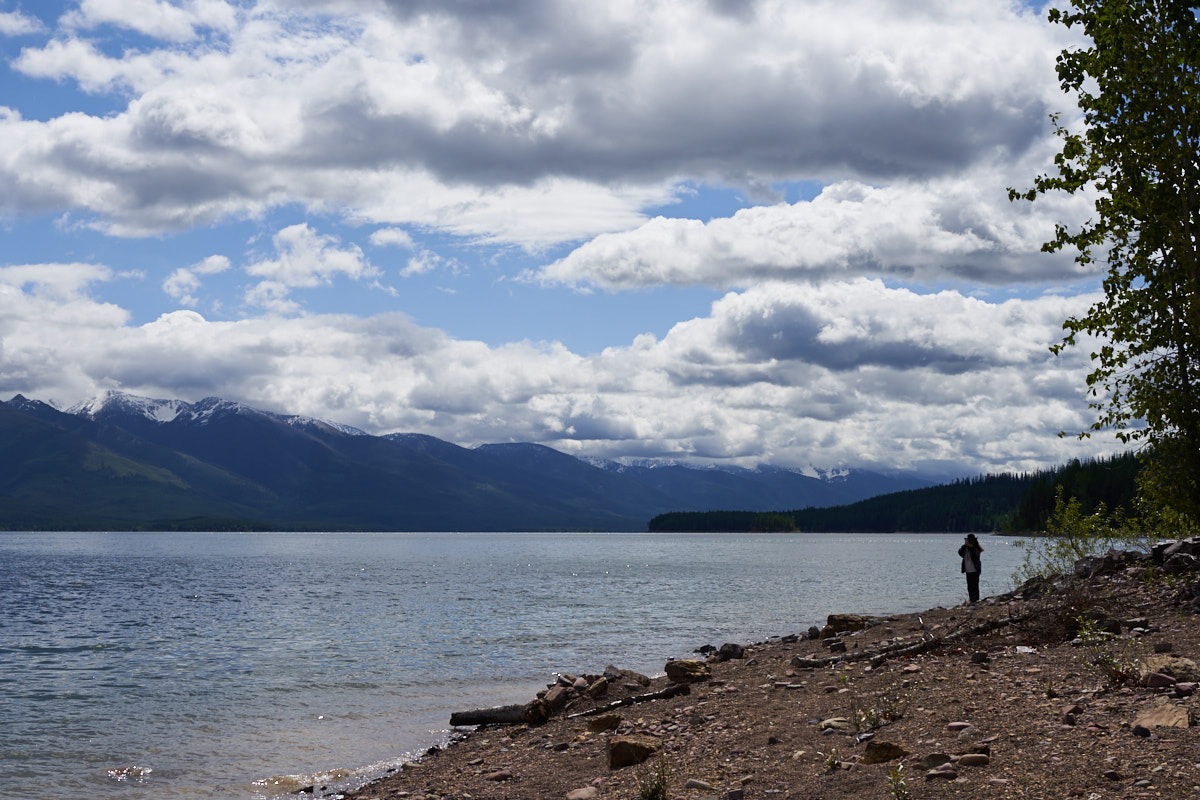
campground that was deserted. Our camp at Lakeview had,
not surprisingly, a lake view. The weather turned against
us with cold rain and wind and we spent two days here.
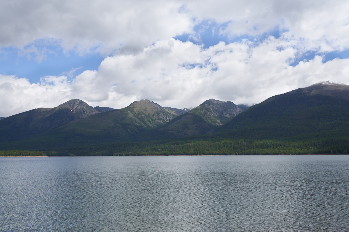
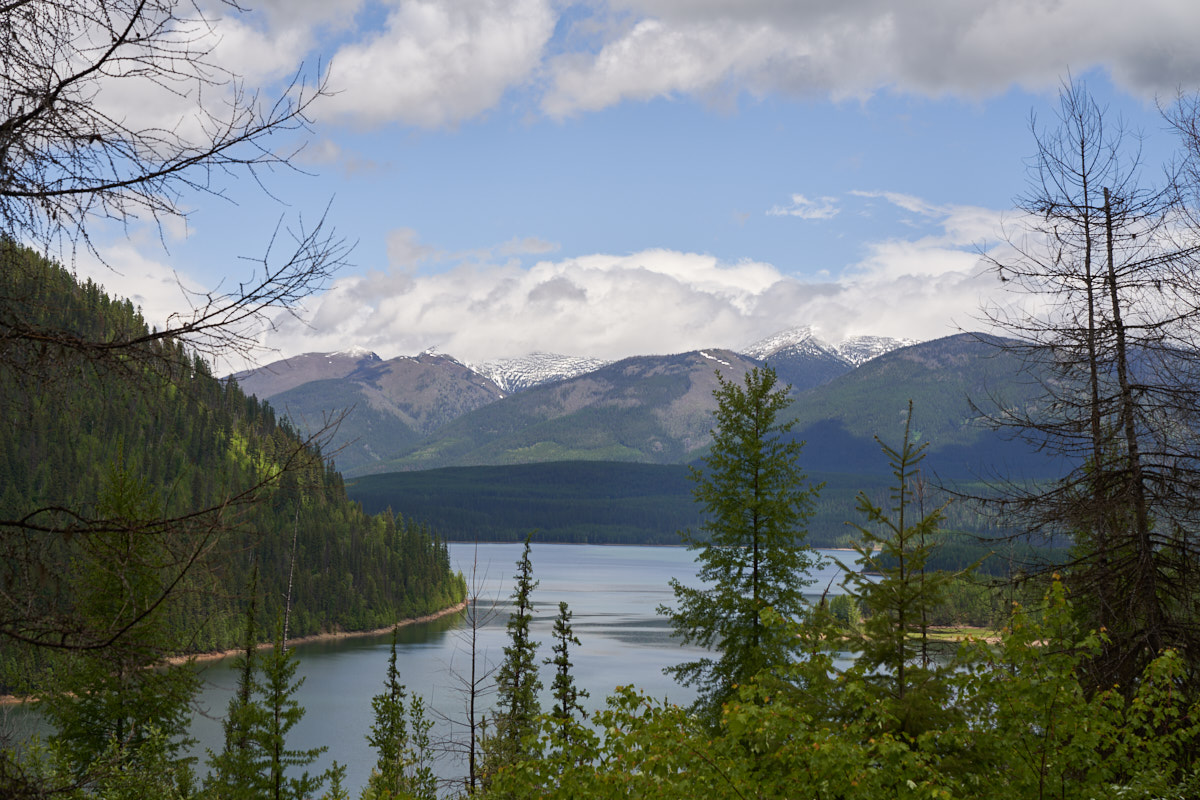
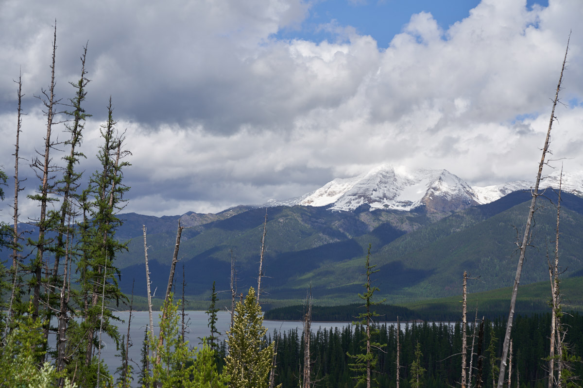
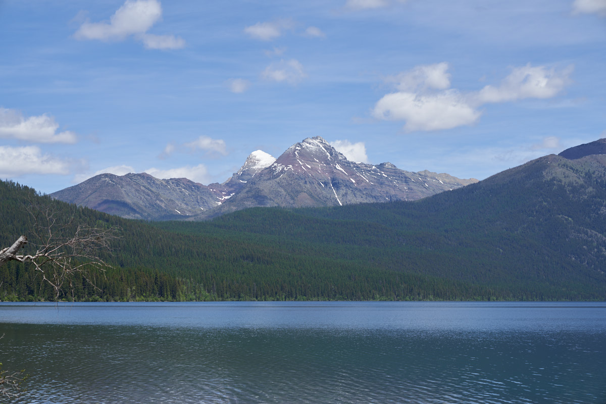
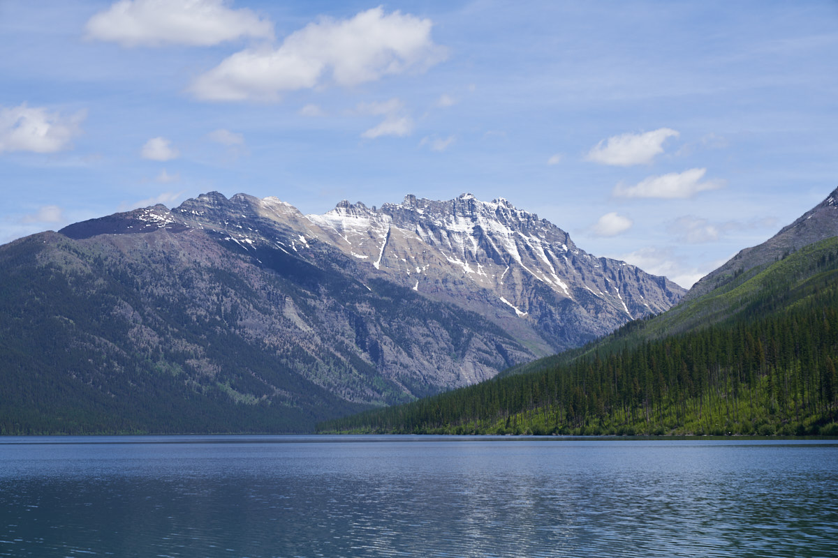
On the
second day when it finally stopped raining we grabbed our
cameras and headed to the lake. The peaks across the
reservoir in the Bob Marshall Wilderness were covered in snow
the previous morning, but it was gone today.
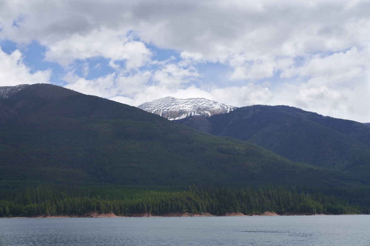
A higher
peak to the south still had a frosting of snow from the previous
day's storm. We decided to head further south on the west
bank road.
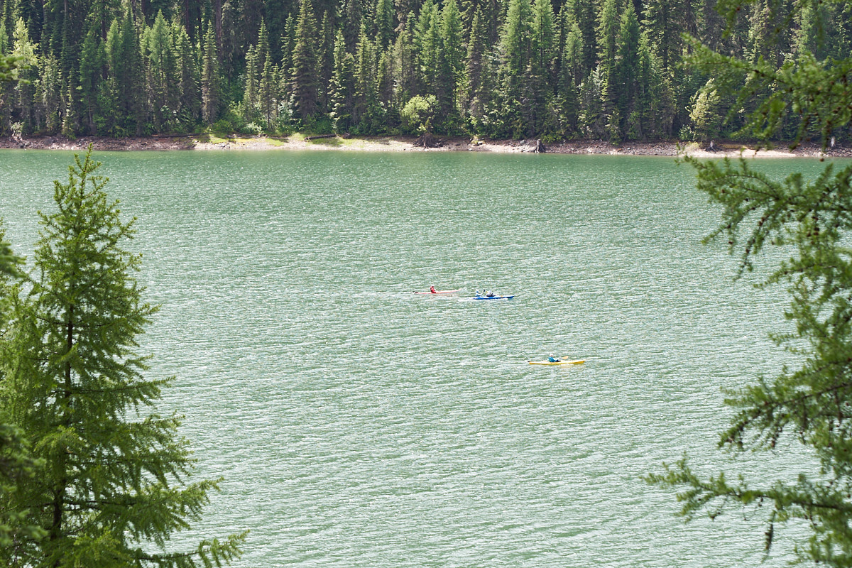
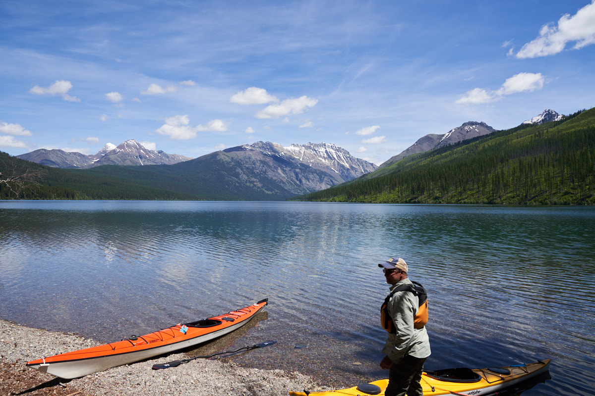
South of
our campsite we encountered some kayakers out on the lake.
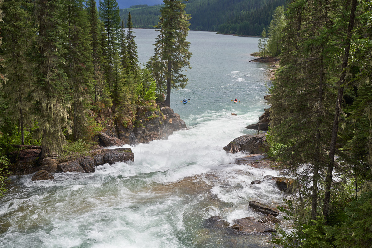
I am not sure if this is the same group of kayakers or whether these fellows went down the falls.
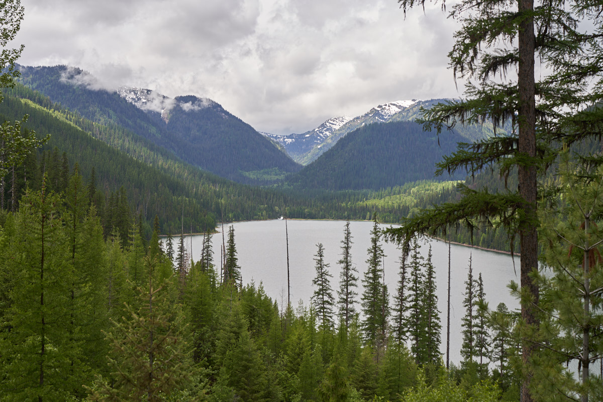
Further
south the sky cleared a bit allowing nice views of the Bob
Marshall peaks.
A few
miles later we discovered that the road was closed due to a land
slide. Looking west from the closure we could see the
previous waterfall at the end of the canyon.
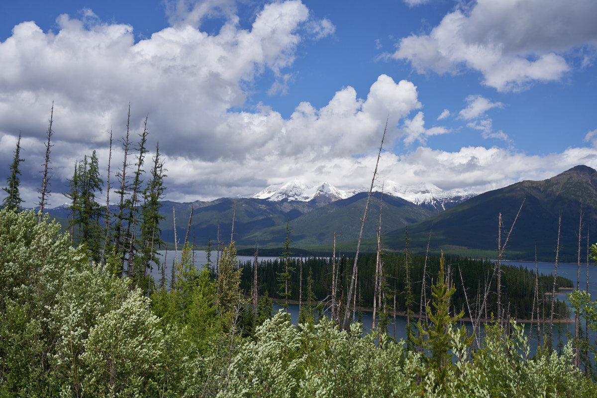
The
island in the lake might be a great place to kayak camp assuming
you are willing to brave the 'skeets.
Kathleen
was creating a panorama with her Fuji XH-1 camera.
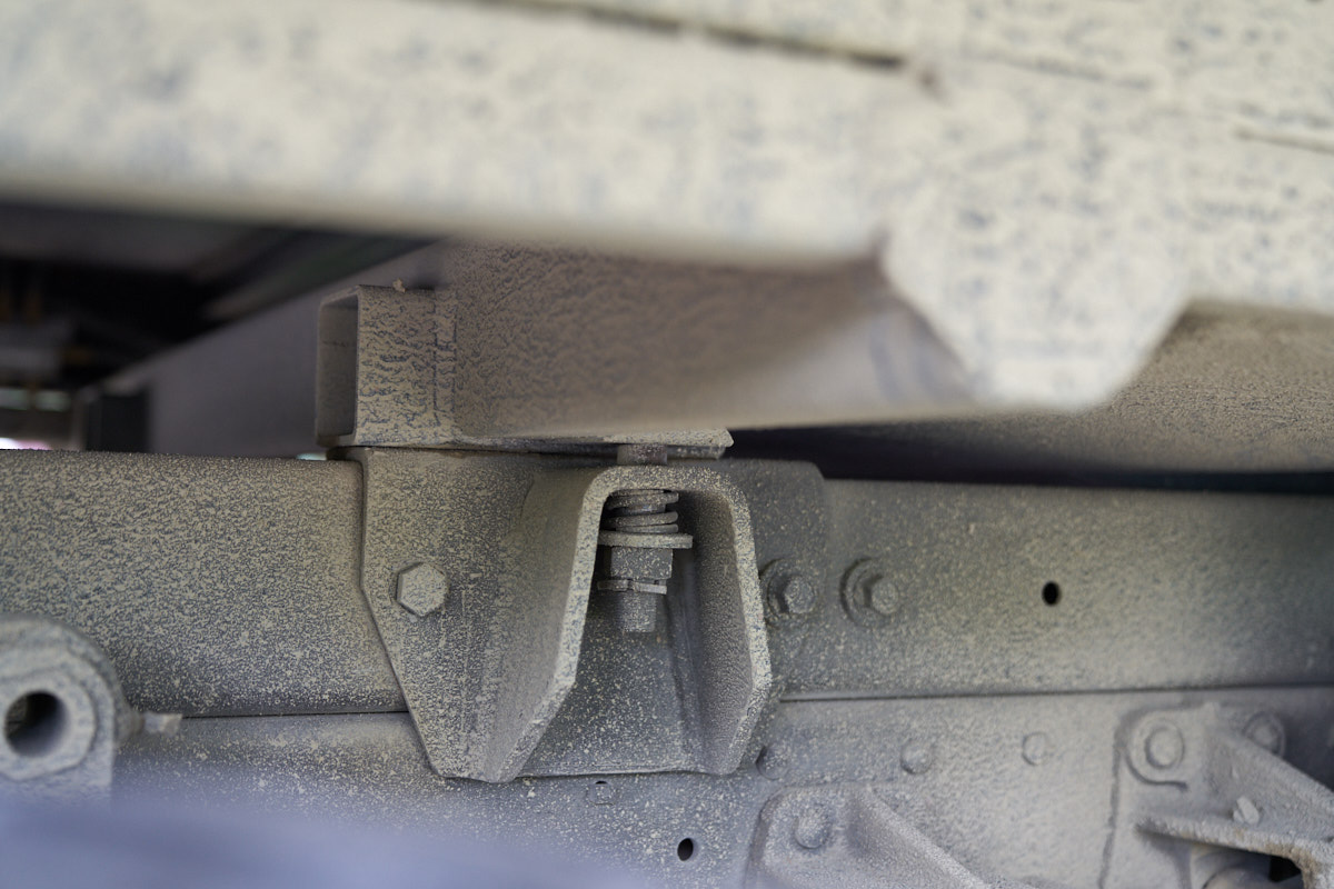
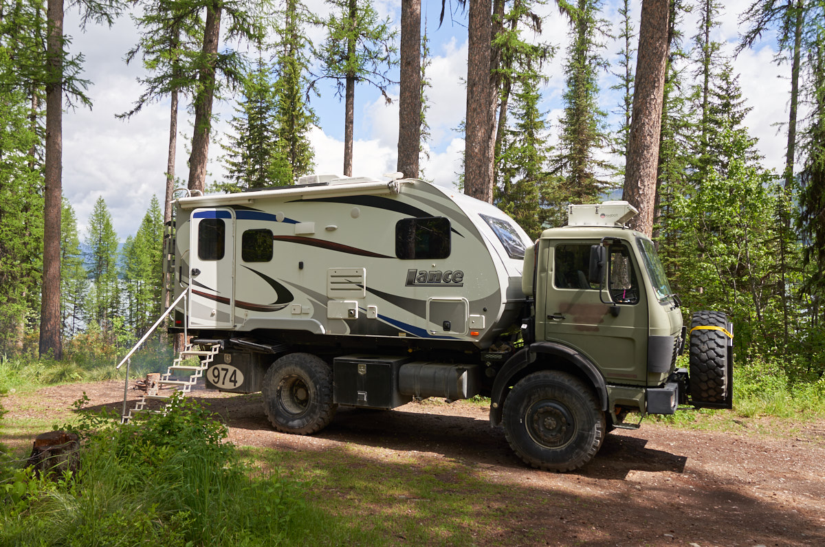
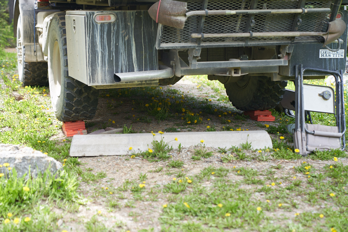
The camper
was sitting skewed on Thor and inspection revealed that we
likely bent the center cross member on a bump.
We spent
two more nights in Hungry Horse at a campground closer to the
dam. The weather did not really cooperate, so we headed
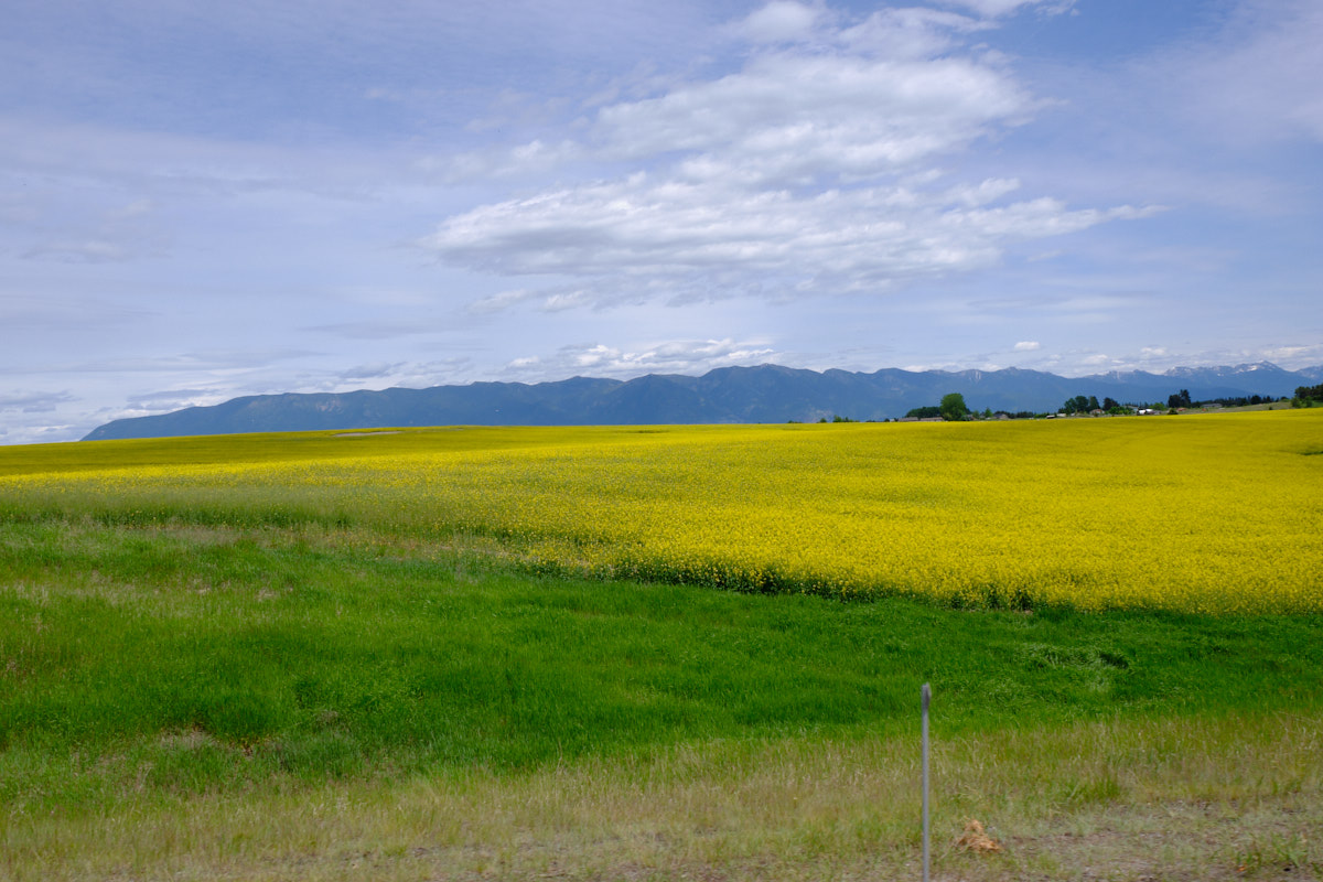
into Columbia Falls for drain/fill, store stop and shower.
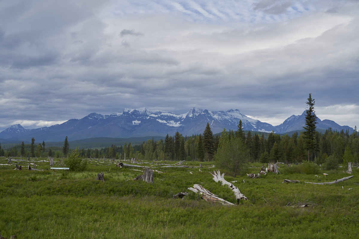
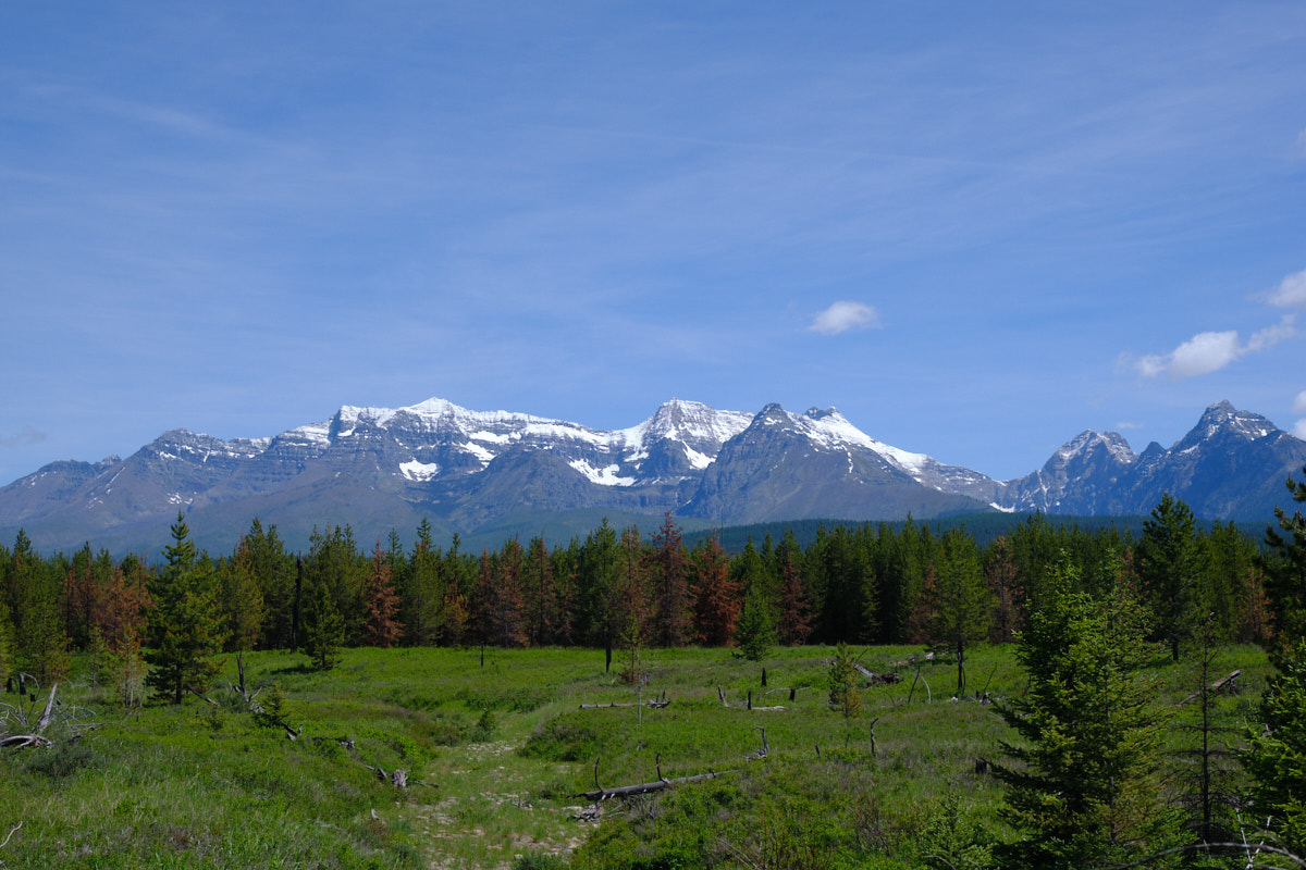
From there, we headed north and encountered this field ablaze
with color.
We
continued north along the Flathead River toward Bowman Lake
inside Glacier National Park. The cloud layer was low
enough to touch the top of the peaks.
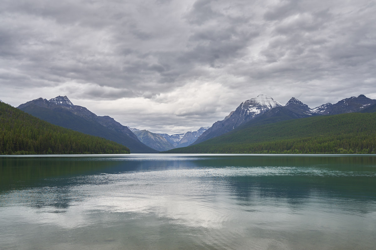
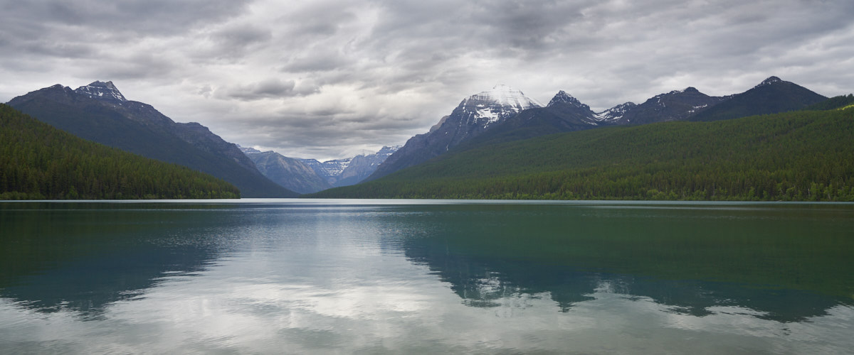
We
arrived at Bowman Lake late in the afternoon. The clouds
produced dramatic, if subdued, lighting.
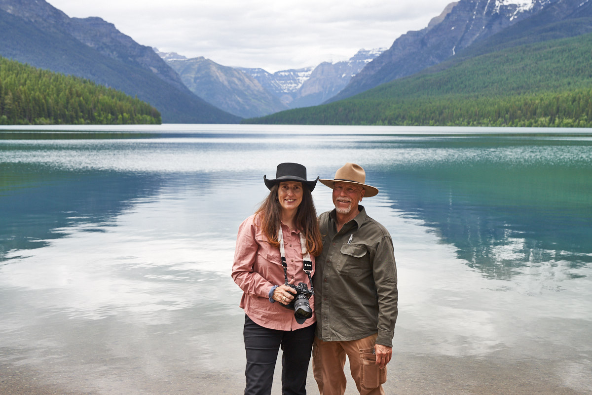
A
bystander was nice enough to offer to take a photo of Kathleen
and I with Bowman Lake in the background.
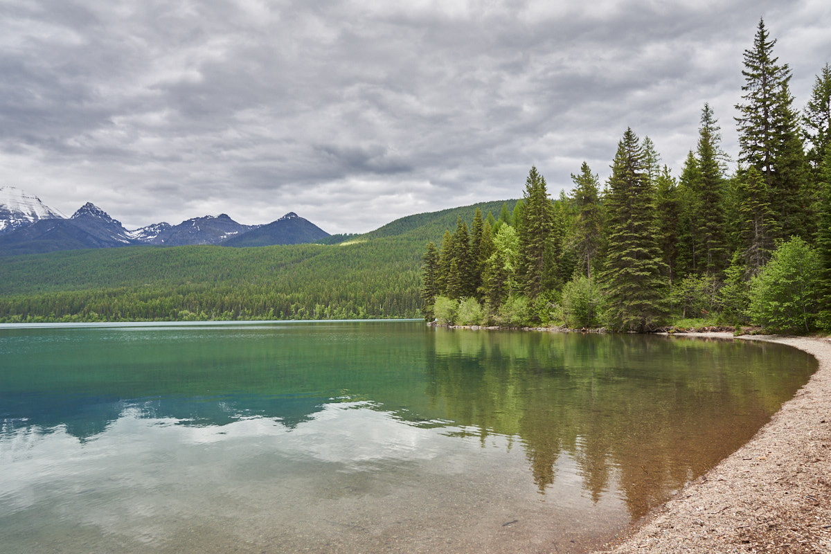
The
canoe launch area at Bowman Lake has a nice gravel beach.
No
amount of wishing was going to get us better light. We
retired to the camper for dinner and a movie.
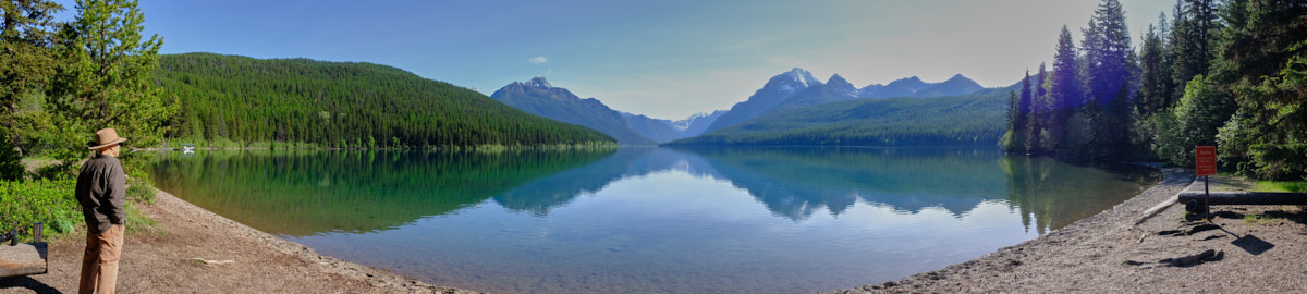
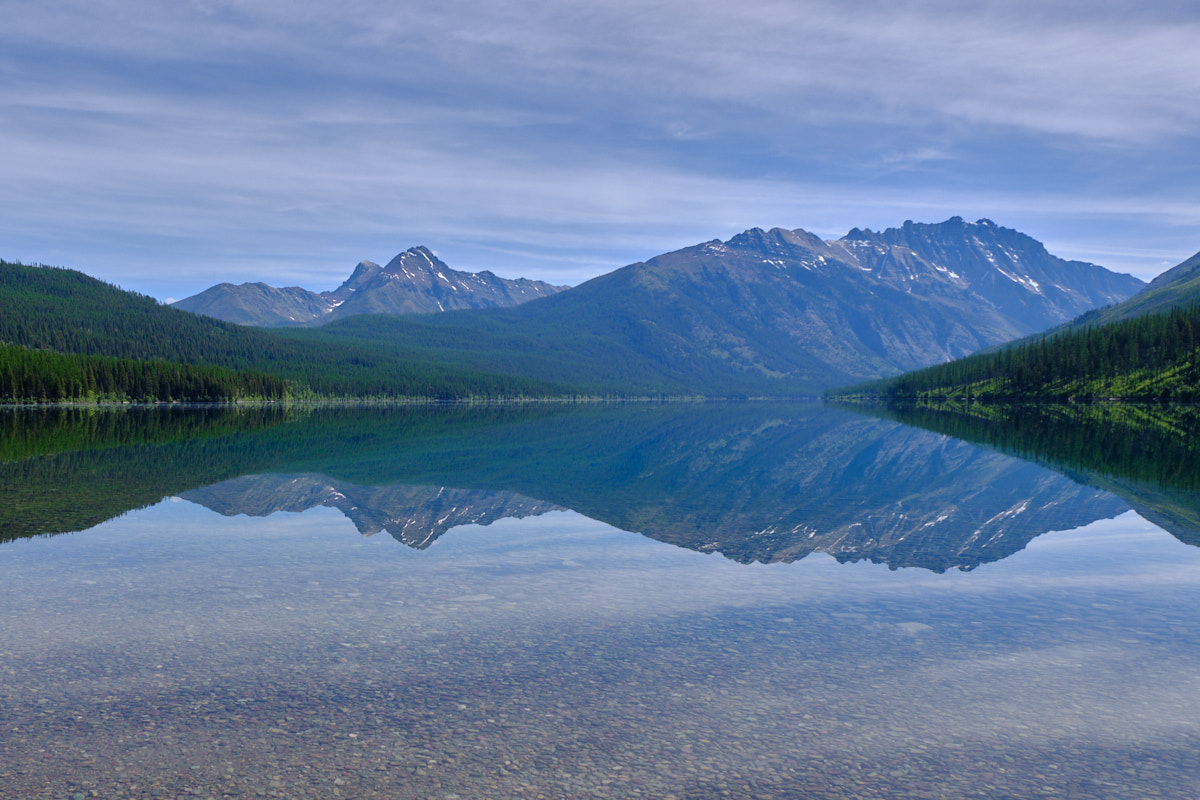
The
following morning dawned clear so we headed to the lake shore
for a photo or two. Kathleen's camera is capable of
creating panoramas in the camera. This is Bowman Lake with
a 270 degree view.
We only
spent one night at Bowman Lake. The following morning we
broke camp and continued north to Kintla Lake near the Canadian
border. Our path followed the Flathead river. The
morning sun and clear skies gave us great view of the cliffs and
peaks to the east.
After 15
miles of very pot-holed dirt road we arrived at Kintla Lake and
were treated to an awesome scenery.
The lake
continued to the base of the cliffs.
This
fellow and his wife were returning from a trip in their kayaks.
The
following morning, Kathleen arose early and went outside to get
this nice reflected view in the calm waters of Kintla Lake.
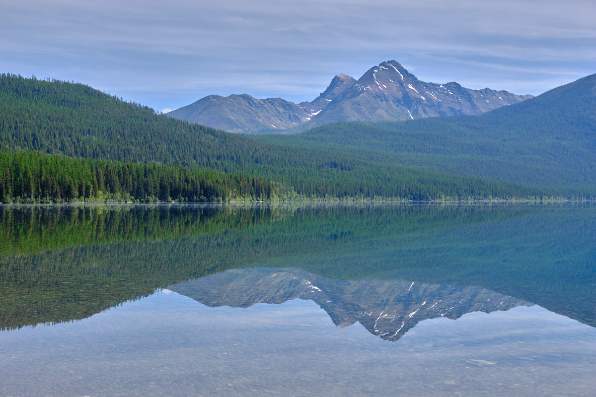
There
was much less snow on the peaks this morning that the previous
evening.
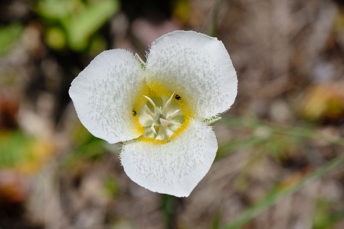
Kathleen spotted
these flowers in bloom and got a nice closeup of the fresh
bloom.
The next morning, we
left Kintla Lake and had to suffer the pot-holed trail to get
back to the bridge that spans the Flathead River. Once
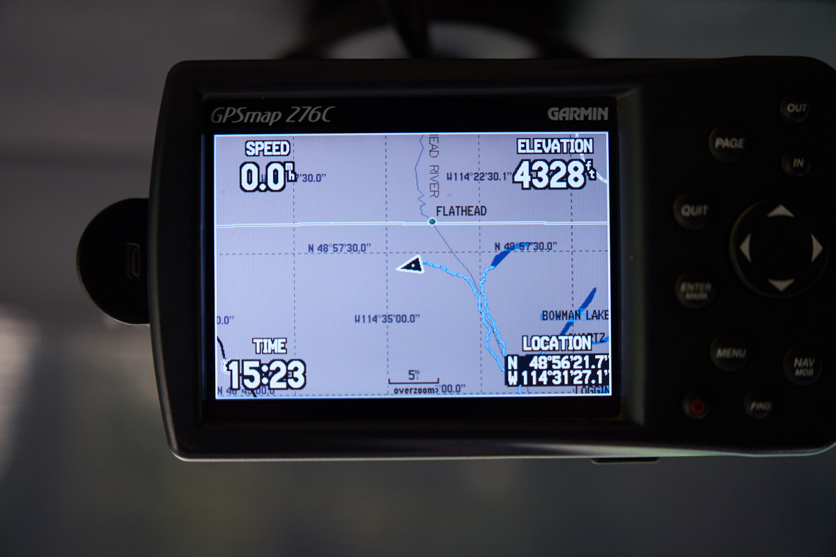
we hit the west side road, we headed north. Our path
took us nearly to the Canadian border. Both Bowman and
Kintla lakes are visible on the GPS display.
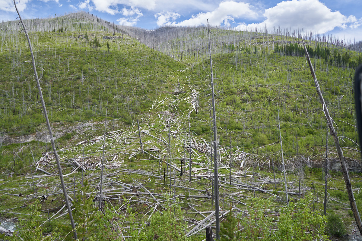
Our path to Tuchuck
camp went on a narrow, exposed, off-camber trail cut into the
face of an eroding cliff. Across the ravine we could see
the results of a large landslide or possibly an avalanche combined
with a landslide. This area had burned recently and it
is likely that the burn scar became unstable and slid taking
with a huge amount of timber with it.
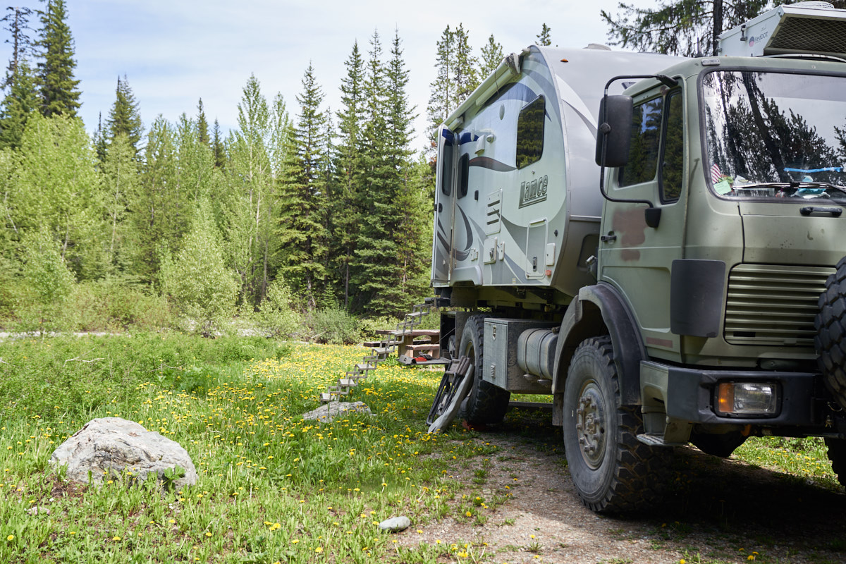
We were the only
people in the camp so we had our choice of parking locations.
Our desired spot next to the stream was a somewhat off-level
requiring a bit of lego work to make it acceptable to us.
We spent seven days in this area. That fact, alone, speaks volumes about the beauty of the region. Should your travels bring you to the Kalispell area, you must put Hungry Horse and Glacier on your "must do" list.
| Previous Adventure | ||
| Trip Home Page |
Photos and Text Copyright Bill Caid 2019, all rights
reserved.
For your enjoyment only, not for commercial use.