Next
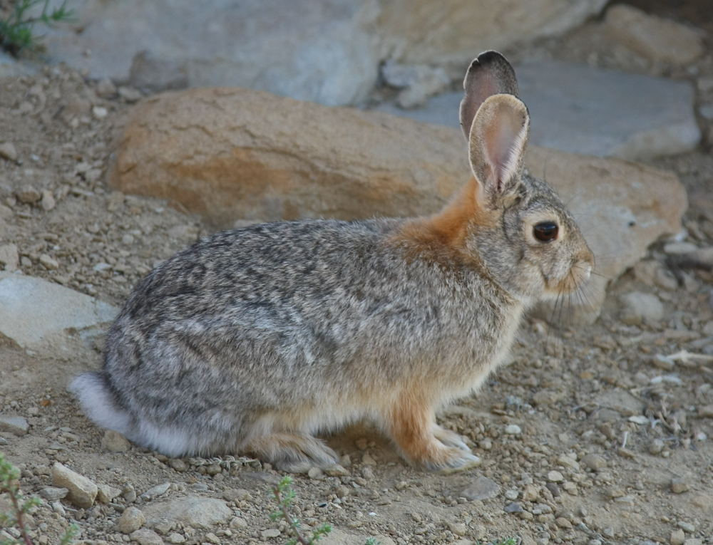
morning as I was preparing to exit the camper I spotted this
rabbit attempting to eke a subsistence from the barren
terrain. Note the notches in its ears; it appeared as if it
had been in a tussle with something.
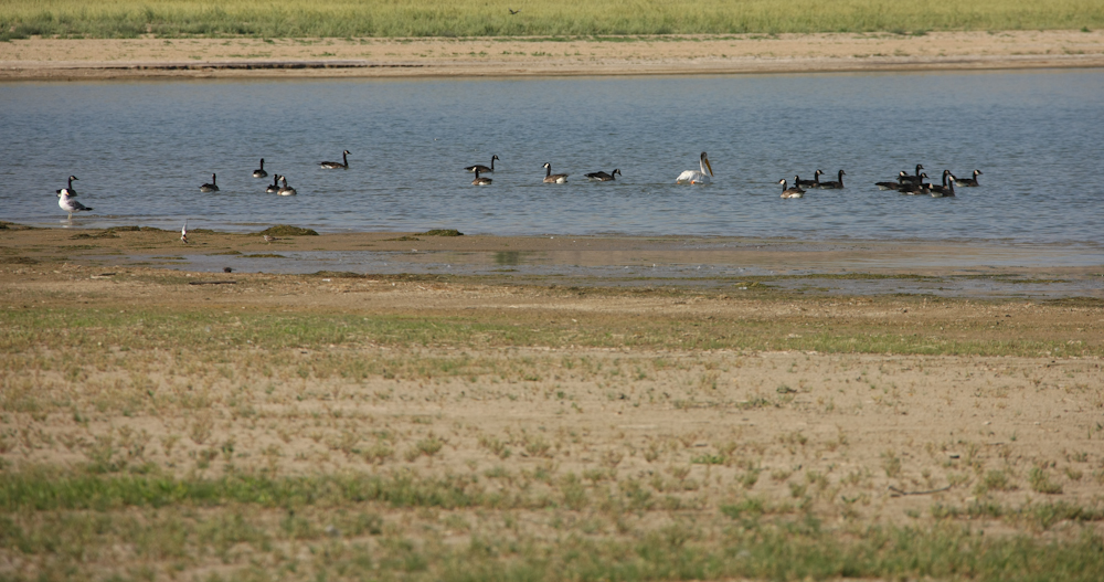
There
was a gaggle of geese that had been feeding on the lake shore
grasses the previous night and they returned with several marine
birds: a pelican and a seagull.
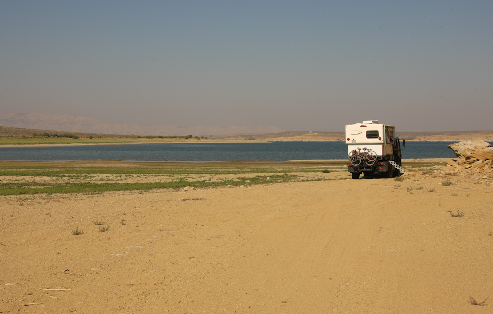
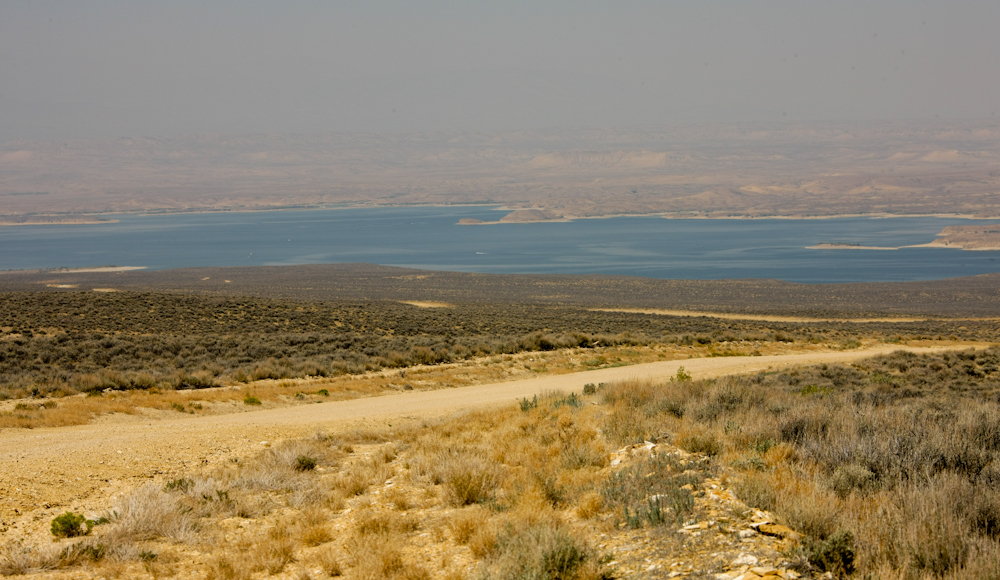
The
story here is not the stark barrenness of our camp but rather the
poor air quality. During the night, we awoke to the smell of
fire. Not a camp fire but rather a brush fire. Most
Californians are attuned to the smell of burning grass and that is
what got our attention. We felt that we were safe and that
since the wind was coming from the west (over the lake) and there
were substantial expanses of open ground between us and any grass,
we noted the situation and went back to sleep. The next
morning when I went outside, the pall of smoke was apparent.
We never did determine the actual location of the fire but it must
have been rather large as the poor air quality persisted for many
miles south of our camp.
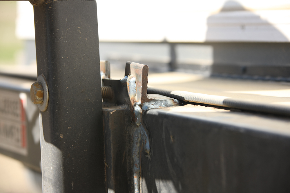
Since
it was now light, I took a photo of the hillbilly repair on our
bike rack. It is ugly but it is robust. This patch
should get us back to San Diego without further incident.
Besides, what do you want for $40?
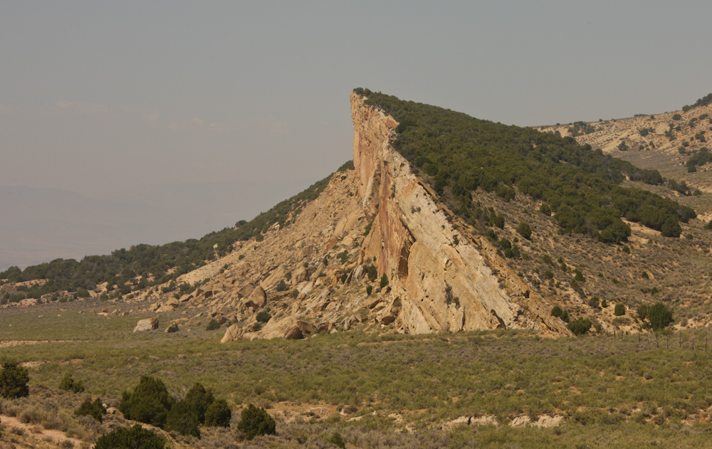
After
many miles of dirt, Flaming Gorge road finally intersected US-191
and we turned south toward Dutch John, UT. Along the way, we
could see many hogbacks that were the result of faulting,
uplifting and erosion. These hogbacks expose layers of rock
that are normally hundreds or thousands of feet underground.
In addition to being visually appealing they make it easier to
explore for buried minerals.
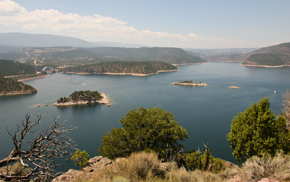
From
an overlook near Dutch John, UT we got a nice view of Flaming
Gorge reservoir close to the dam. Note the bridge in the
upper left of the photo above.
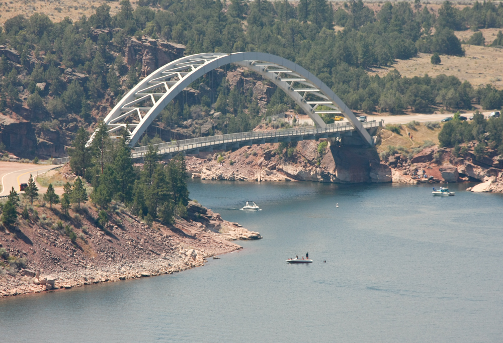
The
bridge on US-191 was built as part of the dam project.
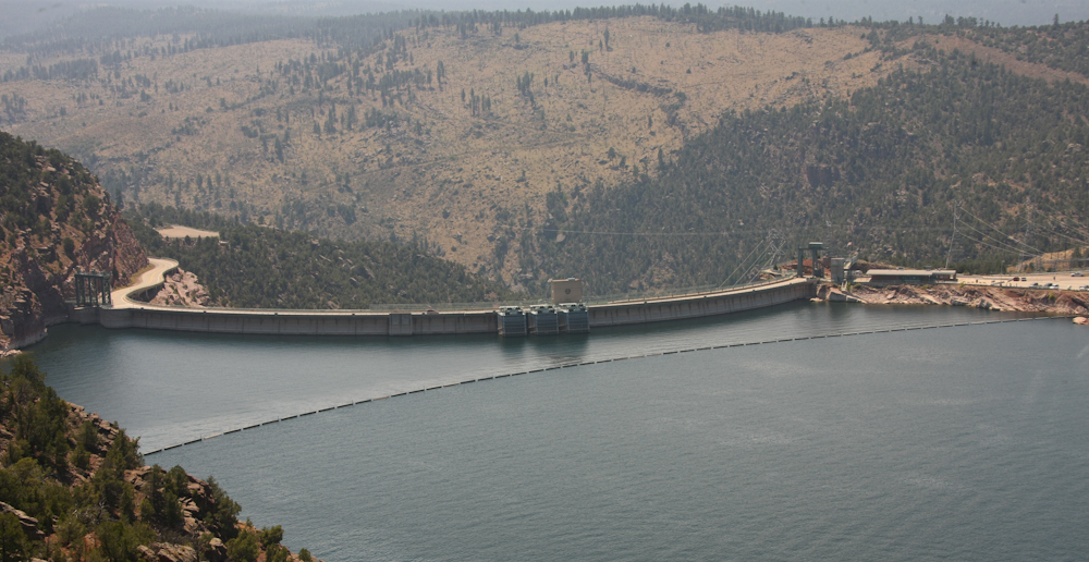
Flaming
Gorge dam is almost 500 feet tall and is used as part of the
Colorado River Storage Project. In addition to water storage
the dam produces hydroelectric power. The inlets for the
turbines are the 3 square boxes in the center of the dam.
There are tours that take you inside the dam to the turbine
gallery and control rooms. After nine-eleven security was
beefed up. Back in the 1990s Kathleen and I visited the dam
and while looking at the control room I noticed some flashing
indicator lights. But, there were no personnel in the
control room. We waited several minutes and still no
personnel. Finally, when a person appeared, I was jumping up
and down and waving my arms to get this fellow's attention to
point out the alarm. He saw me and came out of the room to
see what was wrong. When I told him about the alarm light he
replied "Oh, that. Yeah, it does that sometimes. Do
you know anything about this stuff?" I replied "Yes, a
little, but you are not going to ask me to debug your system are
you?". He stated "No, but I thought that you might like to
see inside the facility". Hell yes! He took us through
the entire control room, through the turbine gallery and below the
gallery to the turbine bearing room. At that point, we were
below the bottom of the lake and the turbines were above us
rumbling away. The entire dam was vibrating from the
rotation of the massive turbines. I asked him about the
vibration and he told me that balancing the turbines was a big
deal. They have to be balanced or the vibration will damage
the bearings, the mounts and the dam. I wondered how such a
feat was accomplished on a massive chuck of metal and he said that
there was a fellow that worked in Denver that did this for a
living. He comes to the site and spends weeks there getting
things just right. He was very old-school and used a network
of piano wires to do his job. The worker added that the
fellow has since retired and now they use laser measuring
equipment. He further added that the old guy did a better
job; the lasers are quicker but the manual method produced a
smoother result. He also made a comment about lubrication
used in the turbine bearings. He stated that the "enviros"
forced a switch from petroleum-based lubricants to vegetable oil
and that no good came from that. The bearings now wear out
regularly at great cost both to repair/replace the bearings and
from the turbines not producing electricity during the maintenance
interval. Water quality tests never showed any contamination
due to the lubricant, but the change was made anyway. And,
if petroleum contamination was a concern, why are power boats
allowed to use the reservoir? That is why they are called
"enviro-mentals" with the emphasis on the "mental".
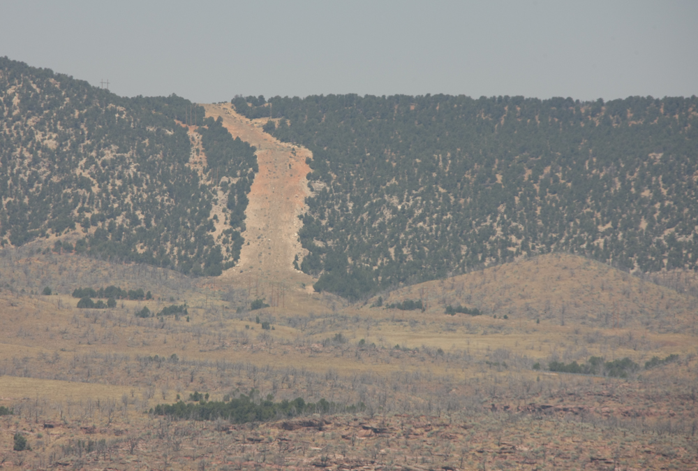
Looking
north from the dam site, we could see a bald stripe on the
hogback. I thought this was the result of a natural gas
pipeline but I learned the following day that it is a liquid
phosphate pipeline that runs from Vernal, UT to the Union Pacific
main line at Rock Springs, WY.
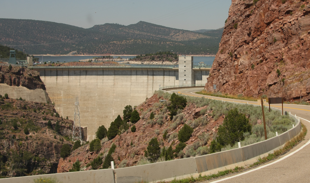
A
view of the face of Flaming Gorge dam.
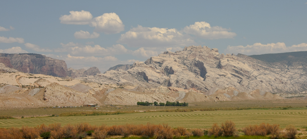
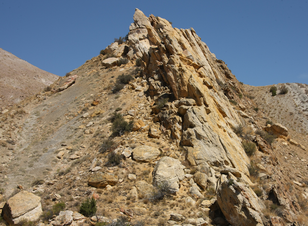
From
Flaming Gorge, we headed south on US-191 over the Uintah Mountains
to Vernal, UT. We spent the night in an RV park in the town,
did a re-supply action including food, diesel and propane and did
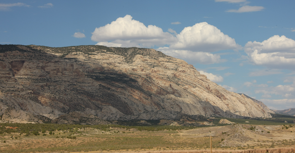
laundry. Next day, we headed out to Dinosaur National
Monument. DNM is on the face of a very large monocline, see
above. The "up and to the left" curve of the terrain is due
to the monocline and subsequent erosion has exposed large faces of
sandstone.
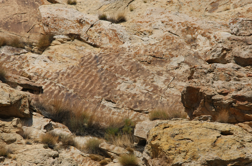
Visible
on the face of the exposed rock are sections that reflect a marine
environment in the distant past. The ripples in the
sandstone are visible in the photo above.
The
more durable strata that were exposed in the monocline result in
hogbacks. The less durable strata are eroded away.
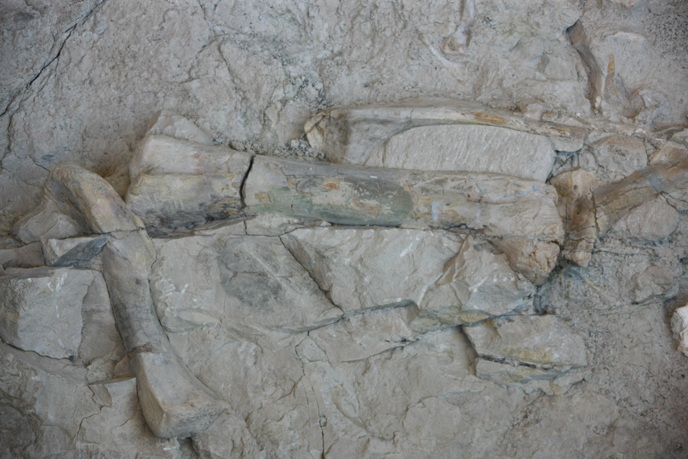
The
fossil quarry at DNM is on the exposed face of one of these
hogbacks. The discovery of the bones, like most great
discoveries, was happenstance back in the early 1900s. But
once the discovery happened men of science came west and revealed
the true wonder of the discovery. The bones above about 4
feet in length.
This
section of the hogback is rife with specimens. The claim is
that this was once a river bed and that the dinosaurs had died due
to drought. But, a flood came and washed the carcasses
downstream but they settled in a bend in the watercourse.
Some
of the bones were scattered, some were still attached to
carcasses. Above is a spinal column.

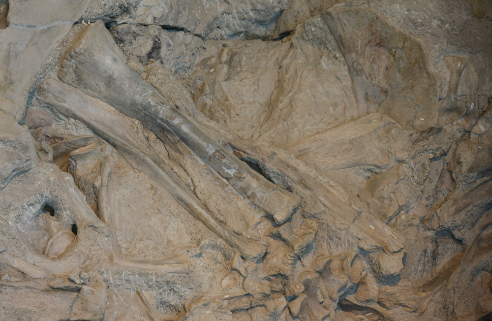
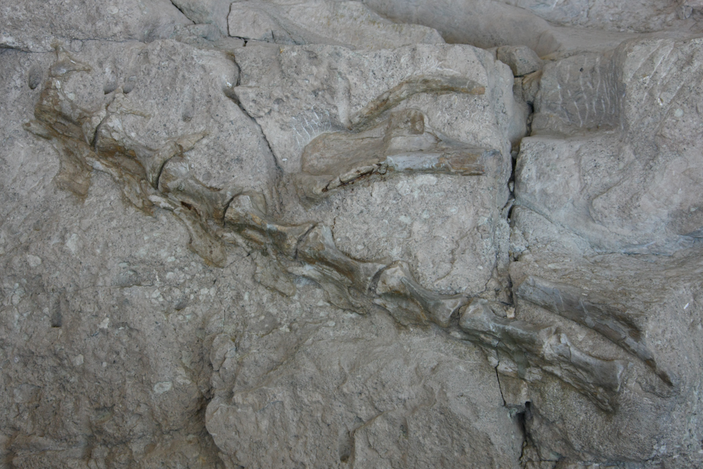
Two
femurs. The head of the femurs are pointing down.
Looking at these, being a curious person, several things come to
mind. First, is to note that the morphology of a femur bone
has not changed all that much from the Jurassic period.
Second is to wonder about the bearing surface of the head of the
femur. The shafts of the bone were very well preserved, but
the rough surface of the head of the femur makes me wonder if
these animals had a disease that eroded the joints; something
similar to arthritis in humans?
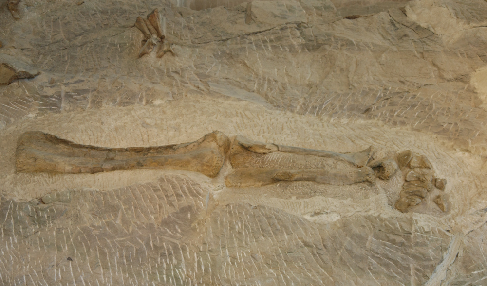
A
complete fore-limb segment.
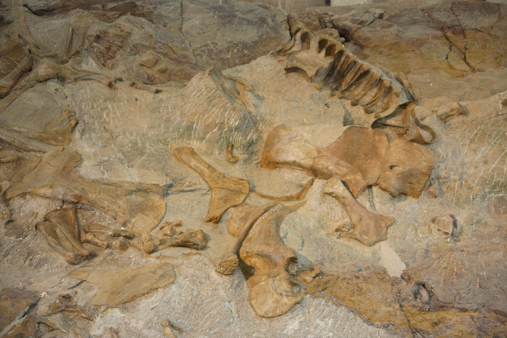
A
smattering of bones from various species. Note part of a rib
cage in the upper right.
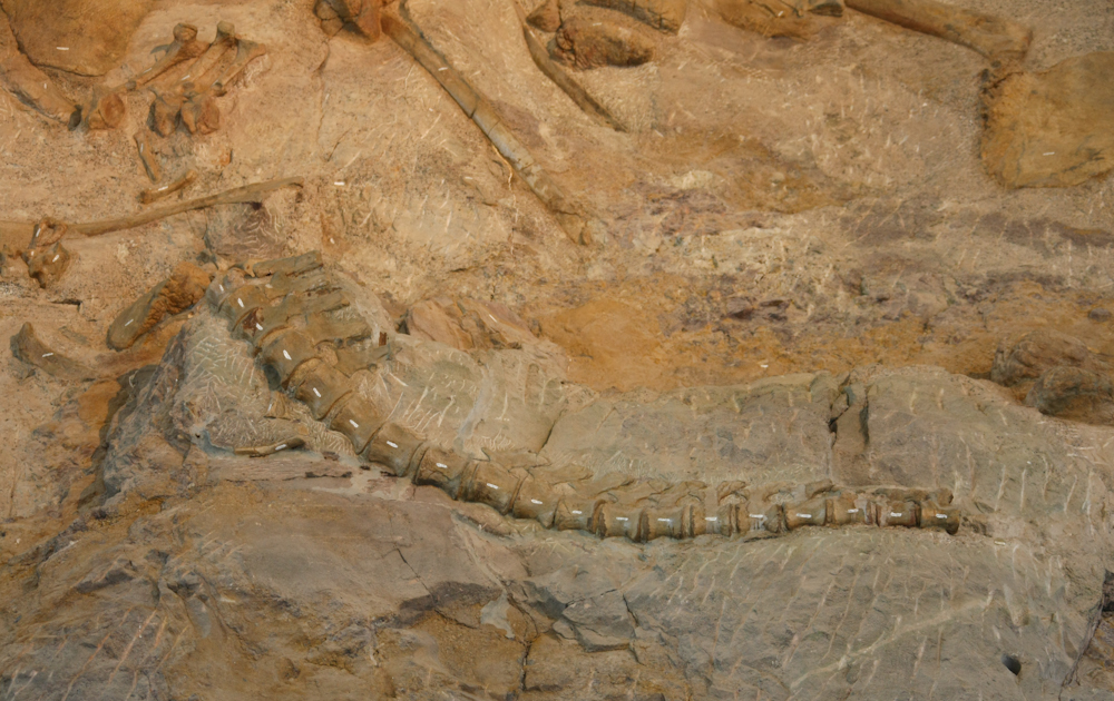
A
segment of tail that has been indexed.
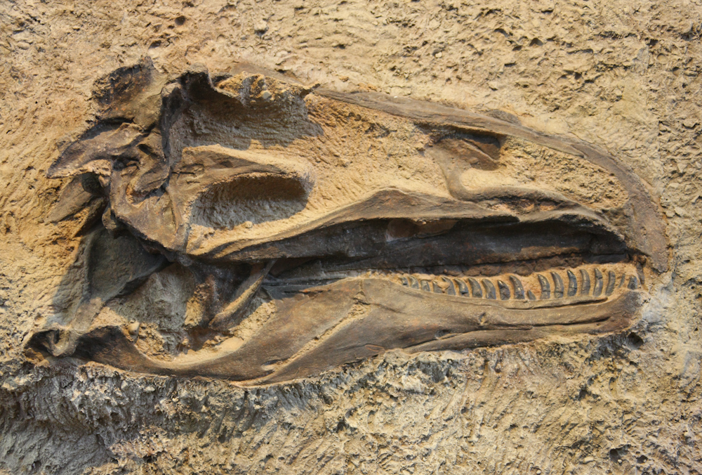
This
intact head is about 2 feet long, complete with gnarly teeth.
From
the quarry at DNM we decided to head east, then north. We
left the are on US-40 and got another view of the large
monocline. The curvature of the bedding is dramatic and the
forces required to accomplish this are almost unimaginable.
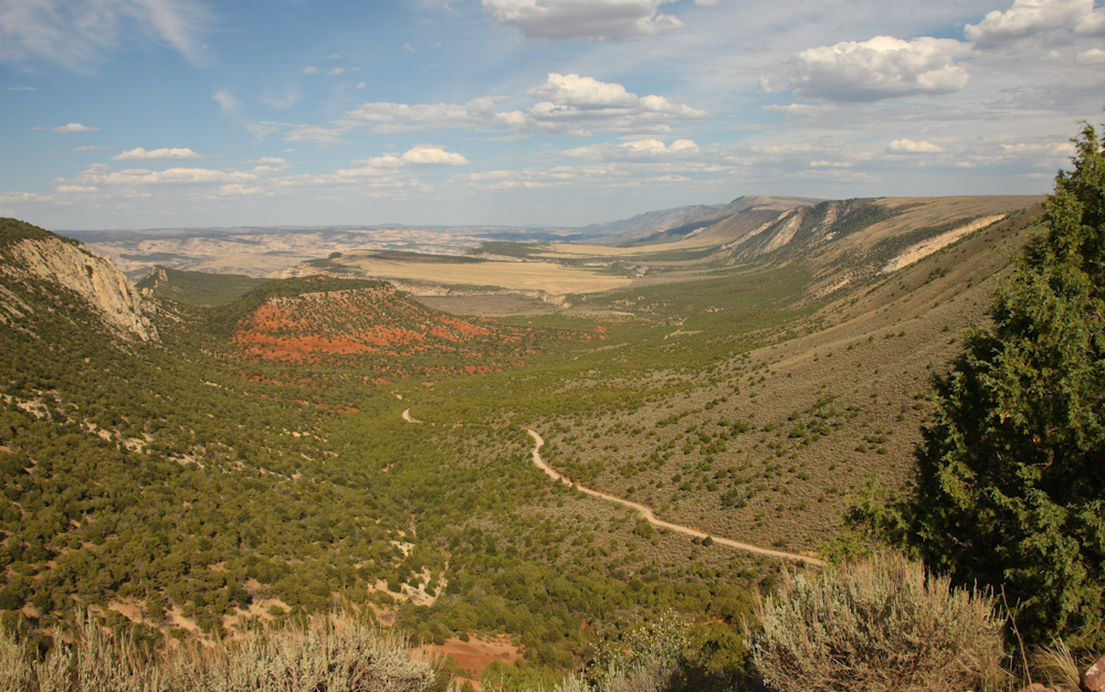
We
decided to go to Echo Park on the Green River. Our route
took us over a 7800' plateau and then on the north side we had do
descend into the Green River canyon. From the plateau we got
a great view of a portion of the valley to the northeast.
The road was steep and narrow but the exhaust brake on Thor did
it's job well. The descent into the canyon from the plateau
took a full hour.
Down
the face of the plateau and past the flats we again descended into
deeper layers of sandstone.
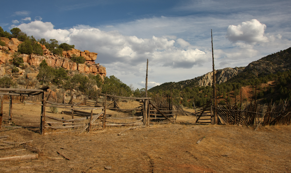
Along
the way we passed an abandoned ranch and corrals.
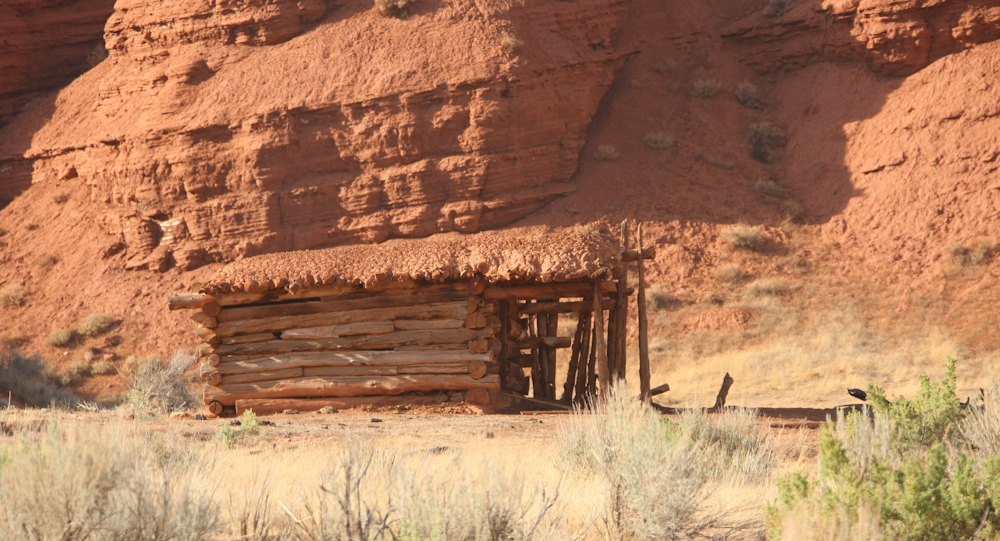
Now
here is some HARD LIVING. These folks lived in a log cabin
with a mud roof.

We
got our first view of Echo Park on the Green River. The
canyon walls are perhaps 1,000 feet tall, maybe higher.
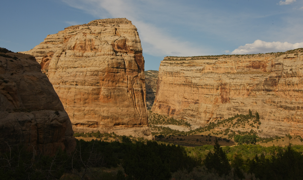
It
was about 1830 when we arrived so the shadows were starting to
overtake the canyon floor.
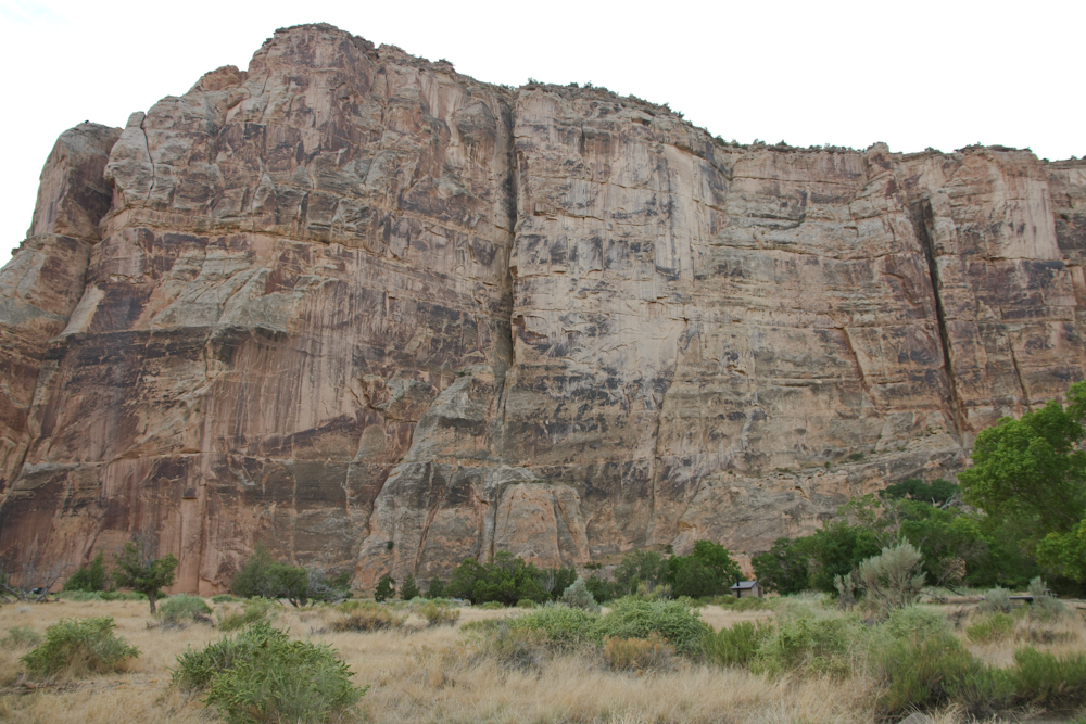
A
view of the canyon walls from our campsite. A sense of scale
can be obtained from the outhouse at the bottom center of the
photo.
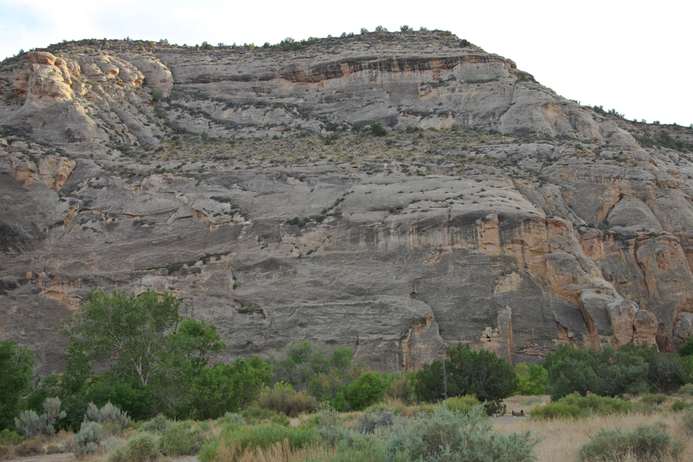
The
southern rampart was just as imposing.
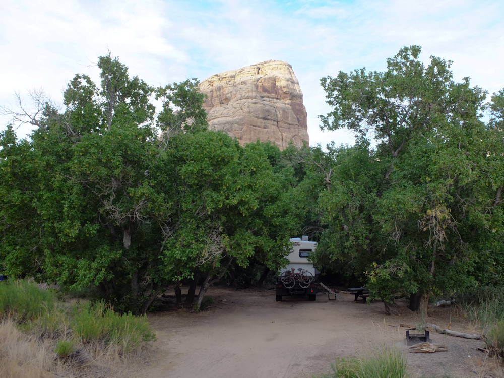
Thor
settled in the trees with the canyon walls on the opposite side of
the Green River in the background.
| Previous Adventure | ||
Photos
and Text Copyright Bill Caid 2012, all rights reserved.
For your enjoyment only, not for commercial use.