Ladder Canyon was a nice camp; very quiet and sheltered from the wind. Well, quiet in a southern California sort of way. The mud hills are directly below the main flight path to both Ontario and LAX airports, so we could hear the jets on their approach. But, they were still quite high in altitude, but we could hear them nonetheless.
The objective for the day was to travel north from Ladder Canyon through the Mud Hills to Joshua Tree National Park. We would traverse the park on Old Dale Road which is dirt, and then exit the park on the north side through some old mining areas. From there, we would head across the Mojave desert along the old route 66 to the Mojave National Preserve and continue on to Mitchell Caverns. We got some surprises along the way. The photos below are what we saw.
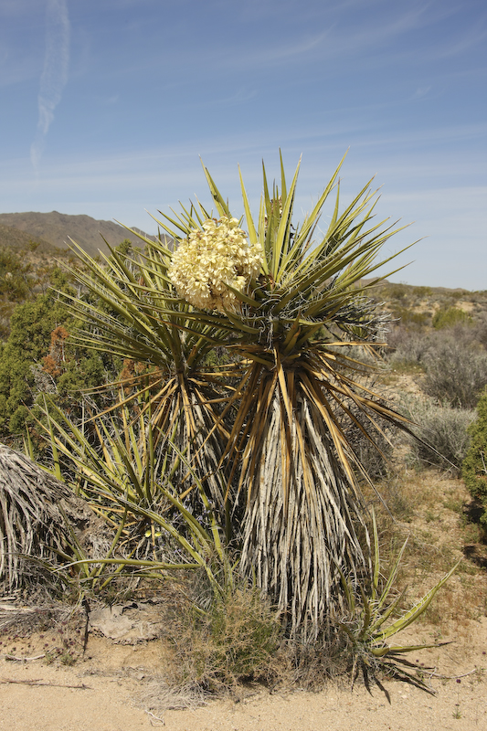
The yucca were in bloom as well as the wild flowers.
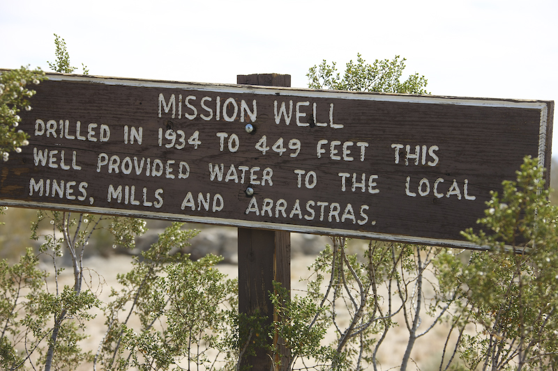
We filled up our water tanks before heading out into the desert again. Water is a rare commodity in this area and without it, no human life exists. This sign tells the story of an old well that we passed on our way to the mines.
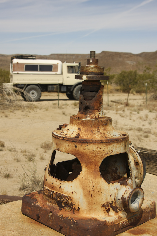
The Park Service mostly dismantled the site, but left this pump housing intact. I am guessing that it was too heavy to move.
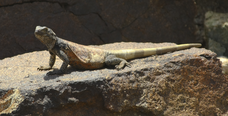
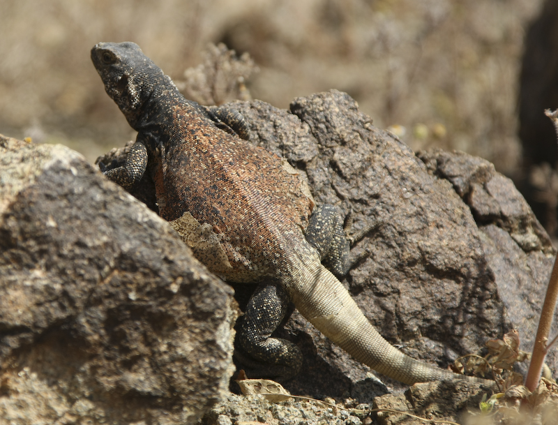
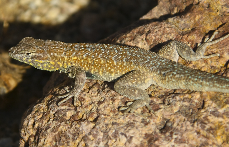
As we headed out of the valley floor and into the hills, we spotted this chuckawalla. He was big and fat. Notice how his markings match the rock. He saw us a long time before we saw him.
Close by, we spotted another chuckawalla. This guy was very well fed. The native americans ate these lizards. When threatened, the chuckawallas run into a crack in the rocks and then blow themselves up to prevent extraction by predators. The indians used a stick with a hook on the end to remove them for dinner.
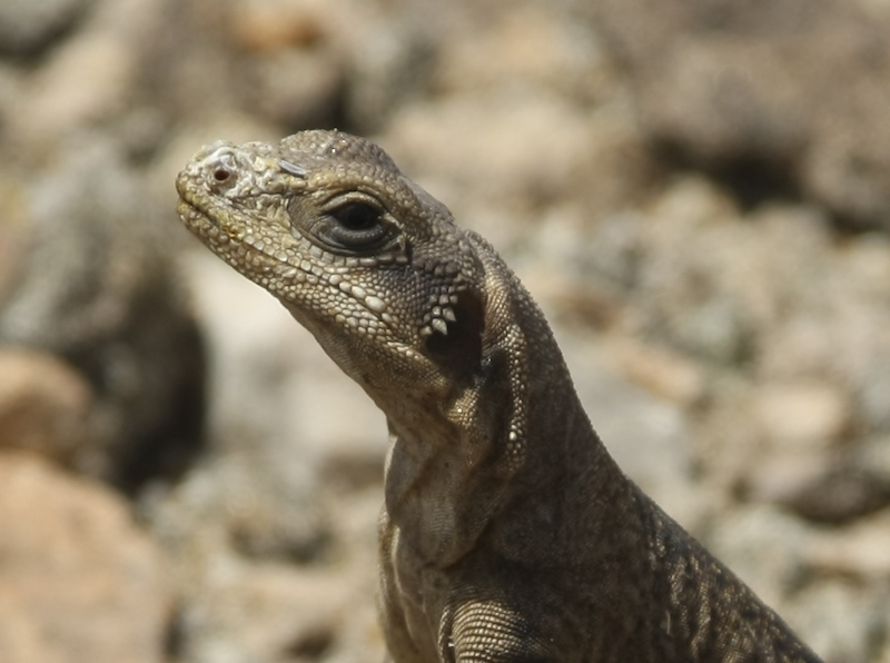
More chucks. This fellow was very close and while curious, was not seemingly afraid.
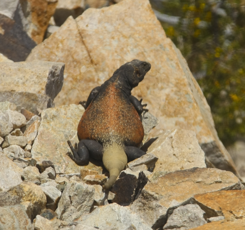
This one needs to join weight watchers. These lizards store fat in their tail, thus the bulbous shape.
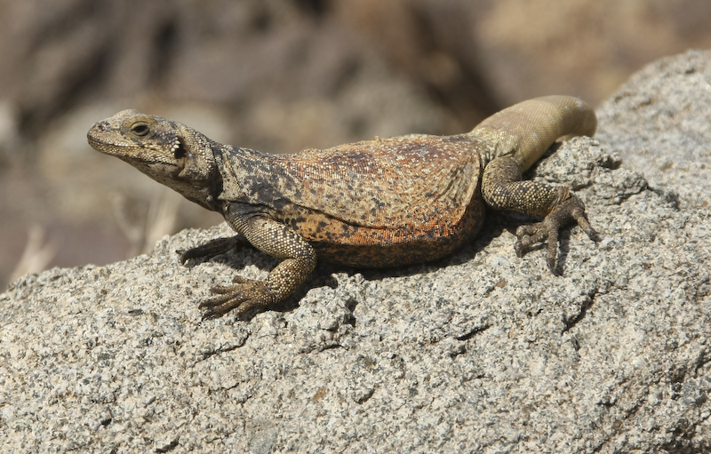
Yet another chuck. After awhile I lost count, and interest. Interesting to note the colorings closely match the patterns in the rock.
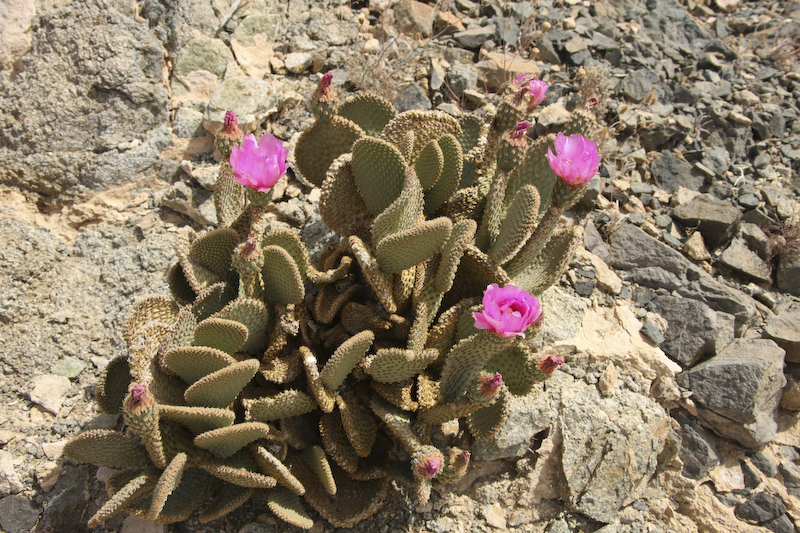
Near the top of the pass, we spotted some beavertail cactus in bloom.
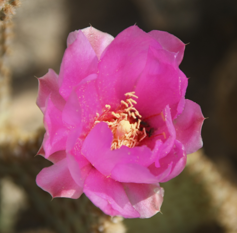
The cactus flowers have nice structure and great coloring.
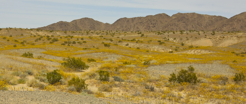
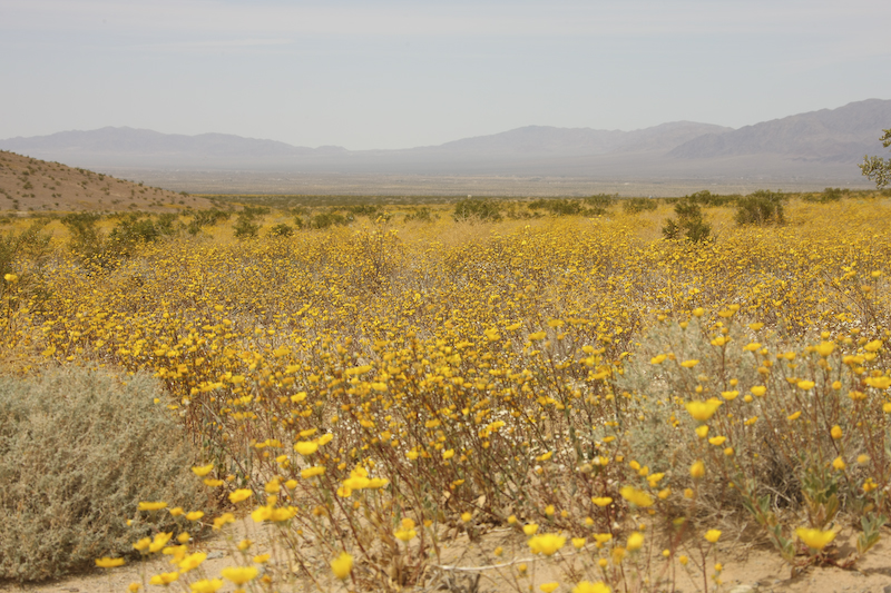
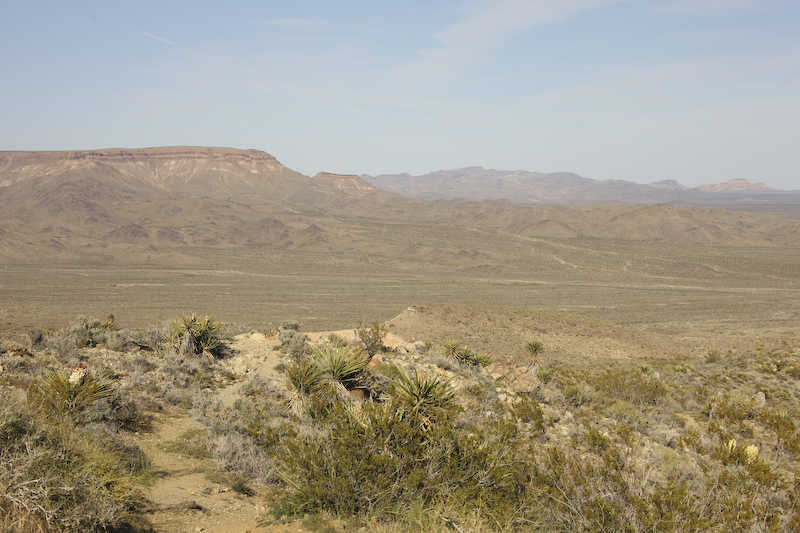
Over the crest of the pass we were presented with whole valleys that were in bloom with yellow flowers. Here, the blooms cover most of the hillside.
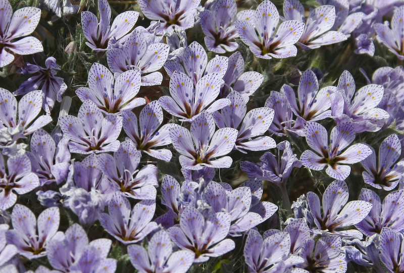
In addition to the yellow flowers, there were nice patches of these blue flowers as well. One of my buddies sent me a link to help identify flower names, but these were not in their dictionary. But, even if I cannot name them, they are still pretty.
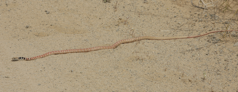
I spotted this fellow before he saw me. I shot this photo from the steps of the mog, but once I stepped down to get a closer view, he was out of there like a shot. He bolted for the base of the creosote at the right and was gone, never to be seen again (by me).
Crossing another low pass we again were presented with expansive views of the wild flowers in bloom. The structures in the distance are along the 29 Palms highway.
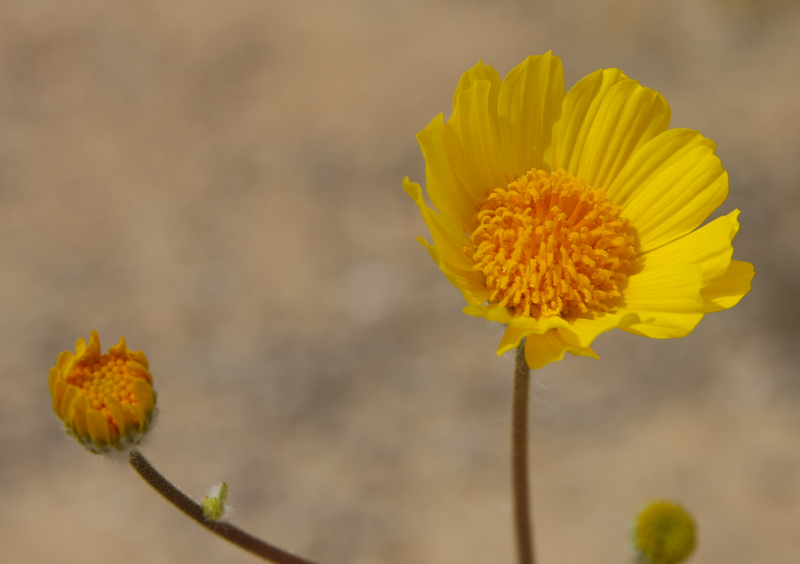
I think that the yellow flowers are Desert Sunflowers. But whatever they are named, they looked great. Needless to say, with the bloom came a legion of bees and other bugs that later provided a shotgun blast of goop on the mog windshield as we drove to the next objective.
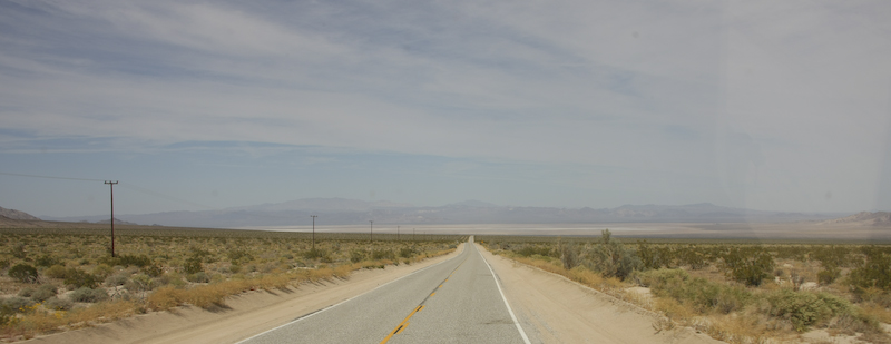
We went from dirt work to road work and headed north toward Amboy. In the distance is the Amboy dry lake.
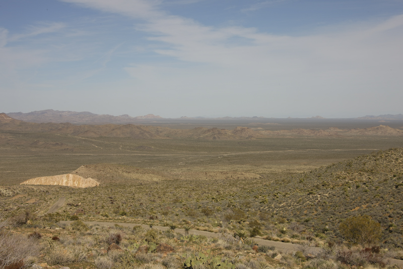
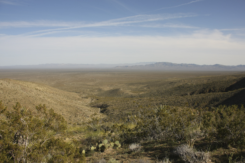
We traveled past Amboy then east on old route 66 to Essex, then north. We finally made it to Mitchell Caverns. We were hoping for a tour, but during the week, there is only one tour a day (at 1300hrs) and we missed it by several hours. So, as a consolation, we stayed at the site in a pretty nice camp area. The view was off the chart, if a bit windy. Here is a view looking to the northeast from the camp site.
To the southeast of the caves, we got great views of the Mojave desert. Interstate 40 is out there at the base of the closest mountains.
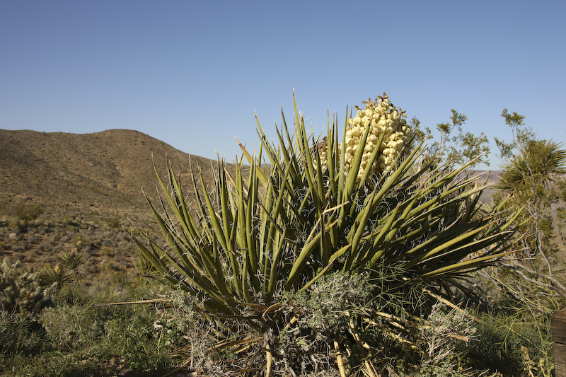
More yucca in bloom at Mitchell Caverns. The caverns were at 2500 feet altitude, so it was much colder than the desert floor.
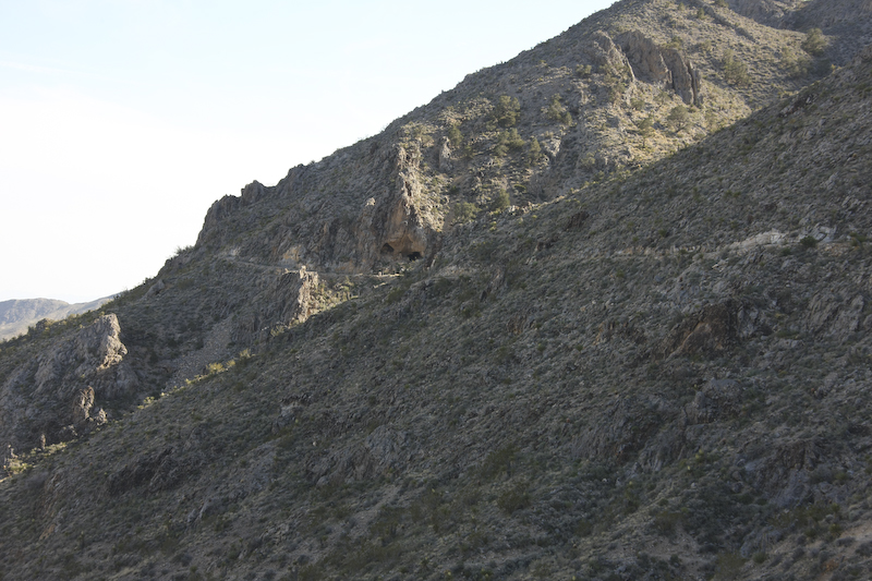
The entrance to the caves is along the trail that traverses the face of the cliffs.
To the northeast were canyons and mesas that are used for cattle ranching.
The camp site came with its own lizards, but this fellow is not a chuckawalla. Or if he is, then he has been working out, unlike his buddies down in the valley.
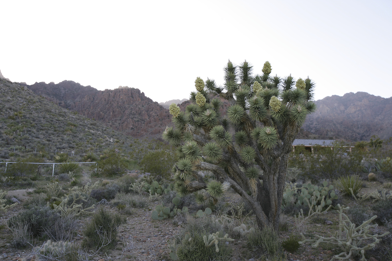
As night began to fall, we had a chance to explore the area around the camp. Here is a joshua tree.
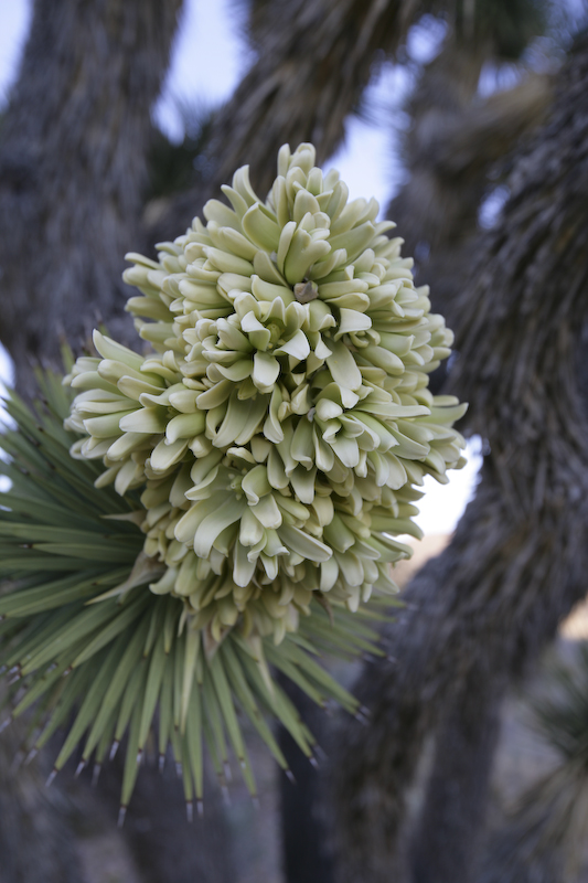
The joshua tree was preparing to bloom but was not quite there yet.
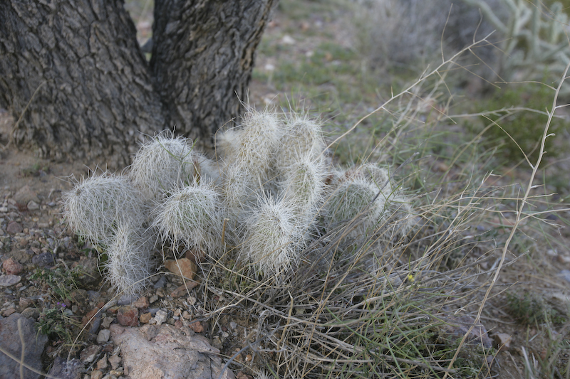
There were some nice cactus at the foot of the tree.
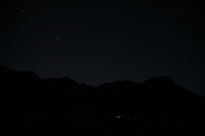
The night was clear and cold. The stars were bright, but there was no moon. I thought there was sufficient light for a time exposure, but was proven wrong. The shot above is a 30 second exposure and the outline of the Providence Mountains is barely visible. The lights in the foreground are the cave caretaker's cabin.
Yet another great day. Despite some wind, we slept well. The hard-walled camper did its job and we were both warm and comfortable. In fact, we watched a DVD on our laptop and then slept in the following day. The next objective was to cross the Providence range on a dirt trail and then head north to Baker, CA for re-supply on diesel and ice. From there, it would be a northern path into Death Valley.
| Previous Adventure | ||
| Trip Home Page |
Photos and Text Copyright Bill Caid 2008, all rights reserved.
For your enjoyment only, not for commercial use.