We spent
several days in Cody, WY with our friends Bob and Sandy.
They have a nice place on the South Fork of the Shoshone
River. While at the ranch, we generally chilled out and
did a few chores.
The photos below are what we saw.
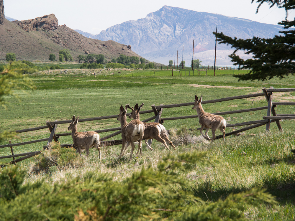
There is
plenty of game around the ranch. From our bedroom window,
I spotted a herd of deer that were lounging under the pine trees
near the rear of the house. I attempted to sneak around
the house to get a photo, but I think their ears are better than
my best stealth mode. When they heard me come close to the
corner, they bolted.
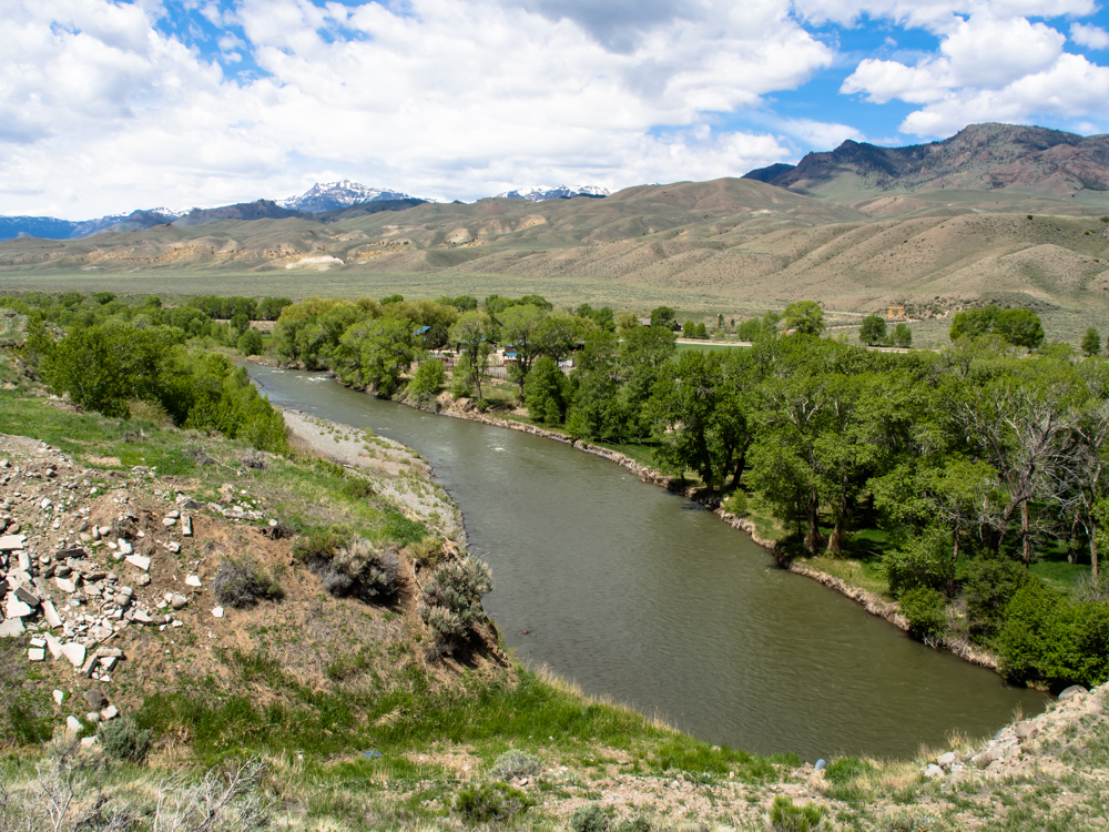
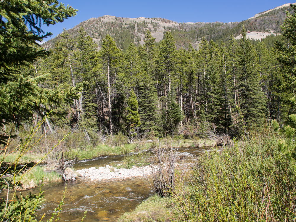
The
South Fork of the Shoshone River as seen from the living
room. The snow-covered Absaroka Range is visible in the
distance.
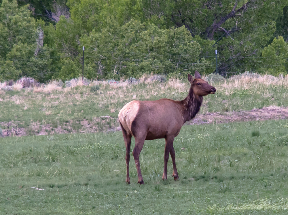
In the
hay field to the north, this elk cow was chowing down.
But, something has her spooked, she is on the lookout for something and I
doubt it was us. We were hundreds of meters away and
downwind. She eventually bolted and jumped over the fence
en-route to the brush by the river bank.
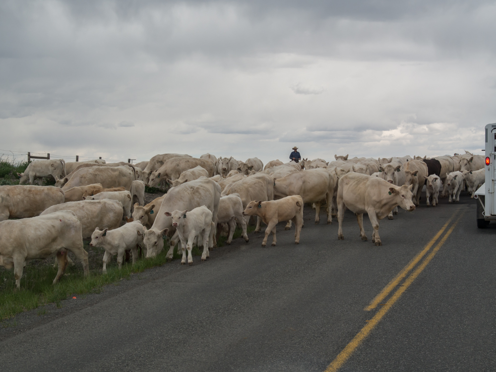
The old
west is alive in Cody, WY. We went into town for some
supplies and shopping and got tied up in a traffic jam, Wyoming
style. One of the ranchers was driving cattle to an
alternate grazing area and the road was the most expedient way
of meeting the goal.
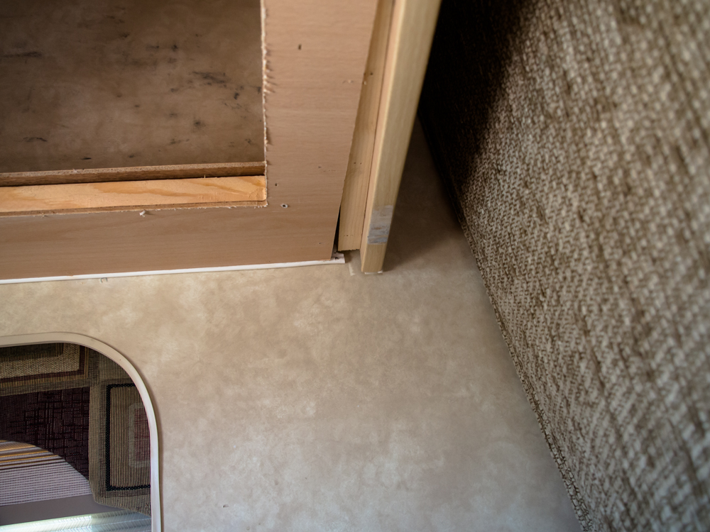
Just
like the last time we visited Bob and Sandy, we discovered some
equipment failure just as we were departing. Kathleen
spotted this cabinet that was falling apart. So, we went to Bob's
shop and borrowed a drill and some screws. We mixed up
some JB Weld, slathered it in sauce and screwed it back
together. We have been chasing cabinet failures in the
camper since we purchased it. To put it nicely, it was
"economically" built, but not off-road robust.
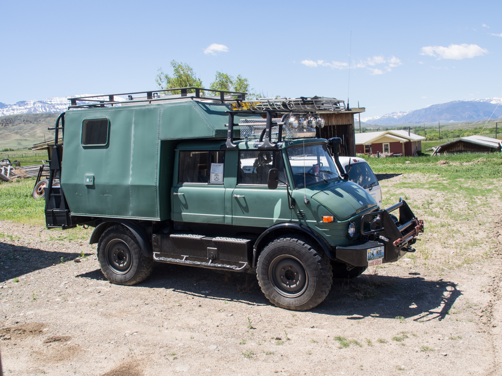
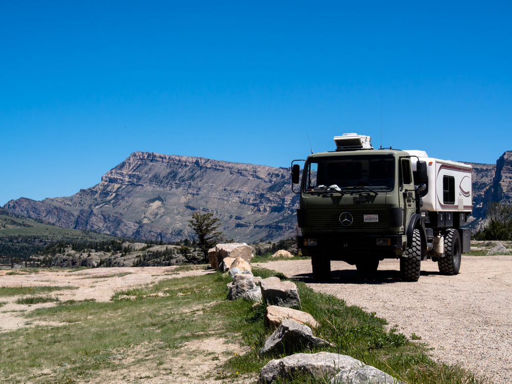
Bob's
416 DOKA camper is for sale. This rig is very capable: it
went up the Moab Rim and many of the other hard-core
trails. If you are interested in his Unimog for sale,
email him at "newsome at codyice dot com".
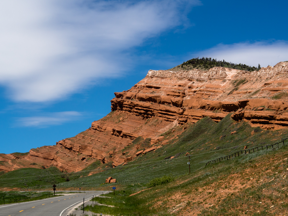
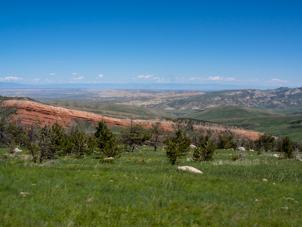
We
headed north out of Cody and followed the Chief Joseph trail and
passed these nice red cliffs.
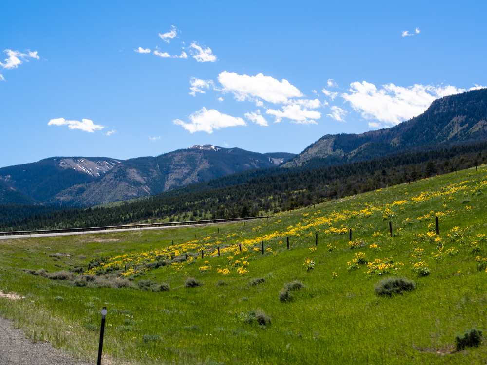
As we
ascended Dead Indian Pass, we could see the green grass
punctuated by the spring flowers.
Near the
top of the ridge, we could see south toward Cody.
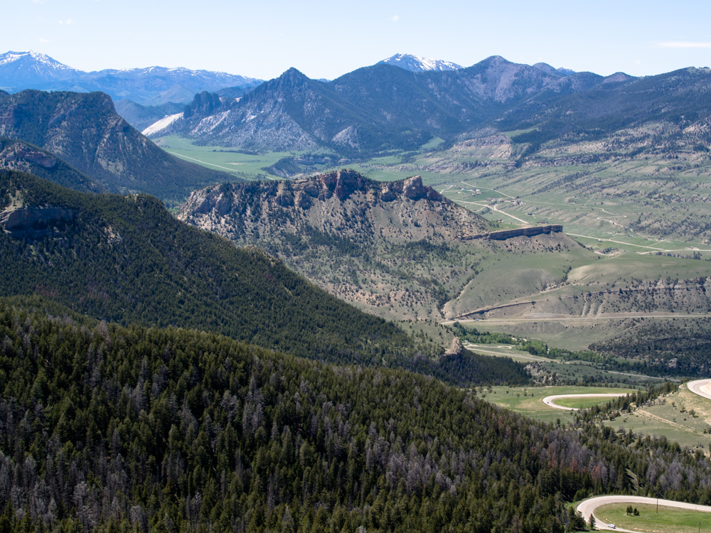
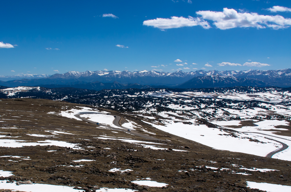
From
Dead Indian Pass, we got a commanding view of the Sunlight
Basin. Note the switchbacks on our path.
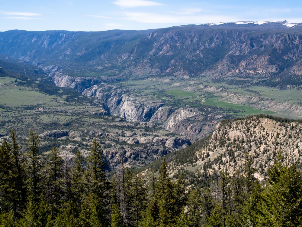
To the
northwest in the basin a steep canyon carved into the volcanic
rock by Sunlight Creek was visible.
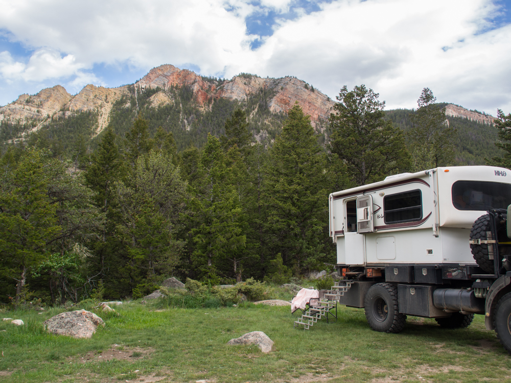
When we
got to the bottom of the Sunlight Basin, we found a dirt road
and found a place to camp.
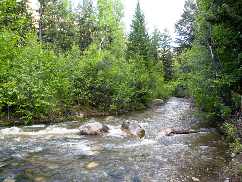
Dead
Indian Creek was right next to our camp.
It was a
bit breezy overnight, but the following morning was clear and
calm. From Dead Indian Creek, large cliffs were visible to
the west.
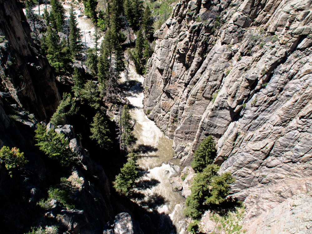
The shot
above was taken from Sunlight Creek bridge. The creek
carved a remarkable canyon into the volcanic strata.
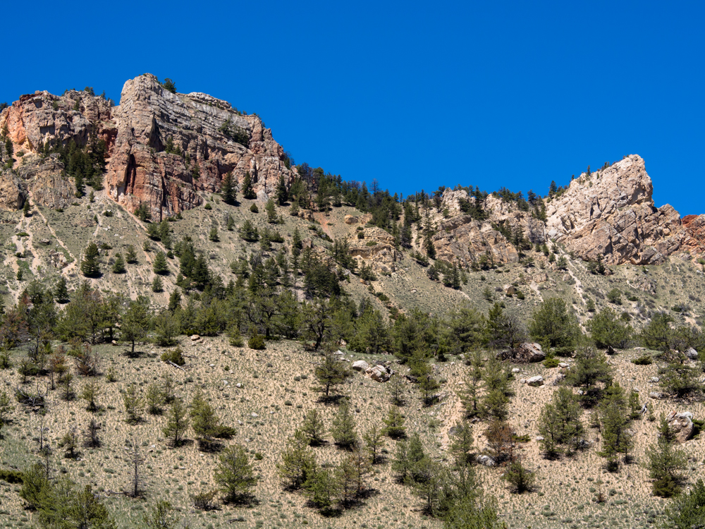
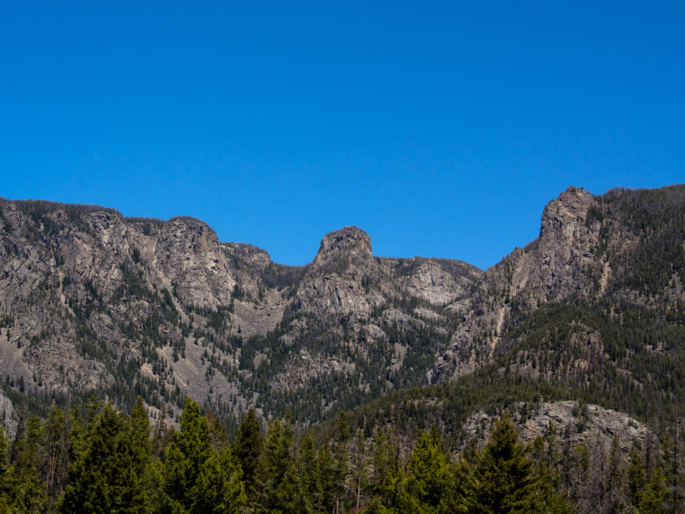
From the
bridge parking area, the uplift and erosion of the formations to
the east were visible.
We followed
the Clark Fork river toward the Beartooth Mountains. The
formations in the Beartooths have eroded to huge castles and
steep canyons.
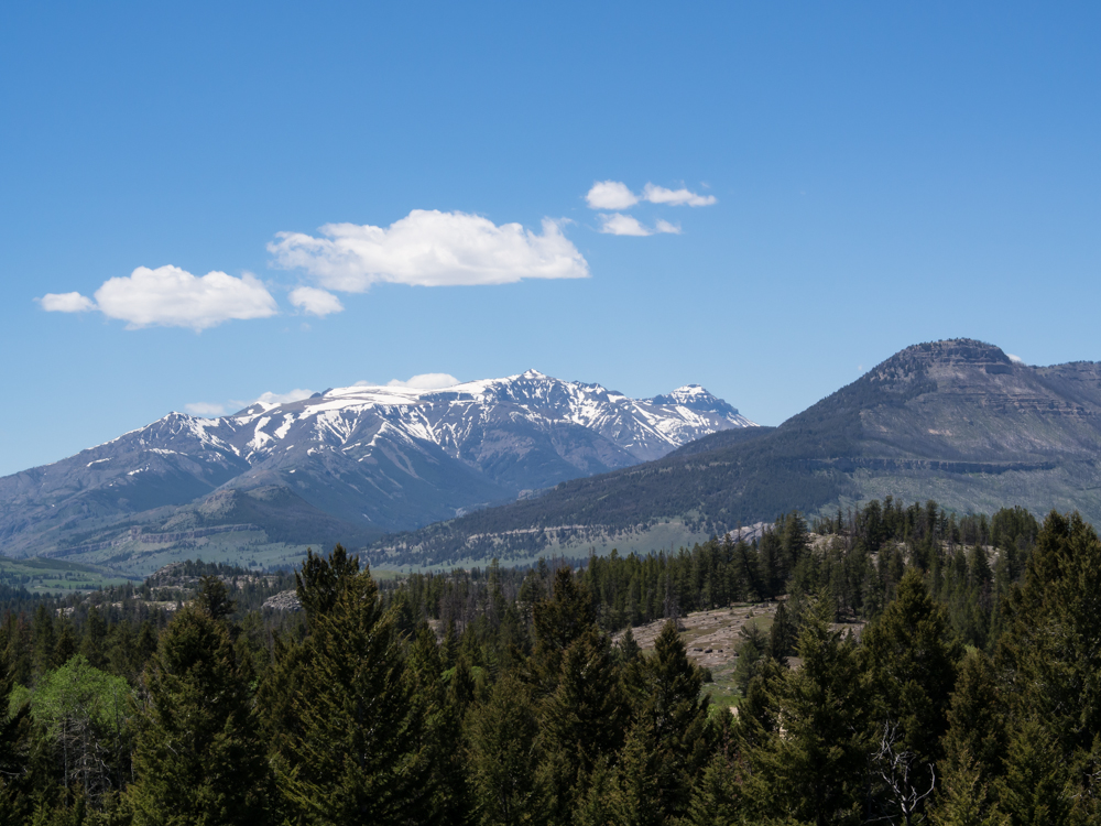
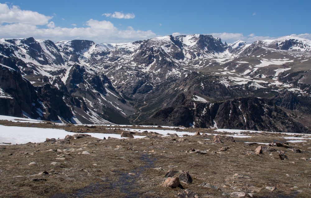
As we
got higher, we got better views of the snow capped ridges of the
Beartooth Range.
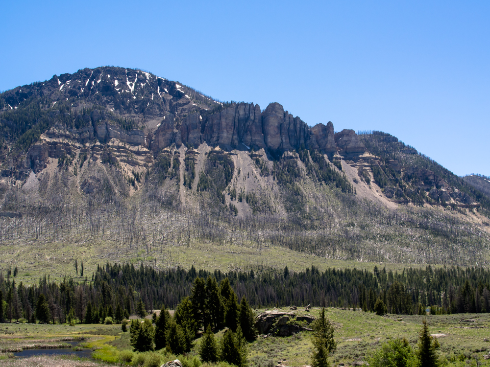
This
formation is called Cathedral Cliffs.
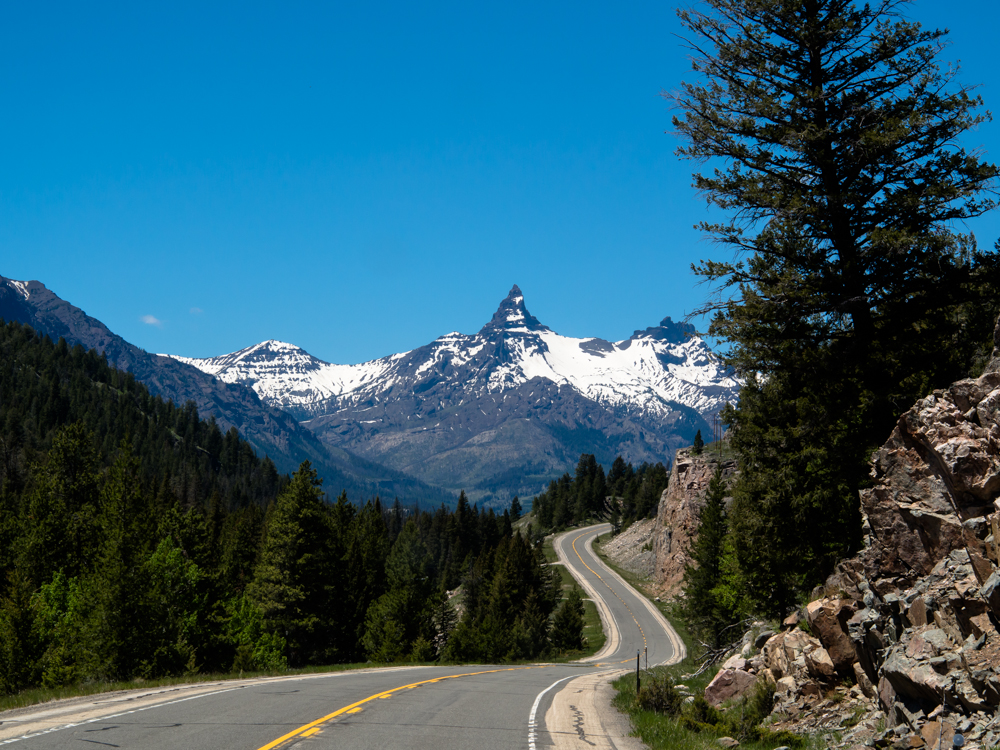
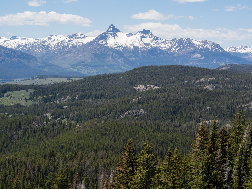
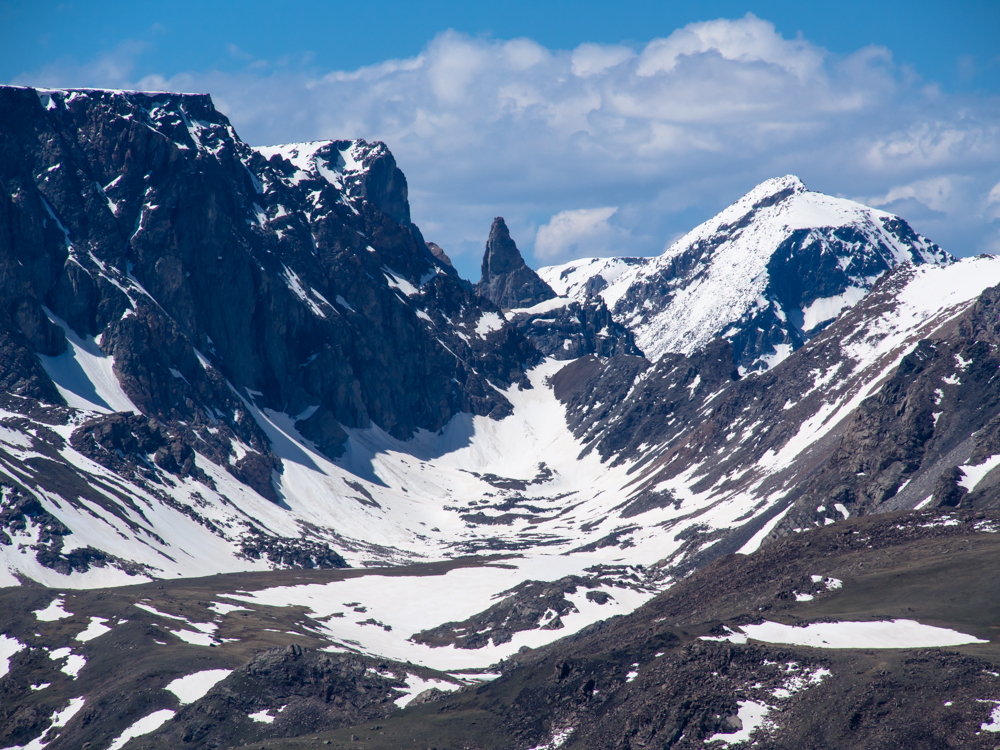
Some of
the peaks in the area were truly remarkable. This one
reminds me of the Matterhorn in Switzerland.
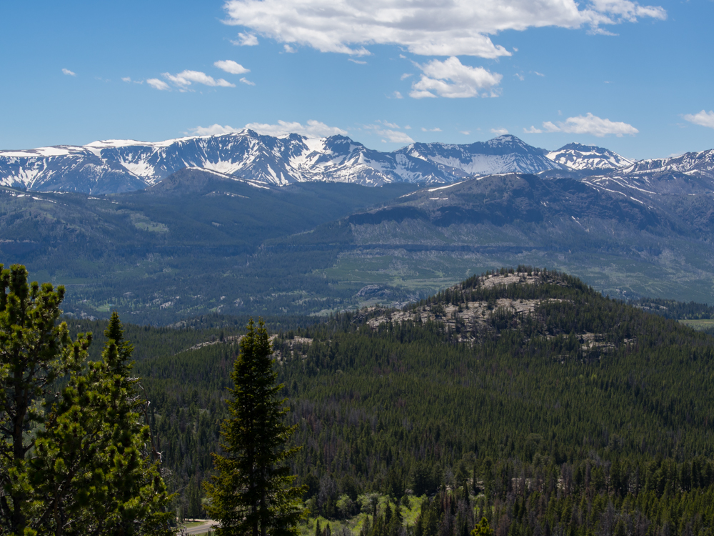
There
were a number of pull-outs that provided great views of the
mountains and valleys. I believe this is Jim Smith peak at
just over 10,000 feet.
Some of
the views were breathtaking.
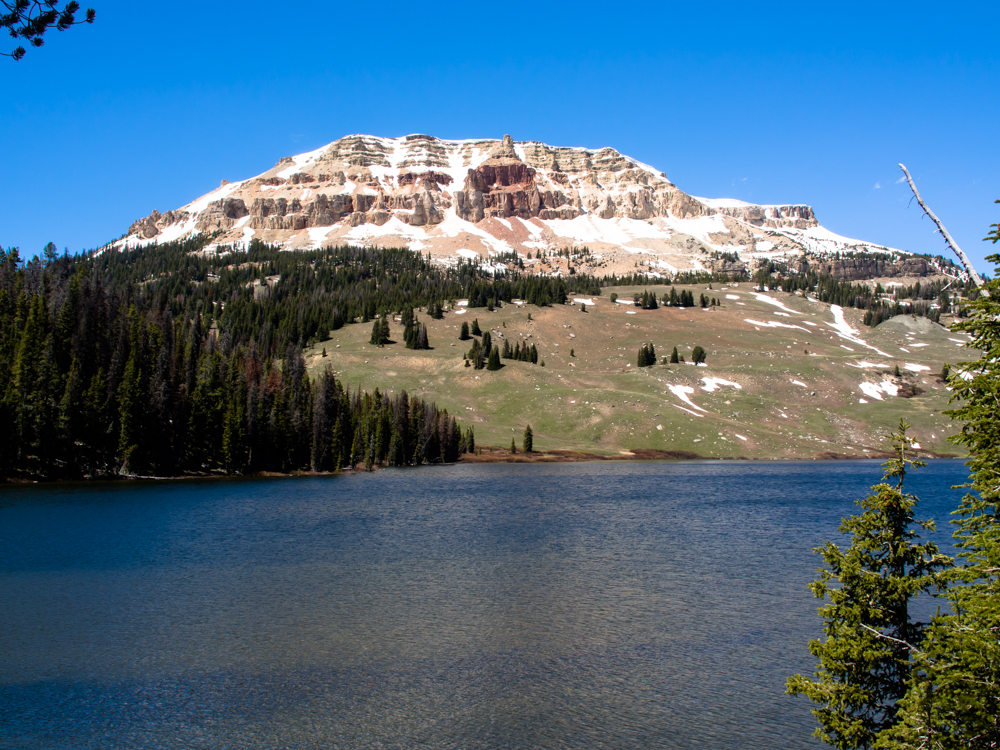
Beartooth
lake in the foreground with Beartooth Butte in the distance.
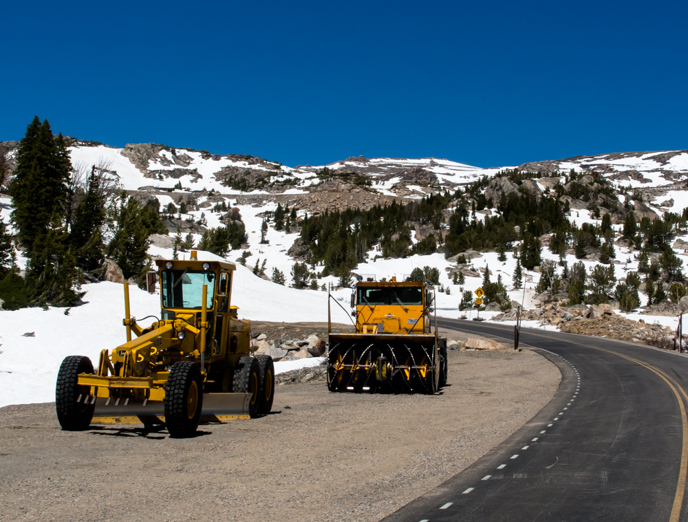
The top
of Beartooth Pass is almost 11,000 feet and has only been open a
few days. They still had a number of snow cutters
stationed along the road.
The pass
took our breath away, both literally and figuratively. At
11,000 feet you will get out of breath quickly.
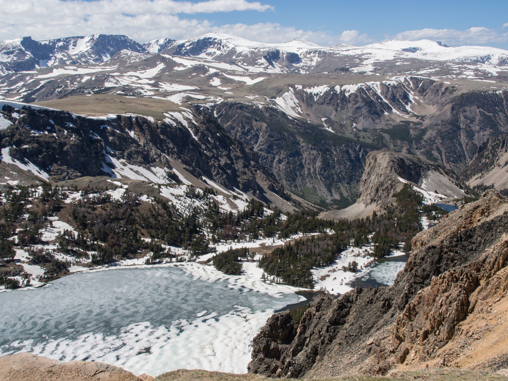
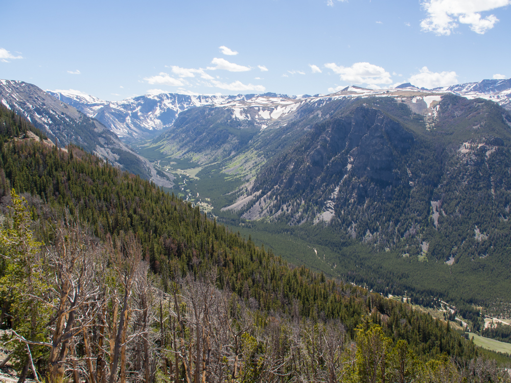
We
passed into Montana and started down the other side of the
Beartooth Range and got a look at this glaciated valley.
Note the dirt road at the bottom of the canyon. We found a
camp site off that road a bit later in the afternoon.
Beartooth
Peak.
Lakes
near the pass were still frozen.
Our camp
for the evening would be on the river side of the dirt road at
the bottom of the canyon.
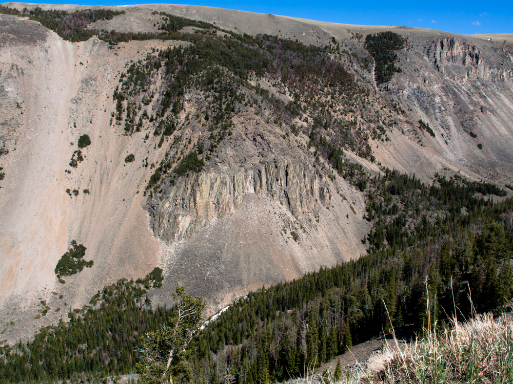
That creek at the bottom of the canyon cuts like a saw.
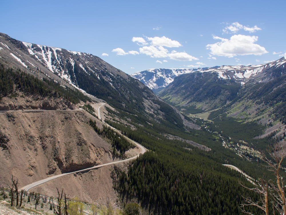
The road
that descended into the canyon was steep and narrow with many
tight switchbacks.
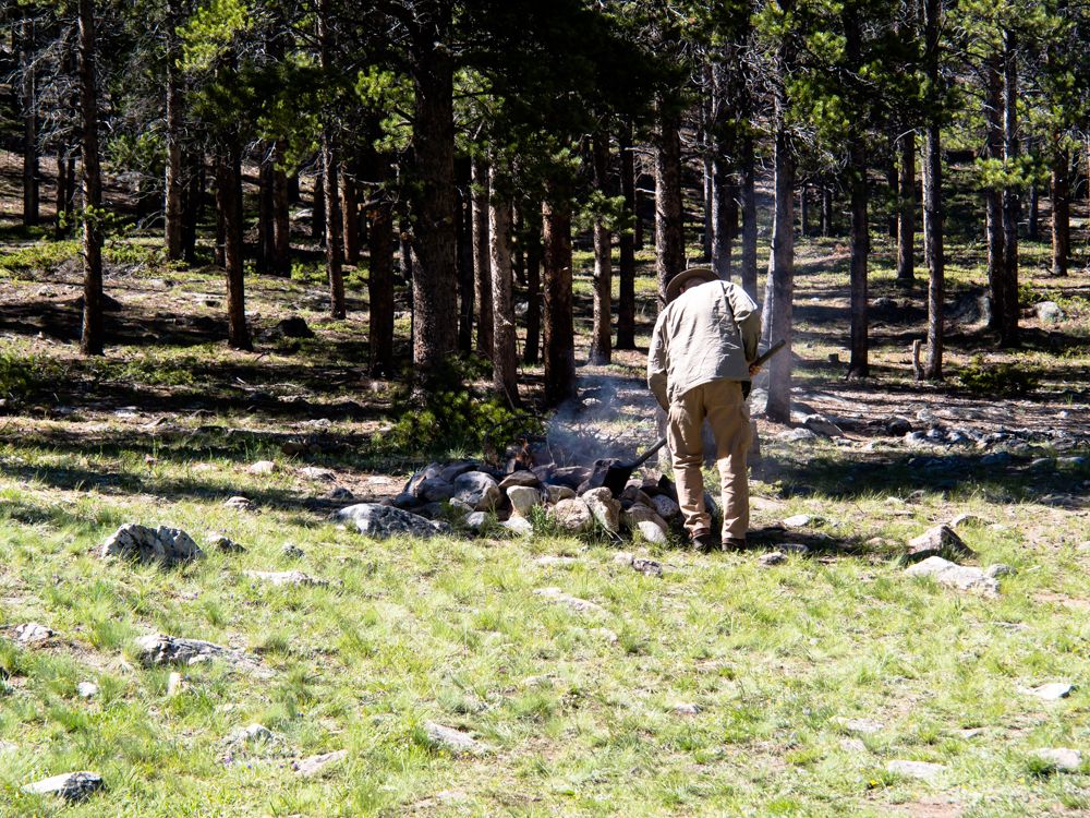
En-route to our remote camp, we came upon a camp fire that someone had left unattended, So, we put it out. It is not good form to depart a camp with a fire still burning.
Our camp was on the
banks of Rock Creek at the bottom of the canyon. One of
the switchbacks on the road is visible at the upper right of
the photo above.
| Previous Adventure | ||
| Trip Home Page |
Photos and Text Copyright Bill Caid 2013,
all rights reserved.
For your enjoyment only, not for commercial use.