We did "family
things" while we were in Tucson. Additionally, we did some
repairs to Thor. The brush and tight quarters we encountered
during the first portion of our trip caused some damage.
When we were completed with the repairs and a re-supply action
(propane, diesel and supplies) we headed north from Tucson toward
Globe, AZ. Our path would take us along the Gila river and
some of the tributary streams.
The photos below are what we saw.
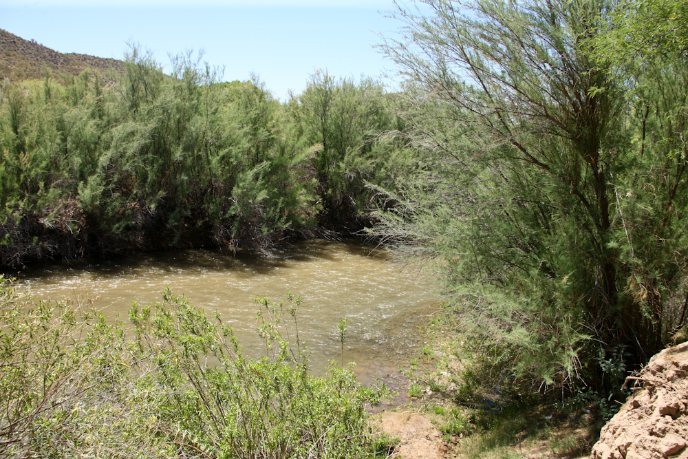
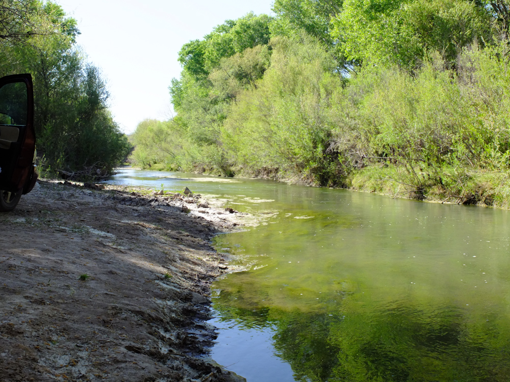
Driving along route
AZ-77 we passed a BLM campground on the banks of the Gila River,
so we stopped to check it out. The path by the river was
choked with low-hanging brush (exactly the sort that cause the
damage we just repaired) so we were extra careful. We
arrived at a nice camp site, but had other plans for the day, so
we took a few photos. In the photo above, the Gila does not
look like much. But, this river runs strong when there is
spring snow melt and the river supplies much of the municipal
water supply for Phoenix. That said, in the east, this would
be considered just a small creek. In the west, anything that
flows year around is a river and is typically critically
important.
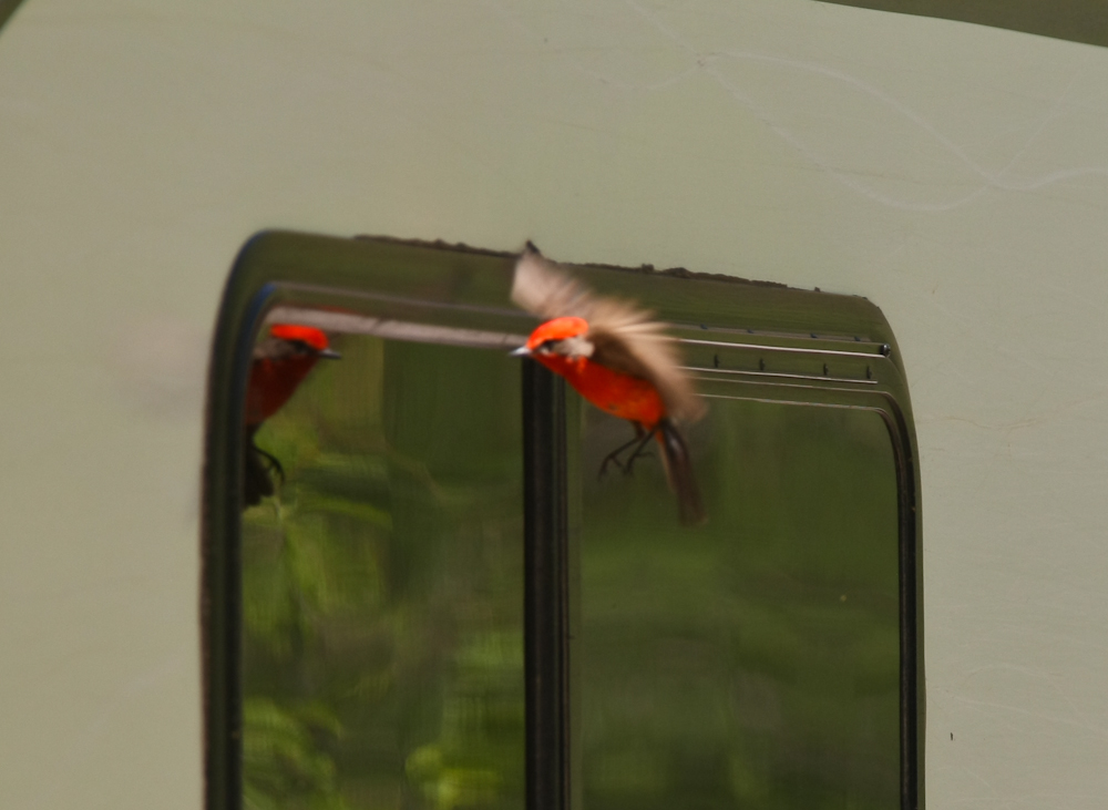
While we were checking
out the river, we heard this tapping sound and turned to find this
red bird beating himself to death on the window of the
camper. He saw his reflection and assumed it was a rival and
attacked -- repeatedly. I now understand where the term
"bird brain" comes from.
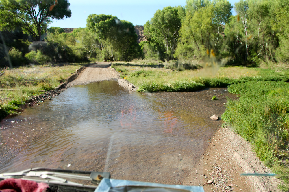
We traveled through
Globe, AZ and then headed southeast toward Arivaipa Canyon.
We traveled about 60 miles of dirt to get within striking distance
of the canyon. I had heard it was nice, but really did not
know what was there. We were both surprised when we
encountered a large water crossing. It seems that a large
spring feeds the creek that flows through Arivaipa canyon.
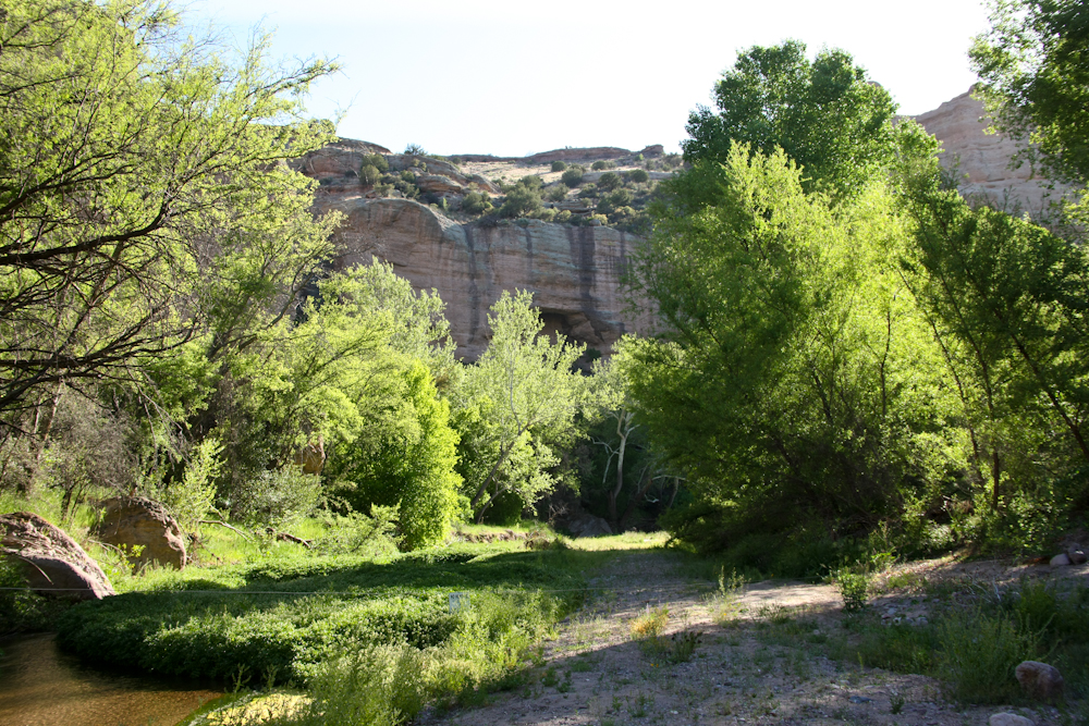
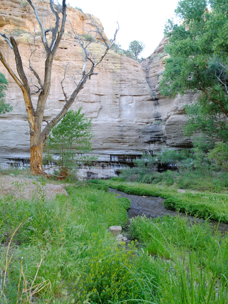
In addition to
producing a large flow of water, the spring is persistent and
provides water year around supporting a lush riparian habitat.
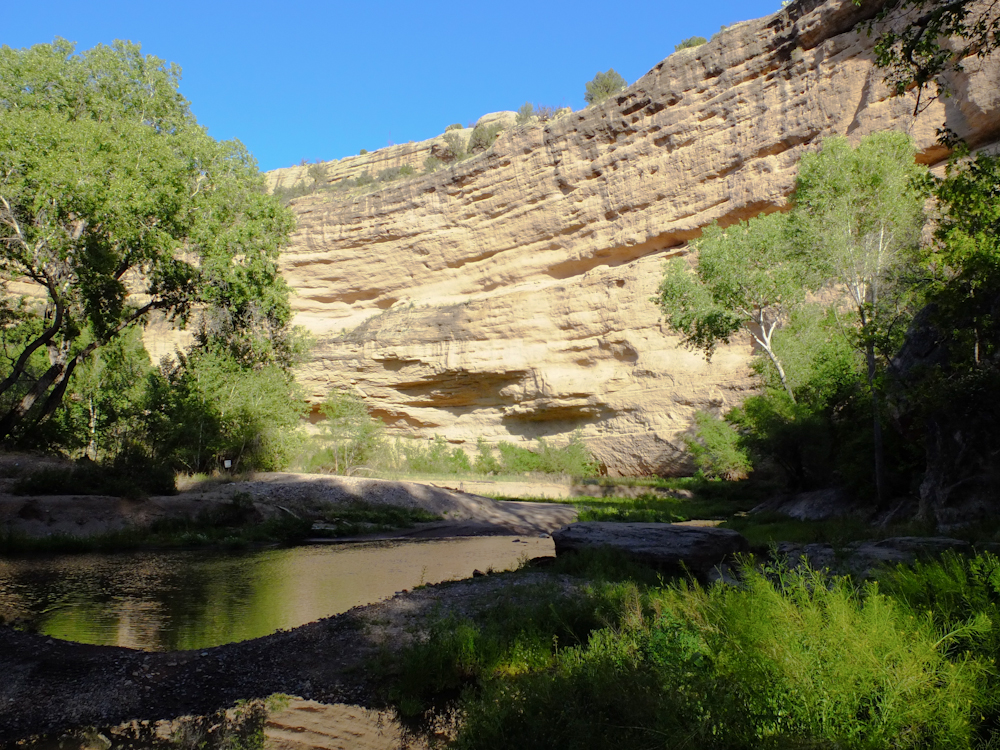
The creek flows into
the mountain which implies that flow of the spring cut through the
mountain as it was uplifted. The water course cut a deep,
well defined canyon into the mountain. The walls were
hundreds of feet high.
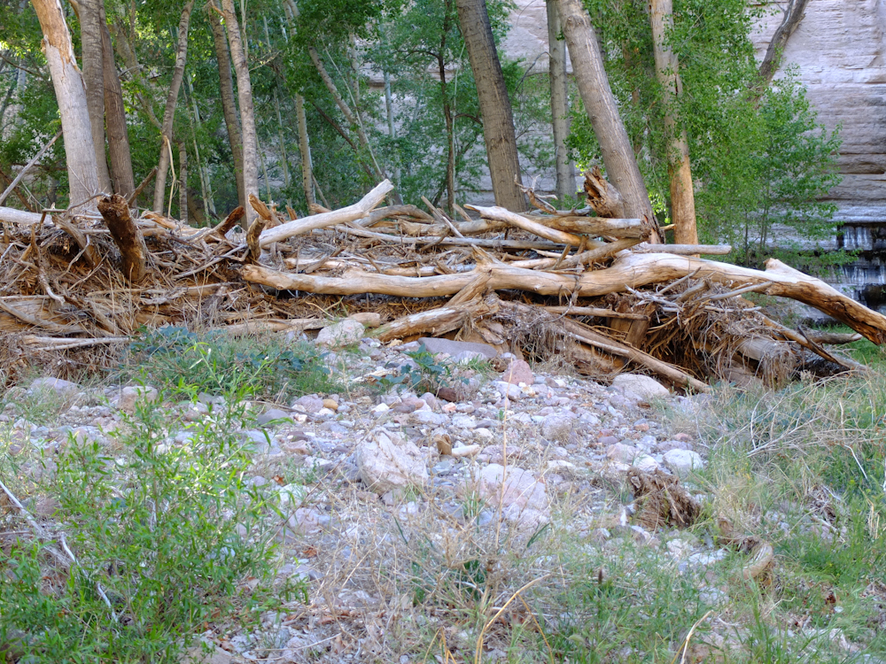
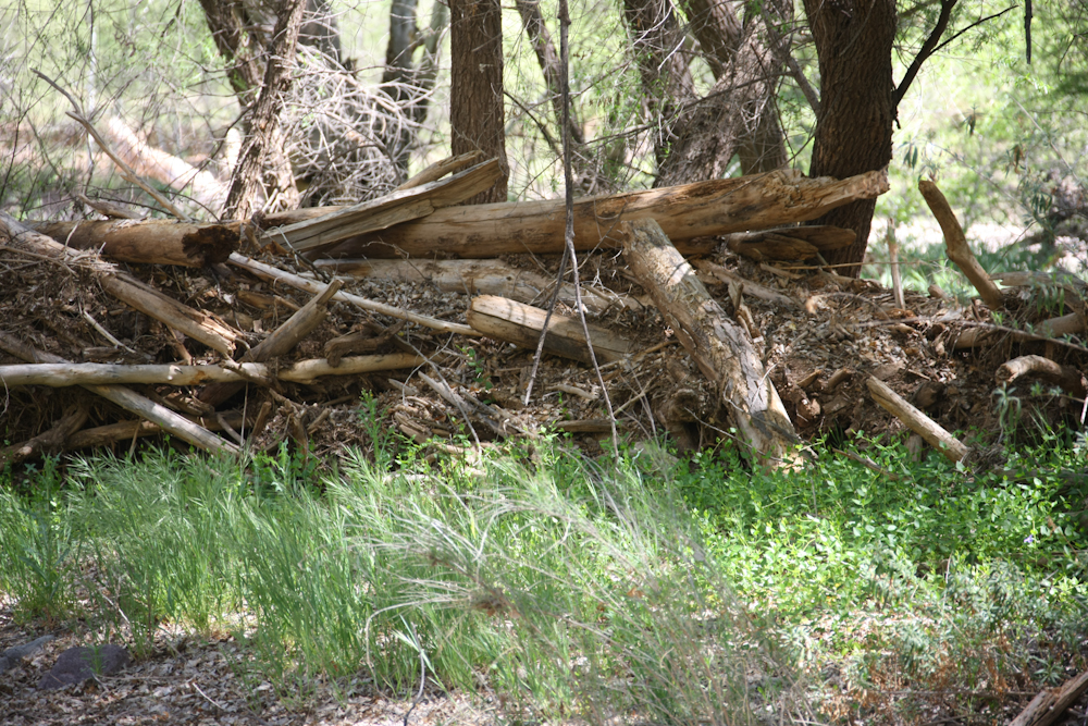
In addition to the
flow from the spring, the canyon floor also suffers occasional
high water flows due to rains and consequent flash floods.
This debris dam was over 6 feet high suggesting the canyon floor
was not a good place to be during the flood. Once in the
canyon, there is no easy escape.
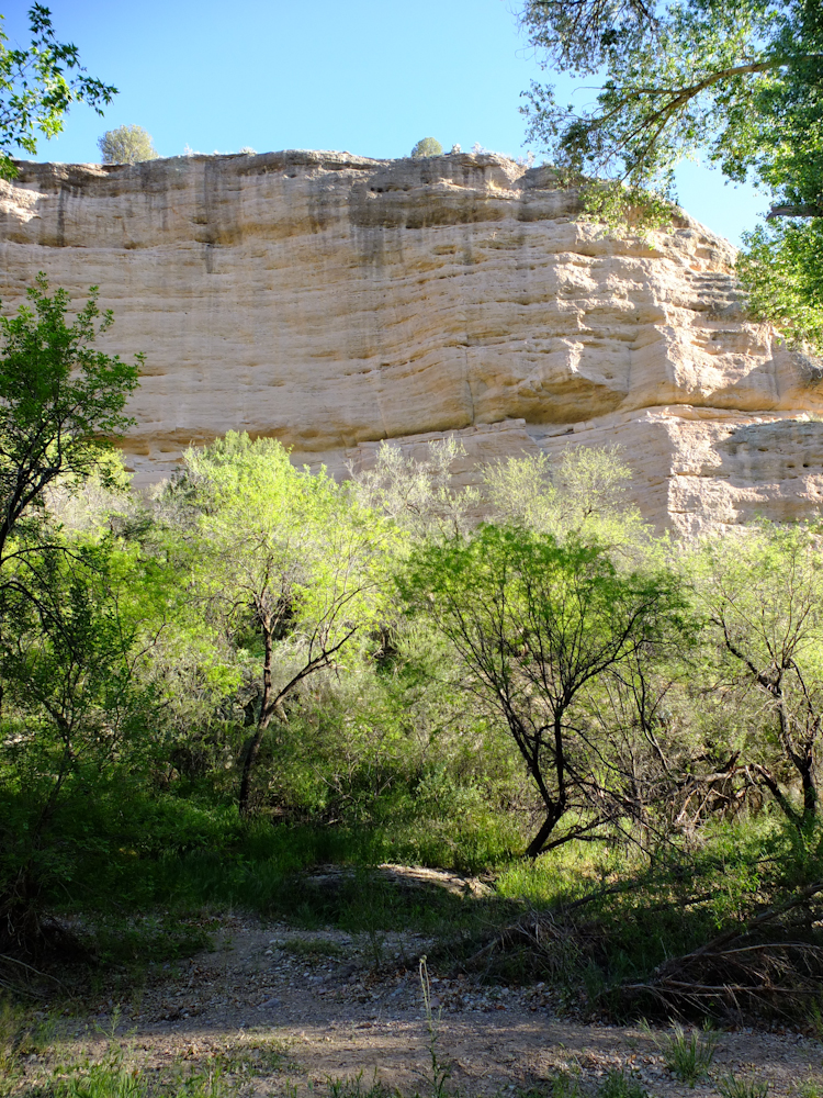
The rim of the canyon
was dry and "normal" desert.
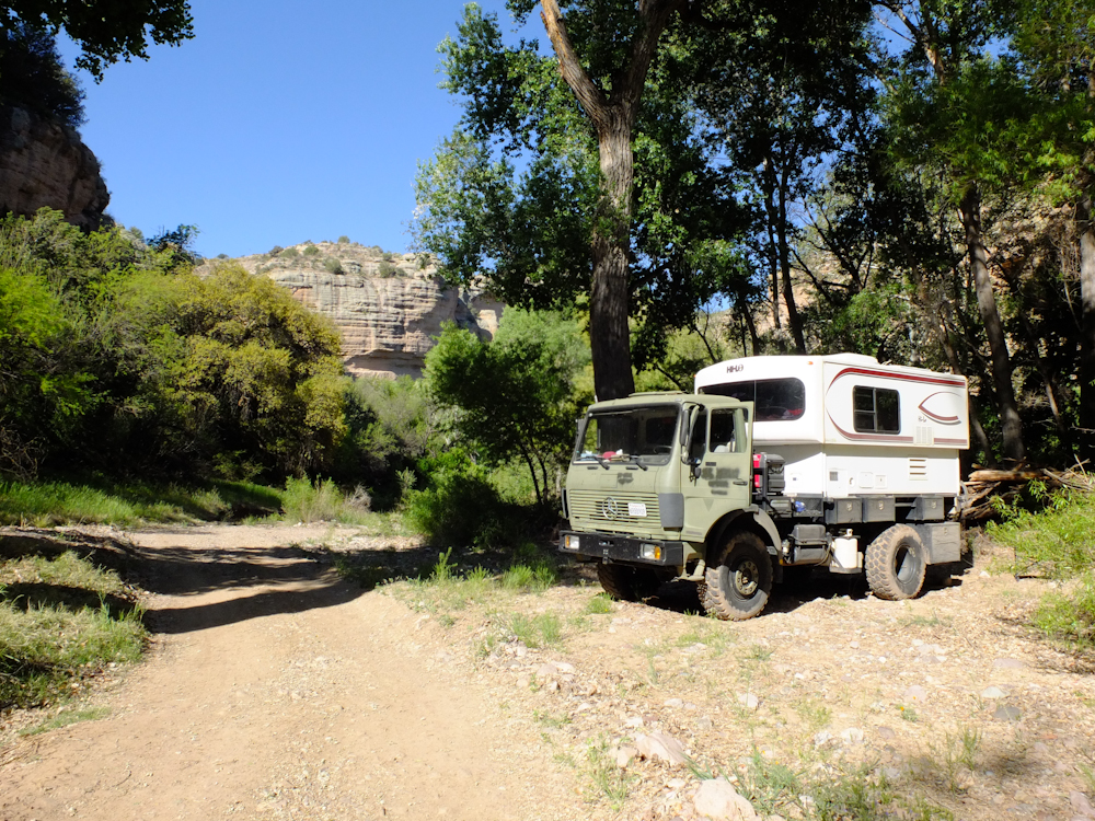
We traveled the trail
until we hit Turkey Creek and then turned around. The trail
became very narrow and I was concerned that we would not be able
to turn around, so we stopped when we could. We returned to
the main canyon and found a wide spot in the trail for the
night. Thor got his feet muddy at Turkey Creek.
It was a calm, cool
night and we both slept well. Next morning, I walked around
to get a lay of the land. I found a deep pool nearby that
had small fish. To the north, the canyon walls had evidence
of water seepage. Note the dark lines on the cliff walls
that show the seeps.
Because the canyon was
deep, it took quite awhile for the sun to reach our camp.
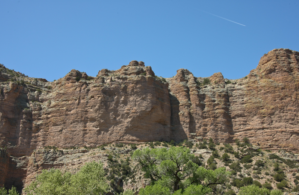
The south canyon walls
were quite high. Visible above were contrails from a passing
jet.
On our exit from the
canyon, we passed many high debris dams that told a scary story
about the dangers of being in the canyon during a rain storm.
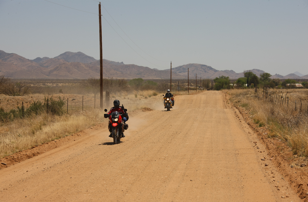
From the Arivaipa, we
traveled south to Bonita, AZ on a county road. The road had
been recently graded and it was in great shape allowing
comfortable travel at 45 mph. En route, we met these
cross-country cyclists on their Dakar-style motorcycles.
They, too, were headed to Arivaipa Canyon.
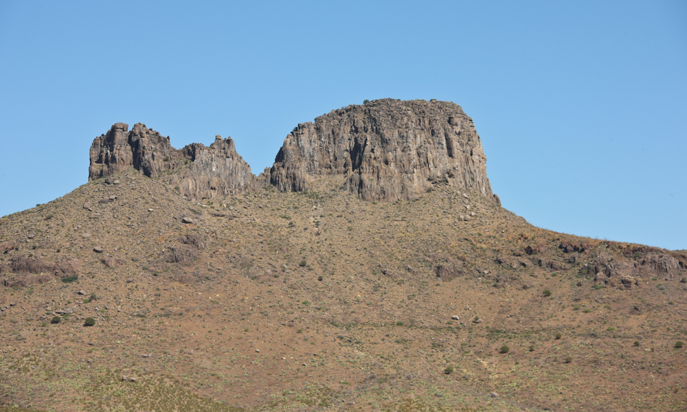
From Bonita, we
crossed the Graham Mountains and headed into Safford for a supply
stop. After diesel and fuel for the humans, we returned to
the back country. From our trail, we passed this large
volcanic plug. Unlike the terrain around Arivaipa, this area
was quite barren.
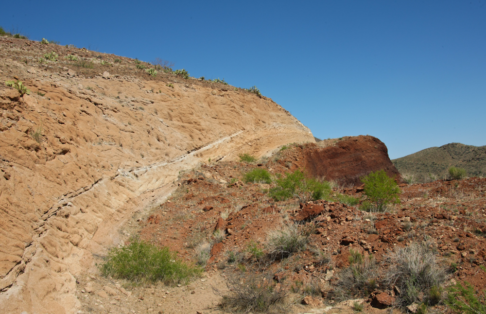
Traveling on the
Backcountry Byway, AKA "Old Safford Road", we encounterd this
interesting structure along the road. This is sandstone on
top of a volcanic pumice layer.
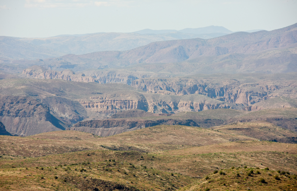
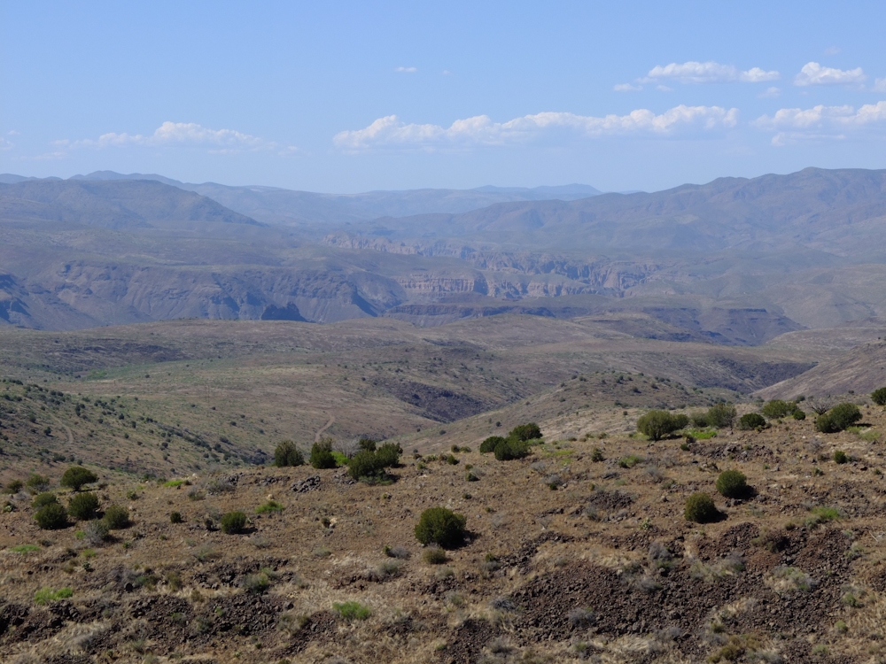
The pass on the trail
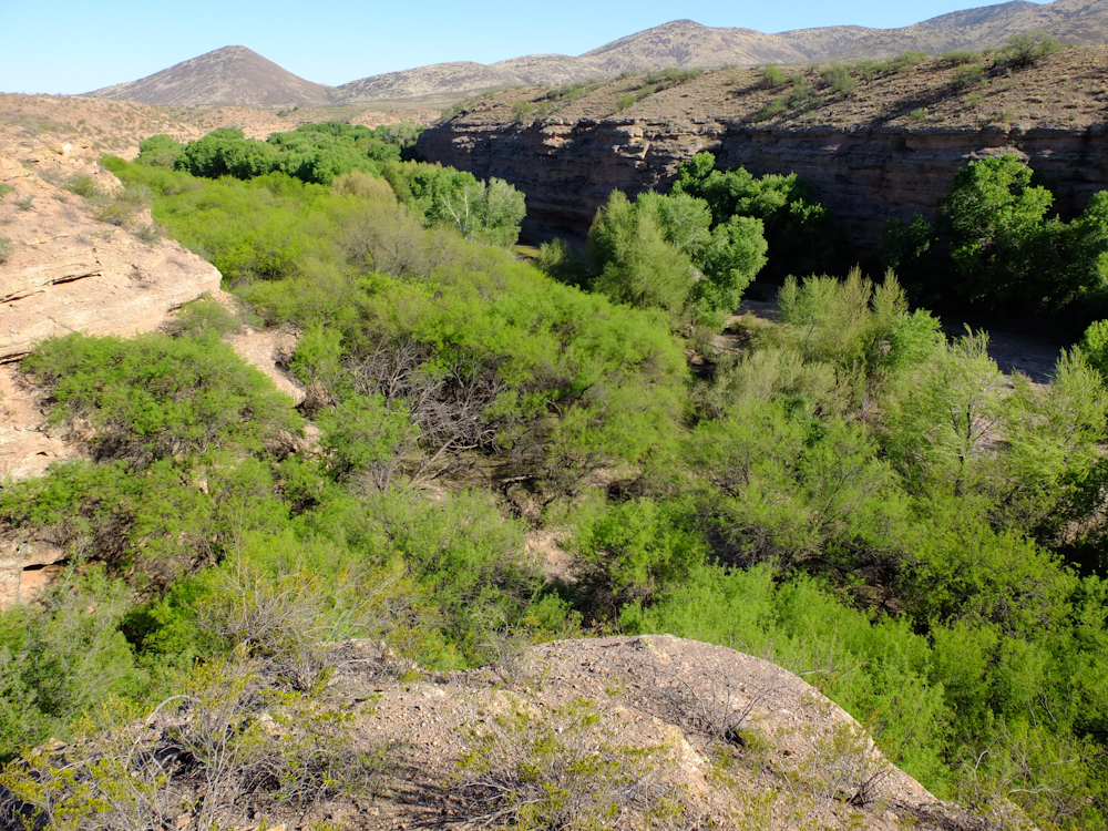
was about 5500 feet and provided a great view of the Gila Box
area. The Gila River is in the deep canyon in the center of
the photo above.
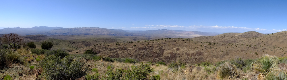
A panorama from my
Fuji X10. This was shot from the top of the pass and that
location provided a commanding view of both the Gila Box
wilderness and the copper mines at Morenci. Click here to see the full-size photo.
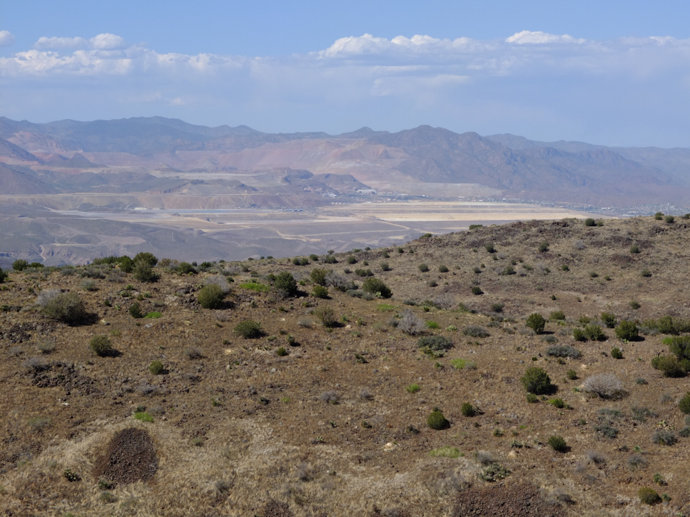
The copper mines at
Morenci have been in operation for over one hundred years.
Note the amount of earth that has been moved recovering minerals.
The Gila Box is
visible in the top center of the photo above.
The trail descended to
the canyon floor below and we finally encountered the Gila
River. We took a spur on the trail that took us to the side
of the river. From this view, the "river" is just a placid
creek. But, as noted above, the Gila is a vital supply of
water to this area of Arizona.
We crossed the Gila and went to the Owl Creek camp on the far bank. From our campsite, we had a nice view of the Gila Canyon.
Arivaipa Canyon was much, much nicer than I expected. A very rare area. So rare in fact, that the Nature Concervancy purchased all the land in the valley floor and has made it a restricted access area. We camped past the NC area on BLM land. If you go, you will have to traverse the canyon to Turkey Creek or beyond to be able to camp. I would definitely go again.| Previous Adventure | ||
| Trip Home Page |
Photos
and Text Copyright Bill Caid 2012, all rights reserved.
For your enjoyment only, not for commercial use.