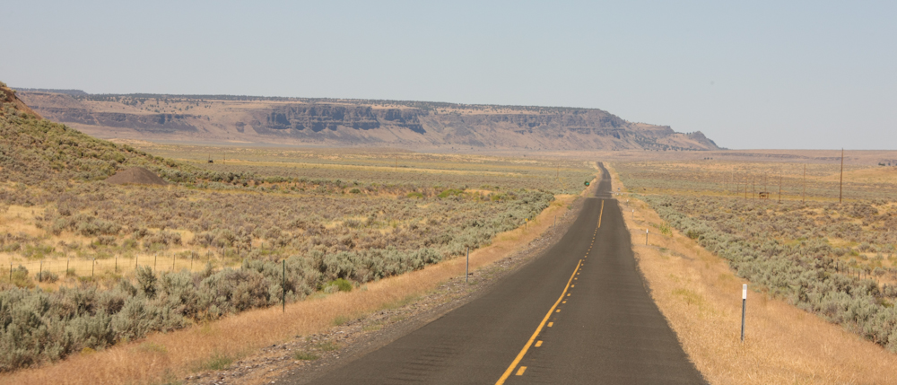
We
stayed at an RV park in Eagle, ID and the primary action was changing
the leaking tire. Once that was completed, we did "chores" and
then packed to hit the road again. Based on the suggestion of our
mog friend Ben, our planed destination was the Steens Mountains in
eastern Oregon.
The photos below are what we saw.
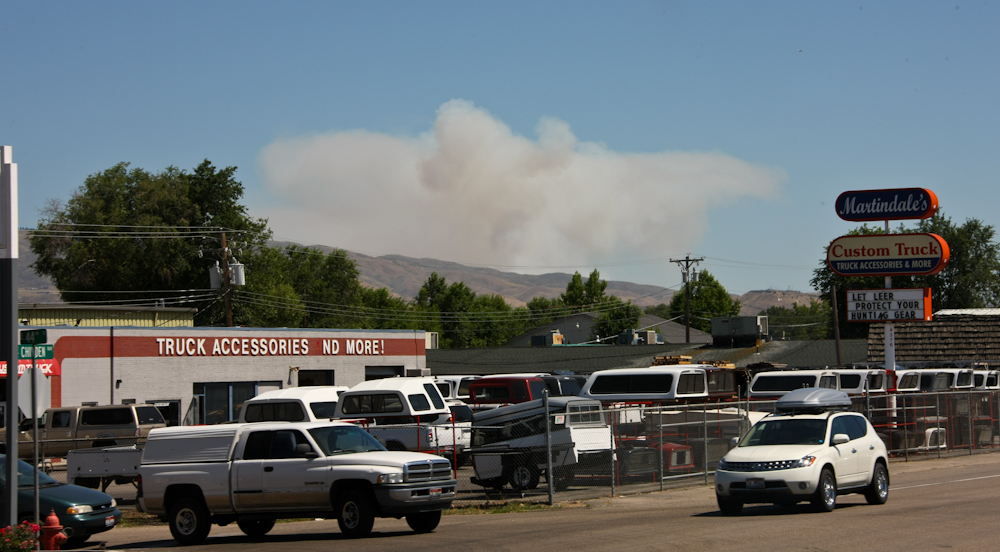
As
we were leaving Eagle, we spotted a large brush fire on the hills
northeast of Boise, ID. Fires were a recurring theme on this trip.
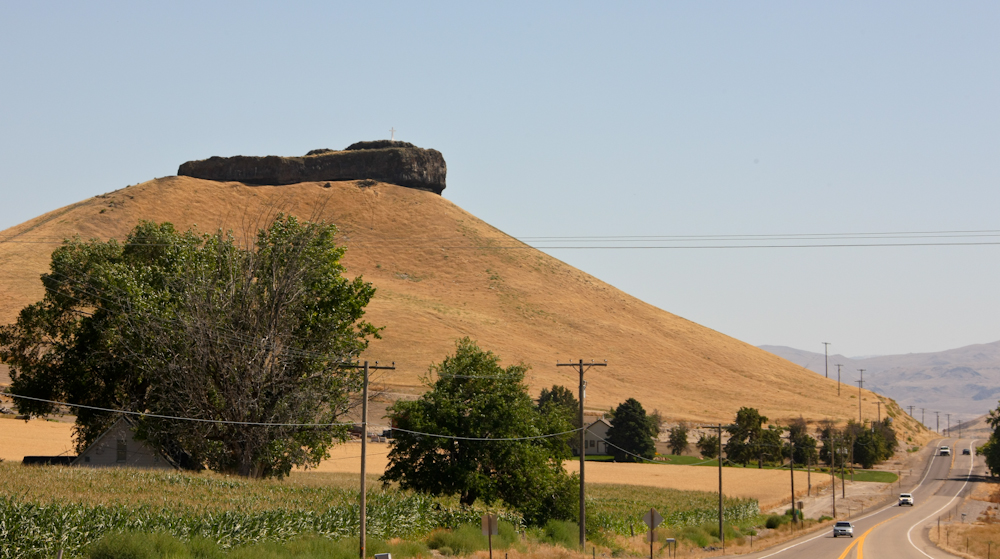
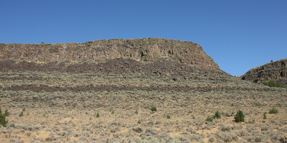
We
traveled to the west, then south and passed this structure called
"Lizard Rock". The structure is a small butte capped with a
volcanic layer.
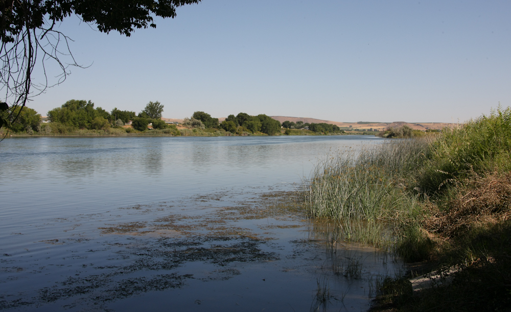
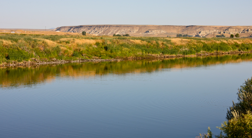
A
bit further down the road we passed the Snake River.
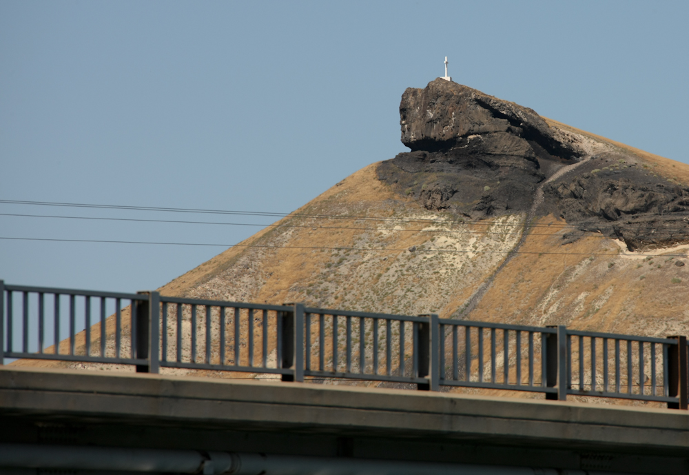
From
a roadside park, Lizard Rock was still visible. The top of the
structure appears to be basalt and the layer below appears to be coal,
perhaps western lignite.
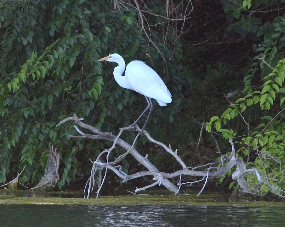
Next
to the park at on the Snake, there was a slough that had lots of brush
and I spotted this egret.
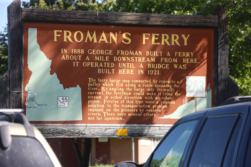
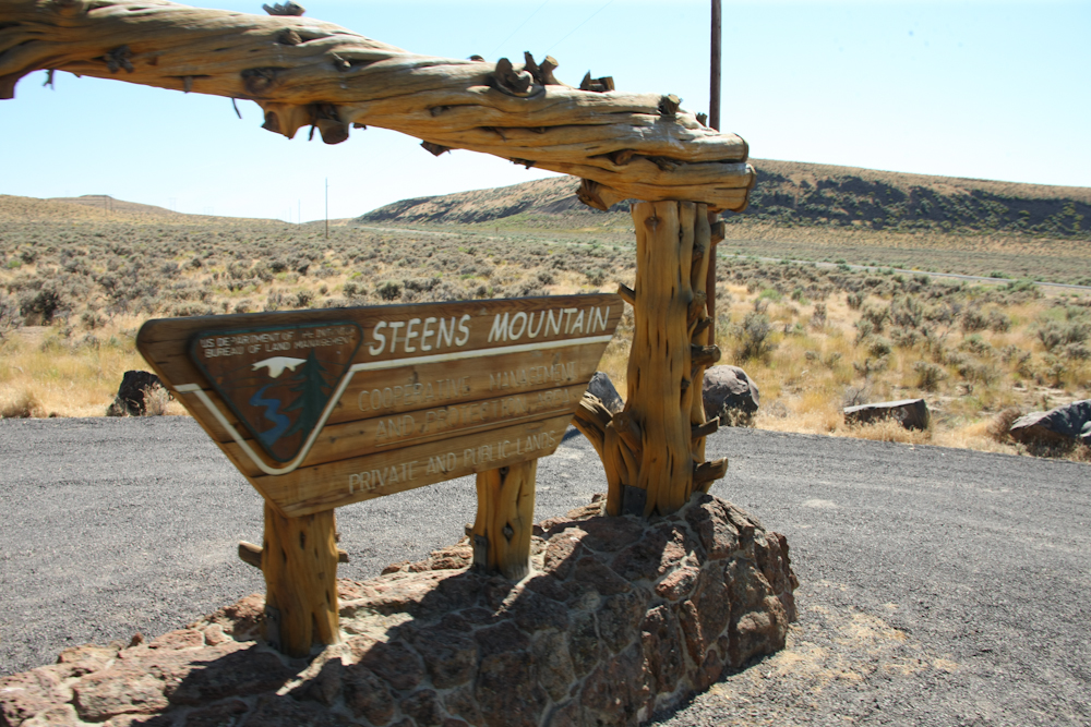
The
sign tells the story.
From
the Snake River, we traveled to the west into Oregon to the Owyhee
River. We went to a BLM site right on the river and spent the
night there. The site was used as a put-in for river
rafters. Indeed, there were a set of rafters that were setting
out on a seven day trip down the Owyhee River. We spoke with
several of them before their departure. Note the striking lack of
riverside brush.
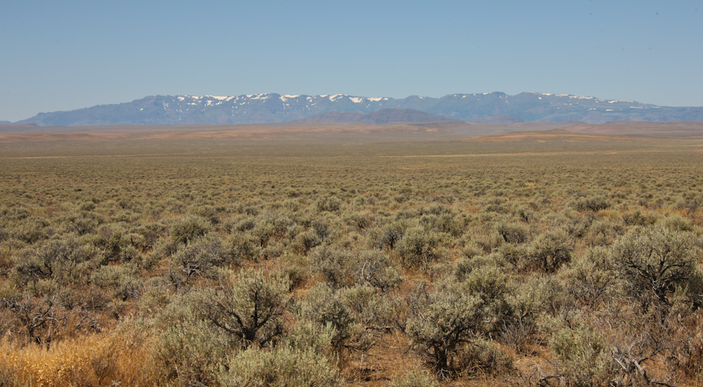
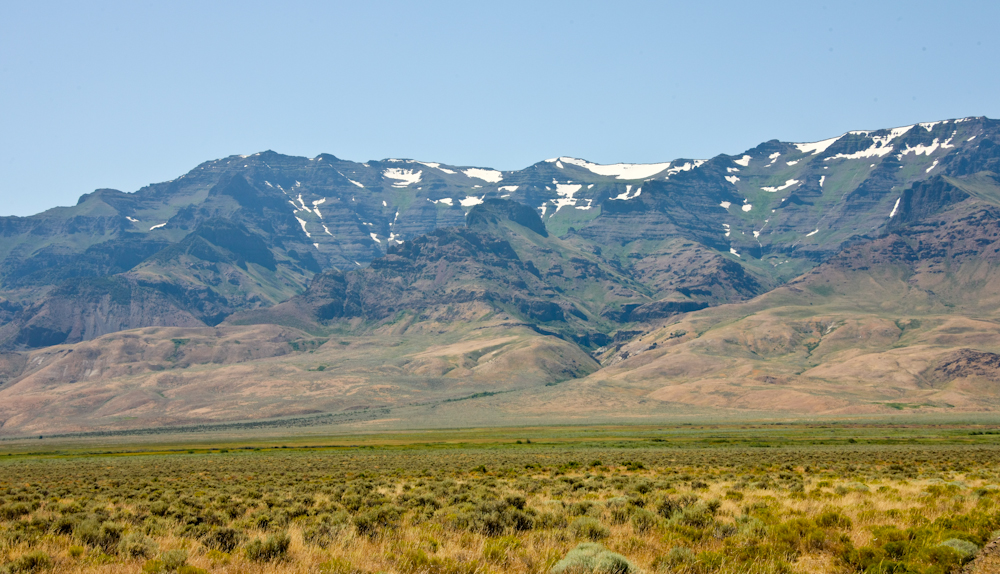
Next
morning, we broke camp and headed west toward the Steens Mountains
across the Alvord Desert. Our path took us on the dirt via BLM
roads. Some of the roads were easier to find than others. Midway
across the desert, south of the Owl Head Mountains, we got our first
view of the Steens from the east. Despite the fact that it was
mid-August, there was still plenty of snow in the 9,000+ foot peaks of
the Steens.
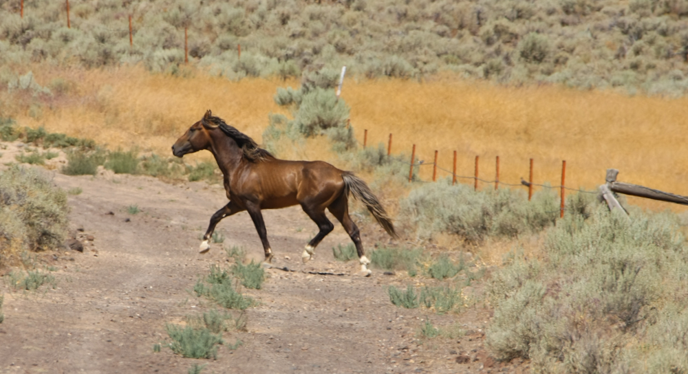
As
we were rolling down the dirt track, a wild mustang (horse) spotted us
from the ridge across the valley. He came to investigate the
intruder to his territory and then he crossed our path. Once he
hit the dirt road he headed out in front of us. Note the muscle
striations on his flanks.
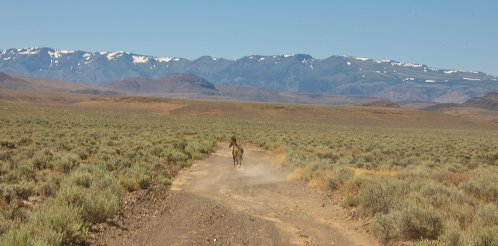
He
came from quite a distance to challenge the 1017, but once he scoped us
out, he changed his path from across the high desert to the dirt track
and took off at a run; we followed. Note in the photo above that
he is checking us out over his left shoulder. Every time we sped
up, he did as well. Likewise, when we slowed, so did he.
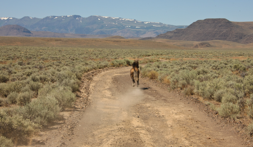
He
was a magnificent sight with the snowy peaks of the Steens Mountains in
the background. A scene right out of a Zane Grey novel. The
mustang led us down the trail at perhaps 20 mph for over 5 miles.
Then, with a glance over his shoulder, he veered into the hills and was
gone.
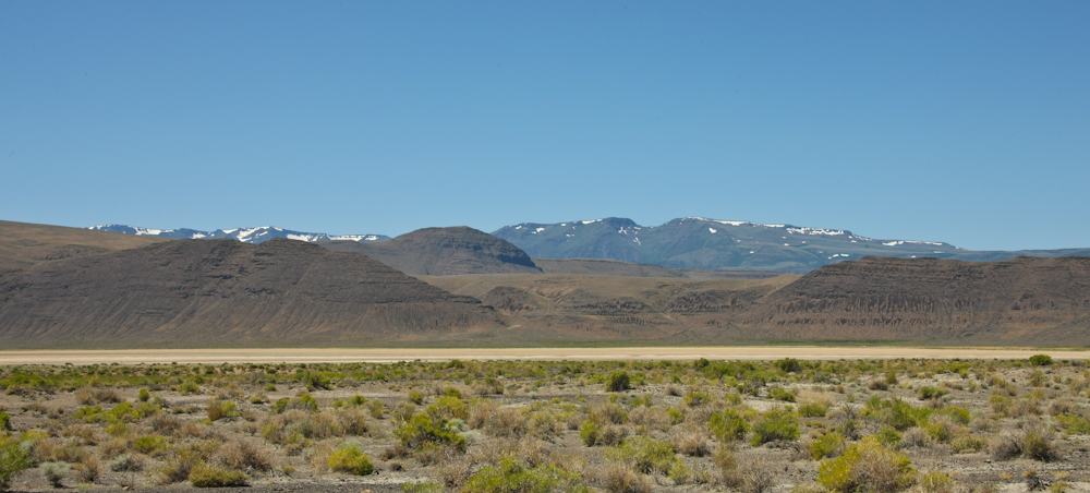
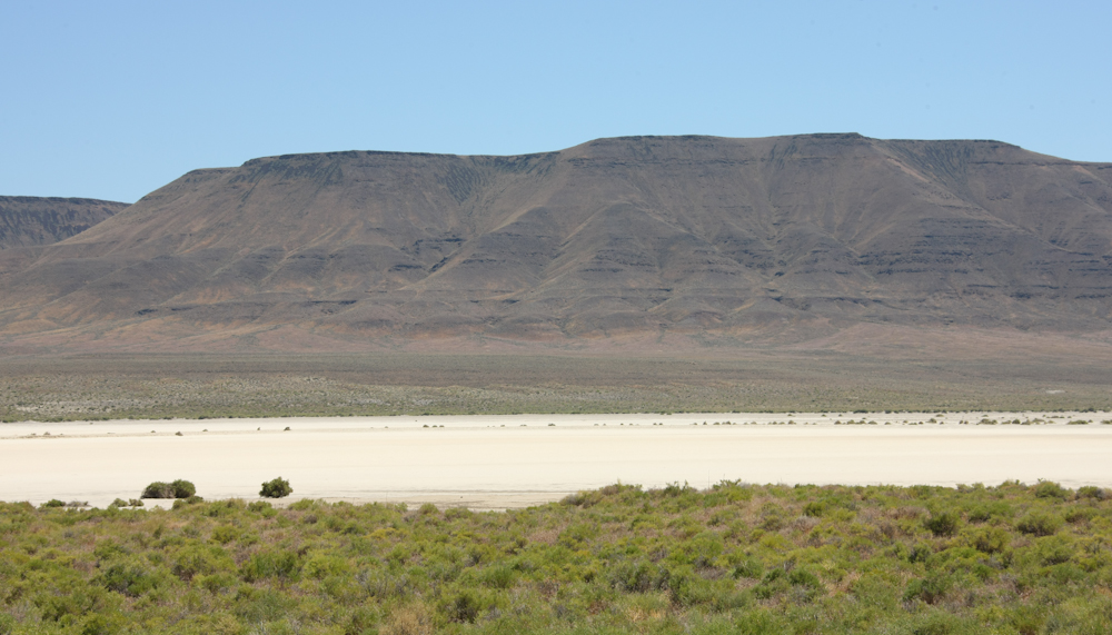
We
crested a small set of hills and got our first view of one of the many
dry lakes that are on the eastern flanks of the Steens.
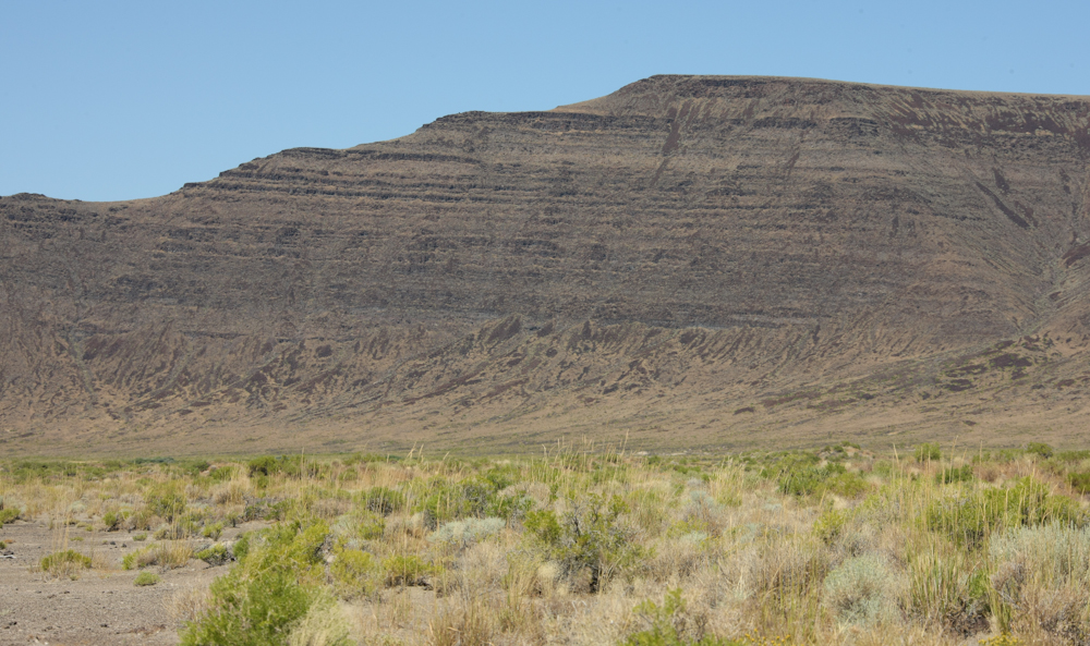
The
strata in the area was volcanic, like much of eastern Oregon.
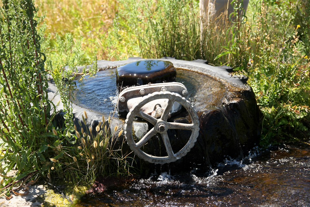
The
trail went past the site of a well casing that had been inserted into
an artesian well and capped with a valve. The tire provided a
watering hole for the local animals.
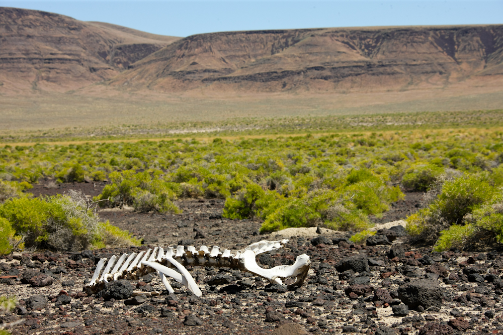
Further
down the trail, we got a reminder of what happens when you cannot find
water. The Alvord desert, like most of the west, has very limited
open water most of the time. I say "most of the time" since this
year seems to be a glaring exception. Heavy winter snows have
created record runoffs resulting in higher grasses and more greenery
than normal.
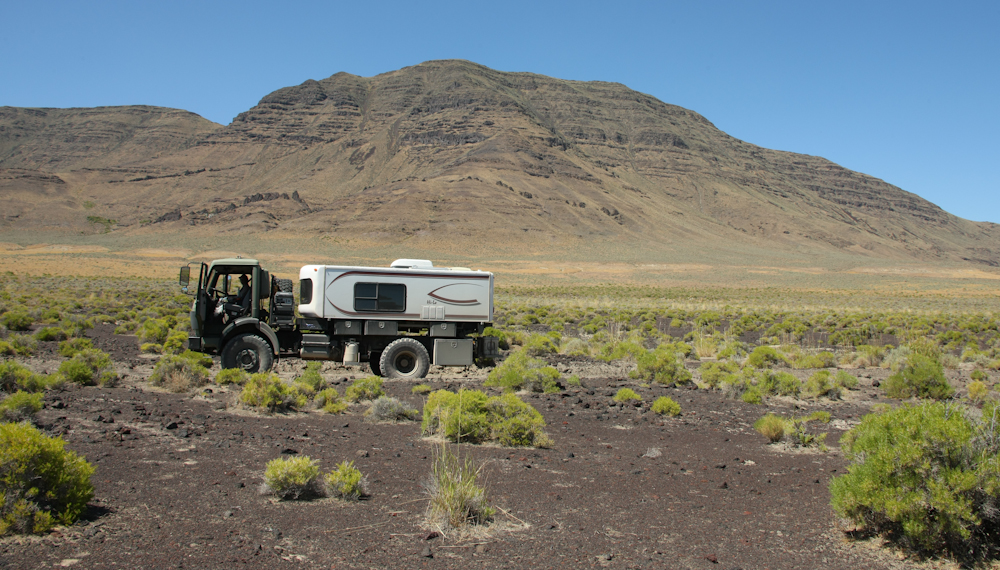
We
stopped to investigate a hot springs and got a photo of the 1017 in
context.
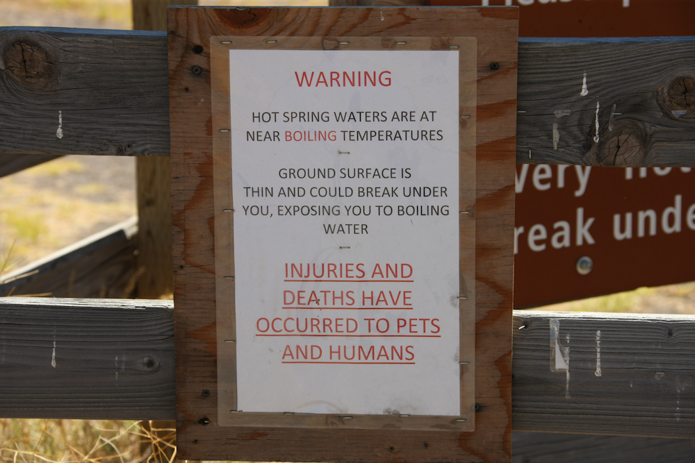
Near
Mickey Dry Lake was a hot springs that was close to the trail.
The sign speaks for itself, but we went to investigate the site
anyway. The boiling temperature comment quickly killed any hopes
of going for a dip in the spring.
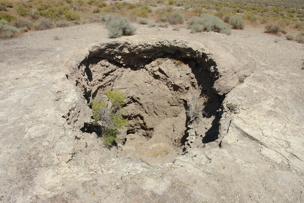
First,
we came upon a dried up vent. The minerals and debris that was
carried to the surface left a cone of material around the vent.
Then, for whatever reason, the subsurface flow patterns of the water
changed and the vent went dry and the flow migrated to another vent.
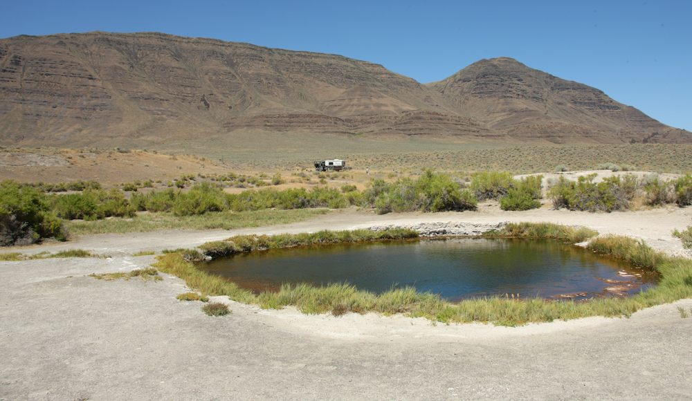
The
vent shown in the previous photo is at the upper right of the photo
above. There were also a set of dry vents directly behind
me. The new pool is perhaps 50 feet in diameter. The water
was hot, but not as hot as the sign suggested. The flow rate was
very modest with the exit path being the small trail of grass at 9
o'clock relative to the pool.
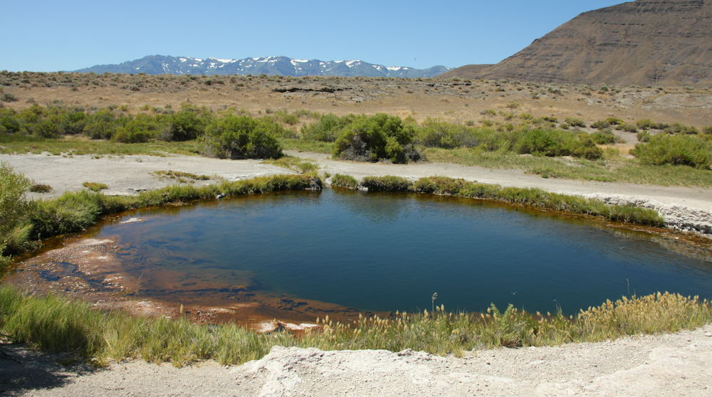
The
mineral pool with the snowy Steens in the distance made a great scene.
We
continued down the trail past another dry lake.
As
we got closer to the face of the Steens, the extent of the faulting and
subsequent uplift became apparent. The crest of the range is over
9000 feet and the basin is at about 4000 feet. A mile-high
escarpment was the result.
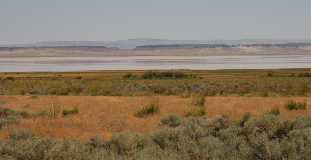
The
Alvord dry lake was not dry this year. Heavy winter snows resulted in
large spring runoffs that filled the dry lake bed.
We
continued around the south end of the Steens and then traveled north on
the west flank of the range. Again, we saw more striking examples
of the volcanic origins of the mountains in eastern Oregon.
The
volcanic flows produced cliffs that ran for many miles.
Our
objective was to hit the southern access road to the Steens and then go
to the crest and make camp. We found the access road without
difficulty (it was the only road for miles), but we soon had to change
our plans.
| Previous Adventure | ||
| Trip Home Page |
Photos and Text
Copyright Bill Caid 2011, all rights reserved.
For your enjoyment only, not for commercial use.