With the help of Bob Benyon and Steve Gluck, we completed our hub change in short order. When we were done, we headed toward Philadelphia to hook up with another mogger Seth, and then south to rendezvous with Bob and Kitty Ragain for a trip down Skyline Drive in Shenandoah National Park and then on to the Blue Ridge Parkway.
The photos below are what we saw.
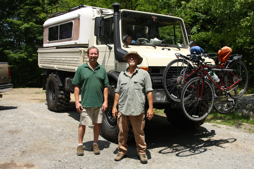
Bob Benyon and Bill after we
completed our successful hub transplant operation.
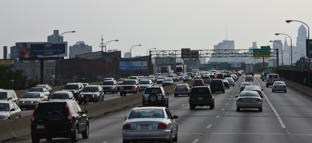
From Highland Lakes, we headed south toward Philadelphia. We encountered some heavy traffic along the way which was not that much fun in the mog.
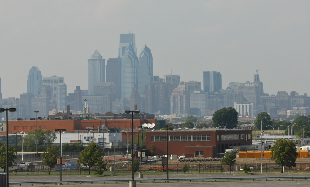
As we passed by Philly, we got a
nice view of the tall buildings in the downtown area. Seth, the
person who we were going to meet, was on a plane returning from Denver,
so we headed south out of town to camp for the night. We would
connect the following day at lunch.
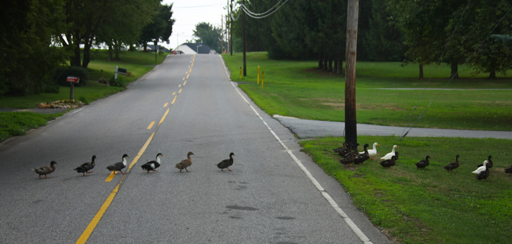
We encountered heavy traffic near
our camp site. There were a bunch of animals in the area
including geese, deer and turkeys.
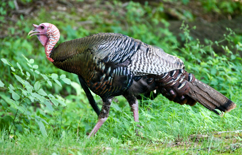
We were able to score some tasty
Chinese food at a nearby restaurant. We had substantial rain
during the night but it cleared by dawn. When we came out of the
camper the next morning, I spotted this wild turkey right next to our
site.
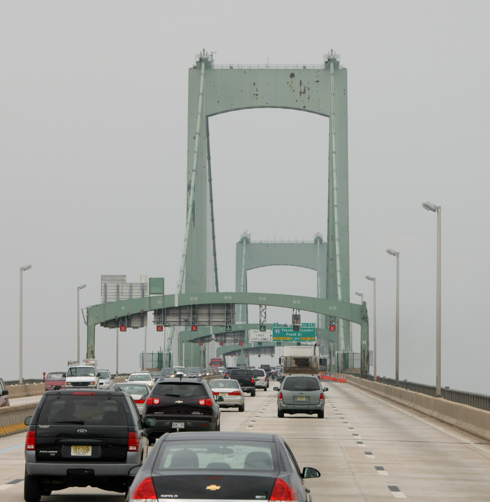
Once we broke camp, we headed back
into Philly to meet Seth for lunch. Along the way, we had to
cross several large bridges.
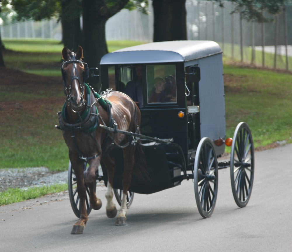
From Philly, we headed west into
the Pennsylvania Dutch country where we encountered this Amish family
on their way to an outing near where we were camped. This is the
ultimate eco-vehicle. This mode of transportation does not use
gas, but instead produces it.
From our camp at a power company
reservoir, we headed south to rendezvous with Bob and Kitty Ragain for
our trip along the entire Blue Ridge Parkway. The BRP is just
over 450 miles and at the north end, it is called Skyline Drive as it
passes through the Shenandoah National Park. We spent 5 days on
the BRP. It was hot most of the trip, hot enough that we spent
one night at a motel so we could have a/c. Above, we stopped at
an overlook to check out the view.
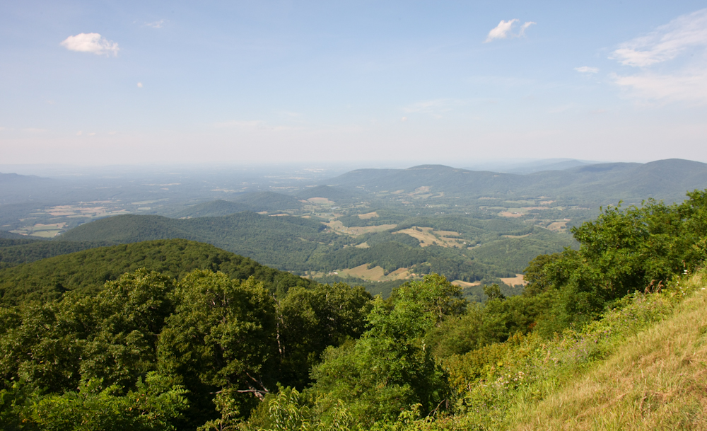
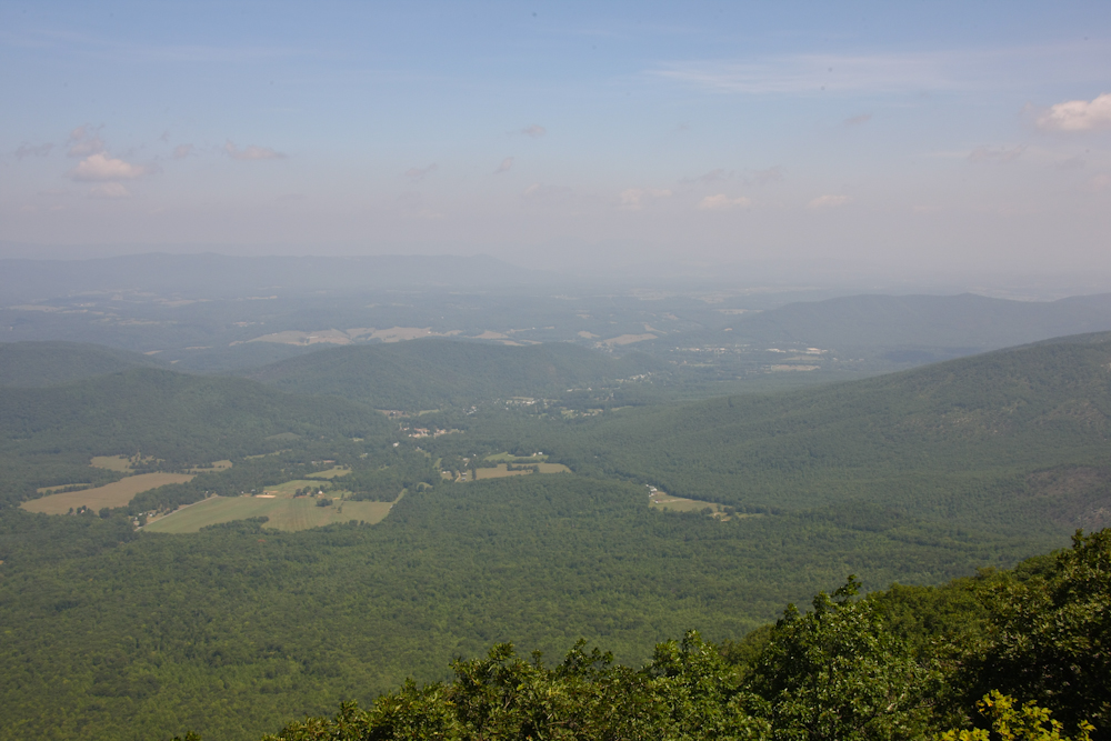
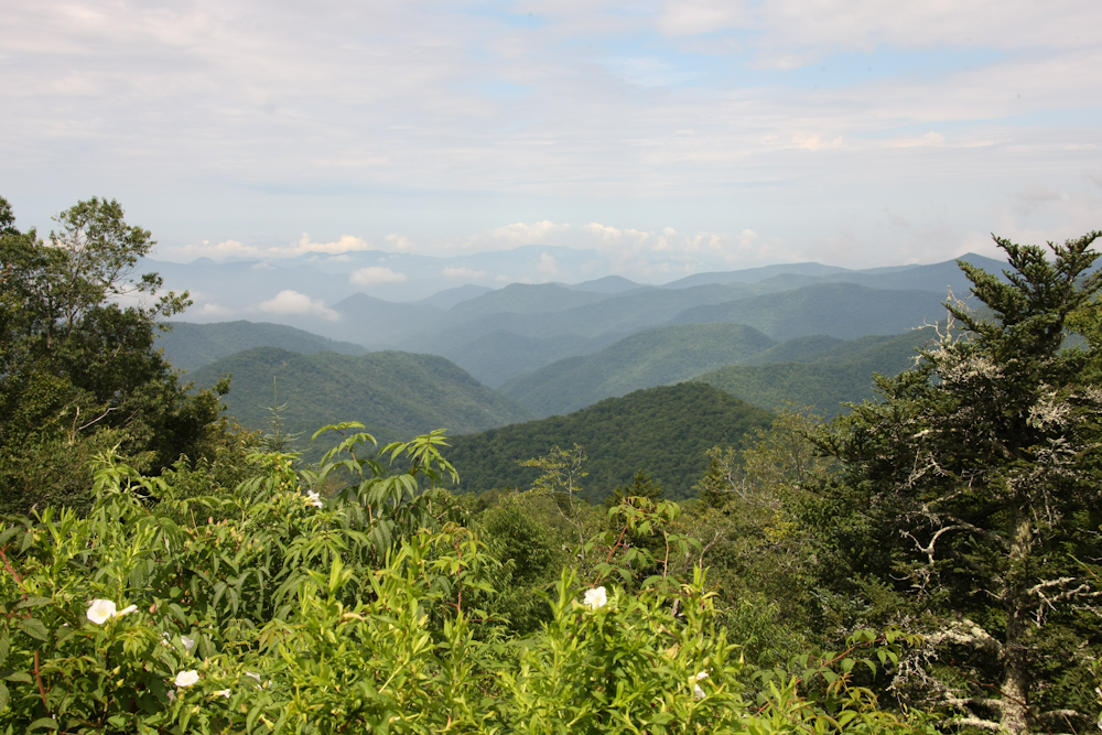
Our first overlook provided us
with a commanding view of the valley to the east. Sadly, the
visibility was not that good, because the haze obscured much of the
detail in the distance.
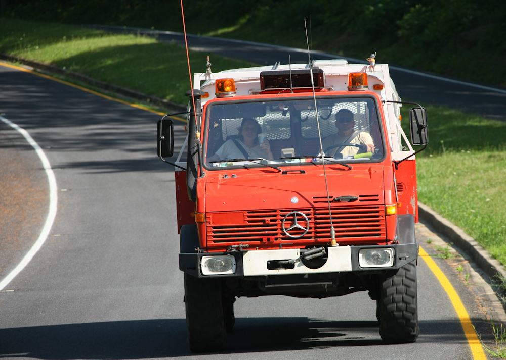
We met Bob and Kitty Ragain at the
Mathews Arm Camp Ground in Shenandoah N.P. Above, Bob and Kitty
roll into the camp ground with their 1300L mog with Alaskan Camper.
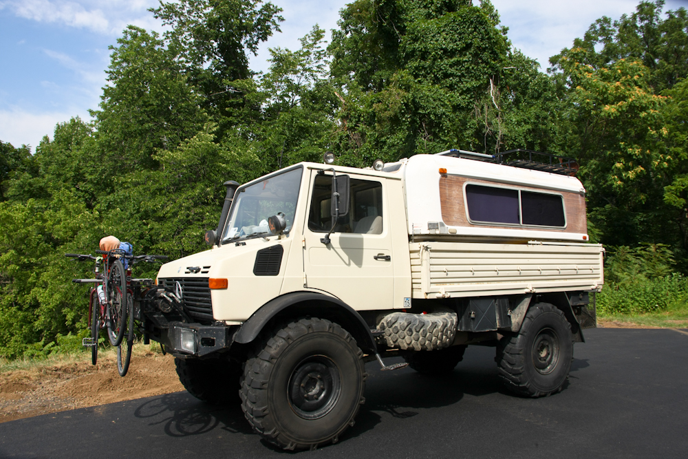
Bob has a 1300L which was a German
fire truck in its previous life. Note the side boards that have a
special hinge that provides a step to allow easy access to cargo in the
bed. He has an Alaskan camper that provides the living
quarters. Additionally, he has his ham radio gear mounted in the
cab.
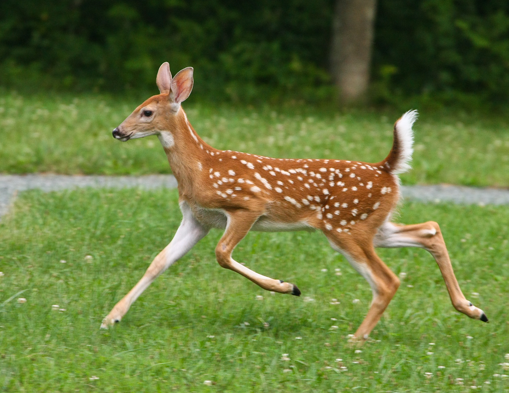
As we were BBQing steaks for
dinner, Bambi came past our camp.
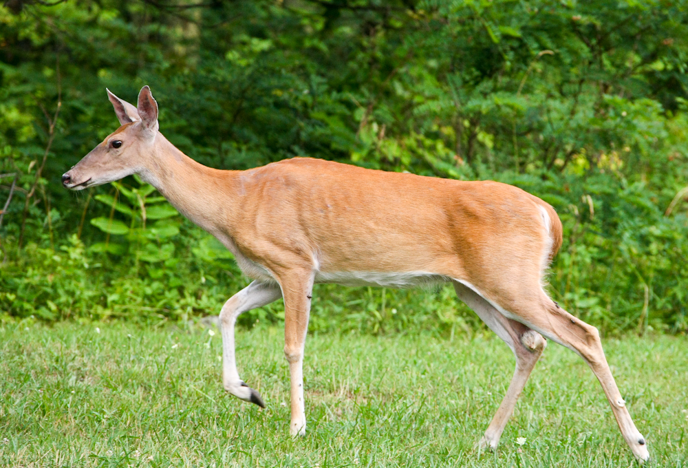
Bambi's mom was close behind, but
she was much less afraid of us. The black dots on her fur are
ticks; ugh.
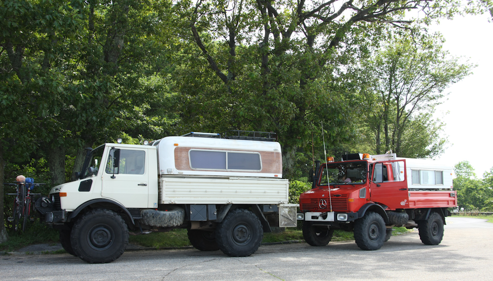
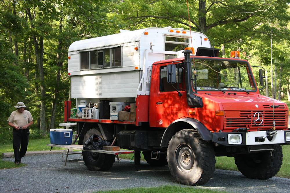
Above, you can see both 1300s with
their Alaskan campers. My fiberglass camper is a 1978, Bob's
aluminum wall-camper 1970.
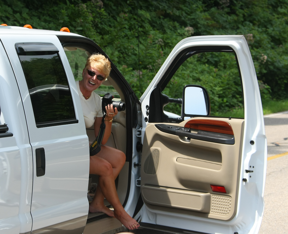
The mogs are certified chick
magnets; this is a well-know fact. While we were traveling along
the BRP, this gal flagged us down so she could get some photos of us.
The BRP follows the crest of the
Appalachian mountains. From the various overlooks we got great
views of the valley below.
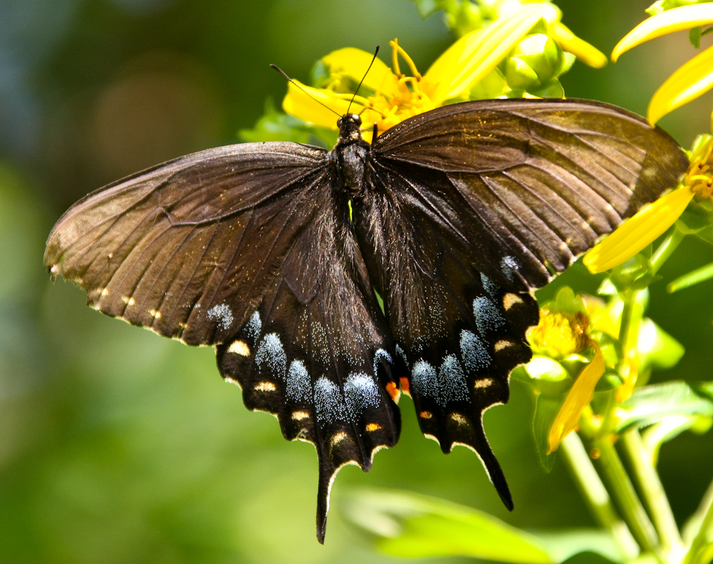
At one of the overlooks, I spotted
a nice butterfly.
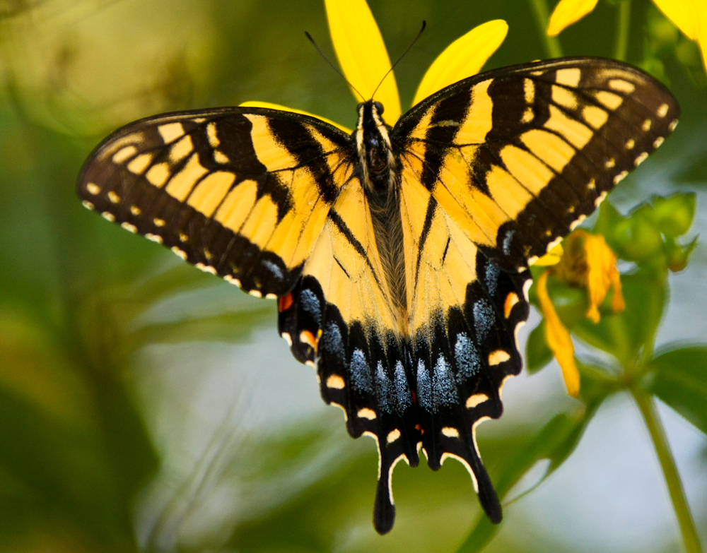
This butterfly has the same
general markings, but is yellow rather than dark brown.
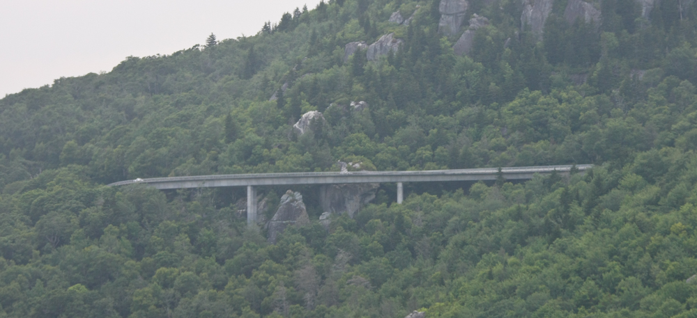
The BRP travels along the crest of
the mountains and some of the sections of road are quite steep.
One of the sections passes a steep cliff that required the construction
of a viaduct to allow passage of the road. Most of the road,
however, was cut along the ridge line of the mountains.
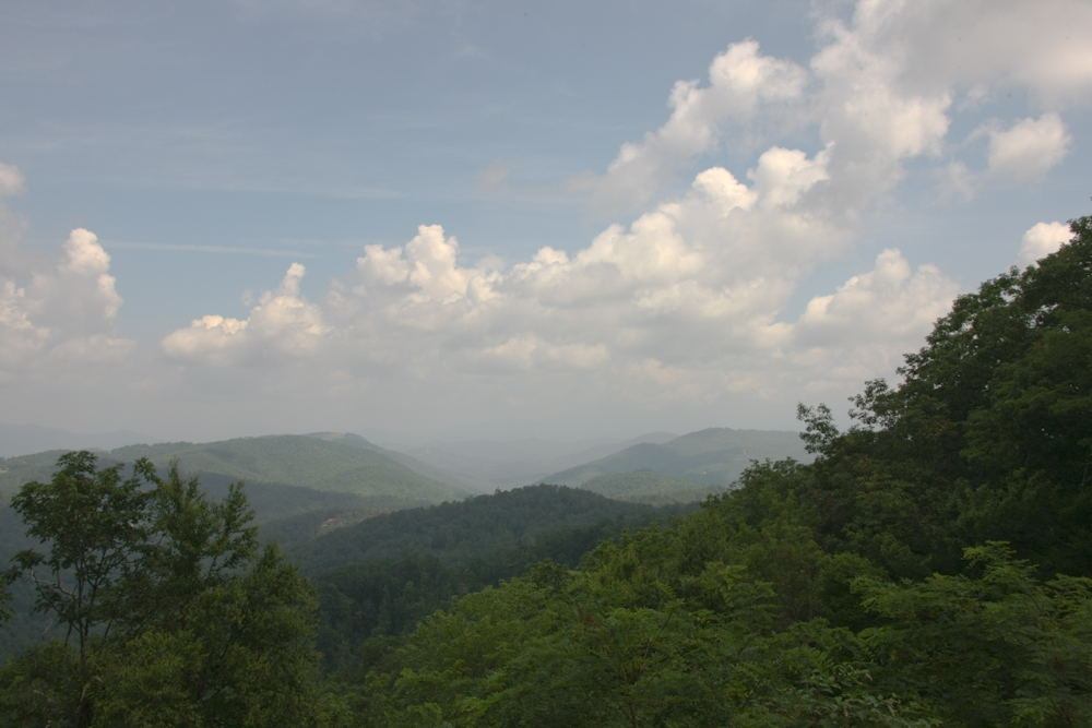
The hot weather brought rains and
nice clouds. But, the downside was that the high humidity limited
the visibility, obscuring details in the distance.
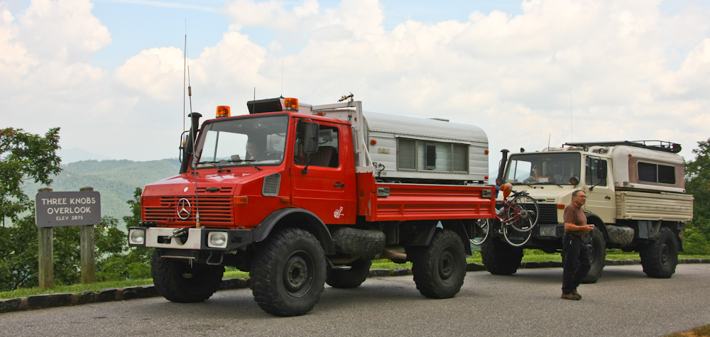
We stopped at many overlooks
taking in the awesome views. Above, we check things out at the 3
Knobs Overlook.
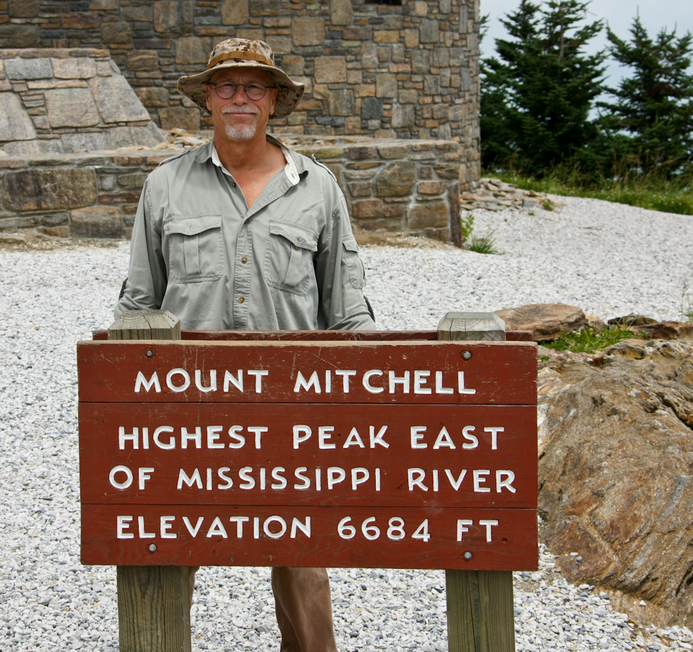
As part of our journey down the
BRP, we passed Mt. Mitchell. Since the road went all the way to
the top, there was no reason to miss the view. As you can see in
the photo above, Mt. Mitchell is the highest point east of the
Mississippi.
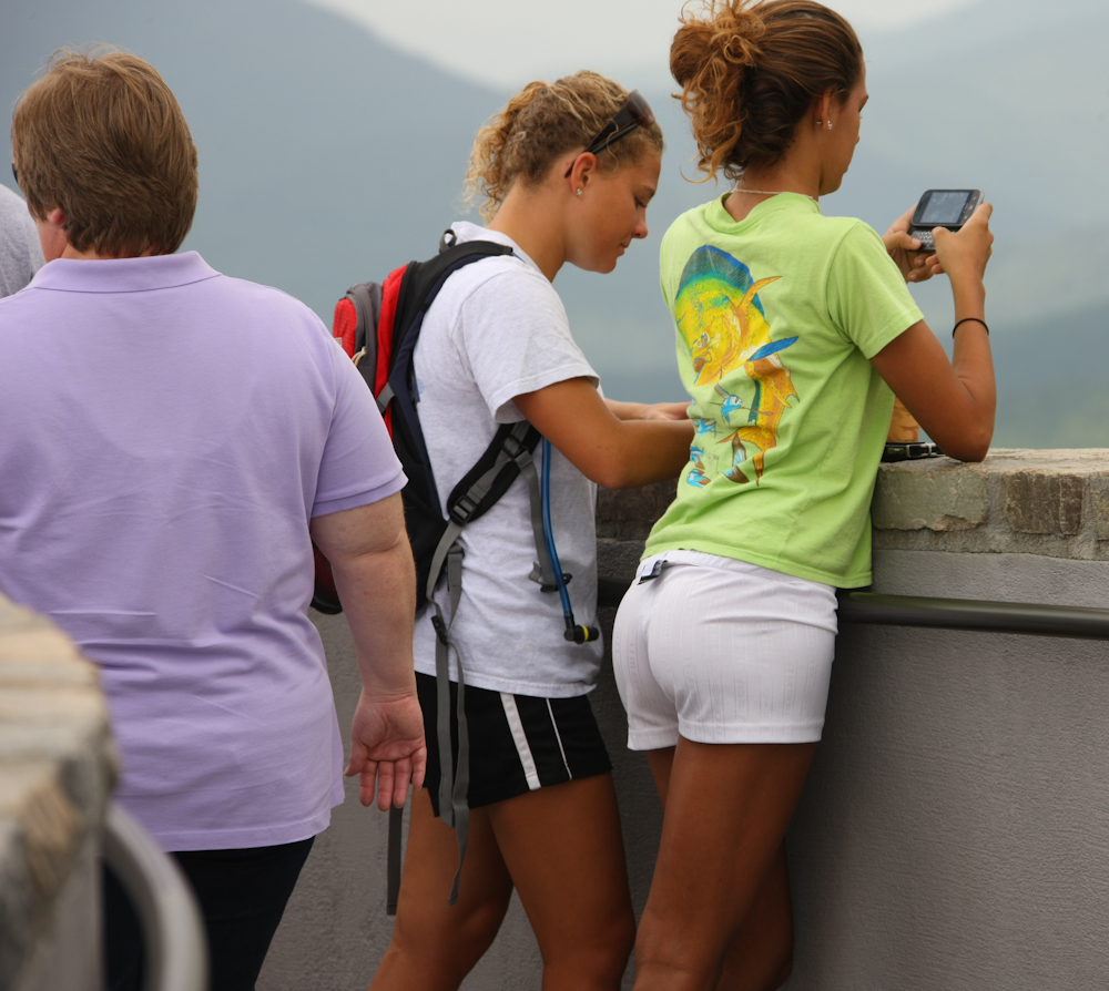
After months of viewing indescribably large cabooses, this was a nice change, person in the left of the frame notwithstanding.
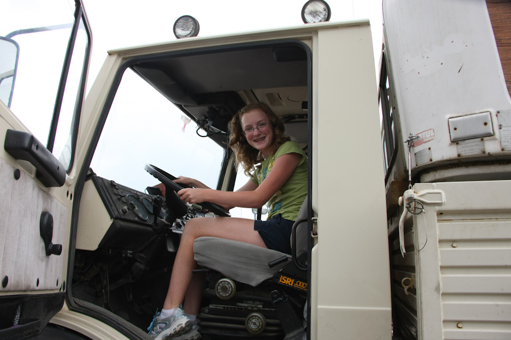
Once we got back to the parking
lot at Mt. Mitchell, this gal and her father were waiting for us.
It is well known that the Unimog is a chick magnet, and she HAD to find
out what it was. She was ecstatic to see our rig. To
promote domestic harmony in their home, I insisted that she climb into
the cab. Now, she can whine at dad all the way home: "Daddy, can
I have a Unimog too?".
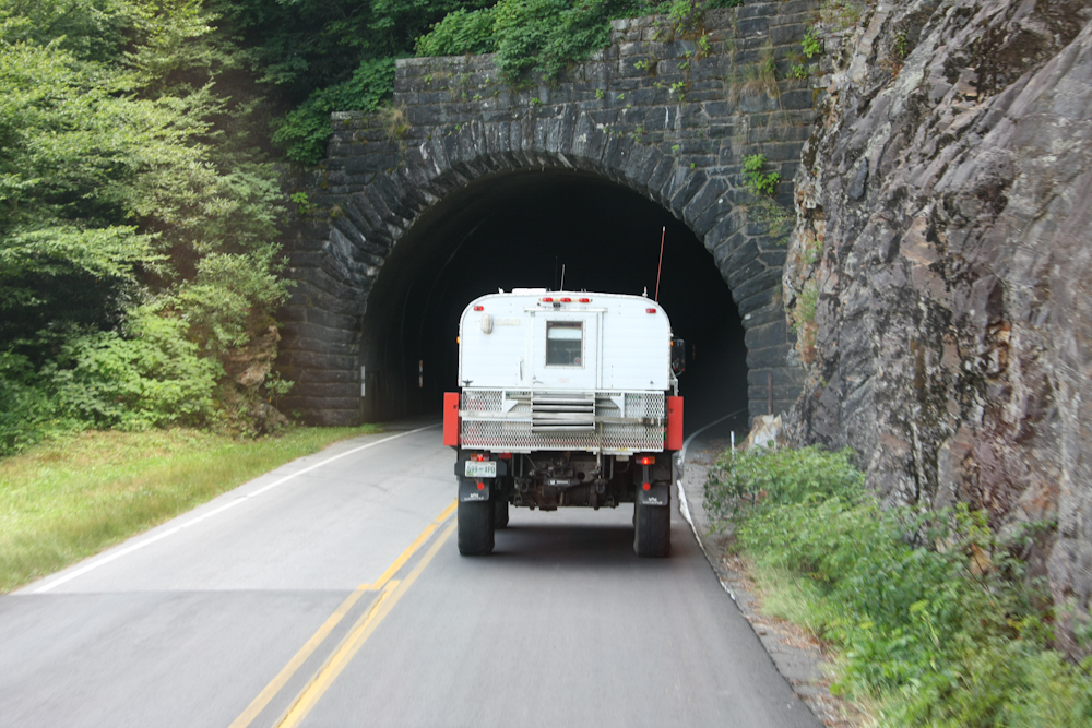
Big sections of the BRP were constructed by the WPA and CCC during the depression. The route passes through many tunnels with nice stone work, which was the customary construction method of the day.
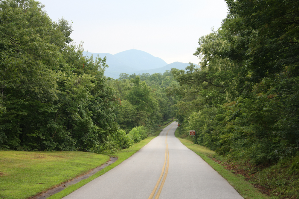
The BRP is lined with with dense
trees and brush. The parkway is green in a way that is totally
unknown in our home state of California.
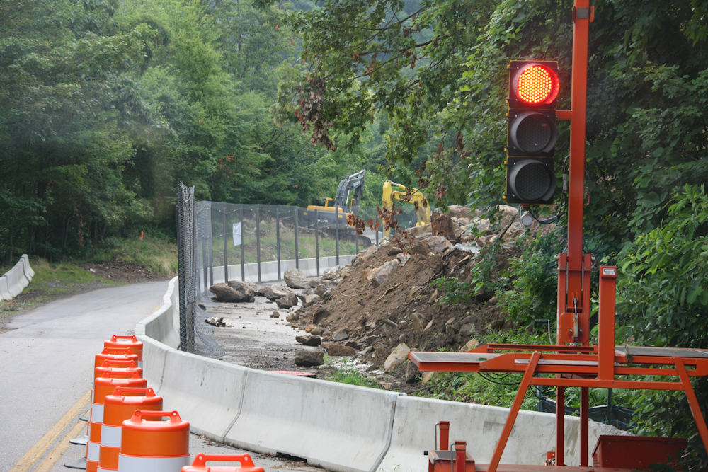
On our way north to Maine, we
attempted to travel on the BRP, but our route was blocked by a large
landslide. During our time in the north, the landslide was
repaired enough to allow travel in one shared lane. Above, robot
traffic lights control the passage of vehicles around the slide area.
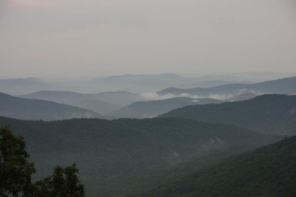
Many layers of mountain ranges were visible through the mist.
It rained during the night and the
rain cleared the air providing improved visibility. The deep
green colors of the mountains were very intense.
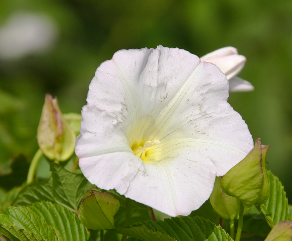
At one of the overlooks, I spotted
some flowers in bloom. The dark smudges were due to road dust or
exhaust residue.
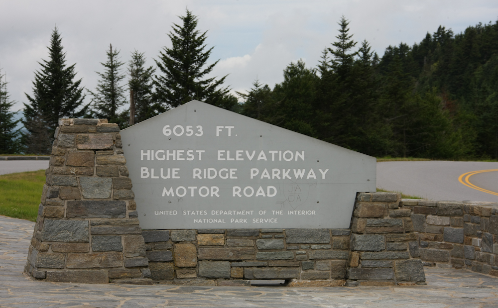
The BRP attains significant
altitude at the south end of the parkway.
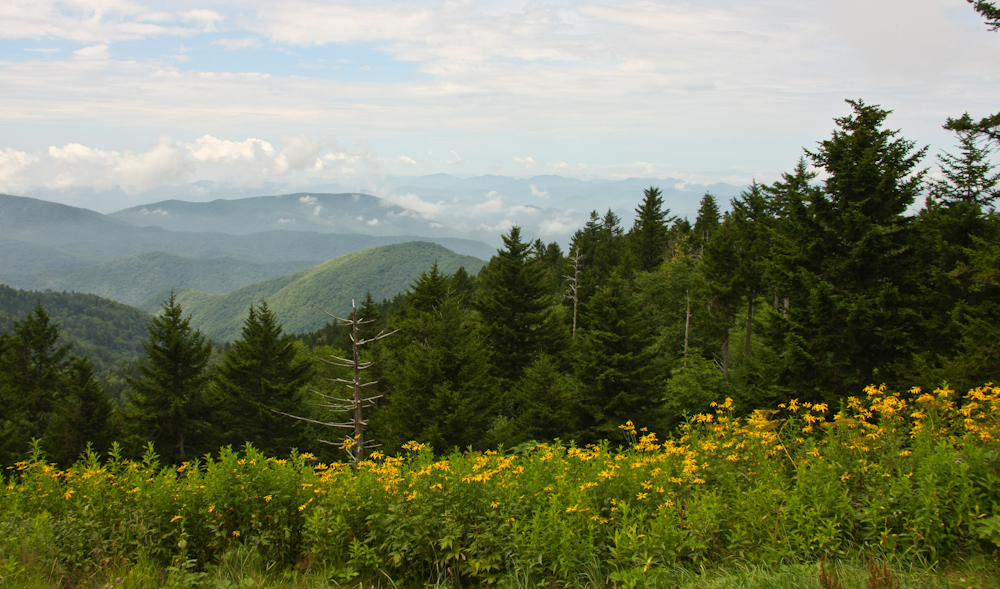
Near the high point on the BRP we
had some great views of the surrounding area. At the higher
altitude, the flowers were still in bloom.
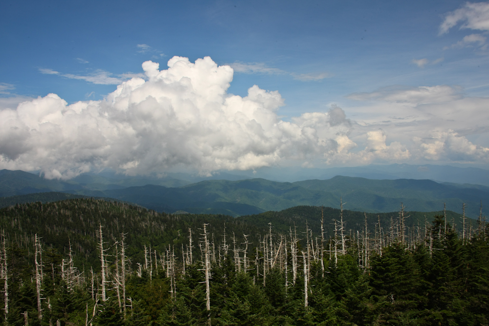
One of our stops was Clingman's
Dome. After a substantial hike, we were rewarded with an awesome
view of thunderclouds building to the east.
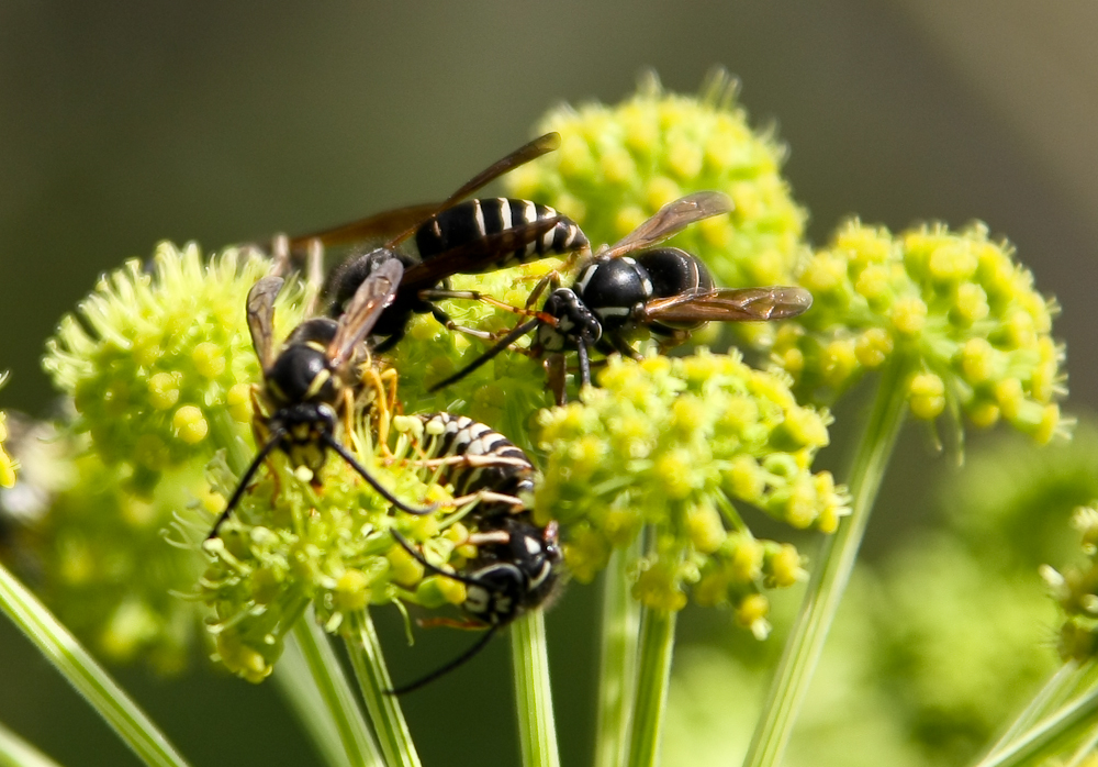
On the descent from Clingman's
Dome, we passed a group of wasps hard at work on some blooms.
Since they were stinging insects with a "short fuze", we watched them
from afar.
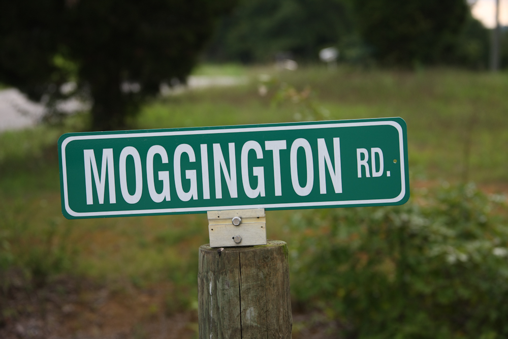
From Clingman's Dome, we traveled
to Bob and Kitty's farm in eastern Tennessee. Given Bob's love of
Unimogs, Kitty had this sign made to order.
The Blue Ridge Parkway was a very pleasant surprise. It was far more beautiful than I expected and coming from the arid west, the vivid green colors were a true treat. The campgrounds that we stayed at were reasonably priced and clean, but with one exception, had no showers. Given that the heat index was 100 degrees plus every day, that made us socially unacceptable in very short order.
From eastern Tennessee, we plan to head into the
Nashville area to check things out.
| Previous Adventure | ||
| Trip Home Page |
Photos and Text
Copyright Bill Caid 2010, all rights reserved.
For your enjoyment only, not for commercial use.