Trip Report 20100218-21
For the past ten years or so, we have been making trips into northern Baja or Sonora during the late winter. This year was no exception. But, rather than doing the high dunes of the Altar Desert in Sonora, we decided to do something a bit less aggressive. Dan Johnson from Fairbanks flew down for the trip and we were joined by Matt and Nancy, Steve and Debra, and the Serrano Family. Our plan was to cross the border at Otay Mesa, then travel east on MX-2 until Laguna Salada, then head south along the mountain front to the hot springs of Guadalupe Canyon.
The photos below are what we saw.
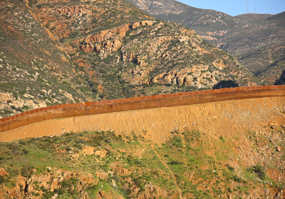
Construction companies have been busy building another section of the border fence. The segment above is in the rugged mountains east of Otay Mesa. The effectiveness of the fence is TBD, but the Customs Border Patrol (CBP) have a huge presence in this section of the border. The photo above is looking north from the MX 2 highway that parallels the border.
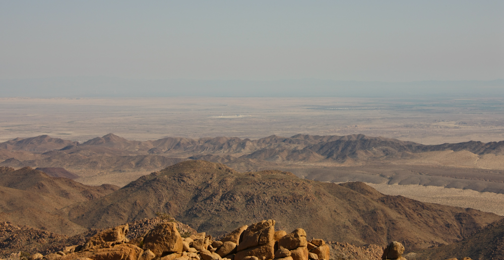
We followed MX 2 to a place called La Rumerosa which sits on the crest of the mountains. La Rumerosa, loosely translated, means "babbling brook". MX 2 descends the mountain front to the desert below, a drop of about 3500 feet. The road, while greatly improved, is still steep, narrow and scary. In the photo above, the light spot near the center of the photo is Plaster City in the U.S. When the weather is good and the dust level low, you can see for 50+ miles.
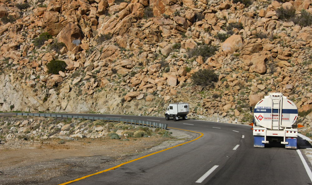
The Rumerosa grade has minimal shoulder to allow vehicles to pull off the roadway safely. Above, Steve and Debra's 1300L has passed a tanker truck on one of the steeper sections of the road. Note the rough, boulder-strewn terrain.
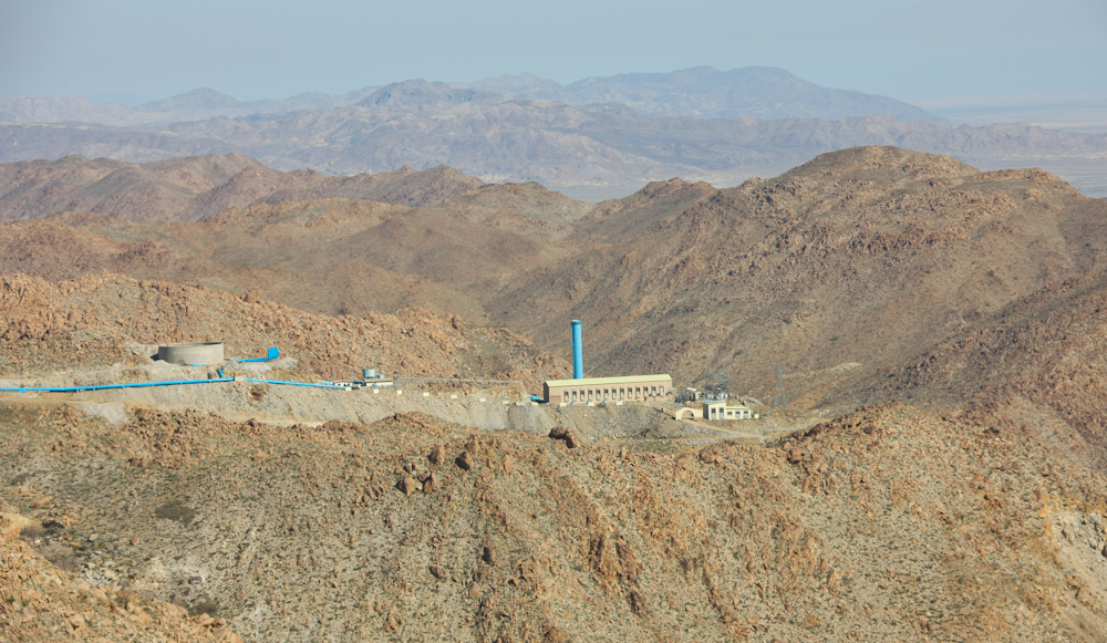
On the downgrade, the pumping plant for the Tijuana aqueduct is visible. This shot is looking north toward the U.S. with the Santa Rosa mountains visible on the far horizon.
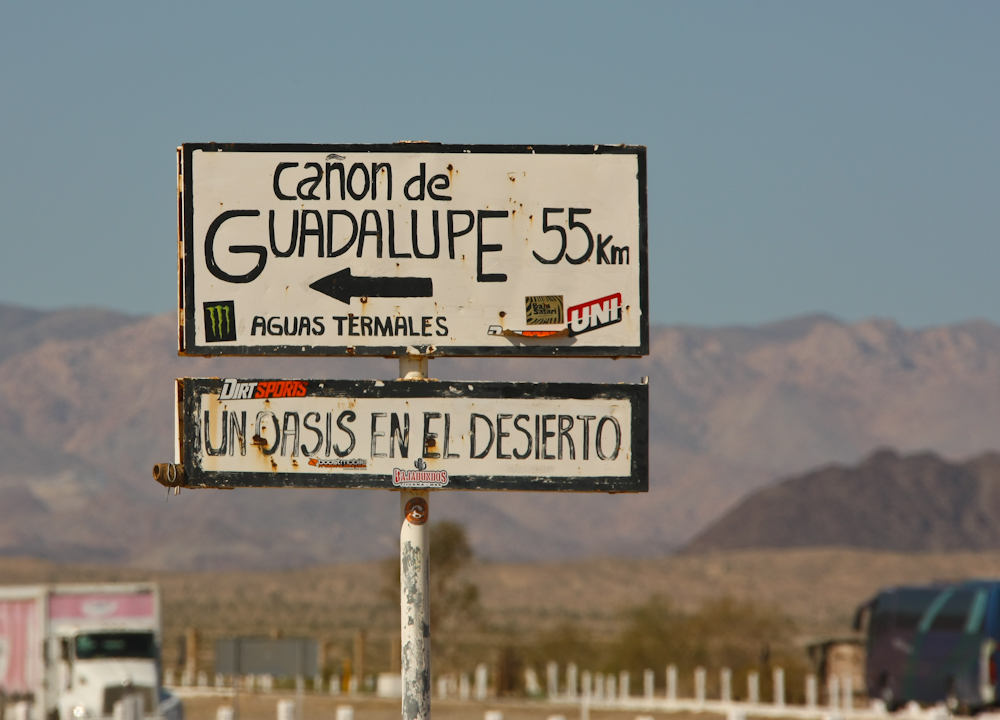
At the base of the Rumerosa grade is the turnoff to Guadalupe Canyon (GC).
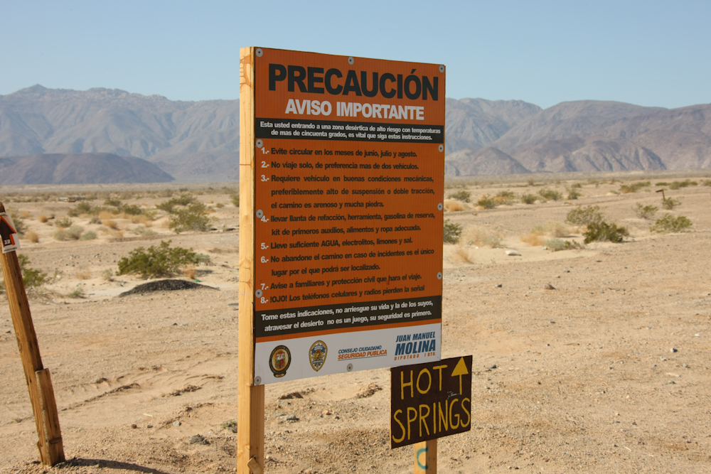
The sign above provides guidance about desert travel. Most of the items are "common sense" things like "take water, stay with your vehicle" etc. But, item 5 is interesting in that it suggest that you take lemons and salt. I presume that the sign assumes you already have tequila, so they want to insure that you don't forget your lemons and salt.
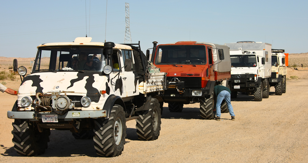
The rolling stock for this trip. We lower the air pressure in the tires to provide a more comfortable ride over the 35 miles of washboard road.
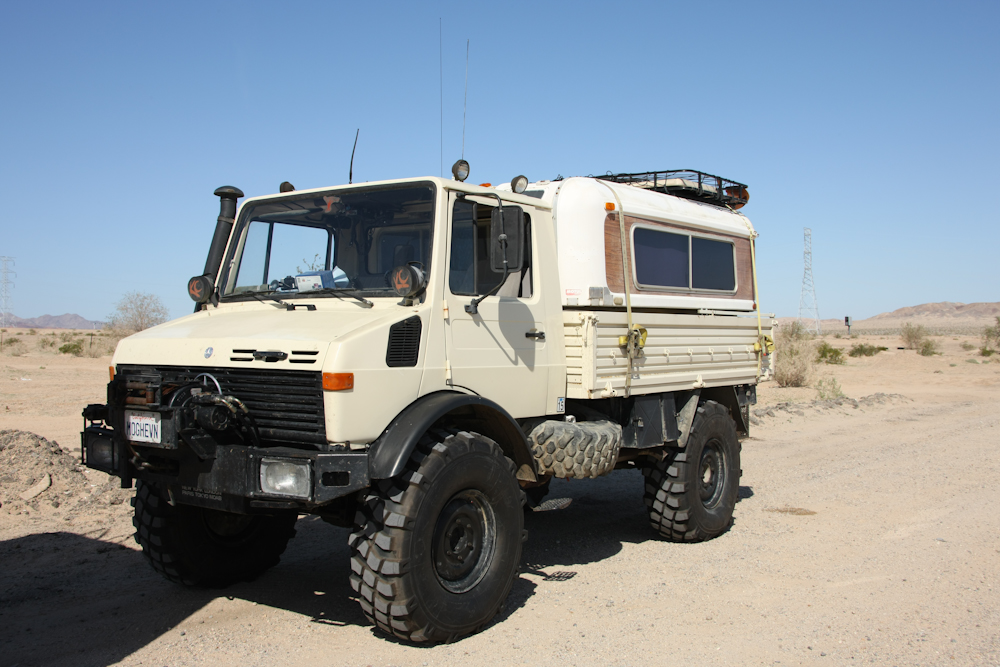
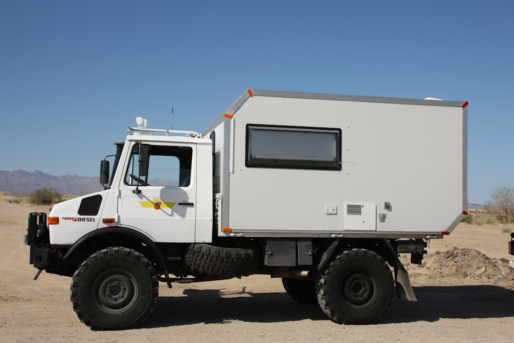
Bill and Kathleen's 1300L with Alaskan Camper. The large ratchet straps prevent the camper from "floating" on the washboard road. We are running a brand new set of 395/85R20 tires.
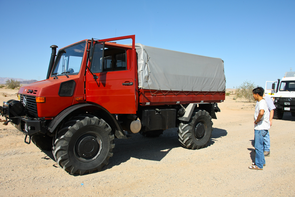
Steve and Debra's 1300L with custom camper box .
Dan's 1550L with XM47 tires.
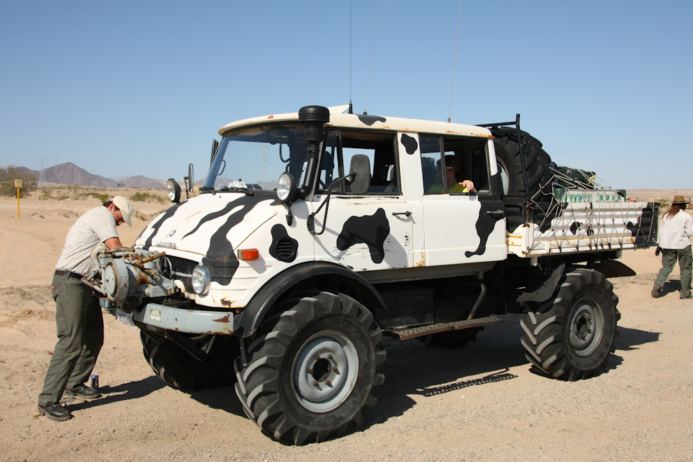
Kai's 416 DOKA with XM47s.
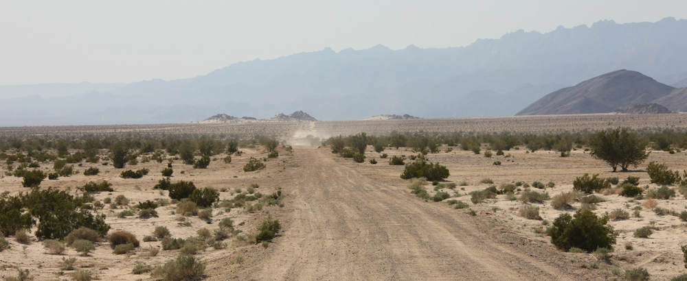
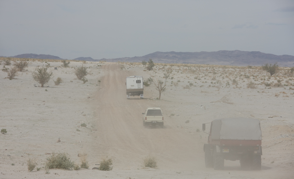
The road south from MX 2 was graded not too long ago but like most dirt roads that are heavily traveled, it develops substantial wash boarding when used by vehicles with excessive air pressure in the tires. Above, the team disappears into the dusty distance as we stop to lower our pressure to 20 psi. Even at 20 psi, our speed was limited to about 20 mph because it was just too uncomfortable to go any faster. So, we grabbed a beer and settled in for a low speed cruise along the mountain front.
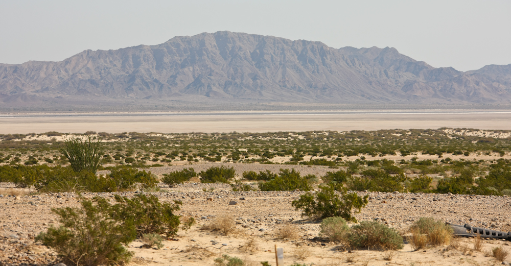
Normally, when we go to GC, we take the alternate route that goes across the dry lake bed. The lake bed route is much faster, say 45 mph, but requires that the surface be dry. The recent heavy rains have rendered the route impassable until it dries out. The dark band in the photo above is the wet area and it is surrounded by a band of dried salt (the white line).
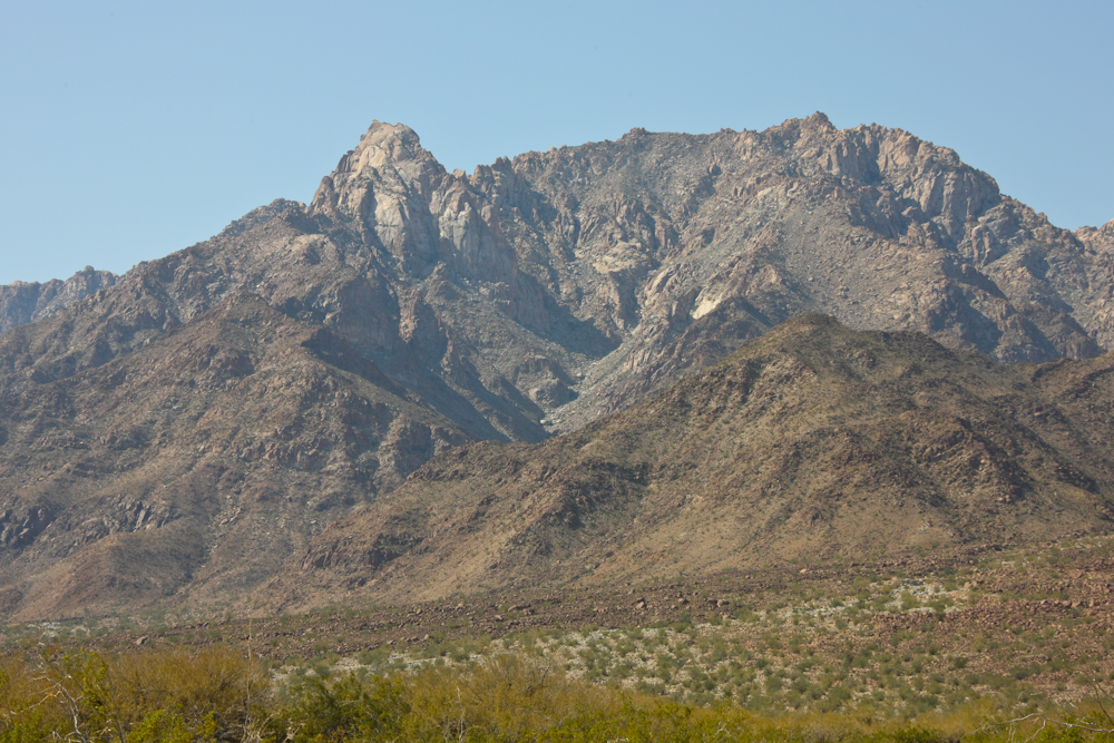
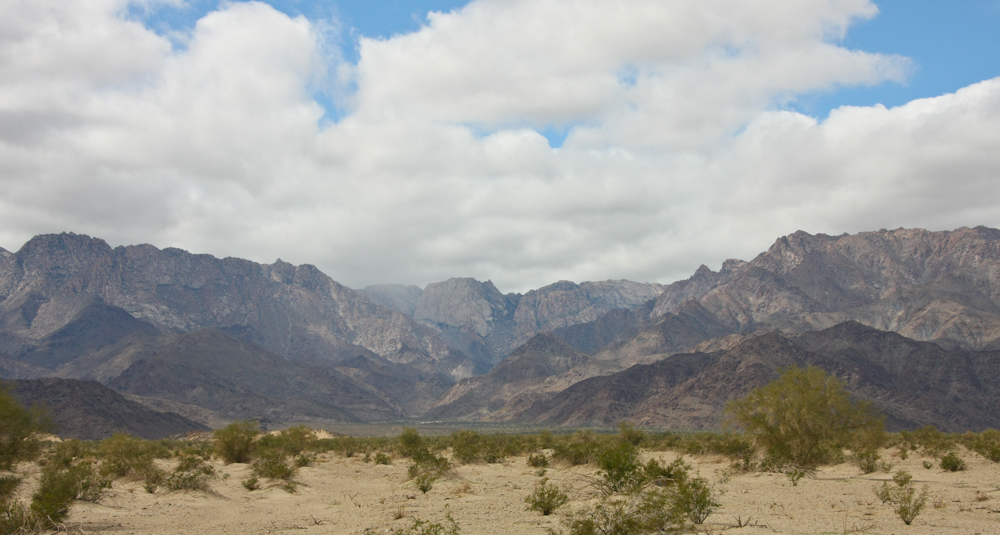
The route near the mountains provides some nice views of the peaks along the ridge line. Some of the faces are substantial.
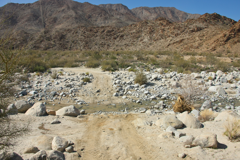
The bottom end of GC still has water in the arroyo at the first crossing. The previous week, the whole area had heavy rains and the trail was washed out in several spots.
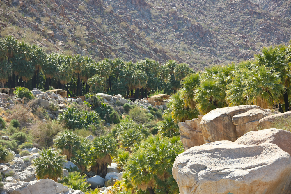
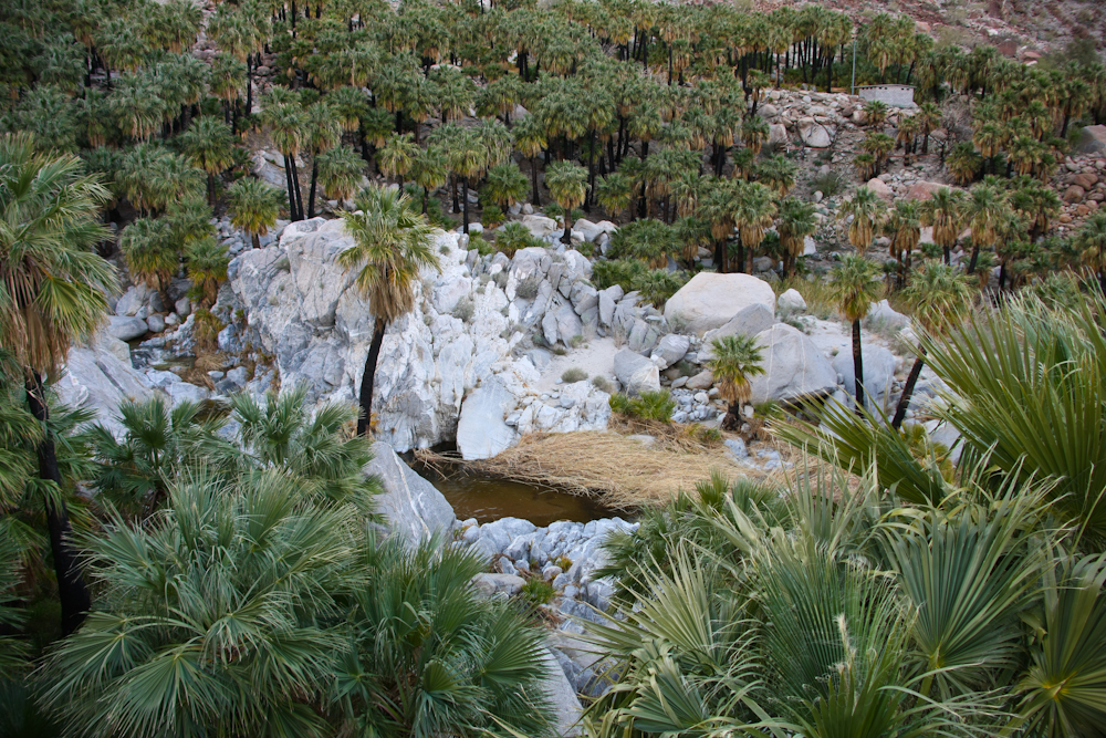
Our first view of the palm oasis.
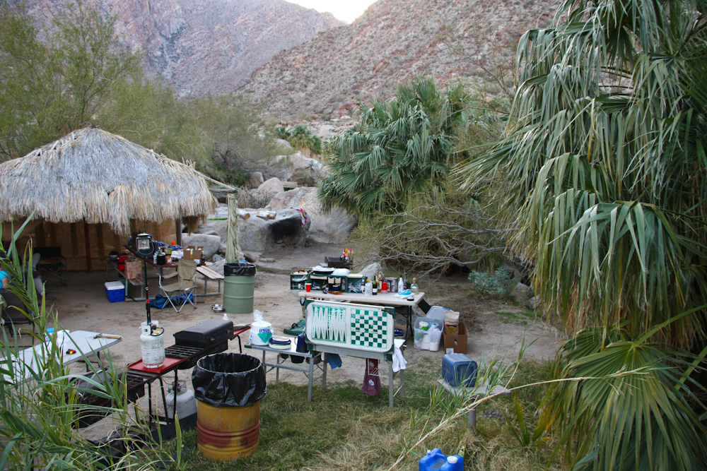
We got our camp set up and the weather started to degrade a bit. It became overcast and windy, but it was generally tolerable. The campsites in GC have their own private hot tubs that are fed by the hot spring. This site had two tubs and the big pool was close by.
A view of the large pool from our site.
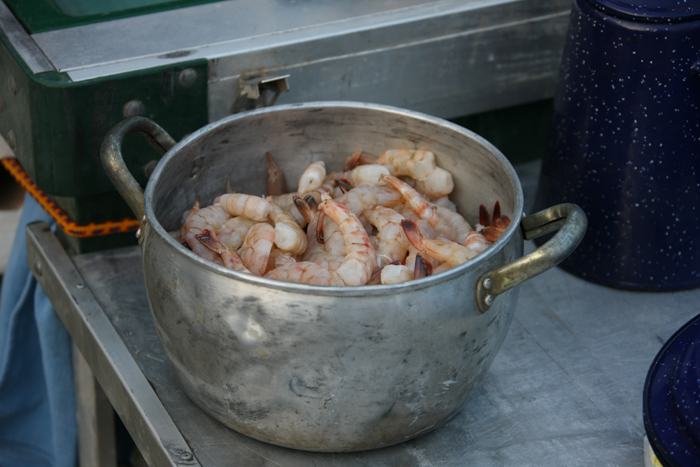
Matt and Nancy had been south of San Filipe looking for a cave on the face of the Sierra Juarez. They failed to find the cave, but they DID find both shrimp and clams in San Filipe and bought a bunch for the group dinner.
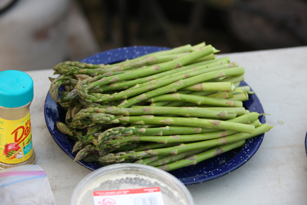
We had plenty of asparagus which we BBQed with the shrimp.
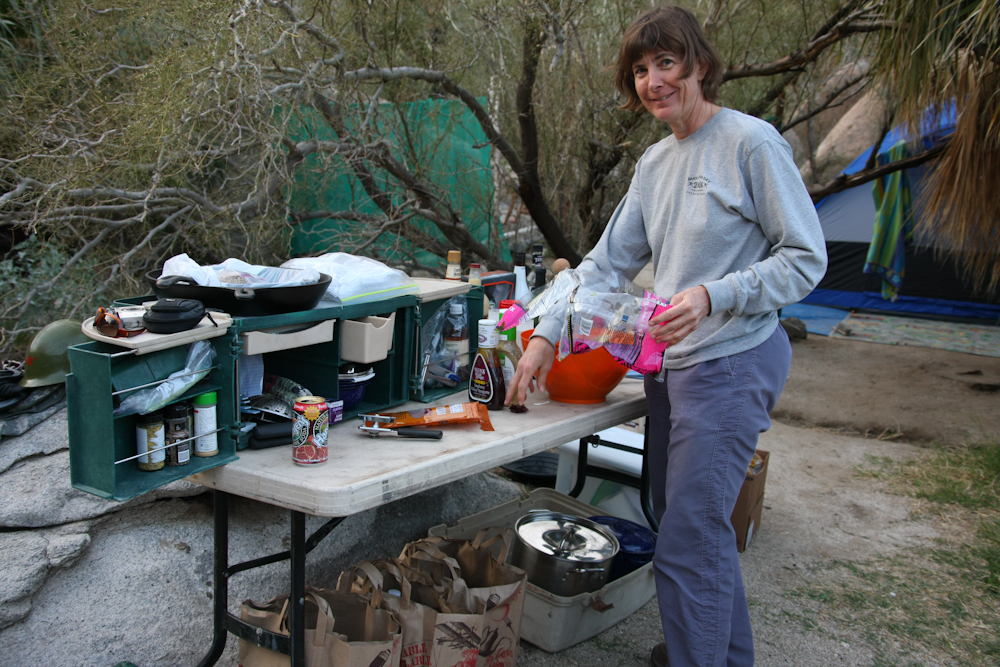
Nancy works one of the kitchen areas.
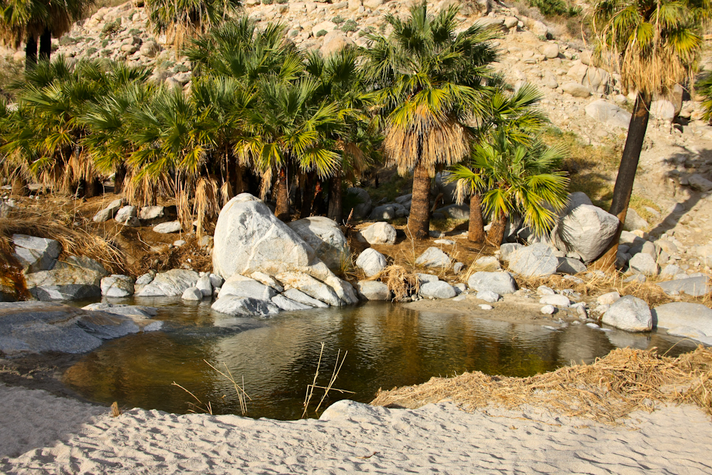
Right next to our camp was the "cold pool" which is just a dammed portion of the creek. The water is ice cold as it comes from the high peaks of the mountain.
The cold pool has a nice view of Pico Guadalupe and the canyon mouth.
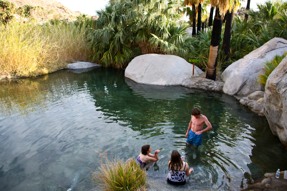
The large hot pool is about waist deep and the water is warm, but not boiling hot. We had quite a bit of wind that night, but since we were in the camper, it was a non-issue. For those in tents, however, it was a different matter.
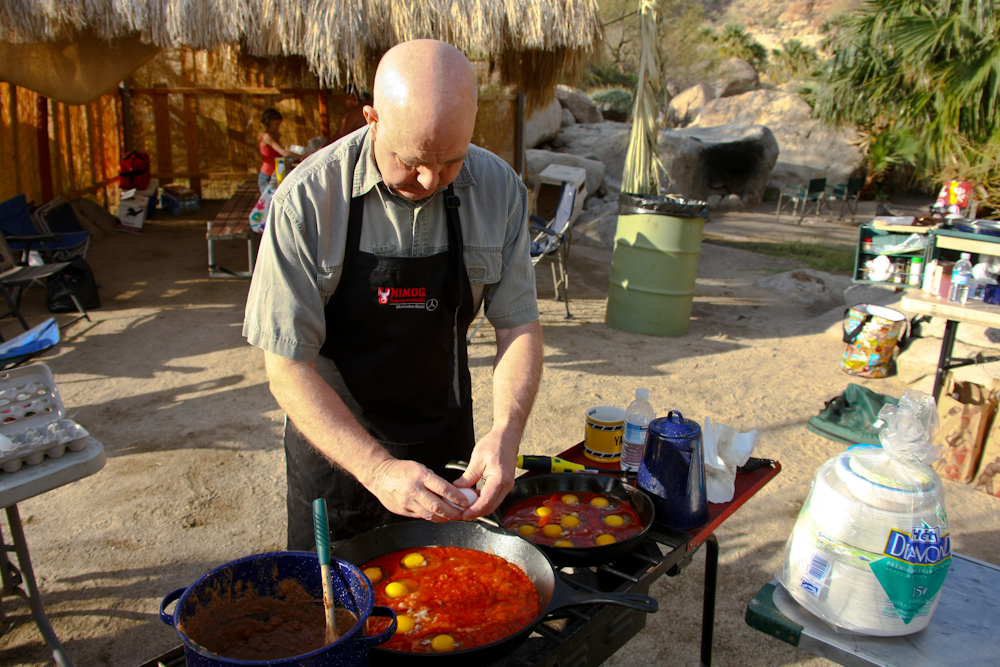
Next morning was Dan's turn to cook and he was preparing huevos rancheros. A big bottle of salsa is poured into a cast iron pan and brought to a simmer. When the salsa is bubbling, the eggs are added and allowed to poach in the salsa until done. Very tasty.
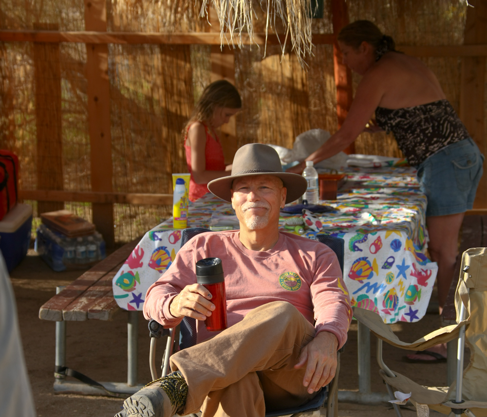
While Dan drives breakfast, I drive my camp chair with a Bailey's and coffee.
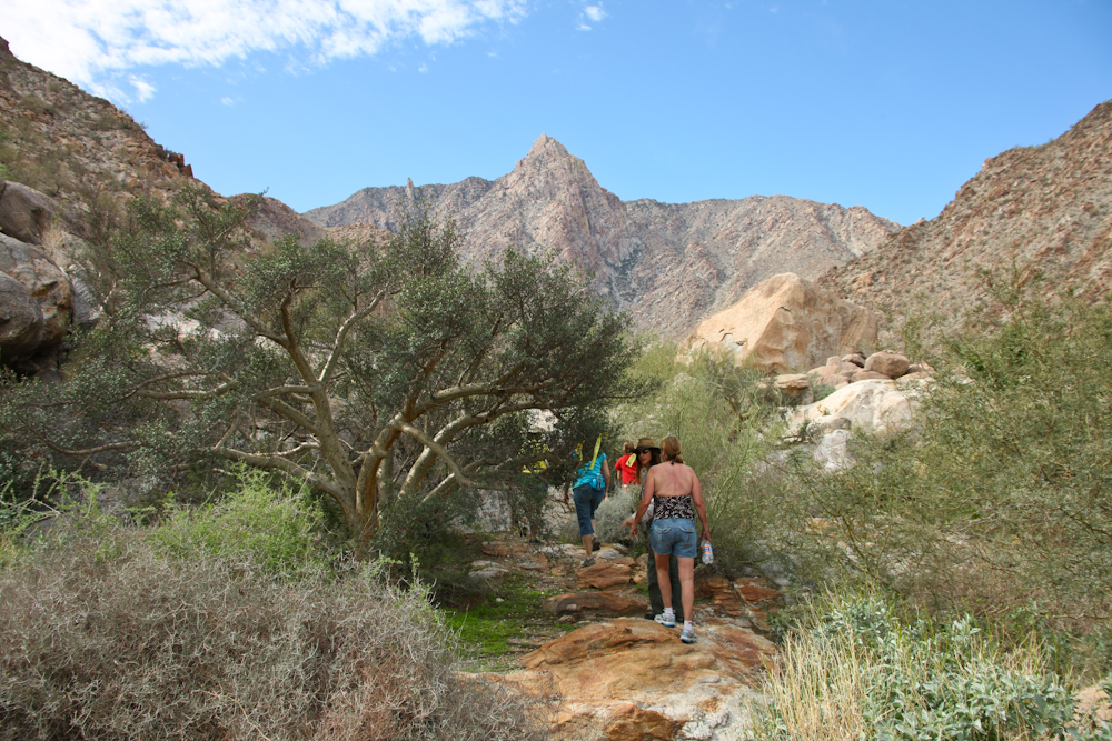
After breakfast, the group decided to hike to the waterfall that is about a mile upstream from the camp. The odd looking tree to the left of center is an Elephant Tree and is a type of succulent that has a red sap that was used by the local indians for medicinal purposes.
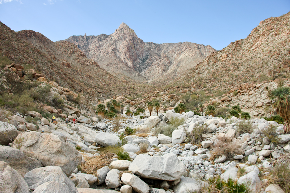
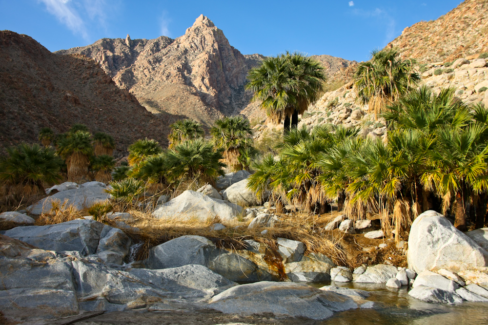
Pico Guadalupe is clearly visible from the mouth of GC. The action of storms and their associated water flow have washed down huge boulders from the peaks above. A portion of our group can be seen in the left center of the photo above.
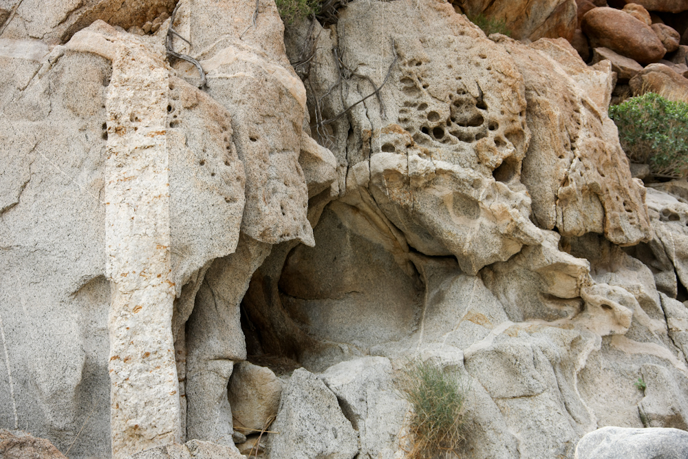
Rocks on the side of the canyon have interesting erosion patterns.
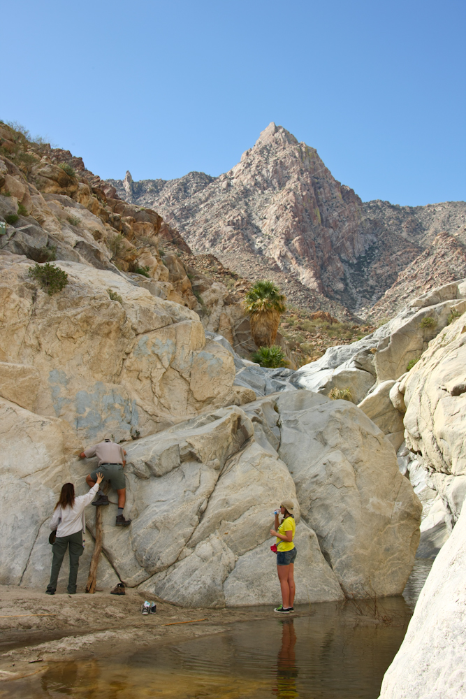
There are 2 routes around the waterfall. The south route requires going up the cliff face, but the north route is much easier. Above, Kathleen supports Kai as he scrambles up the face.
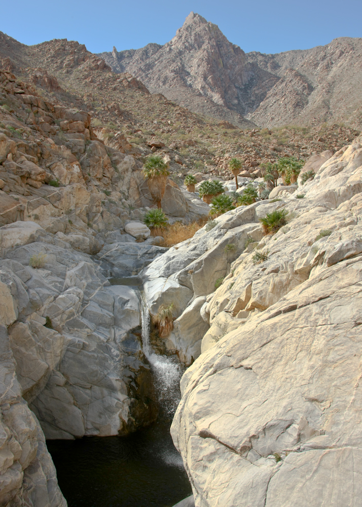
From the top of the north route, you can get a good view of the falls and Pico Guadalupe.
Some of the rocks in the cliff walls were subjected to multiple intrusions of newer rock.
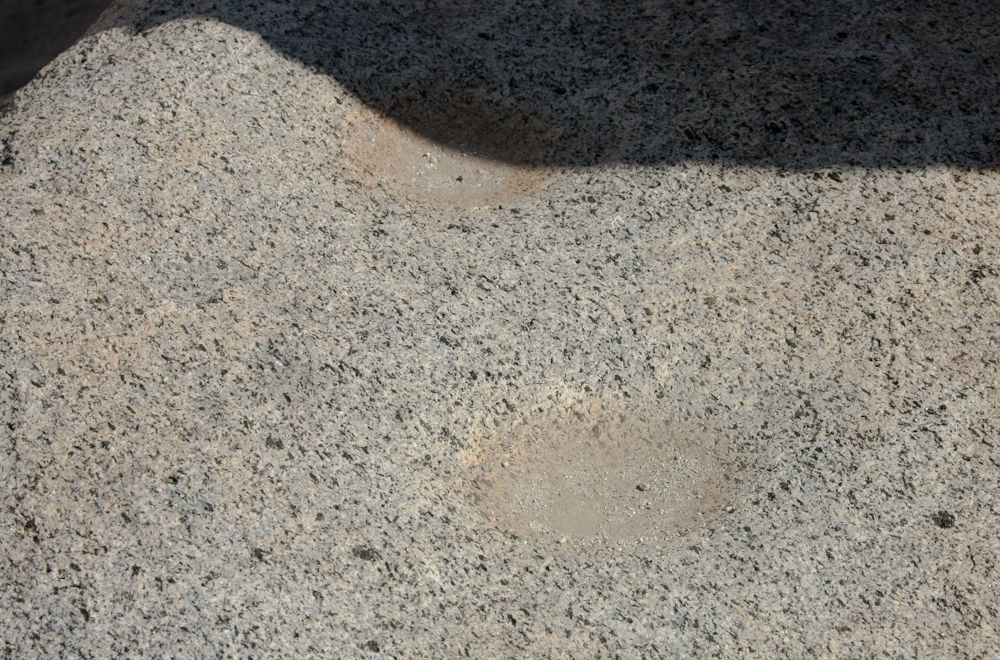
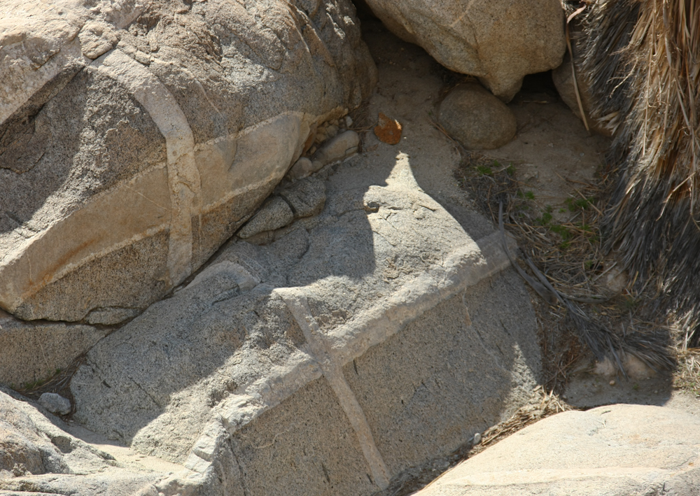
Along the north route, I found these indian morteros (grinding stones) that were used for crushing seeds into "flour".
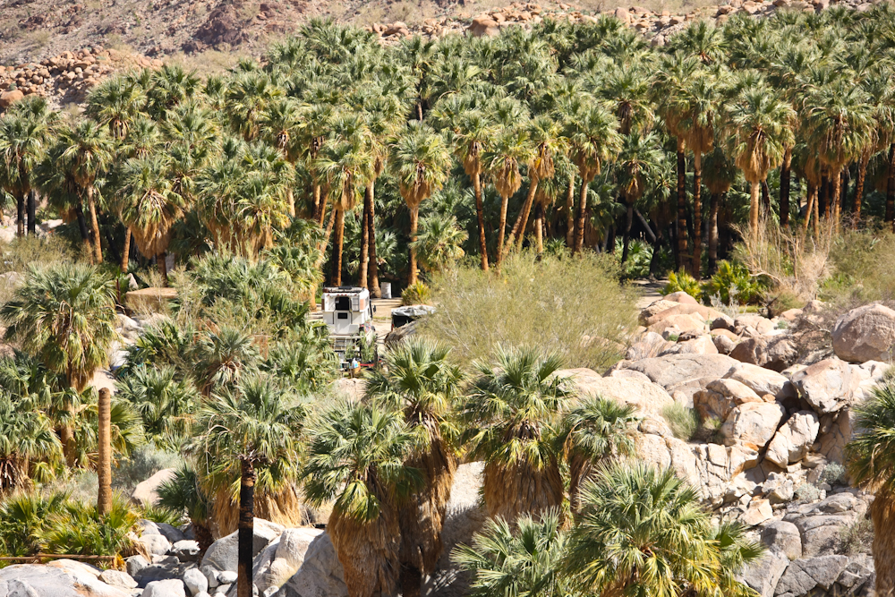
On the return back to camp on the north route, we got a view of our camp. In the photo above, you can see the extent of the palm trees in the camp area -- there are a ton of them!
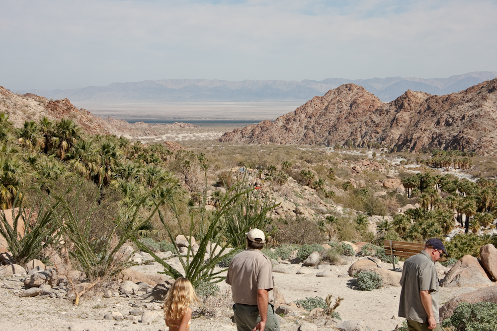
Just before the north trail drops into camp, you get a great view of the dry lake in the valley below. The dark strip is an olive grove that has been developed in the last 10 years or so. While we were hiking to the waterfall, several of the group decided to attempt an ascent of Pico Guadalupe (elev 4900'). There were some exciting moments when the trip took a bit longer than anticipated and the group got caught on the trail at nightfall without lights. Matt saved the day by returning to camp to get headlamps for the group and then met them half way with the lights. The balance of the return was uneventful, save for strong winds.
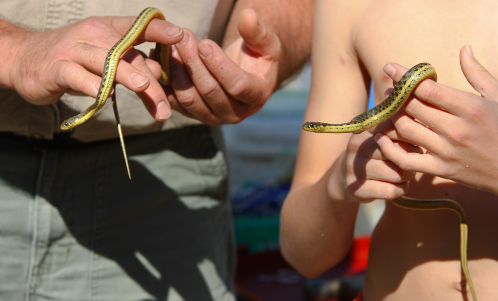
Kai and his son Parker caught 2 small garter snakes near the cold pool and brought them over for show-and-tell before turning them loose again.
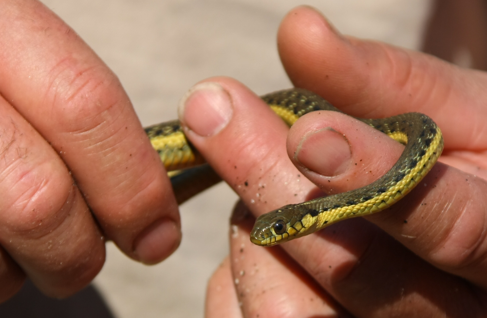
These guys are fast and always in motion. Getting a shot of the snake that was in focus took many tries.
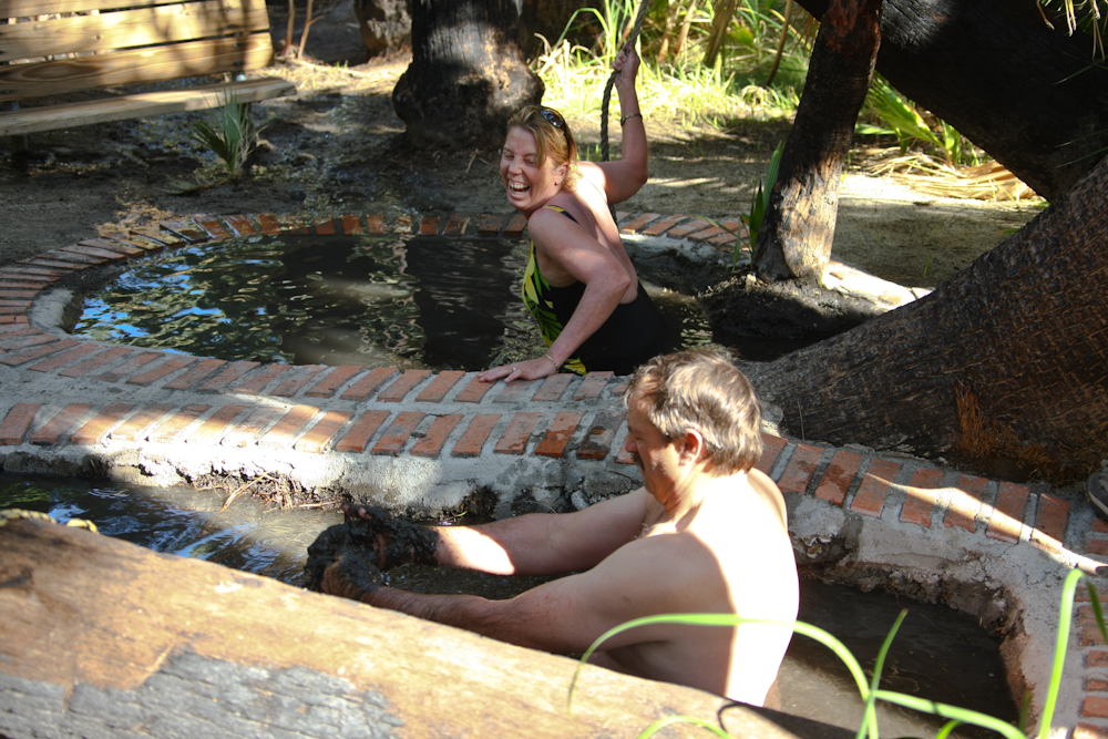
Since the last time we were at GC, the camp owner, Ernesto, has built some mud baths. These are fed from below and are actually pits of organic muck. Above, you can see Kim's reaction as her feet slip into the slime. Later that night, the winds returned again and there was some light rain. No problem really, and when you are soaking in the hot water, it really doesn't matter.
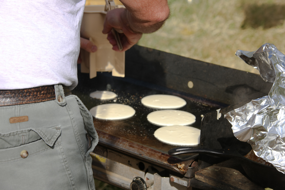
Next morning Kai was on cooking duty and was making pancakes with his big griddle and pancake shooter.
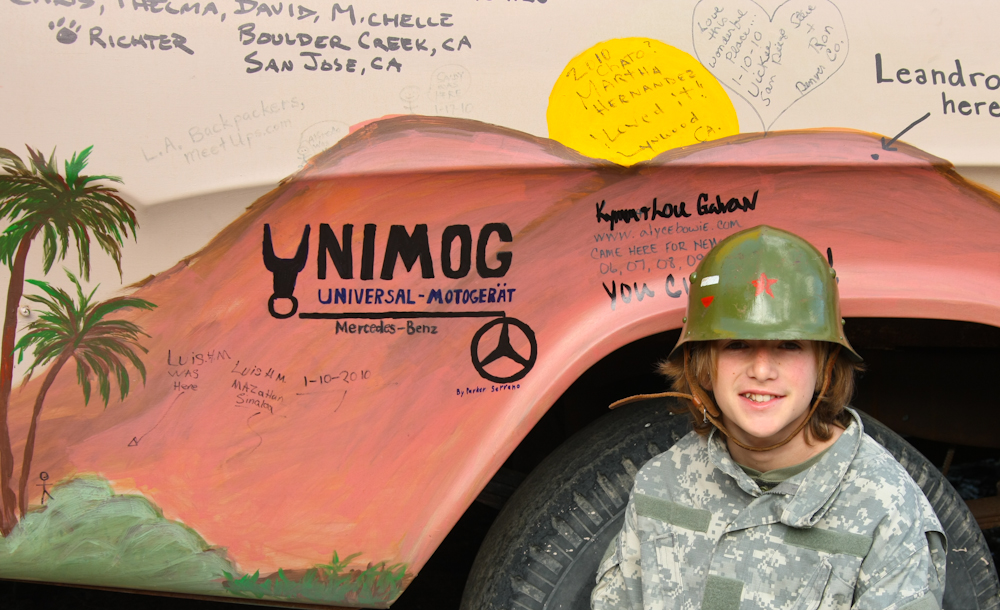
The burned out hulk of a truck that was at the entrance to the camp ground has recently been painted and turned into a sanctioned graffiti area. So, we asked Parker to utilize his substantial artistic talent to put a unimog symbol on the truck. That night, again, we got both high winds and rain. And, again, given enough hot water and wine, it did not matter.
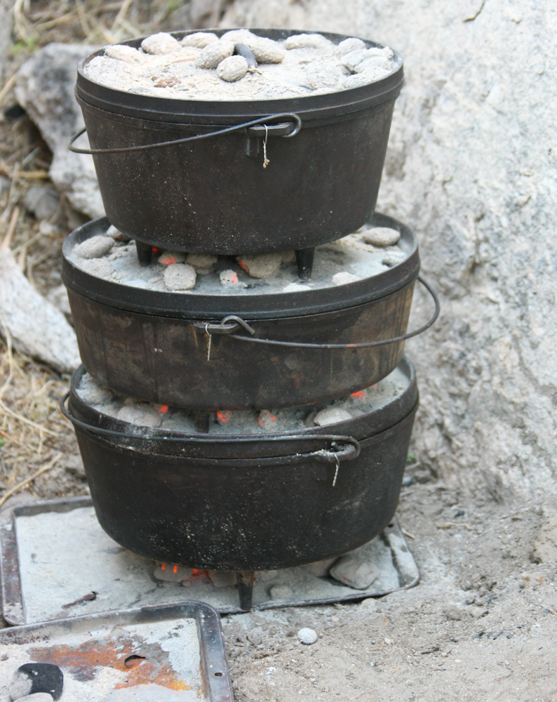
Next day, Bill and Kathleen were on kitchen duty. Sadly for us, the wind never abated making cooking a burden. We were doing pot roast with potatoes and fresh bread, but the propane stoves kept being blown out by the wind gusts, so I resorted to the tried-and-true method of charcoal. When using multiple dutch ovens, you can stack them to conserve charcoal as the top coals become the bottom coals for the layer above. The 2 big ovens have 3 pot roasts and the top one has the made-in-camp bread. It turned out great despite the interruptions in the heat due to the wind. It took the group 2 meals, but we ate it all.
Sunday morning, after a light breakfast, we packed and headed north along the mountain front. The winds were howling and driving a large wall of clouds over the mountain front. In the center of the photo above is a large set of cliff faces that are popular with the hard-core rock climbing set.
As the group works our way north, the wind was whipping up great clouds of dust.
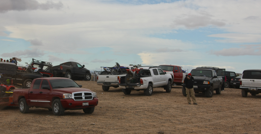
As we neared MX 2, we encountered a group of weekend dirt bikers from Mexicali and the U.S. that were having a "scramble". Above, the fellow does what many do when they see the mog for the first time -- take photos.
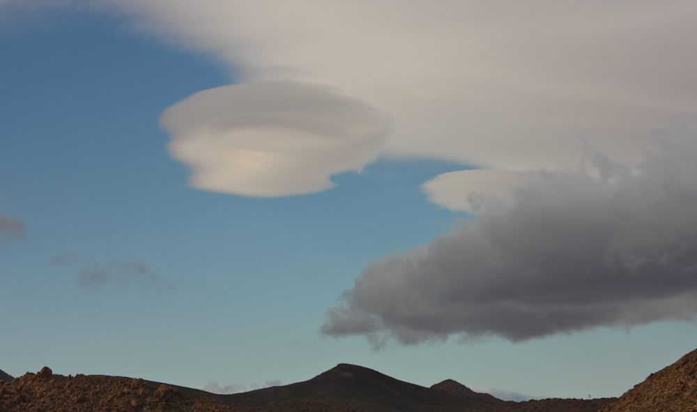
The high winds of the passing front created some interesting lenticular cloud formations.
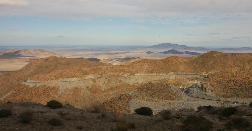
The trip up Rumerosa grade was slow and scary, as always, but it provided some interesting views of the desert floor beyond. Once we hit the top of the grade, the rain started in earnest and continued until we crossed the border at Tecate, CA.
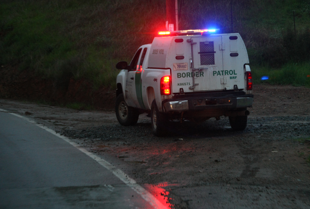
Outside of Tecate, we passed an accident along CA94 that had a bunch of CBP vehicles at the site. We surmised that they were involved with a high-speed chase and the truck that they were chasing ran off the road into the canyon. The truck was not all that damaged and there were no ambulances present when we came by the scene, so we assumed that there were no injuries. By the time that we got the camera out, we were past the actual scene, so the photo above was the best that we could do.
Guadalupe Canyon is one of my favorite destinations in northern Baja. The campground has been improved over the years and it is really nice. We were lucky on this trip in that the camp was mostly deserted; we essentially had the whole place to ourselves. The weather was not as nice as I would have hoped, but that is the luck of the draw when you camp during the "winter" in this part of Mexico. If you go, be sure to take your passport and plenty of cash as well as be fully self contained. There are no services at Guadalupe Canyon and you have to traverse 70 miles of dirt road to get there and back to the highway.