We spent the night in a motel in Waterton. The primary reason was that the motel had an internet connection that allowed us to upload photo. But, much to my chagrin, they also had very restrictive bandwidth limitations. What should have taken a few minutes took nearly 4 hours. But, in the end, I got what I needed. After we checked out of the motel, we did a quick drive-by of the Waterton area and then we headed north again.
The photos below are what we saw.
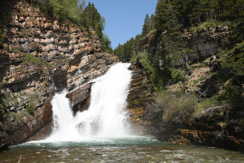
Within the city limits of Waterton we visited this nice waterfall.
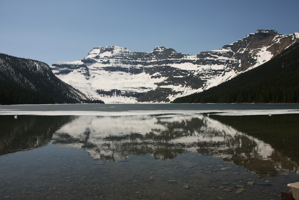
We followed the road from the waterfall up the mountain to this lake. The lake still had ice covering a big portion of it's surface. The lake is pretty big and the south end of the lake touches the US border. Note the ice near the cliff on the surface of the lake.
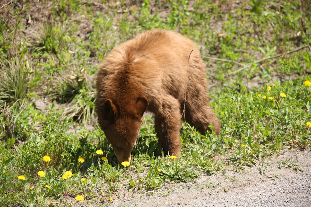
Big trouble is very close by. We saw the cub, but did not see mama. Happily, we left long before she came to check on junior.
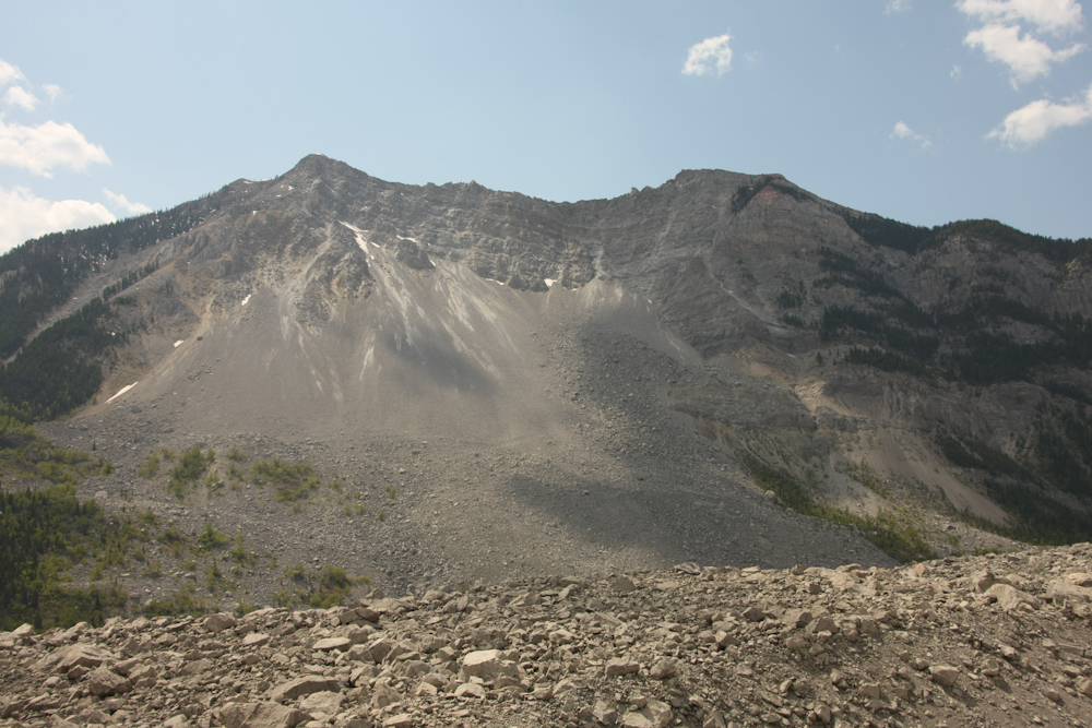
We came to a place called "Frank's Slide". This event happened in 1903 when the whole face of the cliff slid down and covered the mine and town at it's base. The whole gray scar was part of the slide. The slide eliminated the town at the base and all it's inhabitants. Today, there is a museum to commemorate the event.
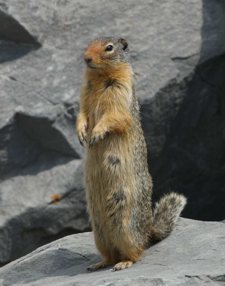
At the Frank's Slide Museum, I spotted this critter. He was checking me out to see if I would give handouts.
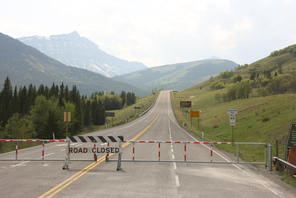
We headed north on the Forest Trunk Road (dirt) through the mountains and then expected to head west. The locals had other ideas. This road is closed until June 15th for benefit of the wildlife. We were forced to take a detour to the east.
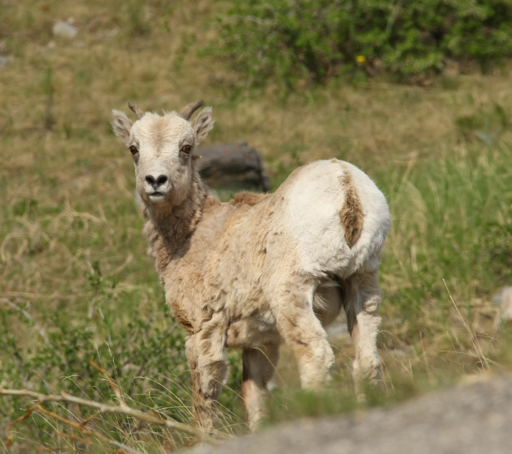
On the detour, we spotted this fellow: a young mountain goat. Down slope from the road closure, we found a campsite and spent the night. We heard from the locals that "weather was coming". Yes, indeed. The next morning was rainy, cloudy and very cold. We broke camp and headed off toward Banff.
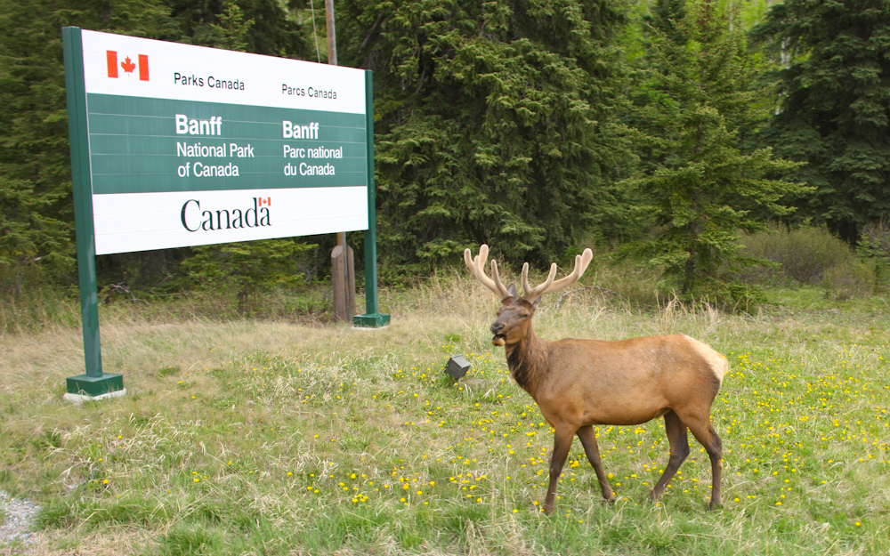
At the entrance to Banff, we spotted this young male elk that still had velvet on his antlers. He was right next to the road and seemingly had the traffic all figured out.
At the outskirts of Banff, we spotted this nice glacial waterfall. As a side note, this waterfall was also visible from our train trip through the Canadian Rockies via the Rocky Mountaineer several years ago. Click here to see those photos.
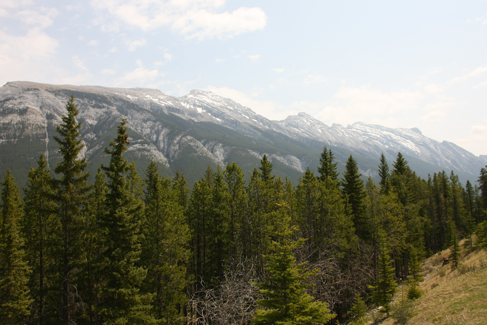
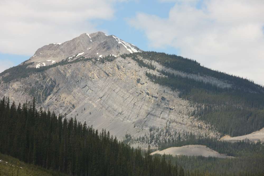
Once in Banff, we fueled up and decided to take the gondola ride to the top of the mountain. En route to the gondola we got a great view of the mountain range to the south of Banff. Note the bedding of the rocks in the range. As we boarded the gondola, the weather was closing in and it started to rain.
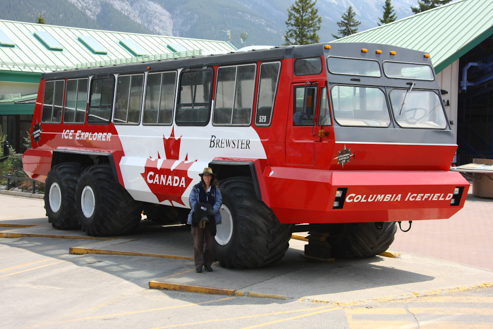
In the parking lot for the gondola, we encountered this beast. This is a "tundra bus" that is used to take tourists onto the local glaciers. Kathleen posed next to it so you can have a sense of scale. This fellow makes the mog look wimpy. In the photos below, you will see my mog next to one of these beasts.
The view from the top of the gondola was spectacular. We elected to have lunch at the top.
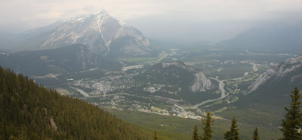
While we ate, the weather continued to degrade. Above is a shot of the town of Banff.
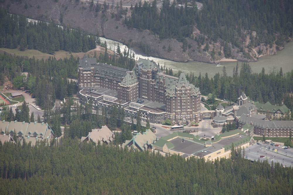
From the top of the gondola, the Fairmont Hotel is visible. This was quite a structure. We considered staying there, but it was about $1,000/night. While that was a consideration, the real issue was that we needed to get further down the road to meet our objective of the North Slope by the summer solstice.
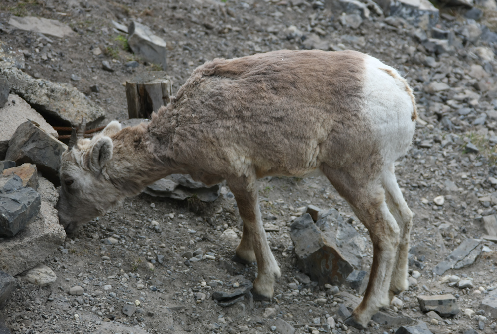
As we left, we spotted this young goat next to the gondola hut searching for food.
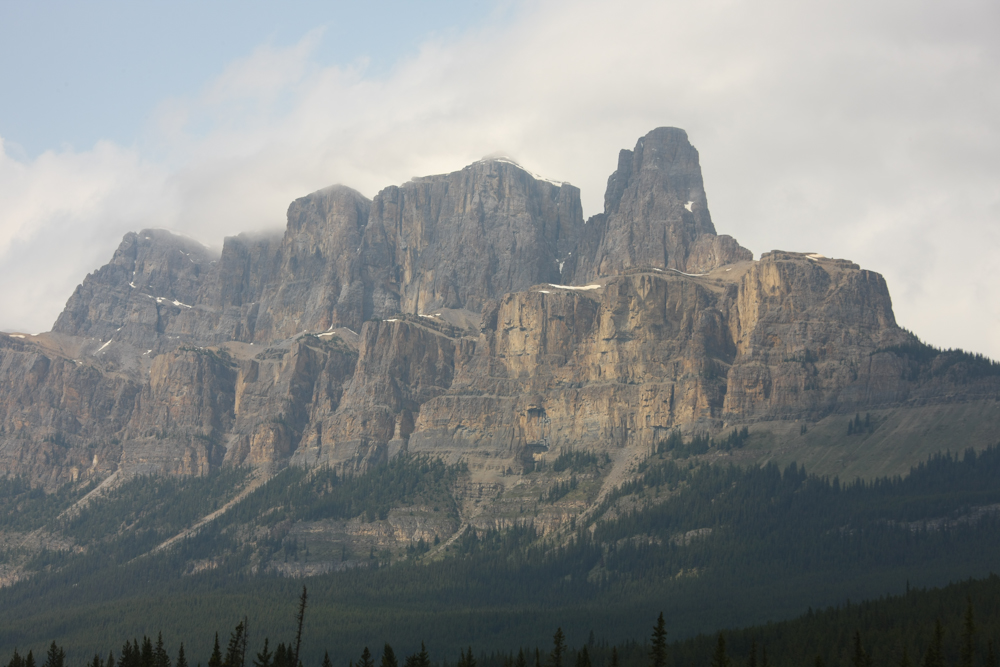
On our way from Banff to Lake Louise, we passed this structure that the locals call "Castle Rock".
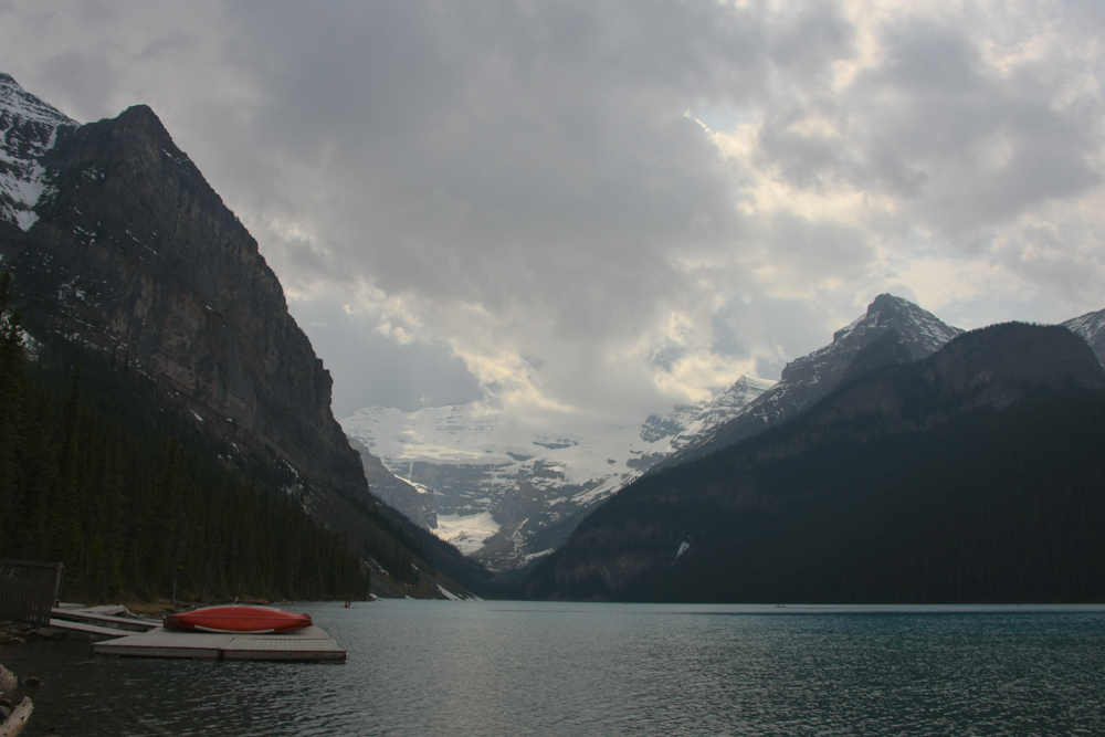
When we arrived at Lake Louise, the weather continued to degrade. The forecast was calling for much colder temperatures and continued rain tonight and snow the following day. We decided to get our sightseeing done ASAP. Above is a shot of Lake Louise and the ice cliffs beyond. The colors of the lake did not come through in the dull light, but it was magnificent.
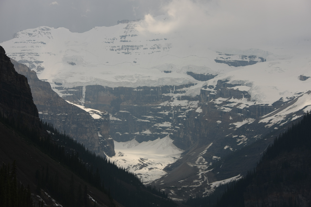
Note the hanging glaciers on the far cliff walls. These detach from time to time and come crashing down to to the debris fields at the bottom of the cliff. The sign at the Fairmont Hotel stated that it takes the sound 20 seconds to reach the hotel when there is a slide.
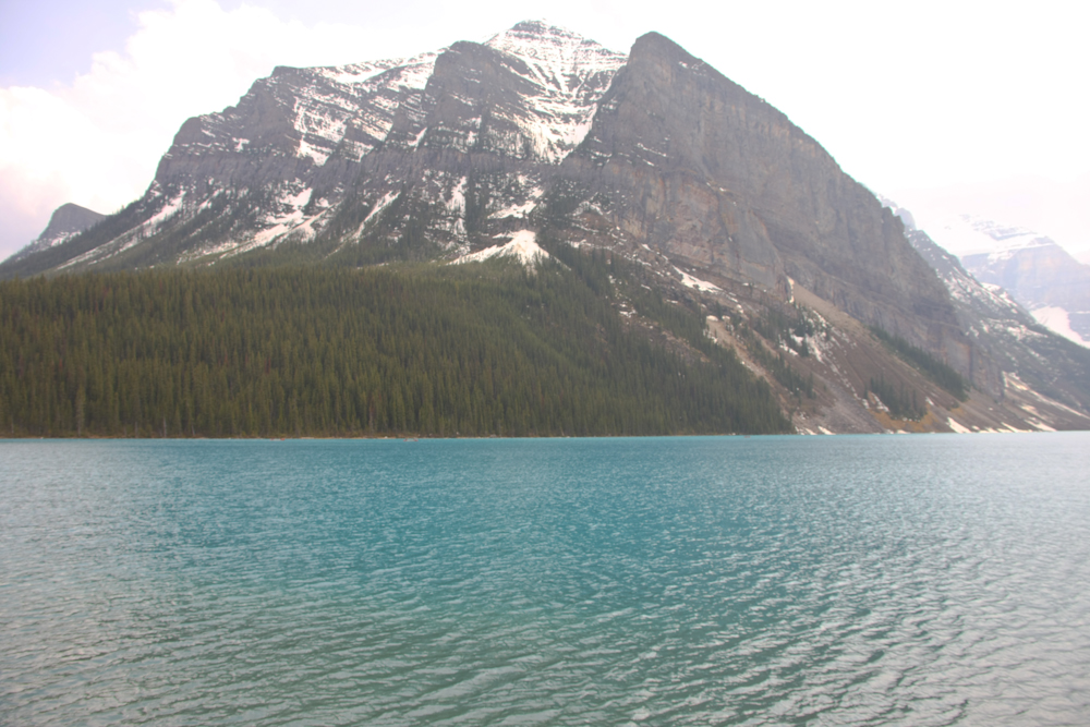
The above photo does a slightly better job of showing the pale blue color of the water in the lake. After looking around, we headed into the Fairmont Hotel for a cocktail. The Fairmont is not cheap, but the cocktails were good. When we finished, we headed to our camp site.
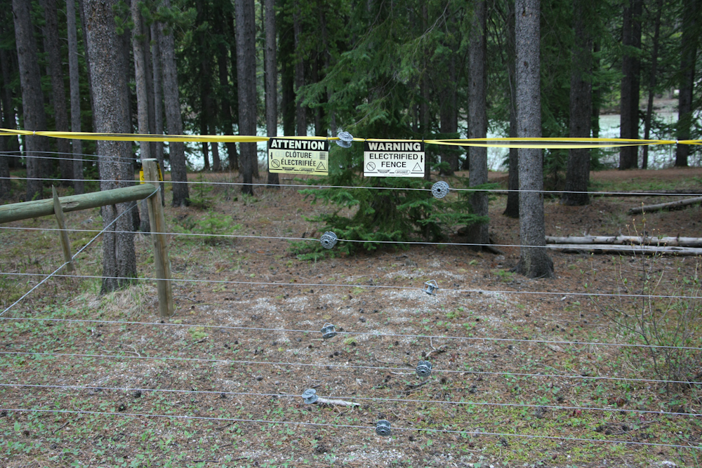
The camp site at Lake Louise is surrounded by an electrified fence to keep out bears!! Or perhaps to keep the camper in. We never confirmed which one was correct, so I preferred to assume it was for the bears.
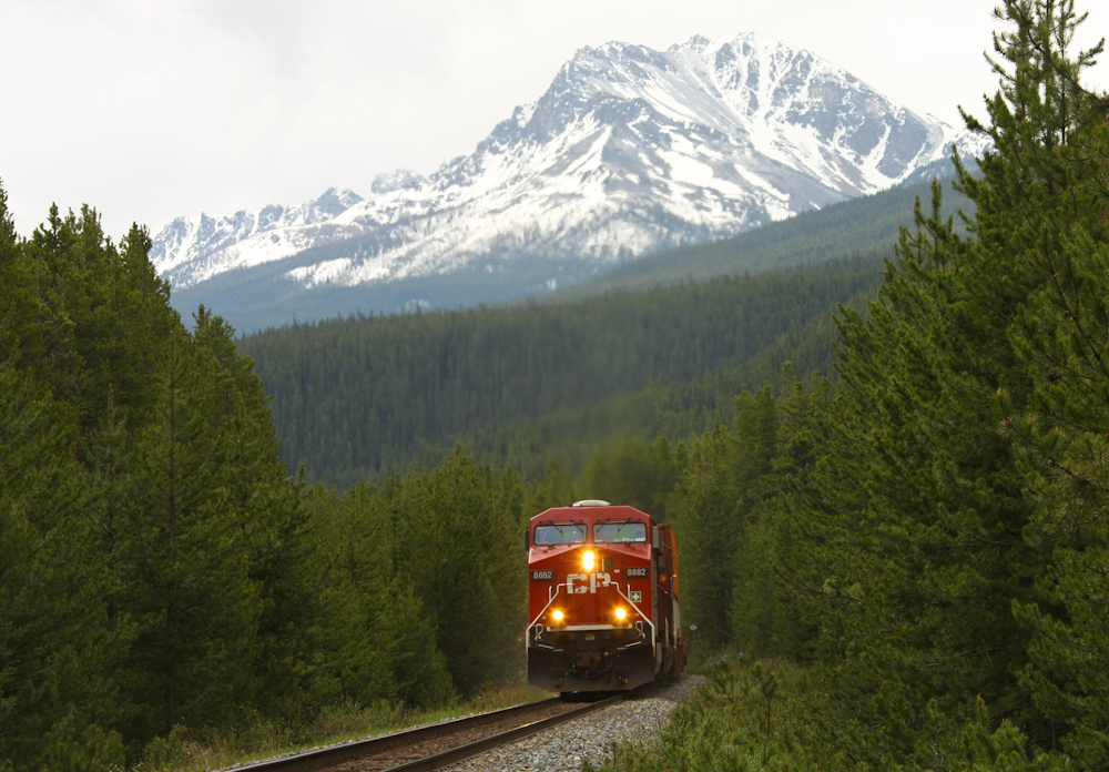
The camp site is right next to the cross-Canada rail line. We heard several trains at night, but could not see them. Next morning when we were taking on water, a CP freighter came by and I got the shot above.
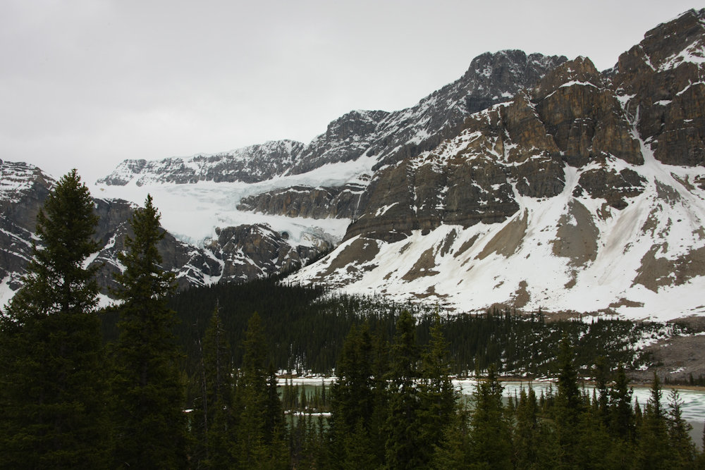
From Lake Louise, we headed toward Jasper National Park via the Ice Fields Highway.
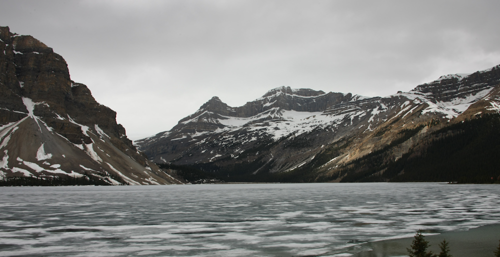
Several of the lakes next to the highway were still covered in ice.
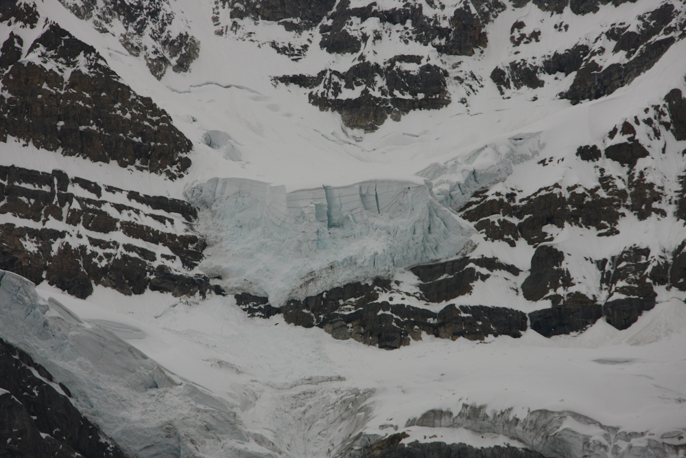
On the far cliffs I could see this hanging glacier. Note the large cracks in the face of the ice. This will come crashing down soon with catastrophic results for anything in its path.
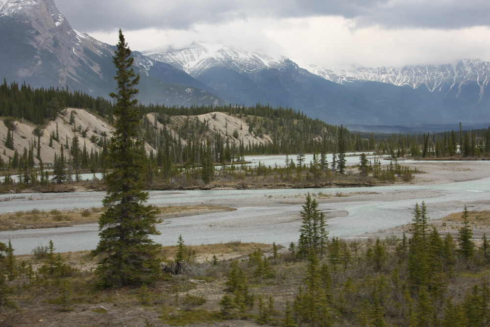
We crossed the high pass on the Ice Fields Highway and descended on the north side. As we did the weather started to break a bit. Above is the Athabaska River.
Note the curved bedding in the rock due to an uplifting event. Many of the mountains in the area showed similar deformations that were caused during the Rocky Mountain Uplift.
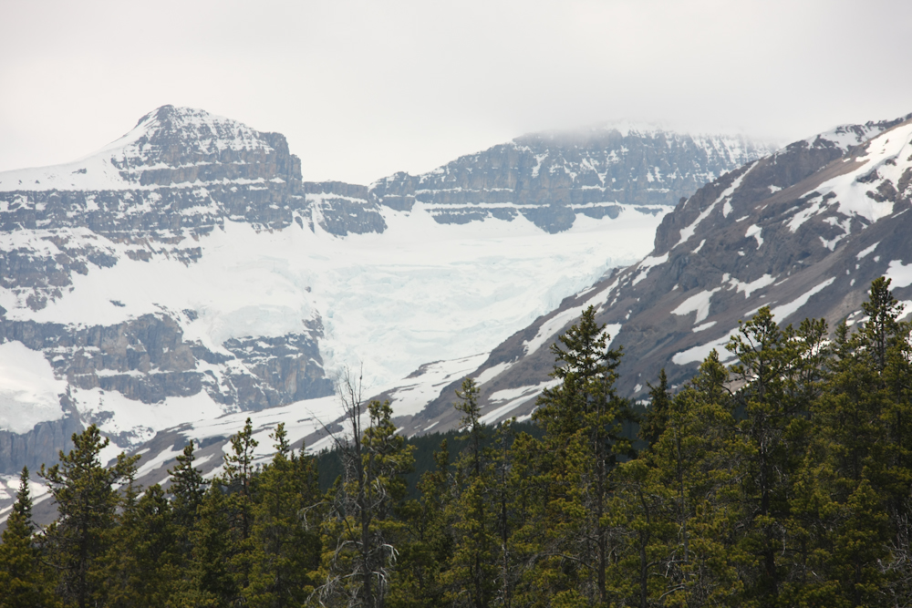
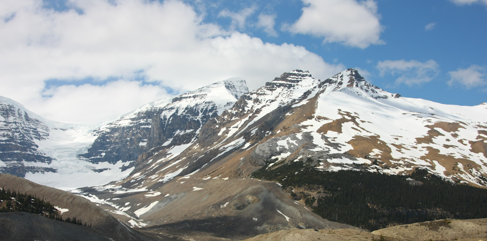
More big ice fields visible from the highway.
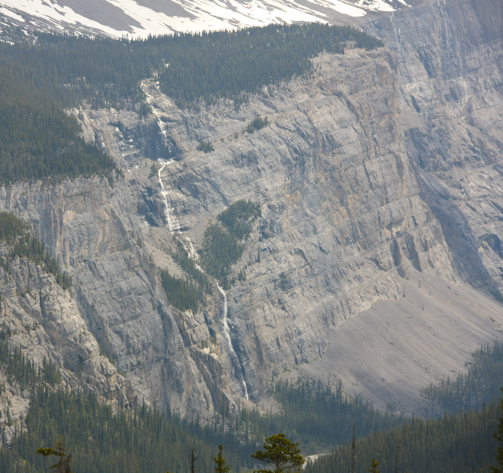
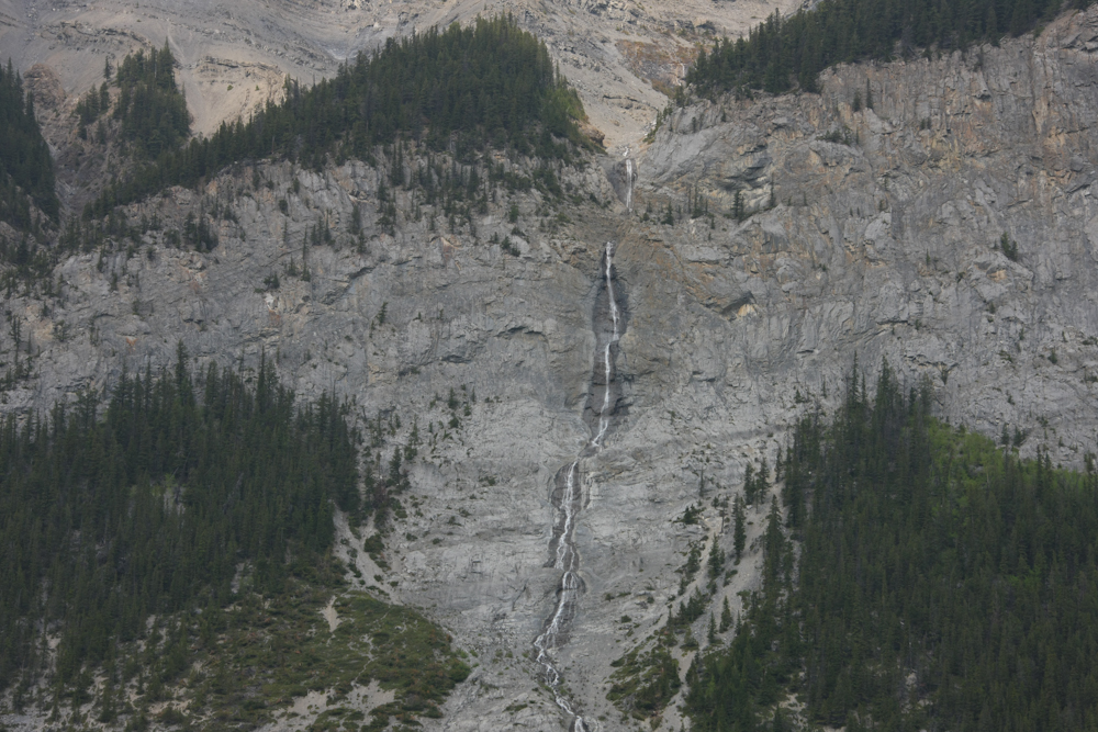
In the spring, the snow and ice melt creating great cascades down the steep cliffs. I am sure that this waterfall was over a 1,000 feet high, maybe more.
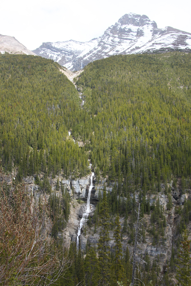
More nice water falls were visible from the highway.
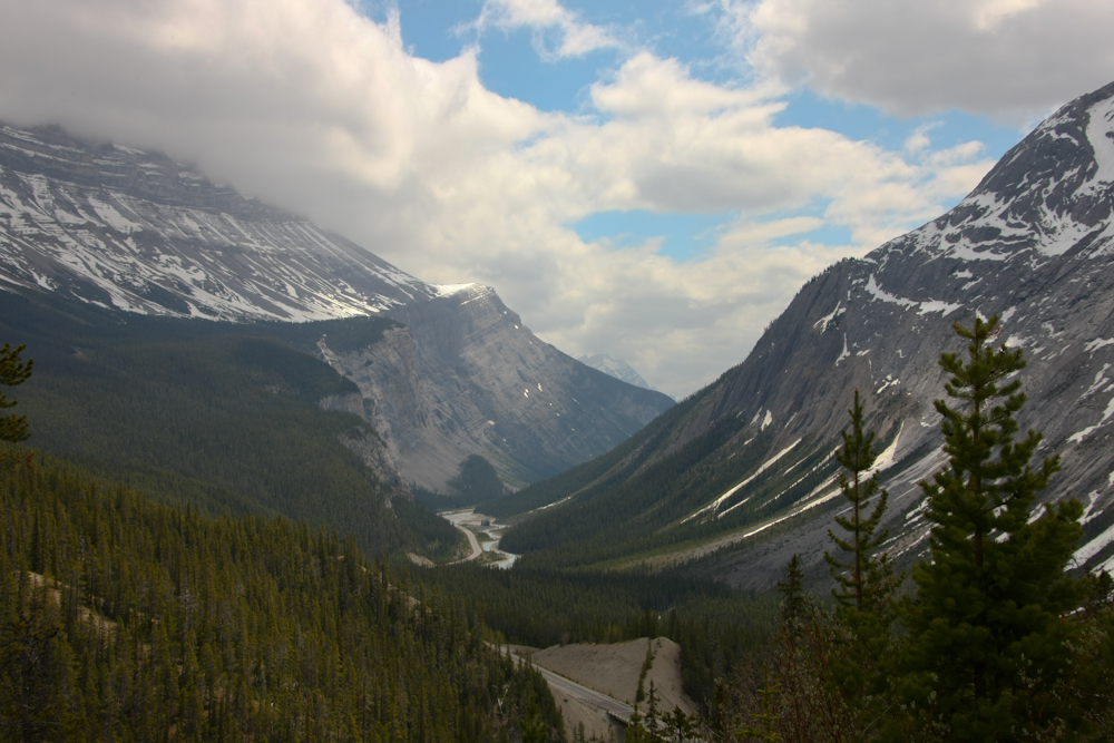
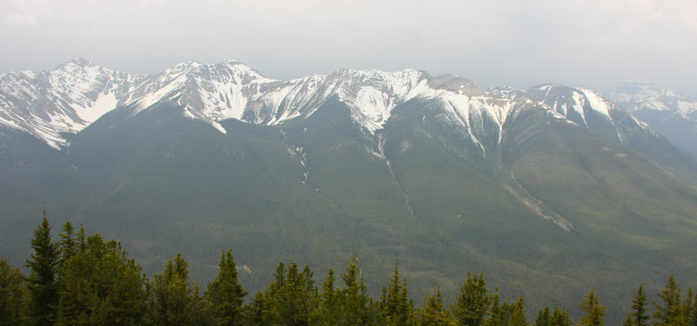
A look south from one of the passes shows the warped bedding and the steep U-shaped valley walls that result from glacial action.
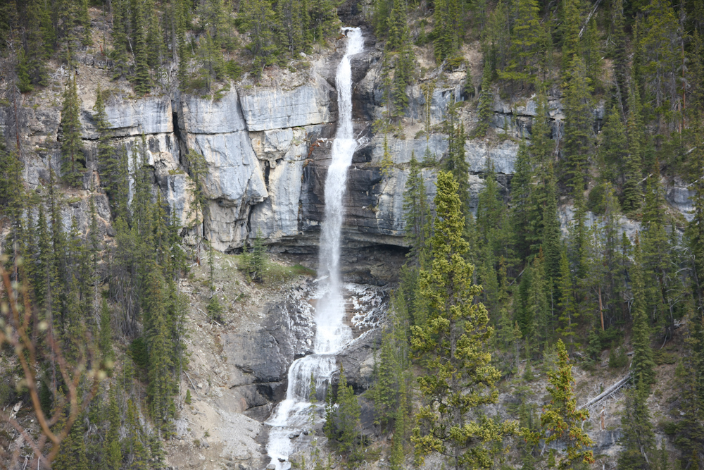
Another good sized waterfall right next to the road.
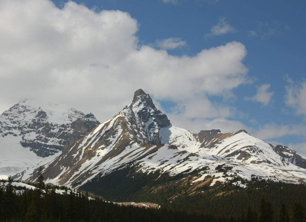
Near the crest of the highway we came upon this mountain that looks rather like the Matterhorn.
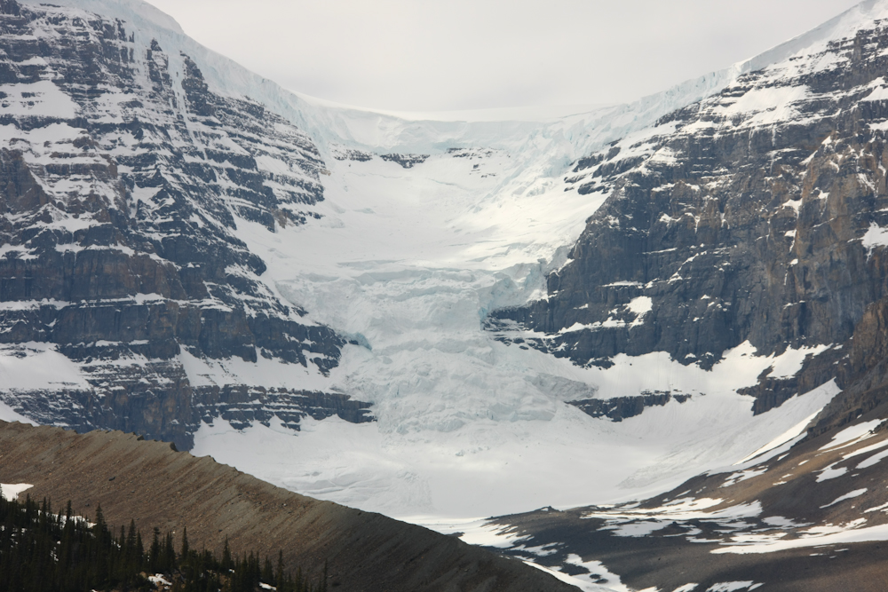
Another very large ice field.
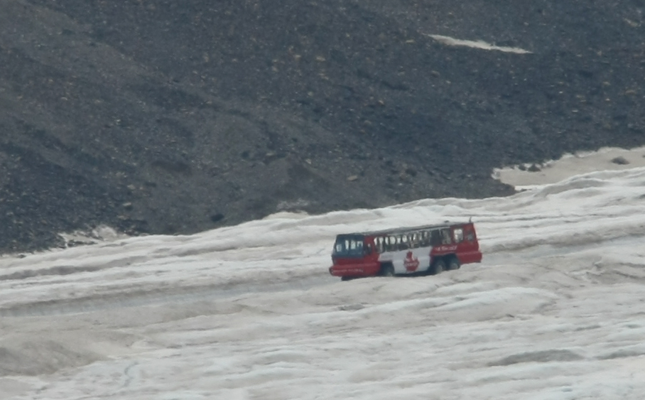
The "Ice Explorer" in action on one of the glaciers.
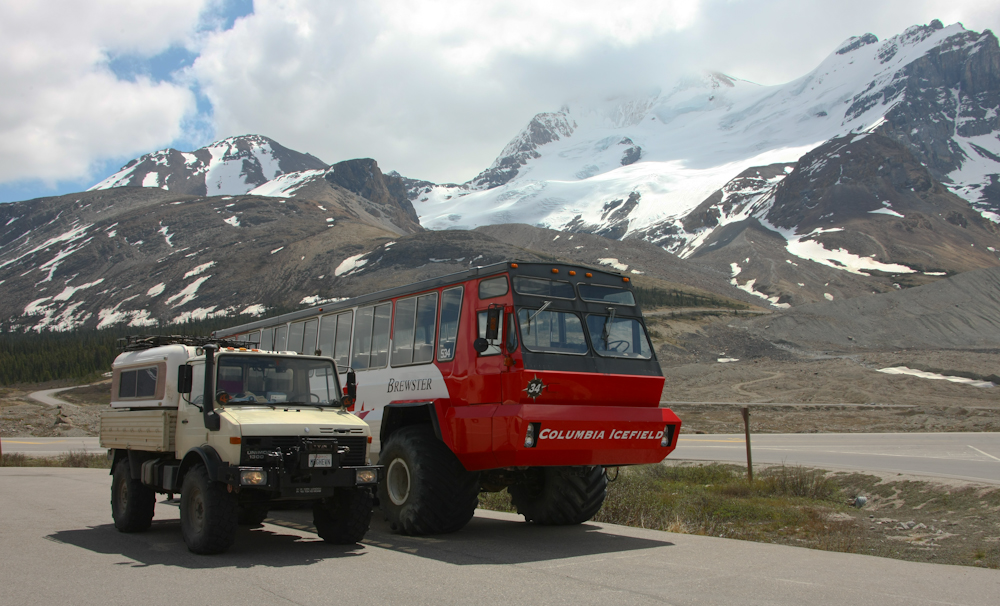
The Ice Explorer is a pretty big machine. The tires are 25" rims running 66 inch diameter by 48 inch wide Goodyear Terra Tires. I attempted to run smaller Terra Tires on my mog in the Altar without much success. The GVW of this beast is about 75,000 pounds fully loaded
Finally the weather broke enough to provide some color in the photos.
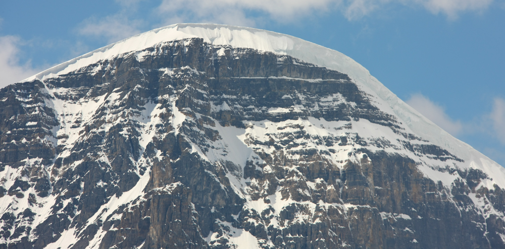
Look at the size of that cornice!! I wish I could see it collapse as it would be quite a show.
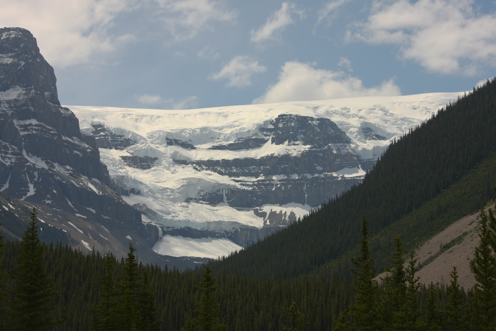
More hanging glaciers.
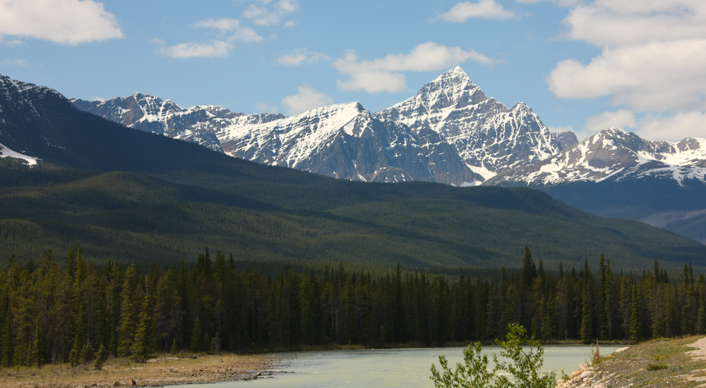
The distant peaks looked quite nice in the afternoon sun.
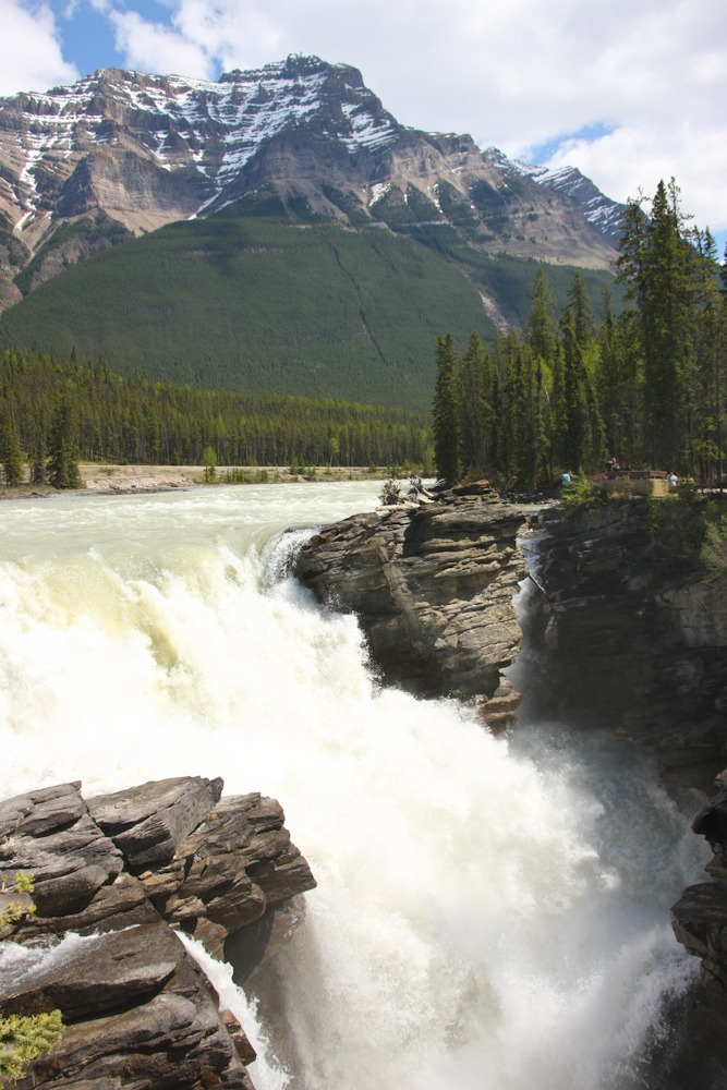
This is Athabaska Falls. The entire flow of the river is channeled through this narrow slot.
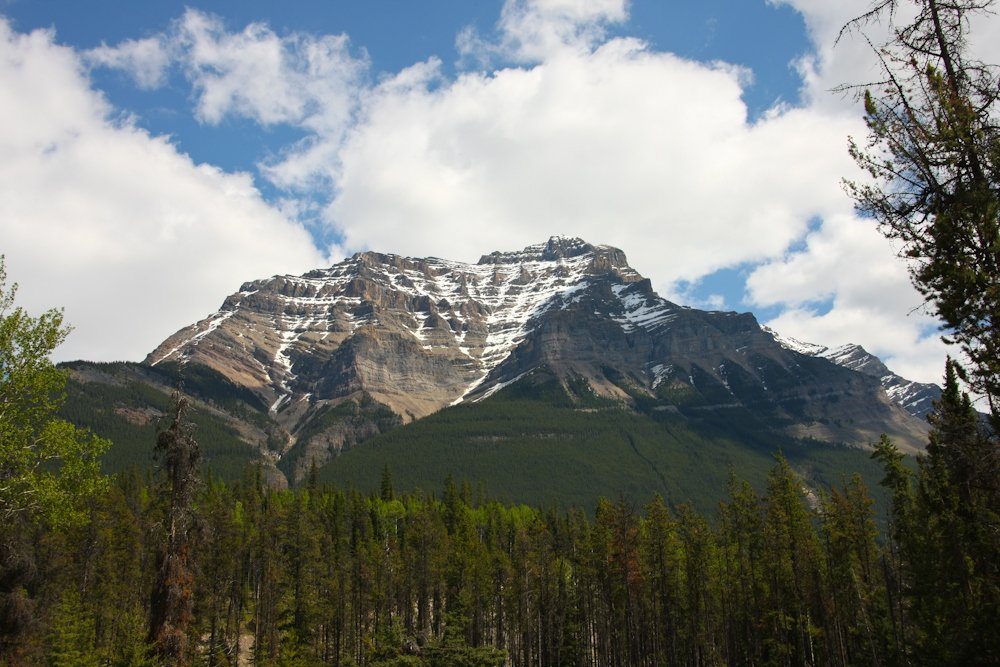
A major peak visible from Athabaska Falls.
When we finished at Athabaska Falls, we headed into Jasper for diesel and supplies. Then we headed to a campground in the Jasper National Park on the east side of town on the Snaring River. It turned quite cold after dark so we started the heater and mounted a DVD for entertainment. Tomorrow, we will continue north.
| Previous Adventure | ||
| Trip Home Page |
Photos and Text Copyright Bill Caid 2009, all rights reserved.
For your enjoyment only, not for commercial use.