When we were done with Northwest MogFest, we headed south along the Oregon coast, then we went inland over the southern Cascade Range to Mount Lassen and from there to Reno, NV.
The photos below are what we saw.
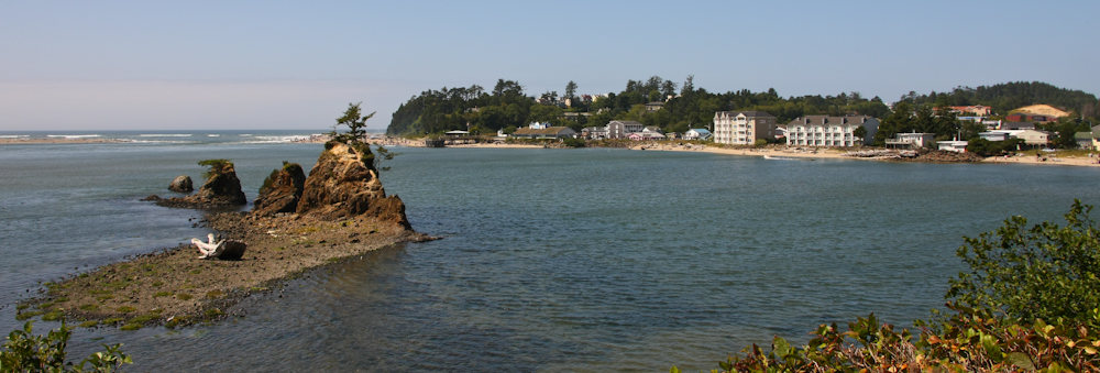
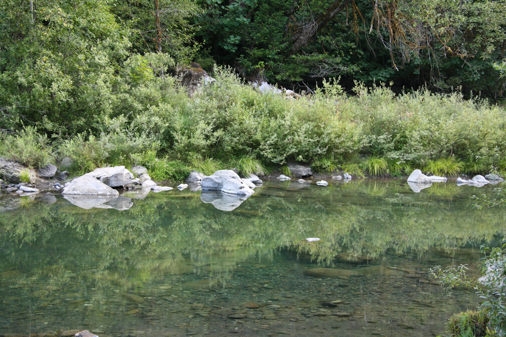
Near Lincoln City, we got a nice view of the water and rock outcroppings.
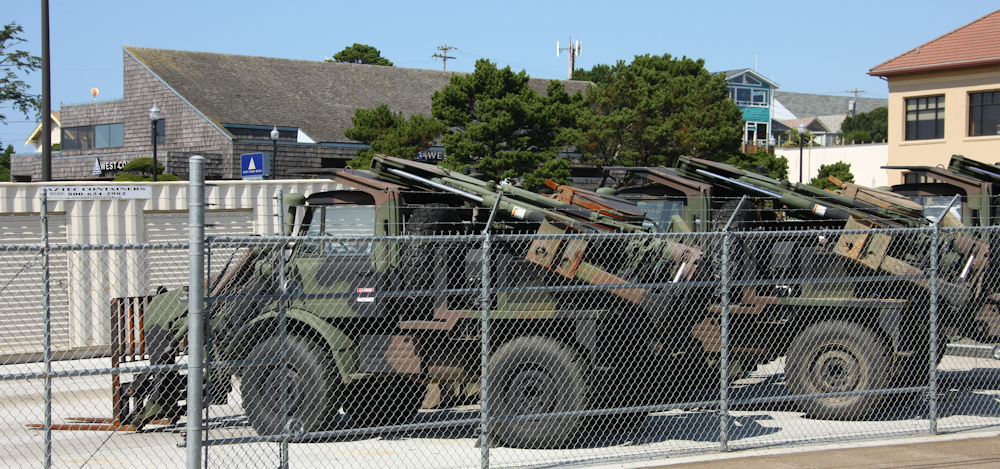
These 406 Unimogs were spotted at the local National Guard base. These are CEE tractors and have a forklift on the front and a back hoe on the rear of the truck.
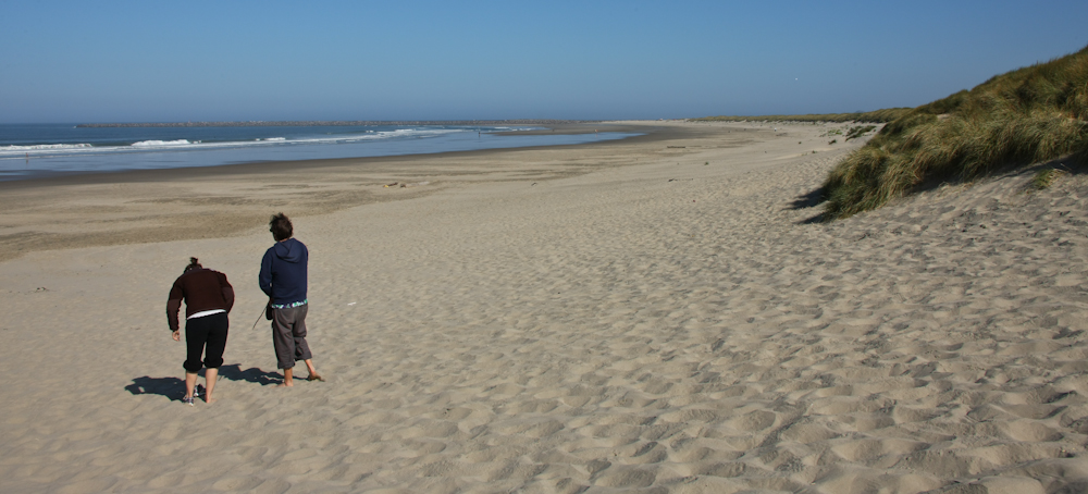
We stayed at the Oregon State Park at South Beach just outside Newport. The place was clean and had hot showers which were a welcome treat. After a calm night, we went down to the beach to check things out. The beach was wide and sandy, but the wind was cold and unrelenting. We only stayed a few minutes before retreating to the warmth of the cab.
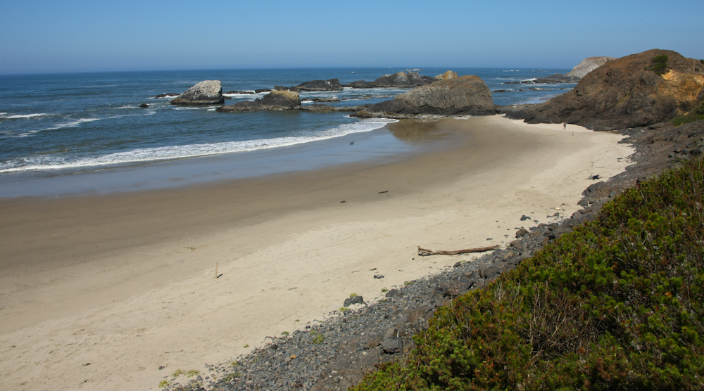
A number of the beaches visible from US 101 were very nice but still suffered from the winds.
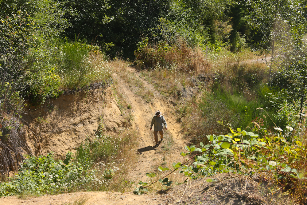
There I was, traveling along and minding my own business and the road had the nerve to be washed out. The road was single lane pavement right up until it was not there. We had traveled many miles south from Alsea on a one lane, twisty-turney road so back-tracking was not that appealing. So, I scoped it out to see if we could cross the obstacle. We had not seen a car all day, so caution was the order of the day. Above, I return from inspecting the far face of the wash-out. Note the height of the embankment behind me; and I am not to the bottom of the wash-out yet!
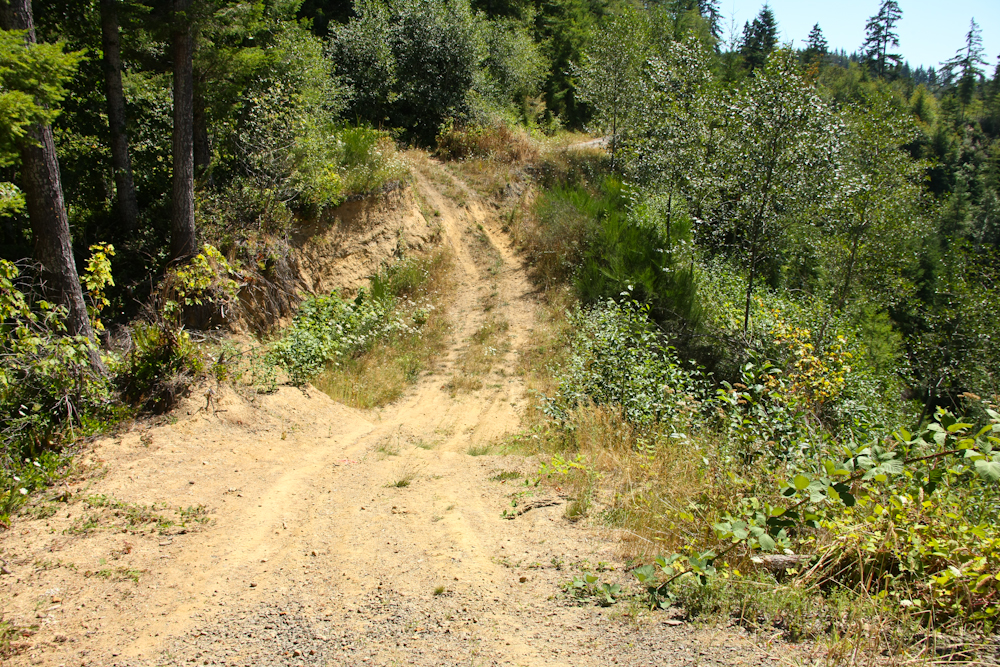
The view down from the cab. I took the camera with me to shoot from the other direction.
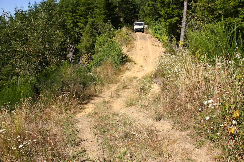
Looking back from the far face of the embankment. We crossed without any issues. I used working gears, 5th gear, 4x4 and differential lock and it was no sweat. Not even any tire slippage. Mogs rule!
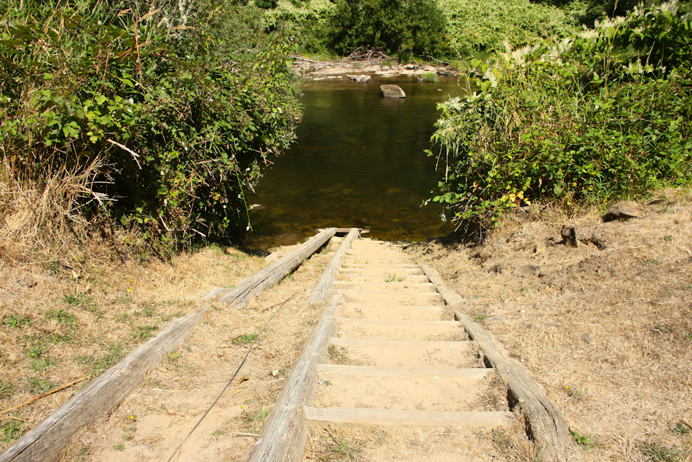
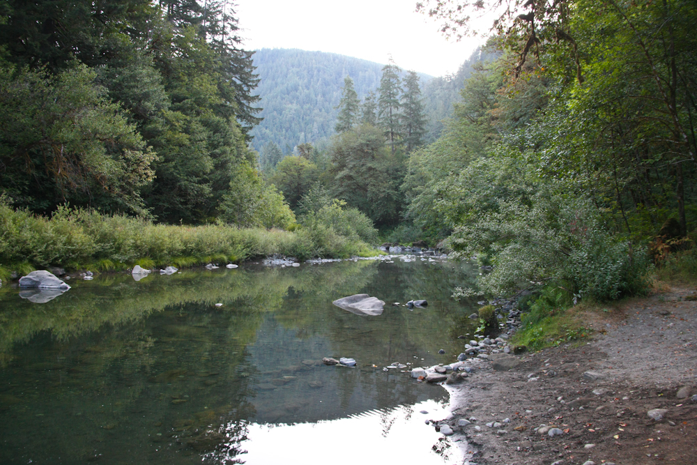
We passed a number of rivers and this one on Wolf Creek had a "boat launch" that was a slide track and cable to allow lowering boats to the river. The water level was very low, so the ramp was not in use.
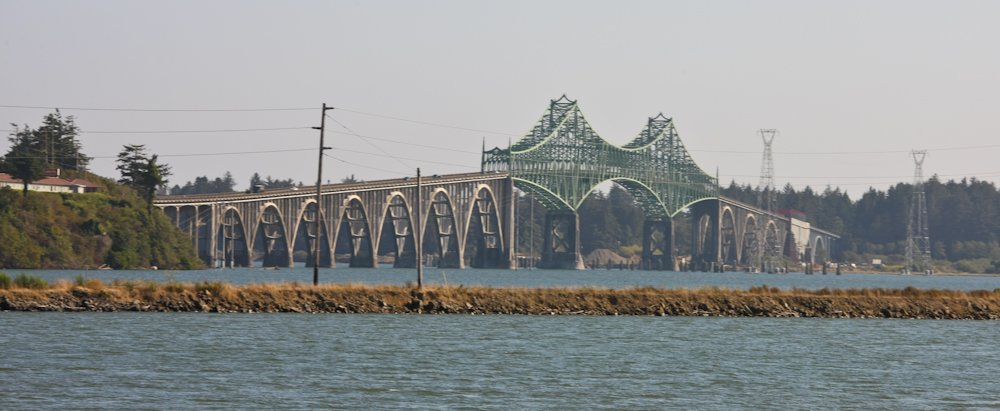
Now that's a bridge!! This bridge is on the north side of Coos Bay, OR on US 101. We spent several days in Coos Bay awaiting a refill on prescription medicine.
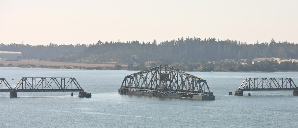
A rotating railroad bridge in the Coos Bay area.
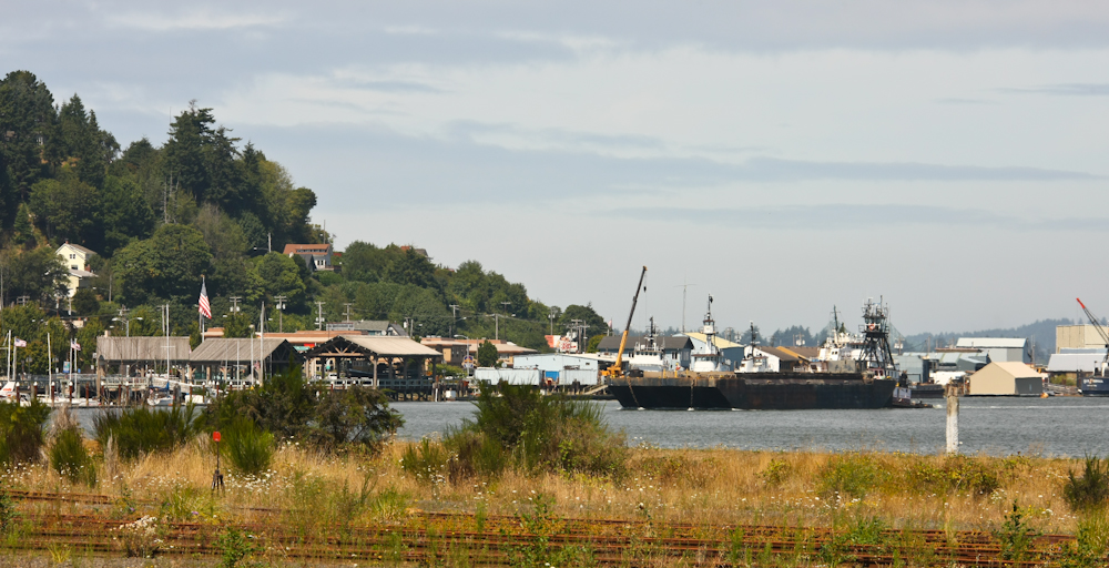
A view of the Coos Bay waterfront from our camp site at the RV park. It was a pretty nice place; clean and quiet except for the boat traffic at night.
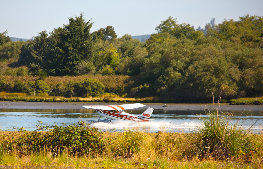
The slough behind our camp was also used as a landing strip for float planes.
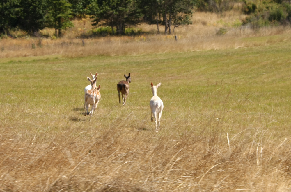
In the hills out of Myrtle Point south of Coos Bay, we passed this herd of deer with two albino does. I had never seen albino deer before and to see several at once was rather remarkable.
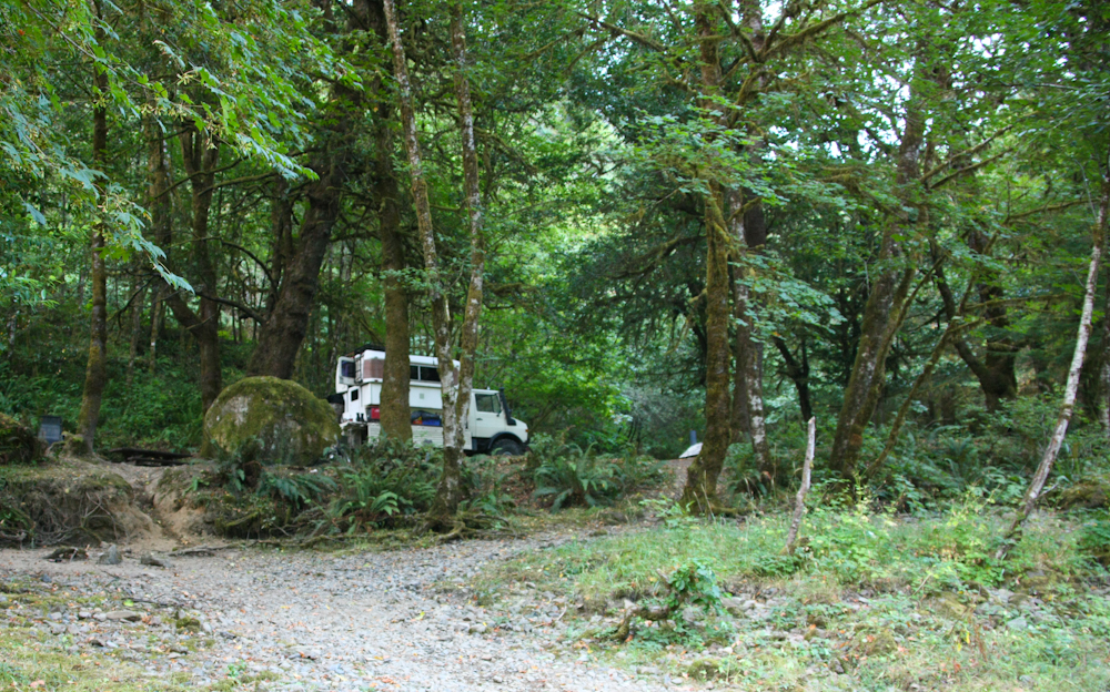
That night we stayed in a Forest Service campsite that was right next to Coquille creek. It was not too buggy, so we went swimming.
The Siskiyou range is visible in the distance.
We had the whole camp to ourselves, so it was a quiet night.
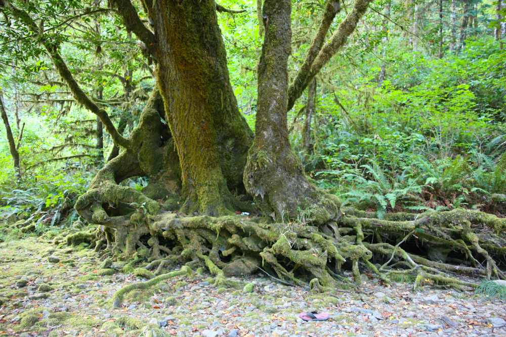
The roots of this large tree look like something out of a fairy tale. I am sure that there are gnomes living in there somewhere.
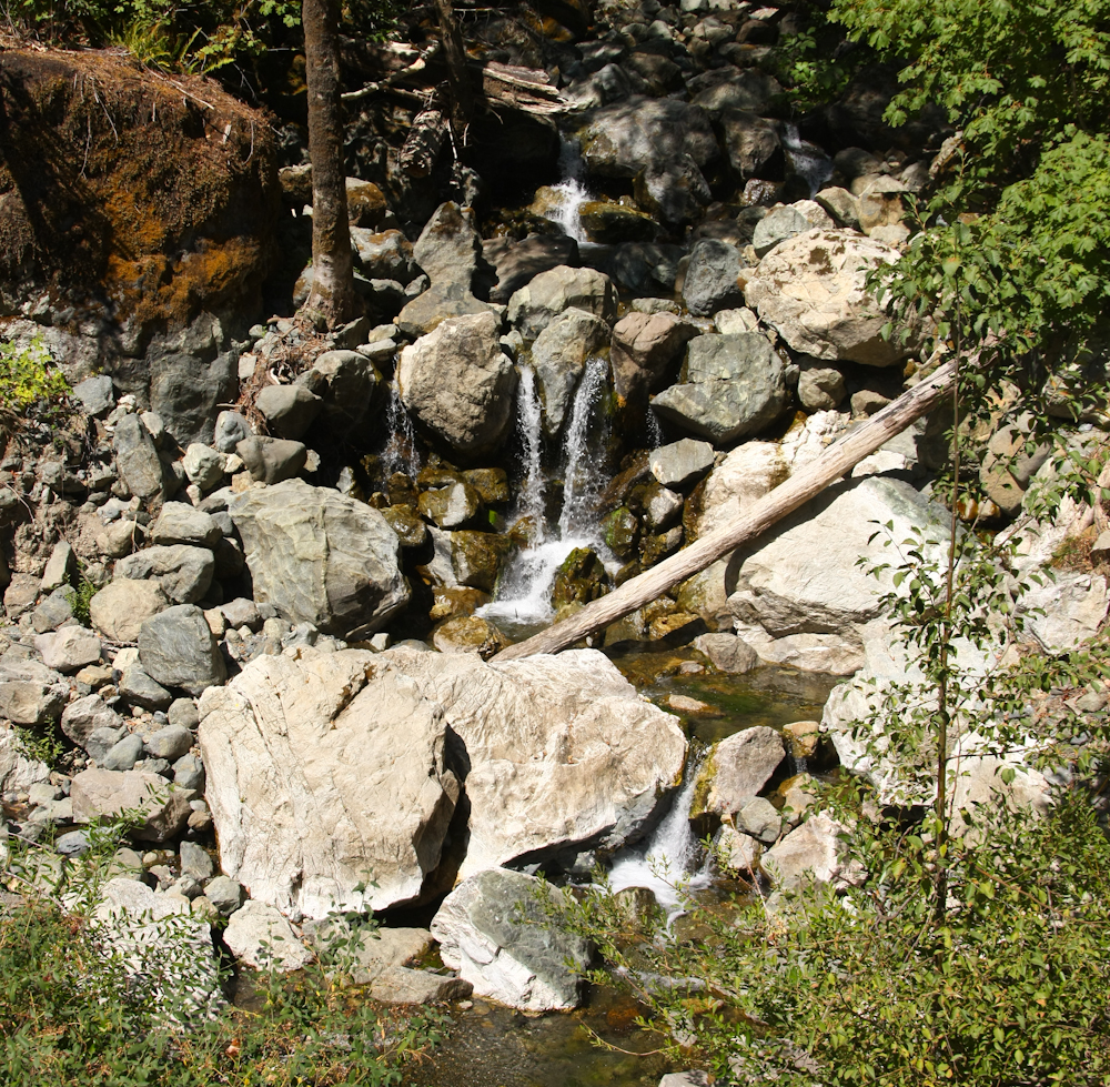
One our way over the mountains, we passed a number of scenic waterfalls along the road. The road was one lane with turn-outs and very steep. Like 20% grade steep. Going up is not bad, but the descent requires great caution and speed control. My life for an exhaust brake.
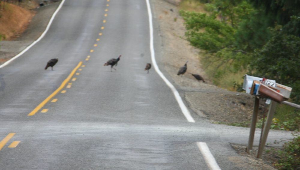
We spent the night near the Oregon Caves park near the creek. It was a nice spot and not crowded. Next morning we went into Cave Junction for supplies and then again headed back into the Siskiyou mountains and over the pass to Happy Camp. Along the way, we spotted this flock of wild turkeys crossing the road.
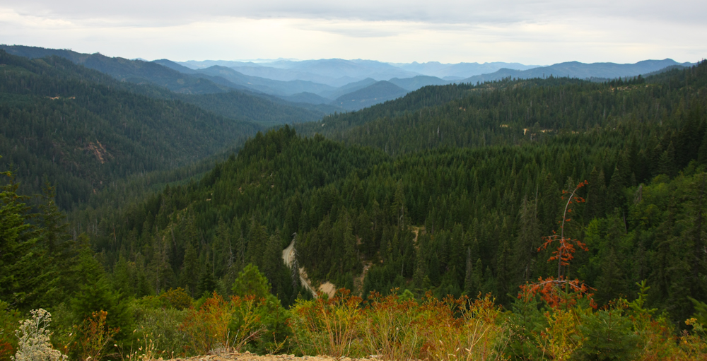
A view from the high point of the pass over the Siskiyou Range on our way to Happy Camp.
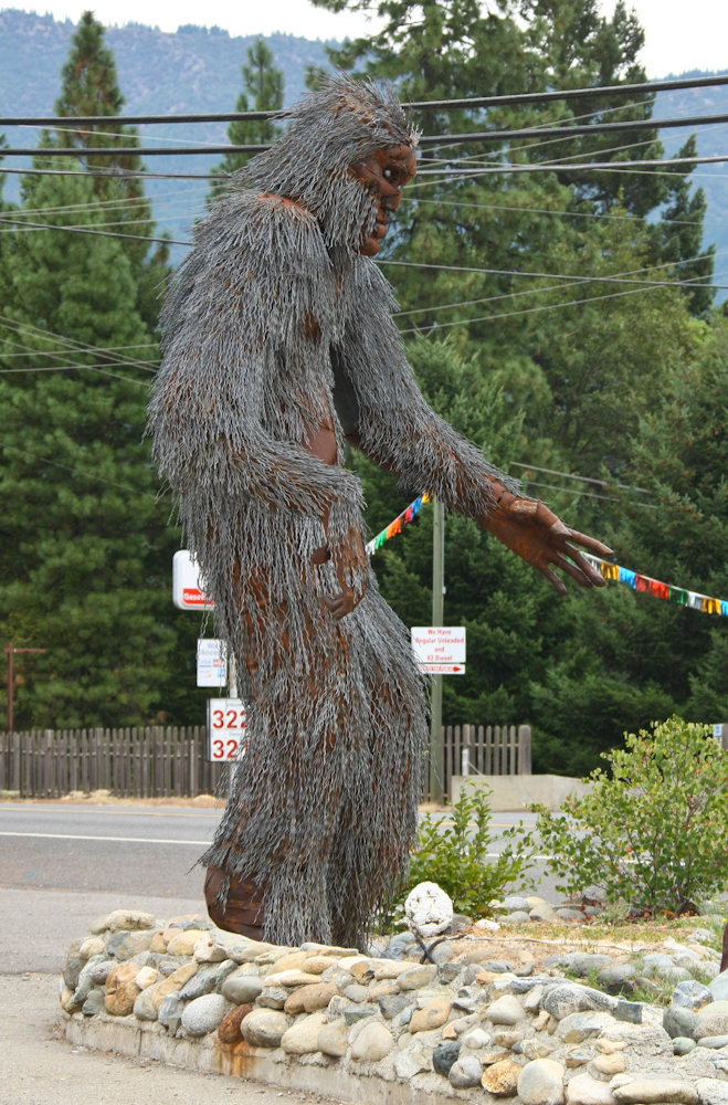
In the center of Happy Camp is this Big Foot effigy. After lunch, we hooked up with a fellow mogger in Happy Camp and then headed to the east.
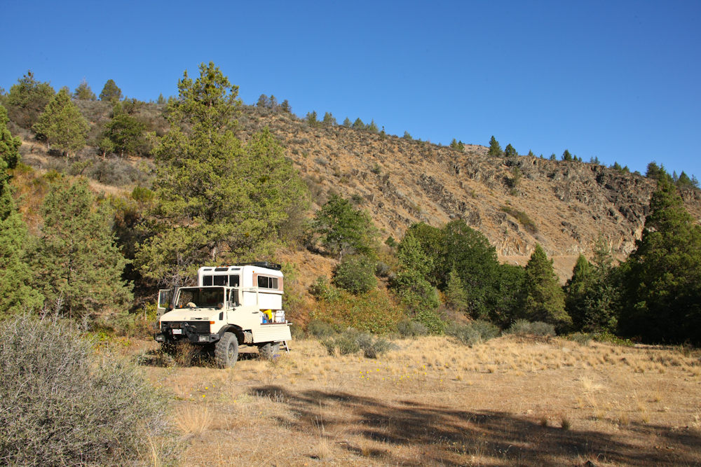
From Happy Camp, we traveled toward Mt. Shasta. Above was our camp on the banks of the Shasta River. I spotted a track that allowed us access to the river and after a short 4x4 session, we arrived at a nice, level camping spot.
After our Shasta River camp, we headed across the south face of Shasta. Sadly, a large number of the trails were closed, so we did not go exactly where we wanted, but we still saw plenty of interesting things. Above is a view of the south side of Mt. Shasta after we descended back toward the main highway. The foray onto Shasta was interesting: we saw 2 bears in less than a mile. One was brown in color and the other black, both medium sized and both running hard to get away from the truck. Since Brown Bears can be black in color and Black Bears can be brown, we were not sure what they were other than scared of the mog.
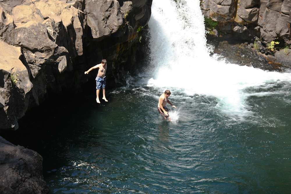
Close to CA 89 at Mud Creek, we passed a good-sized water fall that was popular with the swimmers. These young bucks, full of derring-do, jump into the pool. Jumping into creeks is not advised unless you know what is under the water. Many folks have been injured performing that very trick.
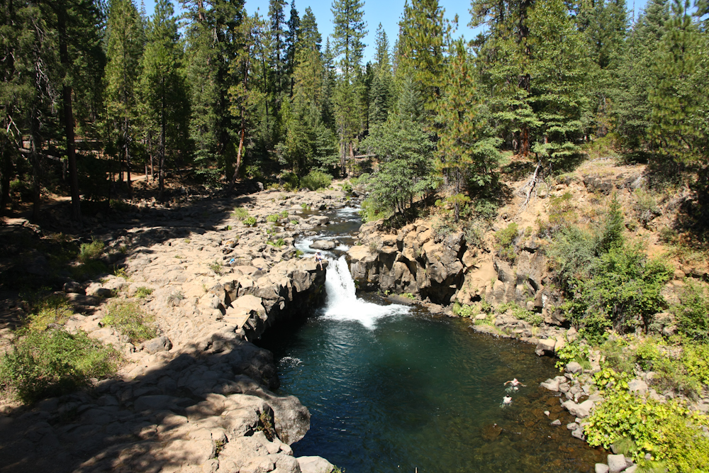
The falls are cut into one of the many basalt flows that cover the area south of Mt. Shasta. The jumpers from the previous photo are visible at the right side of the pool.
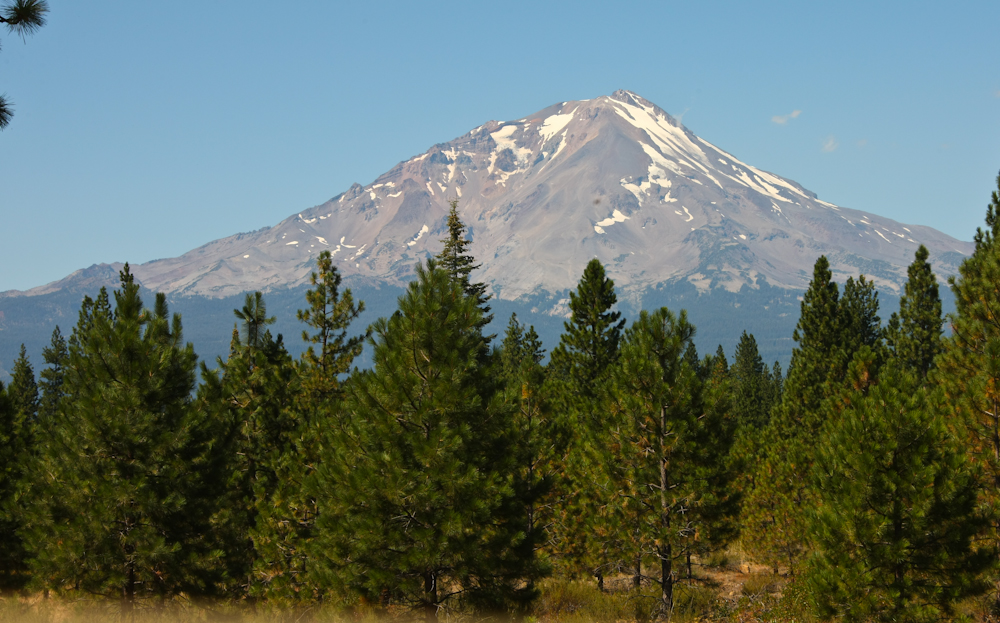
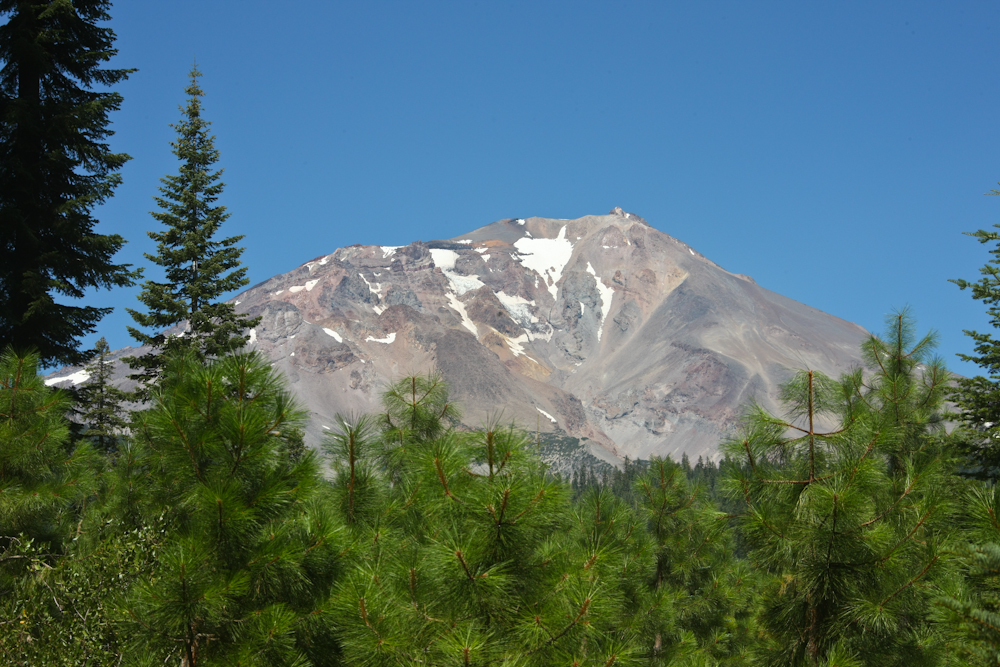
A final view of Shasta from near Mud Creek. Mt. Shasta is over 14,000 feet and is still considered an active volcano, although it is dormant at the current time.
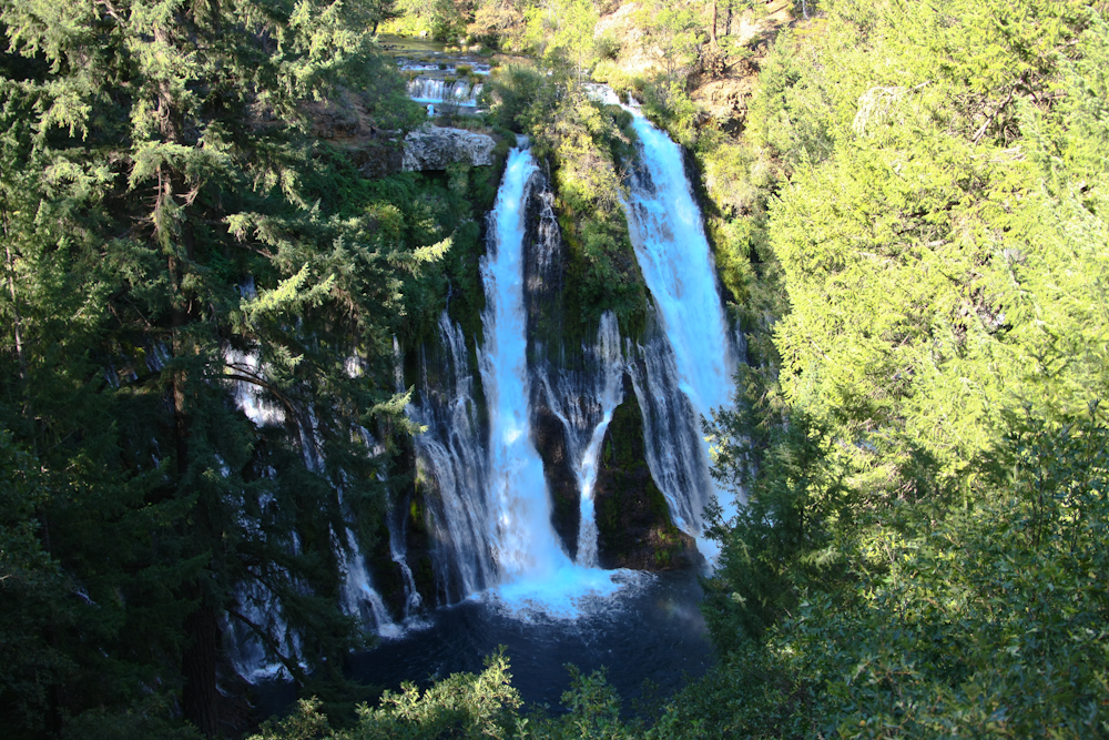
From the Shasta area, we headed east to McAurther-Birney Falls State Park. This park is the 2nd oldest in the California park system and the land was a gift from a rancher that wanted to insure that the PGE dam at Lake Britton would not destroy the falls. Here too, the river has cut through the local basalt to form the falls area.
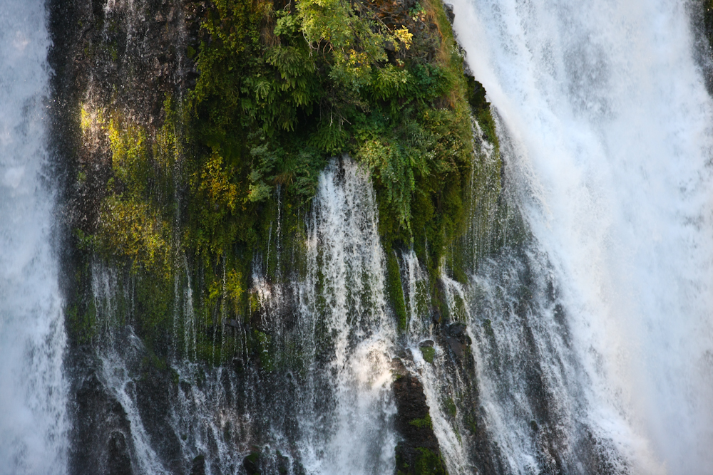
One of the interesting parts about these falls is that there is significant outflow from the local aquifer that is visible at the face of the falls. The mini-falls at the center of the photo above is outflow from the aquifer, not part of the actual river.
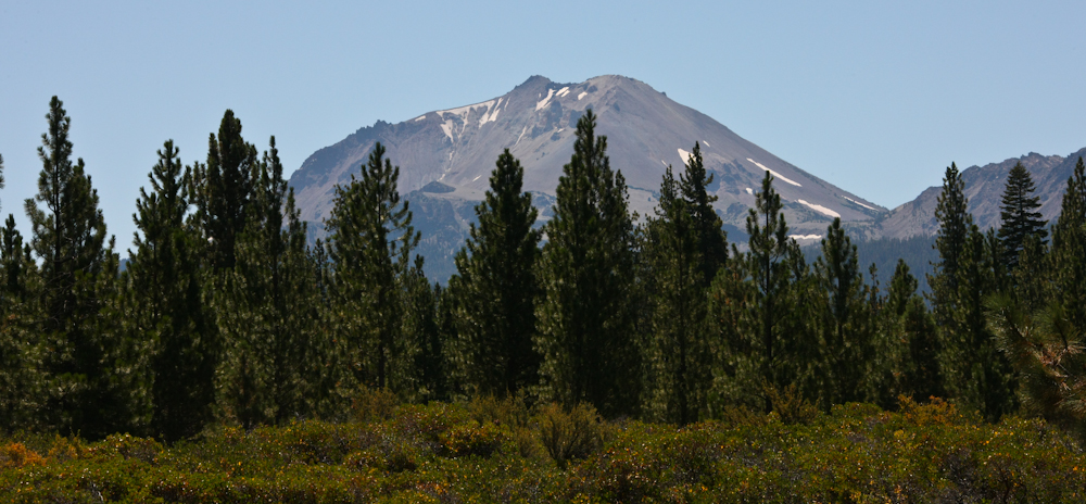
After a nice night at McAurther-Birney, we headed south toward Mt. Lassen. Above, the northern face of the volcano can be seen in the distance. Lassen last erupted around 1914 and is therefore just "sleeping".
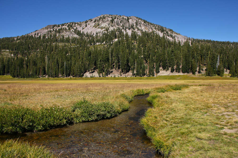
We traveled into the park and took the road that went along the flanks of the volcano. In the photo above, we stopped at a meadow and got a nice view of one of the many cinder cones on the flanks of the actual peak.
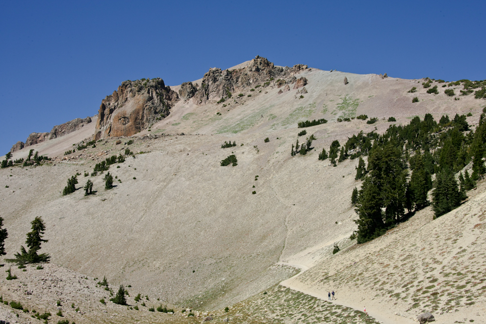
A pull-out at the summit provided a clear view of the peak of Mt. Lassen. Above, the trail to the peak is clearly visible.
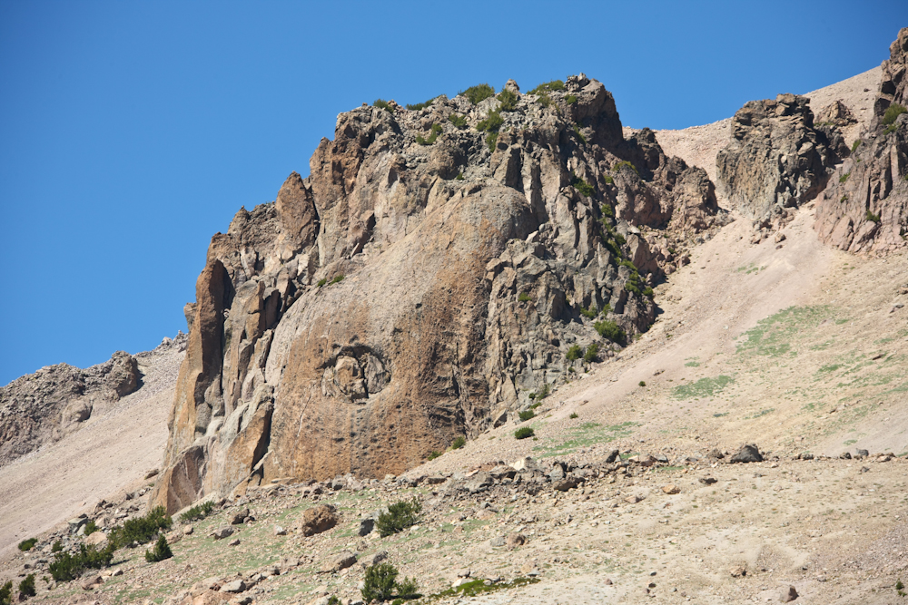
There were a number interesting structures on the slopes of the peak that showed multiple intrusions of magma that have solidified and subsequently been exposed.
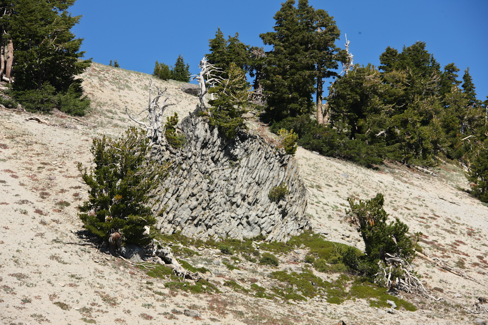
Note the columns in the basalt.
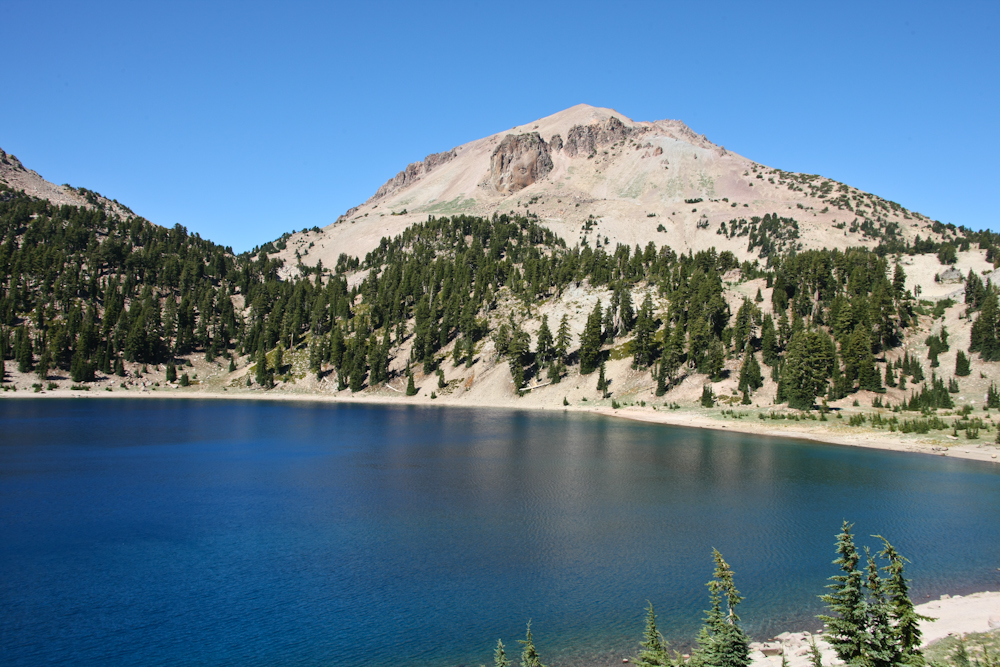
Just past the summit at Lassen was a nice lake. Lassen peak is the dominant structure on the skyline.
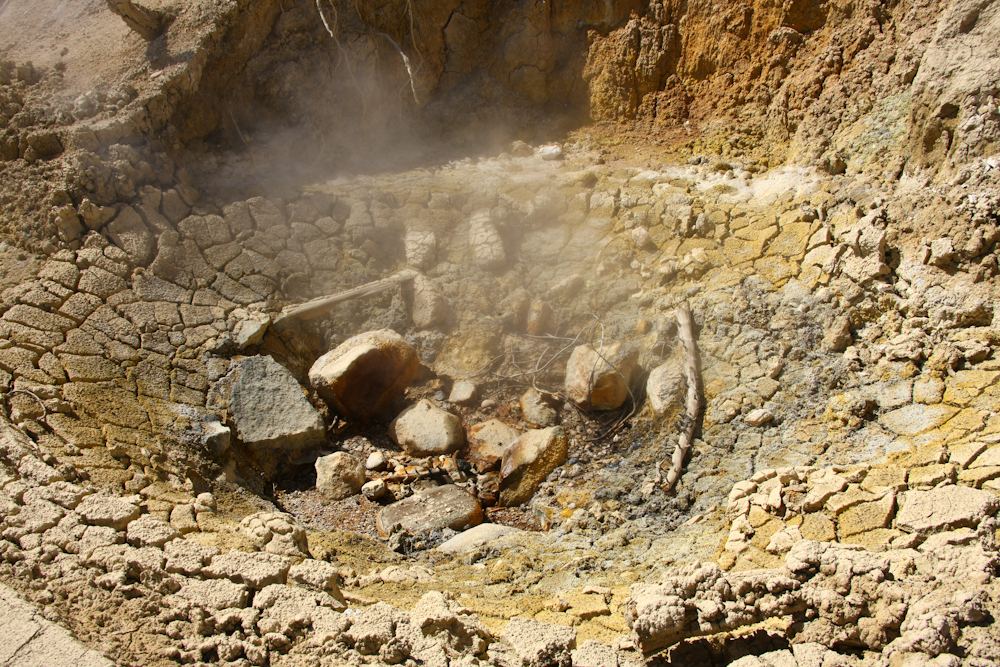
On the southern slopes of Lassen were a number of active fumeroles.
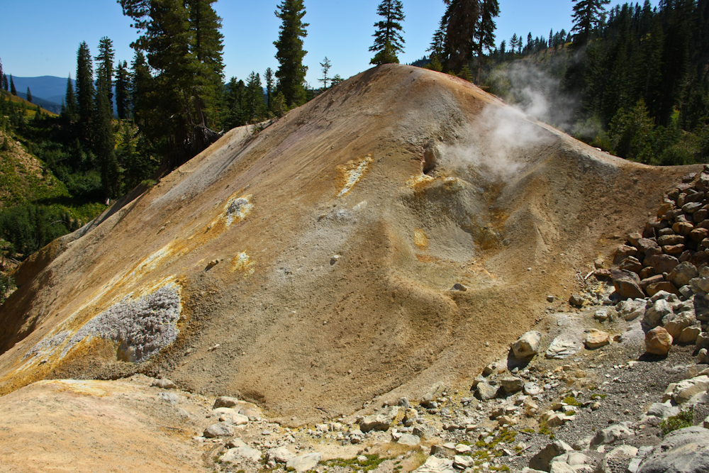
The fumeroles have deposited substantial amounts of sulfur on the ground near their exit ports.
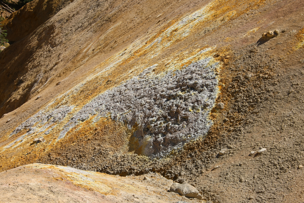
The colors of the mineral deposits are clearly visible above.
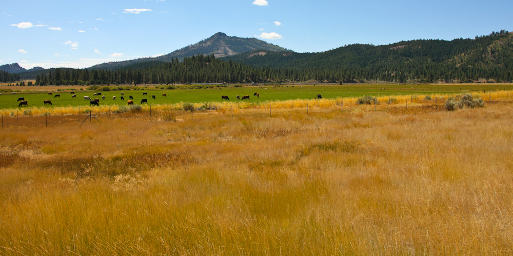
From Lassen, we traveled to the Eureka-Plumas State Park and spent the night in the park. Next morning, we broke camp and headed toward Reno, NV. Above, the Sierra Valley along the Feather River had great grazing lands.
This segment of the trip was great. It was quite cold near the Pacific shore and very hot inland. Aside from the steep grades and washed-out road, there were no real challenges to travel. Our destination was Reno, NV to visit a Colorado School of Mines buddy who lives there. We would also hook up with a local mogger for lunch.
| Previous Adventure | ||
| Trip Home Page |
Photos and Text Copyright Bill Caid 2009, all rights reserved.
For your enjoyment only, not for commercial use.