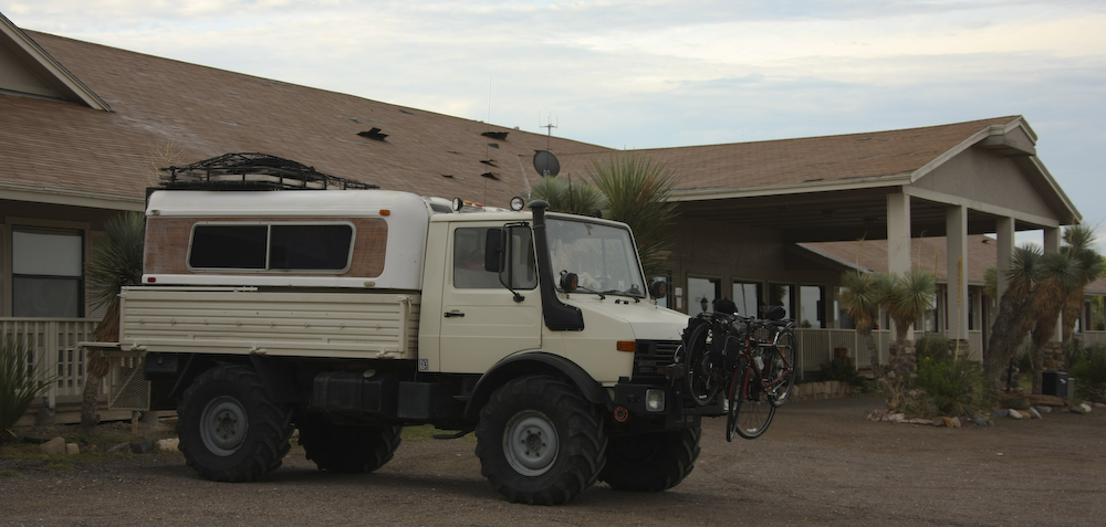
We spent a night in a motel in Terlingua, TX because it was too hot to stay in the camper comfortably. The motel was basic and besides air conditioning, it offered protection from the wind storm that we had that night. Thunderheads had been building all day, and the rain and wind finally came around sunset. After leaving the motel, the plan was to travel the dirt road that crosses the Big Bend National Park along the Rio Grande river. The road is perhaps 60 miles long and during our travels we did not see another vehicle. Along, the way we were challenged by a flash flood due to the rains in the Chisos Mountains to the north. The photos below are what we saw.
The wind storm tore the roof at the motel a new one. Note the upturned shingles. There was significant damage on the back side of the structure due to the high winds.
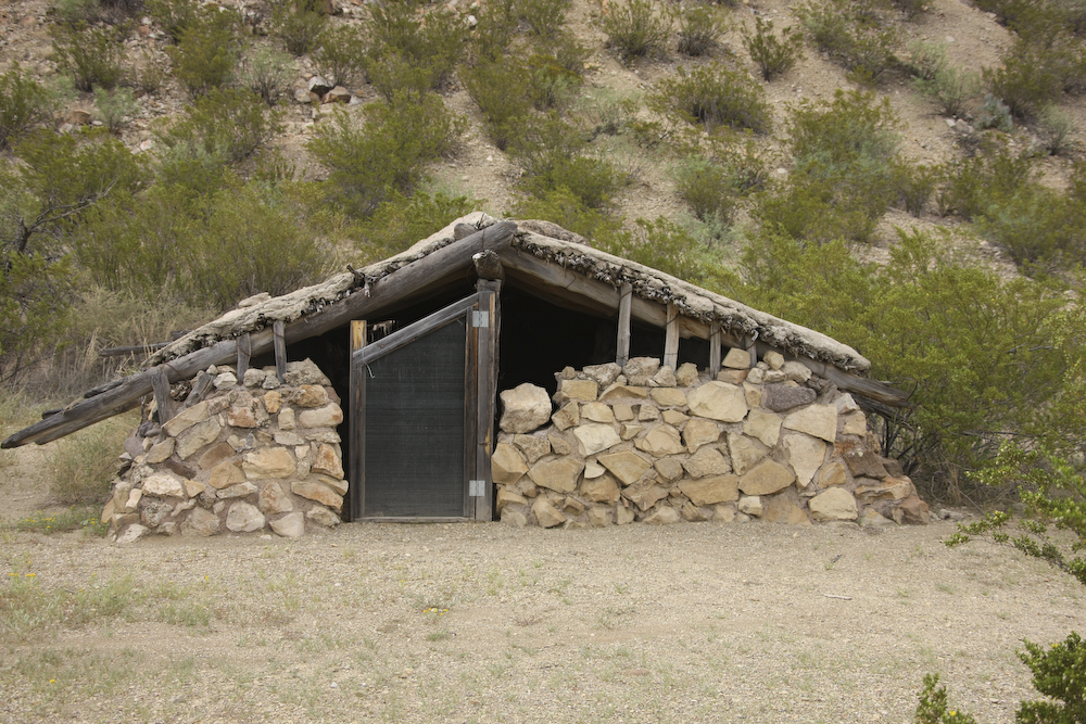
This structure is called a "jacal". The fellow that built this lived here with his family for many years. This is one of the most basic types of dwellings found in the Rio Grande valley.
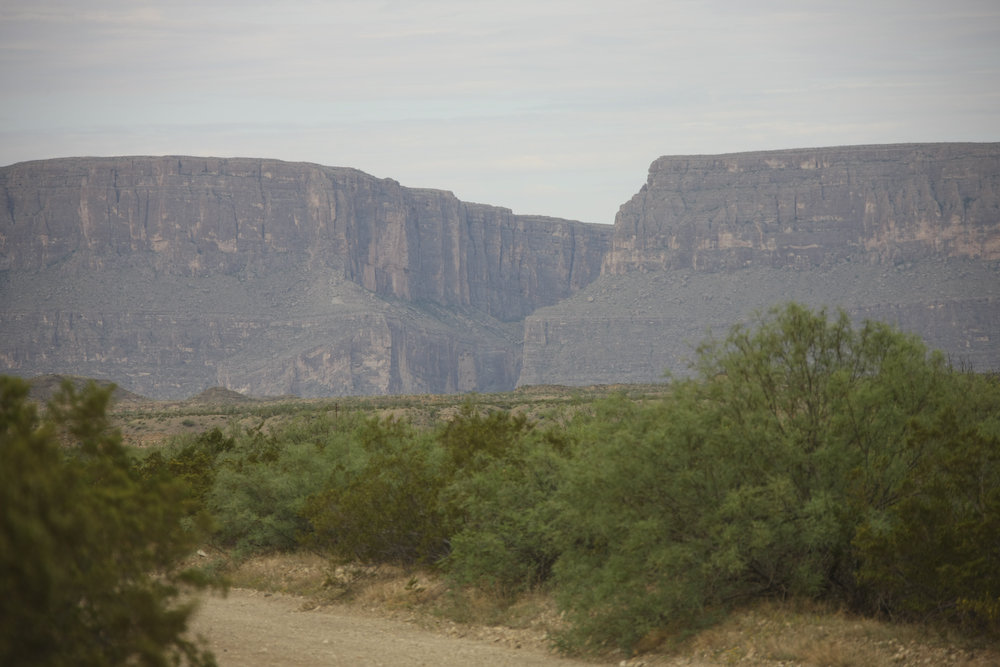
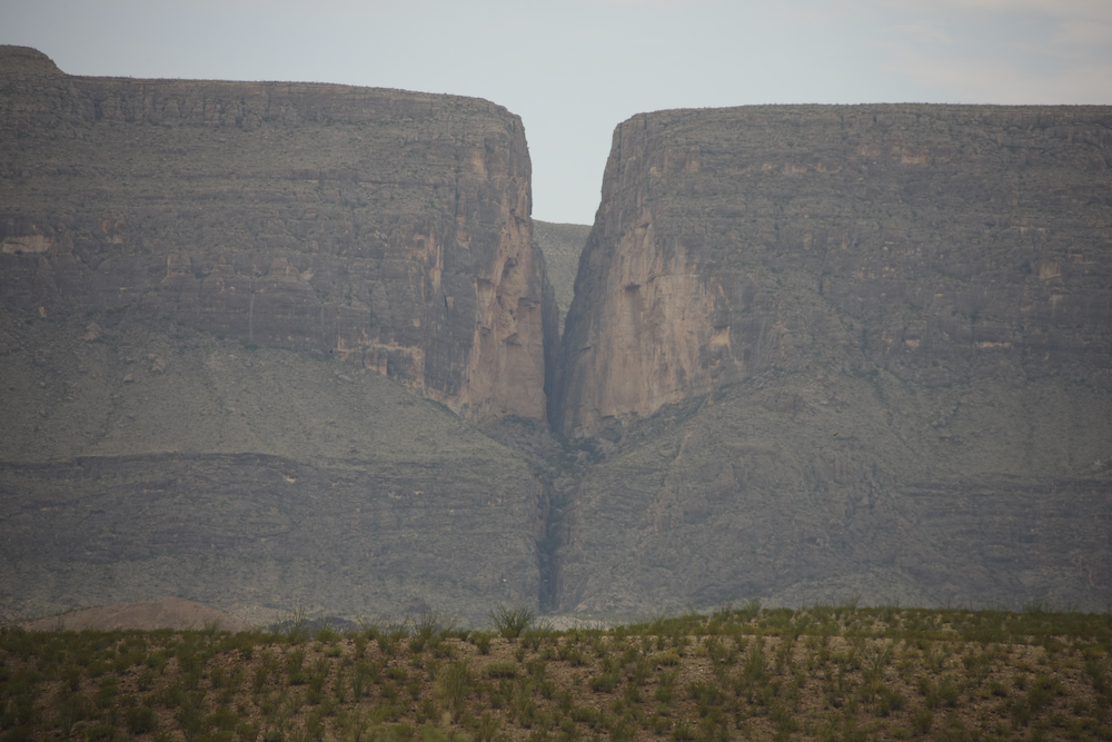
The mouth to Santa Elena canyon. The Rio Grande comes through the slot in the cliff. The river held its course while the uplift occurred allowing the river to cut through the cliff like a knife. Along the base of the cliffs runs Terlingua Creek.
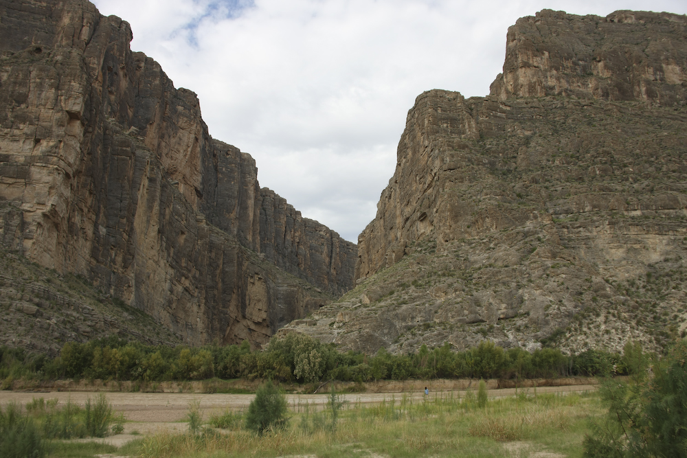
Santa Elena canyon is steep and narrow. The watercourse in the foreground is not the Rio Grande, but rather Terlingua Creek which is running full tilt due to the rains the night before. Note the nice brown color of the water. Kathleen is visible on the banks of the river.
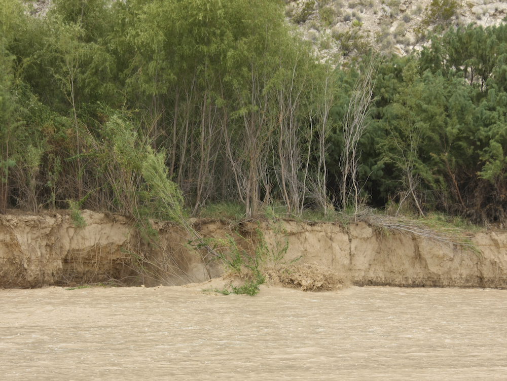
Kathleen got this photo of Terlingua Creek eroding its banks. Note the wave of the bank as it crashes into the fast running water.
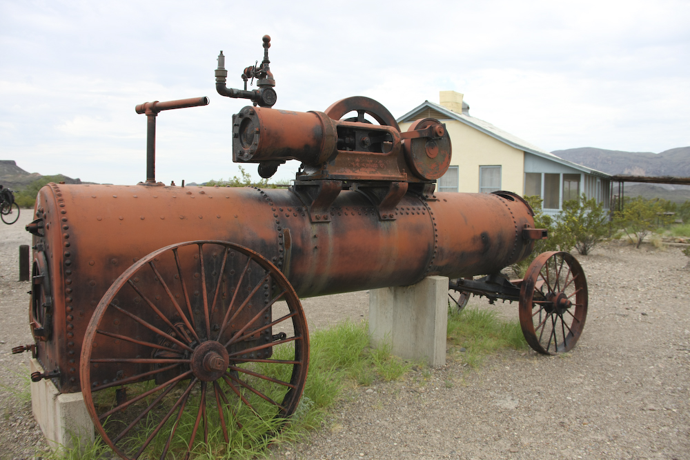
From Santa Elena Canyon we went to a small outpost called Cottonwood where we encountered this mobile steam engine left over from the late 1800s.
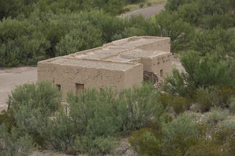
There were a number of old structures at Cottonwood. These were left over from when the Army had an outpost here during the early 1900s.
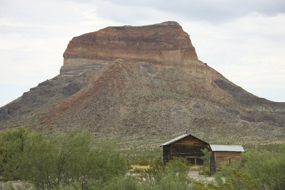
North of Cottonwood these structures sit at the base of a large butte.
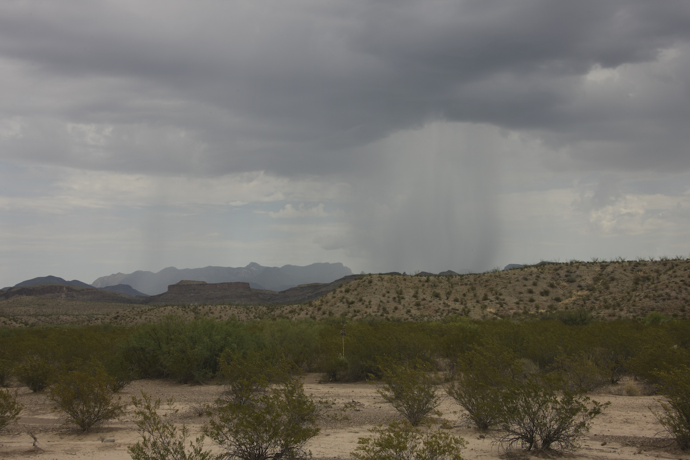
From Cottonwood, we took the River Road towards Rio Grande Village 60 miles distant. This road is actually a dirt track that was reasonable except for a large number of wash-outs due to the recent rains. Because the track was rough, we decided to air down which later would prove to be a good decision. As we proceeded, the thunderheads continued to build to the east and were dropping significant amounts of rain on the Chisos Mountains and their southern foothills. Later, we would meet this rain. Above, you can see the sheets of rain falling on the desert floor.
We spotted another narrow canyon that was due to the same uplift that caused Santa Elena Canyon. This is a slot canyon in the truest sense of the word.
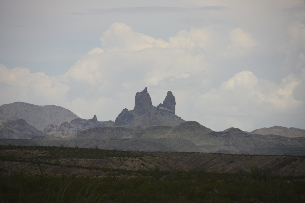
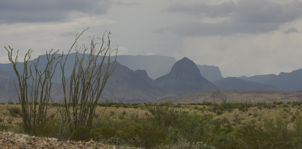
Twin volcanic outcroppings spotted 20 miles east of Cottonwood.
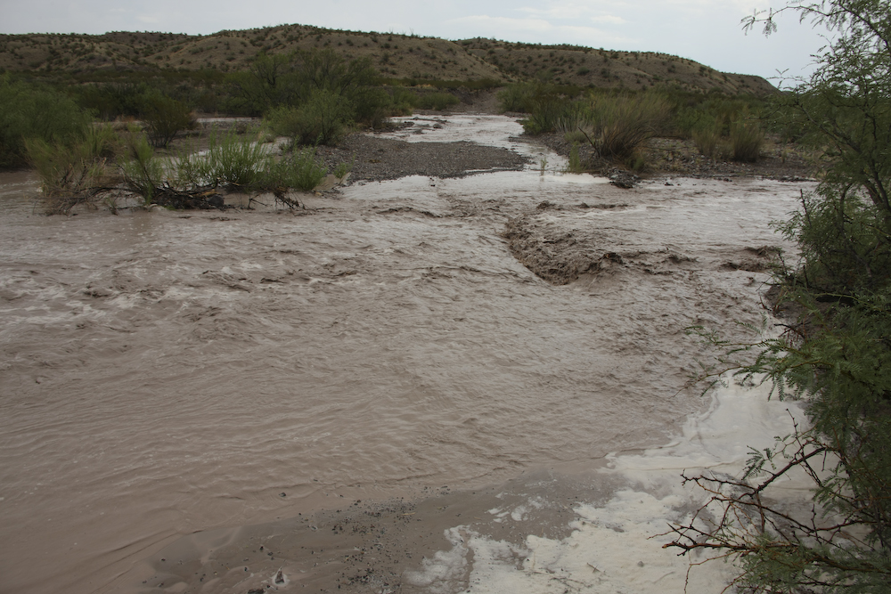
We finally encountered the result of all that rain in the foothills. The flash flood stopped our forward progress so we decided to have lunch and a beer.
Click HERE for video of the flood
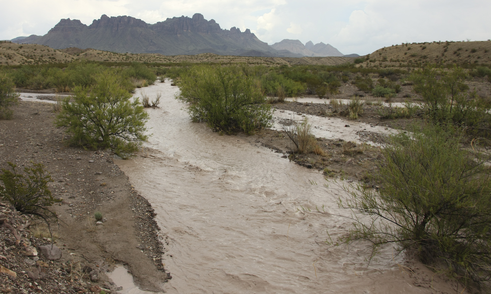
The flow was not huge, but the floor of the wash was sand and therefore risky to cross when the water is flowing.
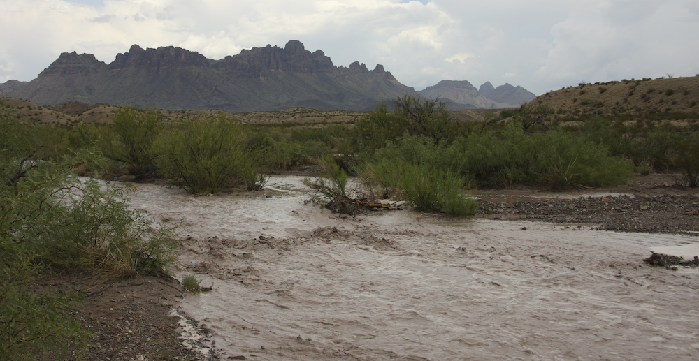
The water both rose and fell while we watched. The action of the water was quite violent, but generally subsided in about 2 beers.
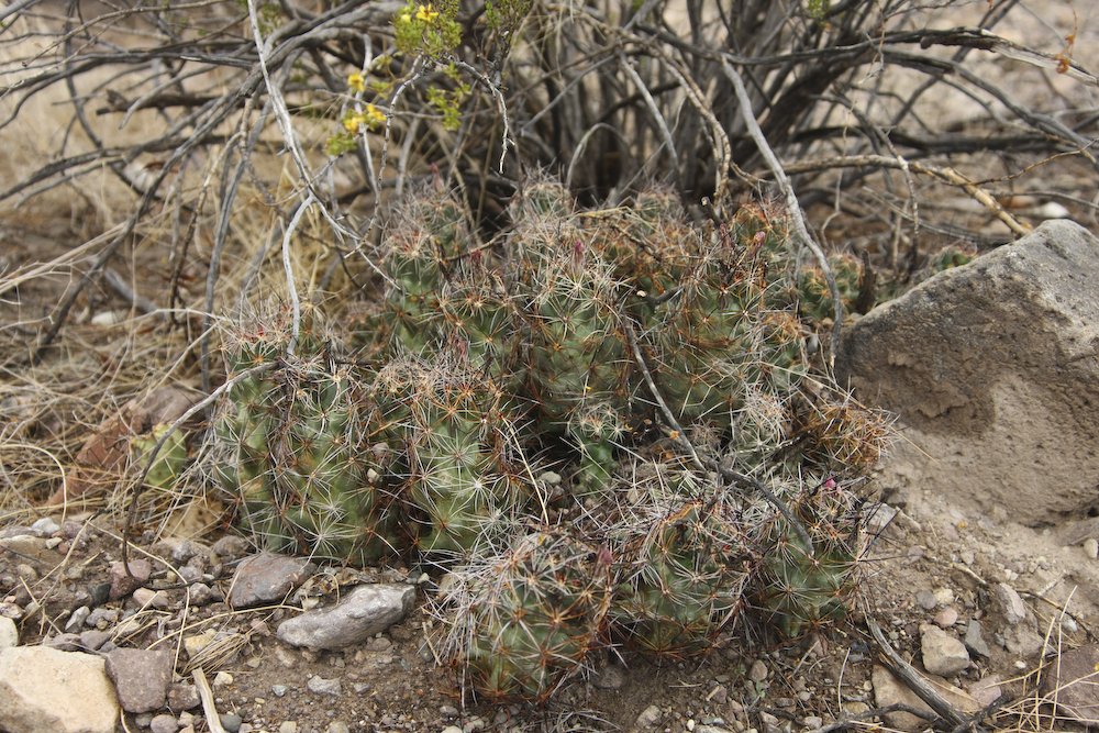
While waiting for the water to subside, I spotted this interesting cactus.
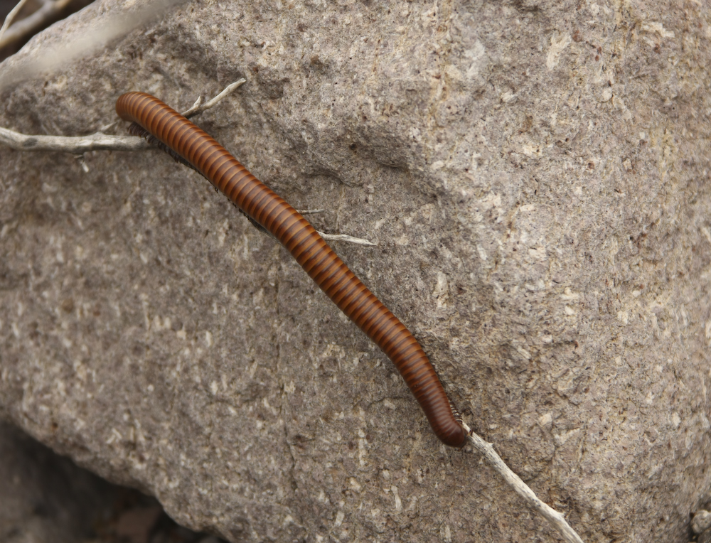
Next to the cactus was a long millipede.
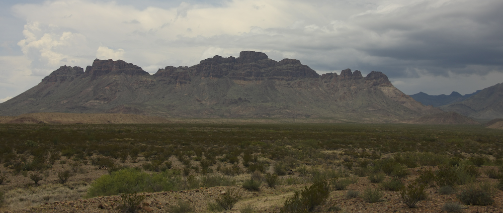
The clouds produced a dramatic backdrop for the Chisos Mountains.
The rain continued on the eastern slopes of the mountains. In the end, we did a number of water crossings before the day was over.
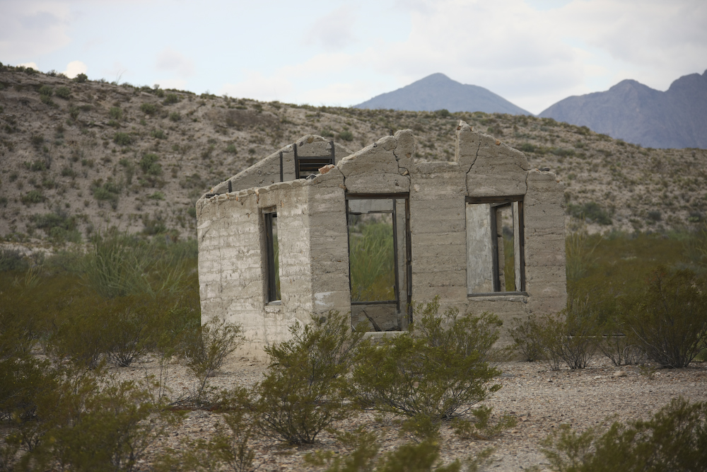
We found these ruins at the remote Mariscal Mine near the border. Note that this structure has been stripped of everything useful.
'Nuff said.
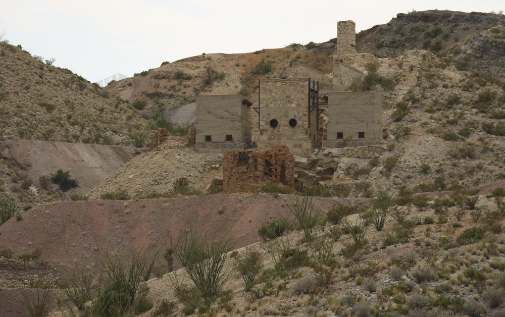
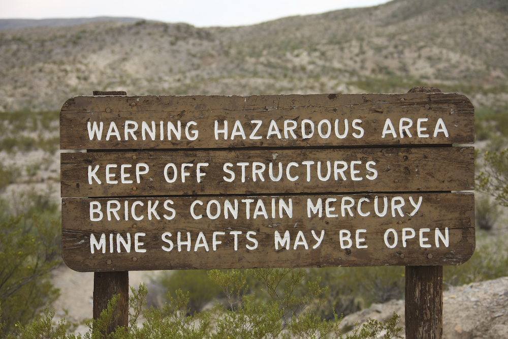
Mariscal Mine was used to extract mercury-bearing ore called cinnabar.
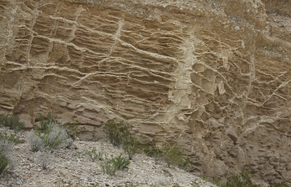
Near the end of River Road, we passed a set of cliffs with these cool erosion patterns.
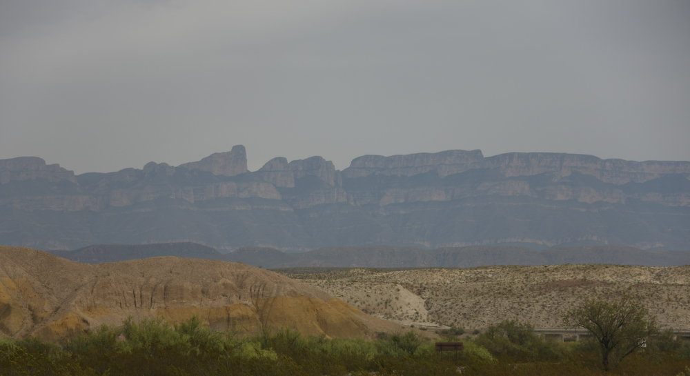
The very rugged Sierra del Carmen in northern Mexico is transected by the Rio Grande. Note the bridge over a "dry" wash in the lower right of the photo above. From the dirt track, we aired up the tires and headed south to Rio Grande Village, the campground and a hot shower.
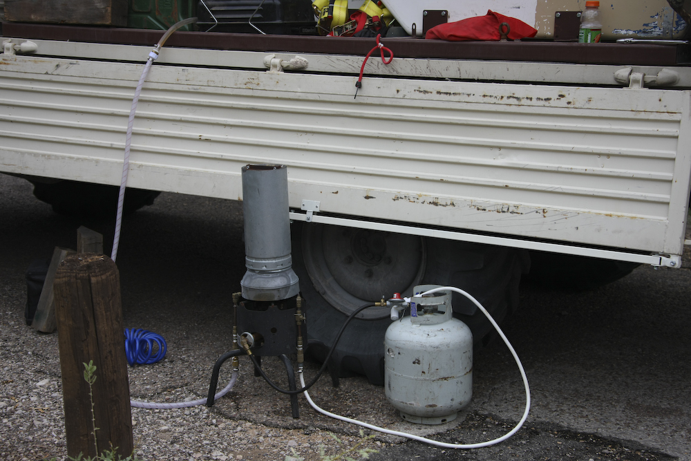
Our hot shower setup. I fabricated the heater and it REALLY works. You HAVE to leave the water on or it will boil in the copper tubes and scald you. The burner was taken from a 75,000 BTU camp stove. The system uses the water pump in the camper and the camper's water supply. It generates both high temperature and high flow. Just like home, except for the wind.
The trip across the River Road was pretty easy. It was rough in some parts, but passable with any 4x4 vehicle, high water notwithstanding. There were plenty of things to see and the views of the Chisos Mountains were spectacular. At the end of the road is Rio Grande Village and we stayed in the organized campground with all the amenities except electrical. As it turns out, the camp site we chose was right next to the Rio Grande. The ranger came by the next morning and told us that robberies were frequent as folks wade across the river, steal stuff and then wade back. As fate would have it, the river was high due to the flash floods and we did not encounter anyone. But, next time I am in the area, I will keep that in mind.
| Previous Adventure | ||
| Trip Home Page |
Photos and Text Copyright Bill Caid 2008, all rights reserved.
For your enjoyment only, not for commercial use.