Trip Report: 20060728
The plan for the day was to leave Visalia at a "reasonable" hour (in our world that means 1000) and head east to the highlands of Sequoia Park. Sequoia is the second oldest national park behind Yellowstone. The lowlands of the park are at the 1500 foot level and the summits are 14,494 at the peak of Mount Whitney (the highest spot in the CONUS). Aside from the radical diversity in elevation, Sequoia is home to the Giant Sequoia tree. Some specimens are more than 200 feet high and 30 feet in diameter. The largest of these trees are in a place called Grant Grove. The General Grant tree is 267 feet tall and 107 feet in circumference (it is not round, but rather an oblong shape).
The plan was to head to the park and explore some of the points of interest. The road is steep and narrow and only has intermittent pull out areas to allow photos. But, the good news is that we both have awesome cars and the drive is at least half the pleasure. The roads in Sequoia are narrow, steep and twisty. Just the ticket for the "Ultimate Driving Machine". And drive we did for more than 6 hours.
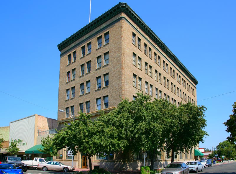
We had breakfast at a little Mexican cafe in downtown Visalia. As we were sitting there, I started to admire the building across the street. Then I realized that it was the tallest building in town (City Hall).
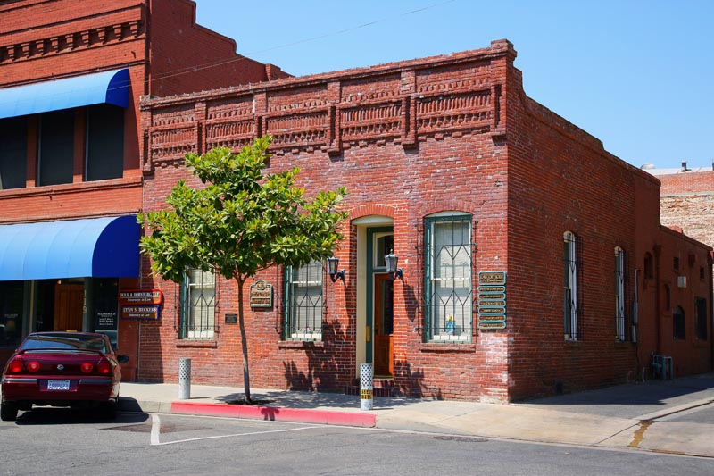
Here is an intersting building in Visalia's historical district. This is a law office. Note the interesting brick work and the fact that it has been refurbished (the color of the brick around the doorway).
This is a view of the creek along the road that goes to Mineral King. We passed the Mineral King road turnoff on the way to Sequoia and decided to take it. The road was narrow, steep and twisty. After a number of miles, we came upon this creek and a bridge that crosses it. Note the fluting in the rock on the left. These flutes are created by eddy currents of water laden with sediment that acts as an abrasive. Also note the high water mark.
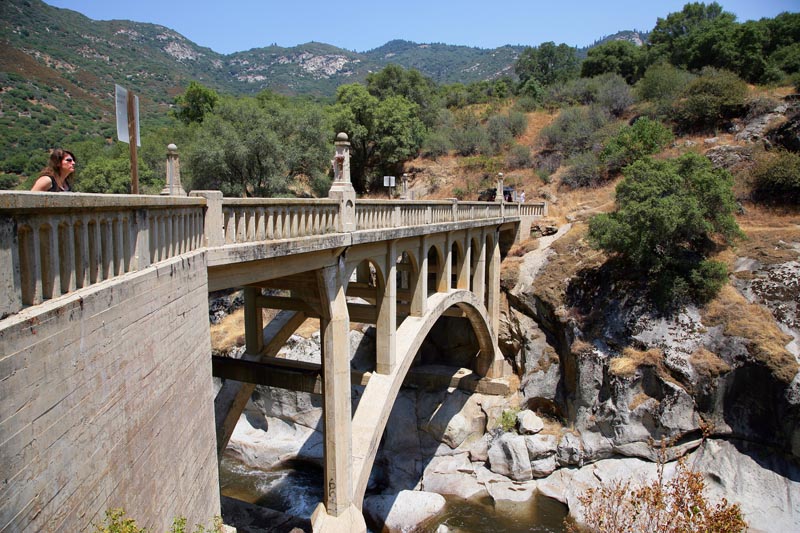
The bridge over the creek with Kathleen checking it out. The bridge was built in the late 1920's.
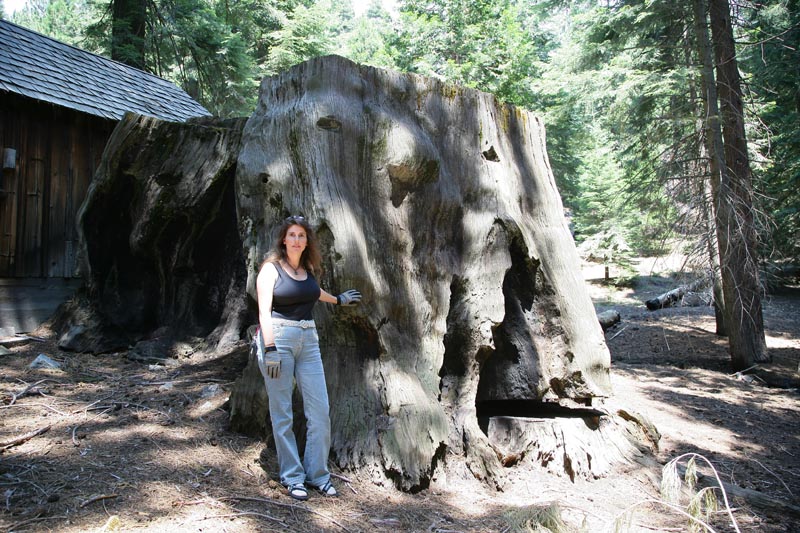
The road to Mineral King was long and nasty. We actually gave up at mile 20 since the road turned to dirt. Dirt roads and my M5 are incompatible, so we bailed. On the way back we stopped at this cabin that was next to the road and discovered this huge stump. The tree has been burned (multiple times) and somebody cut it down, presumably during a logging session.
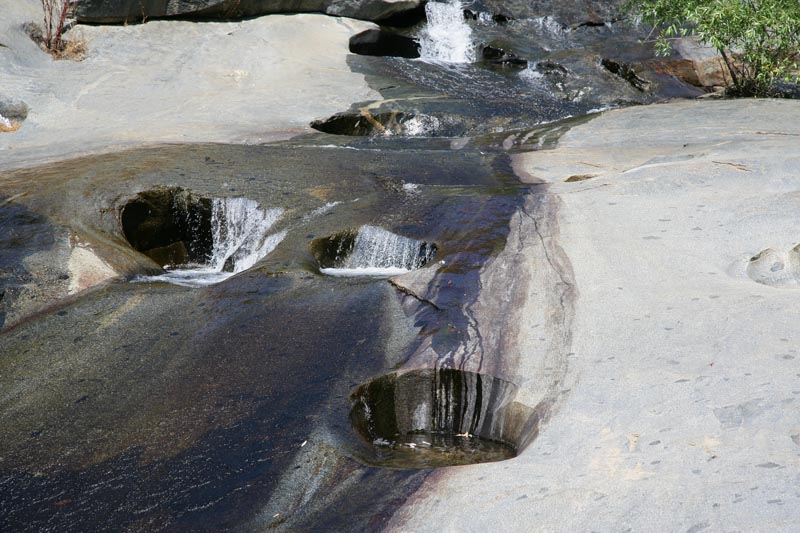
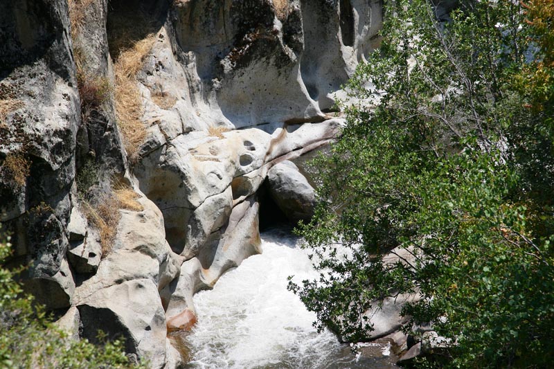
On the way out, we passed several creeks. This one runs over a slab of granite and the action of the flowing water and sediment has carved these interesting holes in the rock.
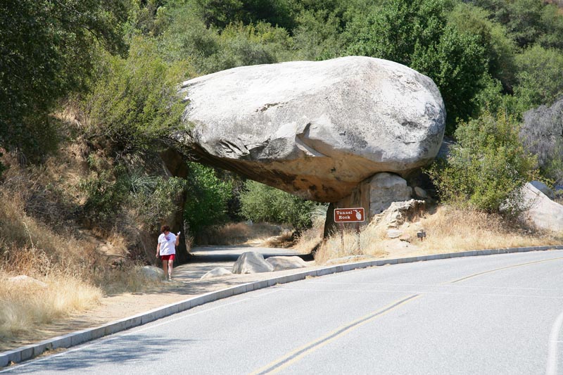
Once we completed the Mineral King road expedition, we headed directly into Sequoia Park. We attempted to get tickets to see Crystal Cave, but we were too late in the day. So instead, we decided to just do a simple drive. As we cruised through the park, we came to "Tunnel Rock" which is a large rock that fell over the old road.
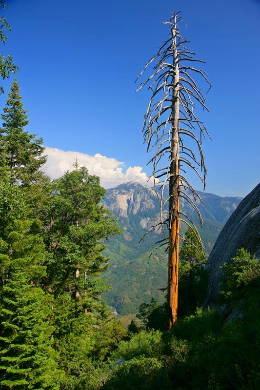
In Sequoia, we went to the top of Morro Rock. Morro is the largest granite monolith in Sequoia and is visible for miles. The road comes close to the top, and there is a set of stairways that lead to the actual top of the rock. On the way to the top, I got this shot of the rock formations across the canyon to the south. The formation on the other side of the canyon is called "Castle Rock".
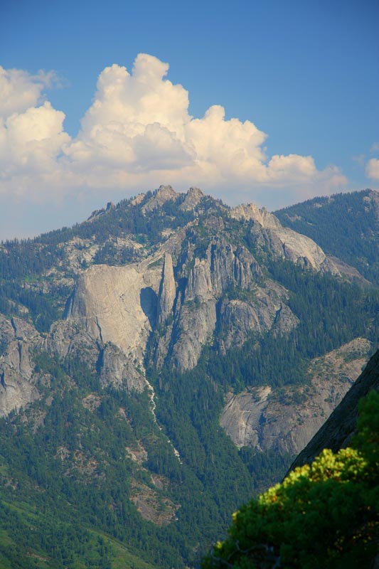
Here is a closer view of Castle Rocks.
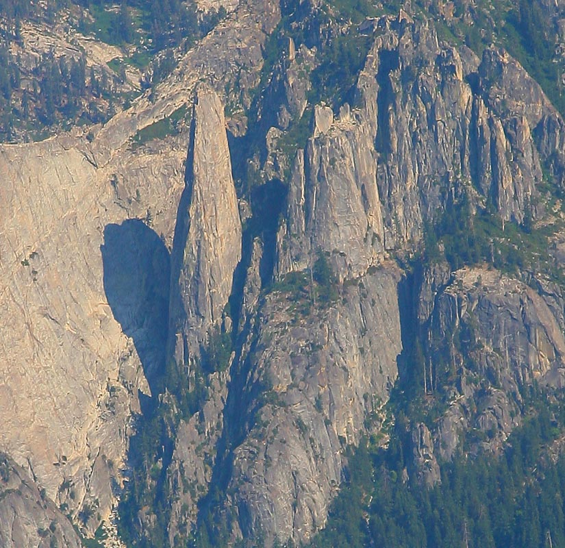
A zoom and crop view of the formation. Note the big granite spire. The photo is hazy since I was generally shooting into the sun and the presence of the light accentuates any haze or pollution in the air.
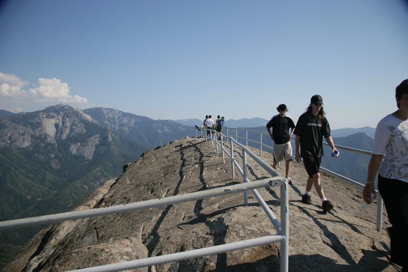
We made it to the top of the rock. The Park Service put these steel rails there to prevent tourists from falling to their deaths over the cliff.
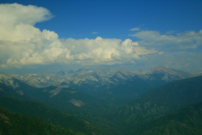
A view from Morro Rock to the east to the spine of the Sierra Nevada. The top peak visible is over 11,000 feet. Some great thunderheads were brewing in the east.
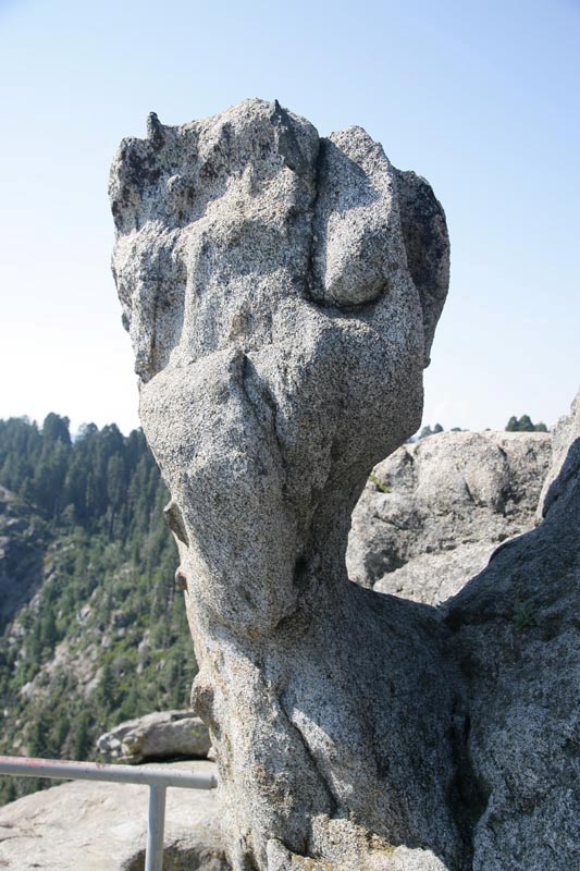
An odd rock formation along the trail to the top of Morro Rock. All the rock in the area is granite and subject to interesting erosion patterns as a result of the freeze-thaw action of the weather.
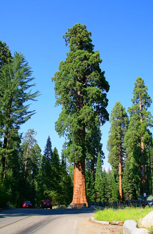
As we left Morro Rock, we came upon this large Sequoia at the junction of the road. These are really, really big.
Sequoia was very cool. My only regret was that we did not get a chance to spend more time there. Drive-bys are great when that is the only thing that is possible, but there is so much to see in the area. When we get a chance to go back, we will do both of the caves that are in the park as well as travel several of the more remote roads.
Once we finished with Sequoia, we traveled to the boundry of Yosmite. Actually, we traveled to as close as we could get a hotel room which was Mariposa. Getting from Sequoia to Mariposa late in the day was a challenge. It was longer than we expected and took more time due to traffic. But, we got there before the resturants closed, so the trip was a success. Sadly, we found out that the primary road into Yosmite was closed due to a landslide and therefore the next day we had to divert back to where we started. Good thing we were on vacation.
Back to the Road Trip Home Page