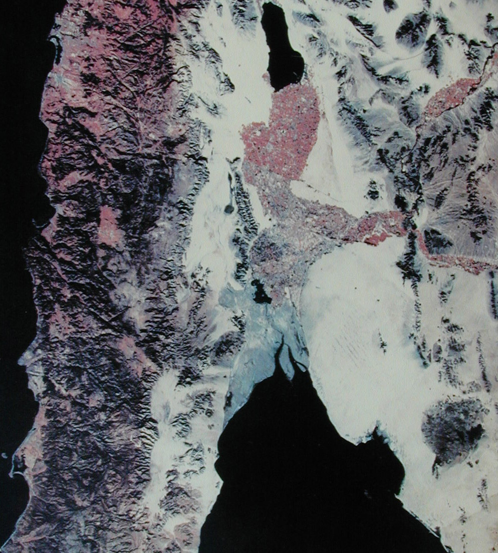
Figure 1. Satellite Photo of Northern Baja and Northwest Sonora, Mexico.
Northwestern Sonora in Mexico is one of the largest remaining remote areas south of Canada. This area is hard core desert, cruel in the summer and unforgiving of mistakes. Four wheel drive clubs in the southwest have been making crossing of the Altar Dunes from either the Sonoita area or from San Luis del Colorado south of Yuma, AZ. for many years. This area offers one of the last remaining true adventures within easy driving distance from the US. I had been dreaming of such a trip for many years, ever since Kathleen and I did the Camino del Diablo back in 1992. From the Camino, you can see the tops of the largest dunes directly to the south of the trail which runs along the Mexican border of southern Arizona. The prospect of a big expedition trip, negotiating a path through the dunes in my fully dune-capable, large capacity 1300L Unimog made my anticipation greater.
Given the time requirements to make this long crossing, substantial pre-planning was required. To do such a trip required detailed knowledge of what conditions were expected as well as research on issues beyond just road conditions. To prepare for this trip, I posted requests for information on several jeep and off road news lists. Several folks kindly responded to my requests and gave me the information I needed to complete the planning. Special thanks to the Tierra del Sol Fourwheelers in San Diego (who has done this trip for more than ten years) for so graciously providing me detailed information.
To insure the success of a major expedition in a foreign country, it is absolutely essential that the proper team of vehicles and operators was assembled. Of key importance was vehicle reliability. The size of the Altar dunes basically precludes the ability to tow a truck as dead weight. While theoretically possible, the time required to complete the winching make recovery a practical impossibility. Therefore, special attention was given to mechanical preparations prior to the trip. And, in general, this paid off in a relatively trouble-free trip, tire issues notwithstanding.
In Figure 1, San Diego bay is just below the top edge on the left. The large lake is the Salton Sea. Farmed areas are shown in red. The road in Mexico that parallels the border can be seen. Refer to the map below for reference.
Figure 1. Satellite Photo of Northern Baja and Northwest Sonora, Mexico.
In Figure 2, the large dunes are evident and can be seen as forming a set that roughly parallel the coast to the south. The destination was El Gulfo de Santa Clara, and this is due east of the end of the largest "gray colored" island at the mouth of the Colorado River.
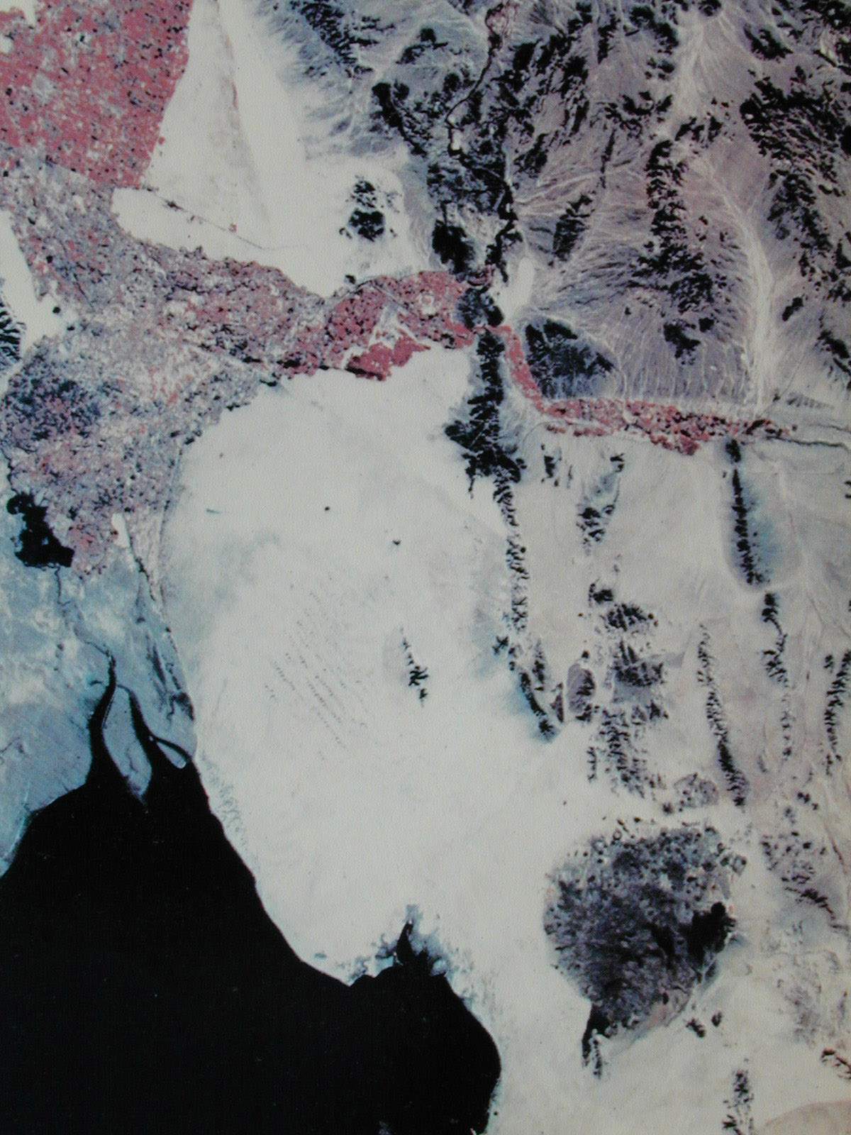
Figure 2. Zoom Photograph of Area of Interest.
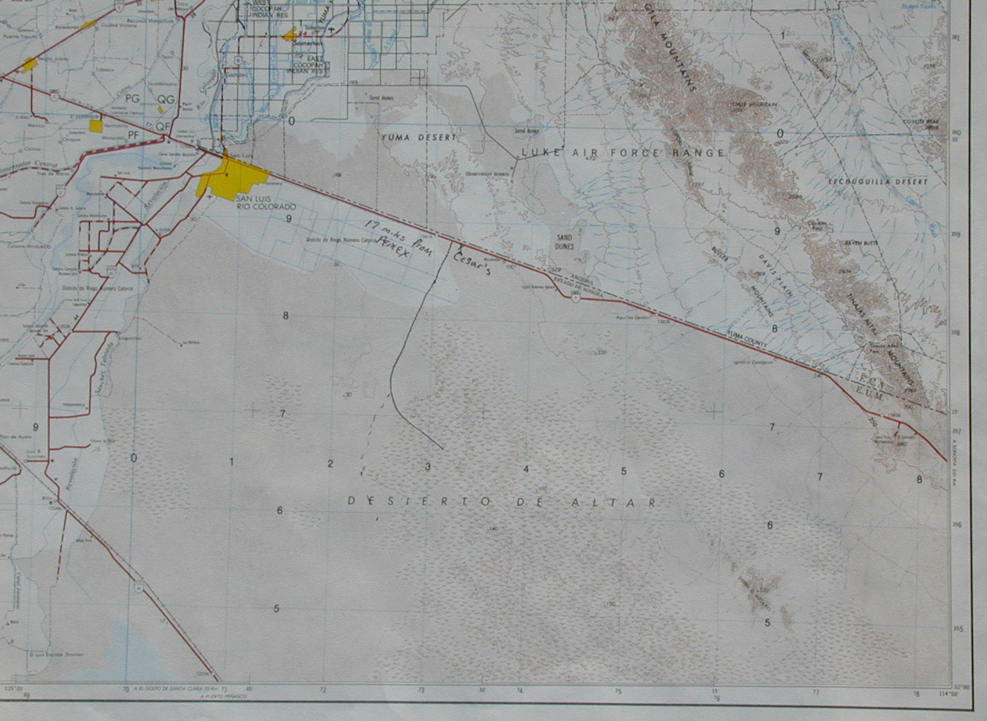
Figure 3. Map of the Northern Portion of the Trip.
Figure 4. below shows the southern portion of the trip. Click on the map to get a full resolution view. This is a 300kb file, so if you have a phone modem, this will take a while to load. The parallel lines are 10km marks, so distances can be estimated from them.
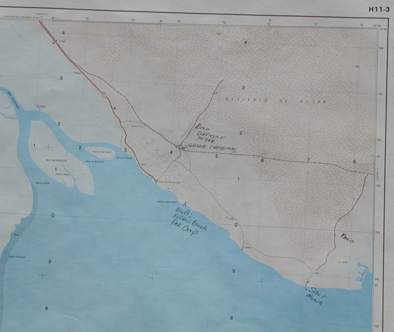
Figure 4. Map of the Southern Portion of the Trip.
The initial plan for the trip called for travel of about 100 km of open
dunes. Before the trip was over, we did 250 MILES of dunes and traversed
the dune field from Cesar's to El Gulfo and back with only a very short
portion on paved roads, perhaps 30 miles total. Total fuel usage
for my 1300 was about 50 gallons border to border.
El Gulfo is a very small town; this is primarily a fishing village, but does cater to tourists, particularly Gringos around Thanksgiving, Christmas and New Years. There is a Pemex station, and it probably has gas. I say probably, because in Mexico, if the fuel truck does not show up for what ever reason, then there will be no gas. There is a store and ice is available along with plenty of fresh fish, shrimp, clams and sometimes other shellfish. Water is in short supply, but can be purchased at the town store. There are several RV parks in town and several "hotels". The quotes are used here since one of the selling features of the hotel is that it has indoor plumbing.
The locals make their living fishing, and good seafood is available
at all times. The best resturant in town is the El Delfin and has
excellent food.
Firearms are prohibited in Mexico. Handguns, in particular, are
frowned upon. If you are caught with one in your posession, you will
go directly to jail. There is a very high likelihood that you will
be unable to "buy" your way out of the situation no matter how much money
you have with you, so this situation is better avoided. While lack
of a firearm in the wilderness will place you at somewhat of a disadvantage
should trouble arise, the penalty for possession is so harsh that it is
not worth the risk. The proposed area of operations is known to be
used by drug smugglers. However, the open desert crossing is not
the preferred route, so the chance of encountering anyone is nil.
But, the Mexican Army does patrol both the north end and the sea-side of
the desert and if they stop you, they will most likely do a thorough search
of the vehicle. They pose no threat to honest Gringos that do not
break the laws of their country.
Back to Bill Caid's Home Page