199709
During the period around Labor Day in 1997, Kathleen and I decided to do a set of trips in the Four Corners area of the southwest. The plan was to take the Unimog and the jet ski and head to the Grand Canyon and Lake Powell. Then, since we were in "the area", we also went to Moab, UT to see what was there. First, we would do an organized white water raft trip down the main Colorado river through the Grand Canyon and then on the way out, we we would put the ski in Lake Powell and cruise around a bit. From there, we would head to Moab. It seemed like a solid plan and for the most part things went well. But, despite my many trips to the area over the years, I still misestimated time and distance. Or perhaps it was distance and time, but the essence is that things always take longer than you think. And map distances are not the same as travel distances. We did hit most of the objectives that we planed, but in general, we did not get to do them for the duration that we wanted. Such are vacations, I think.
When we completed the white water phase of the trip, we took the mog and went to Moab. While in Moab, we did the most terrifying Moab Rim trail, went to Dead Horse Point, did Gemini Bridges and generally saw the sights. We also put the ski in the Colorado River at Moab and went upstream. That was an interesting trip, but I have no photos due to the possibility of getting the camera dunked. And dunked it would have been. Kathleen and I rode double on the ski into rapids and did an endo. No damage, except to our pride. The local rafters were pretty pissed because they were absolutely convinced that the river belonged to them, alone, and that nothing should interfere with their "back country" experience. So, we bid them adieu using "sign language" and sprayed them as we hauled ass away.
The photos below are scans of chemical photos of what we saw. These were taken with a Nikon N90 camera using generic Kodak print film. Enjoy.
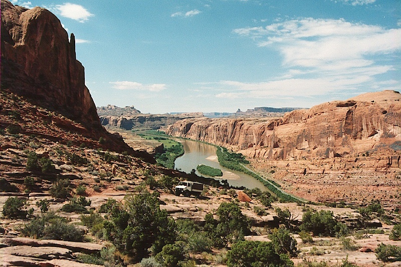
We started the ascent of the Moab Rim. The MR trail is terrifying. So scary that Kathleen decided that she would rather walk. Granted, this was early in her mogging career so we will cut her some slack.
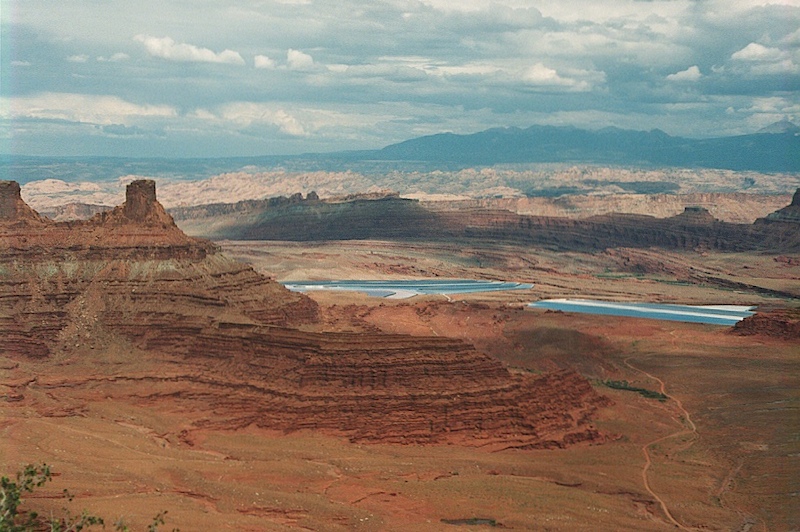
The MR trail rises high above the valley floor on a slick rock trail that will make even jade 'wheeler suffer a bit of anal pucker. Note the Colorado River in the background. Island in the Sky mesa is also visible on the horizon.
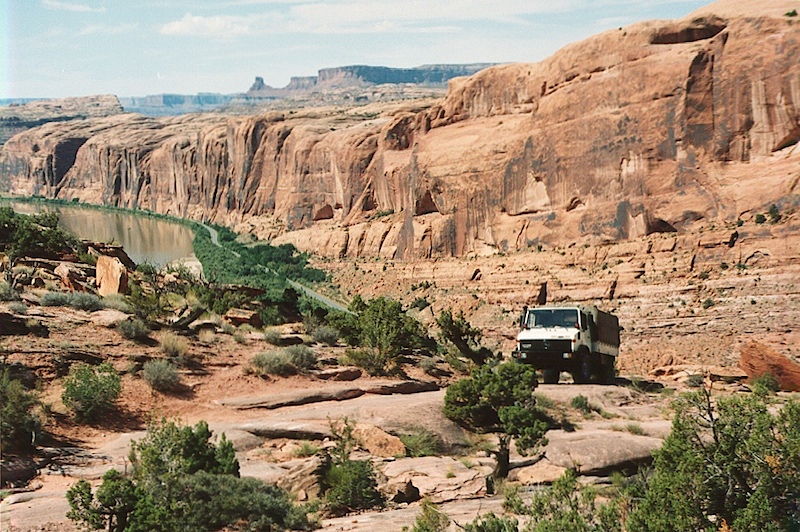
We are near the top the top of the rim.
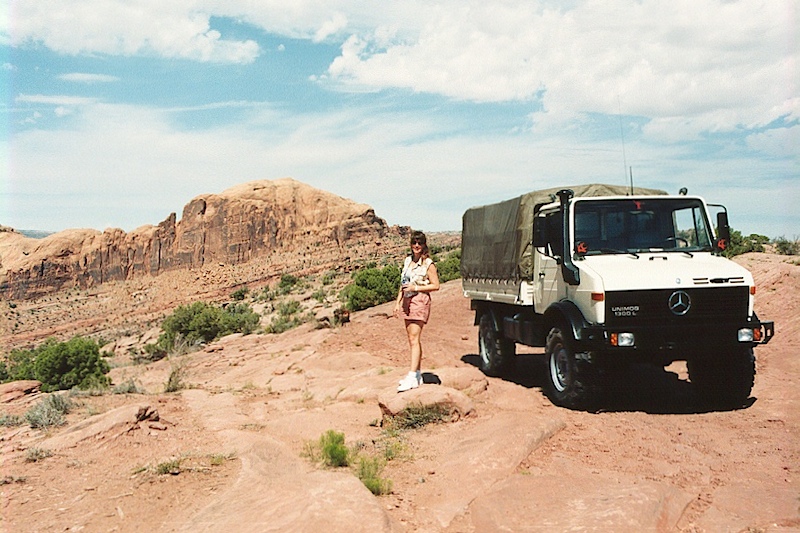
Kathleen enjoys the view from the top.
.jpg)
A view of the Moab valley and the Colorado River bottom.
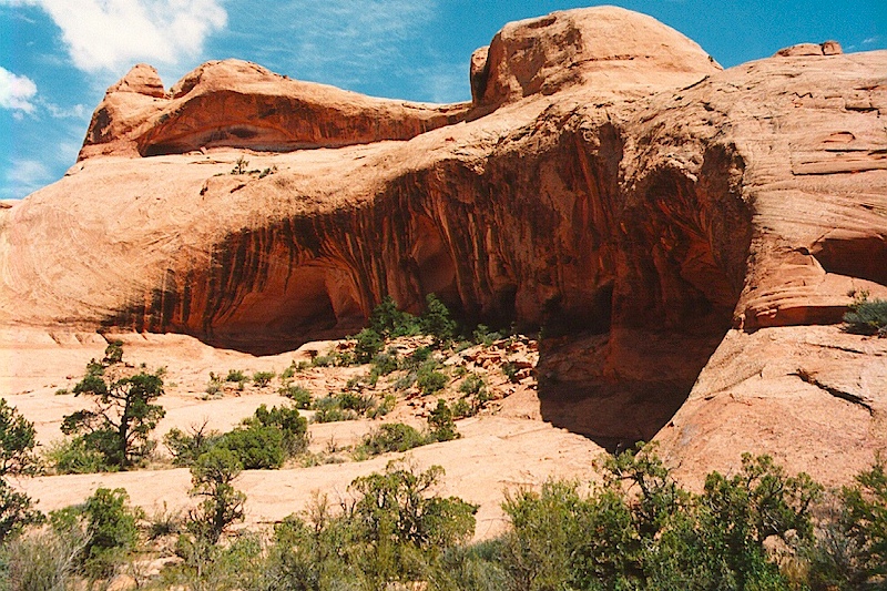
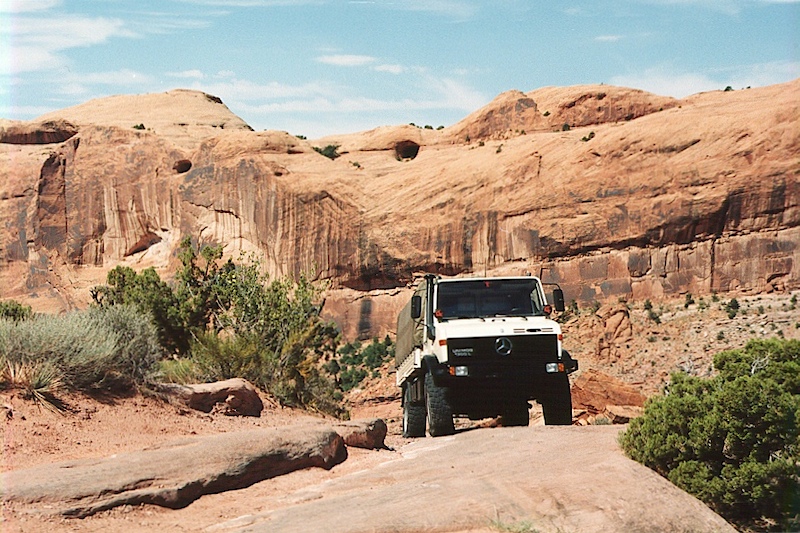
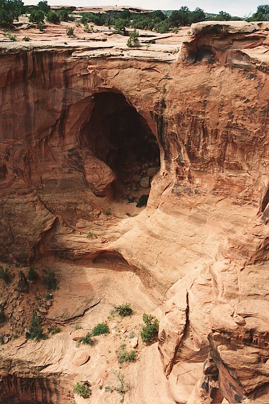
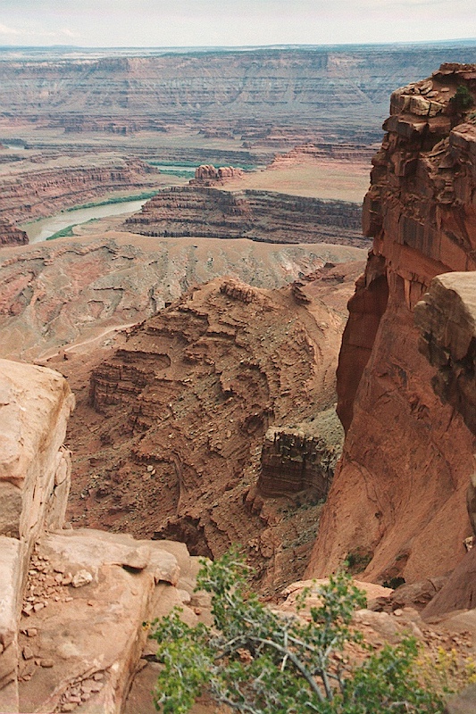
A view of some of the cliff alcoves visible at the top of the rim. Once we complete the terrifying descent back to the river bottom, we went to Gemini Bridges.
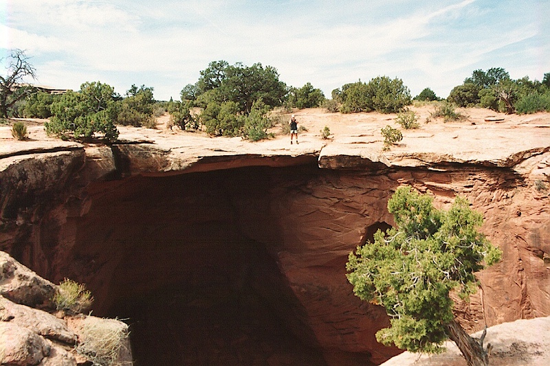
Gemini Bridges is an interesting arch structure in that you can actually drive over it. In the shot above, I am shooting the bridge.
The two parts of the bridge are visible. The left one is where the truck is. The other one is to the right of the crevice .
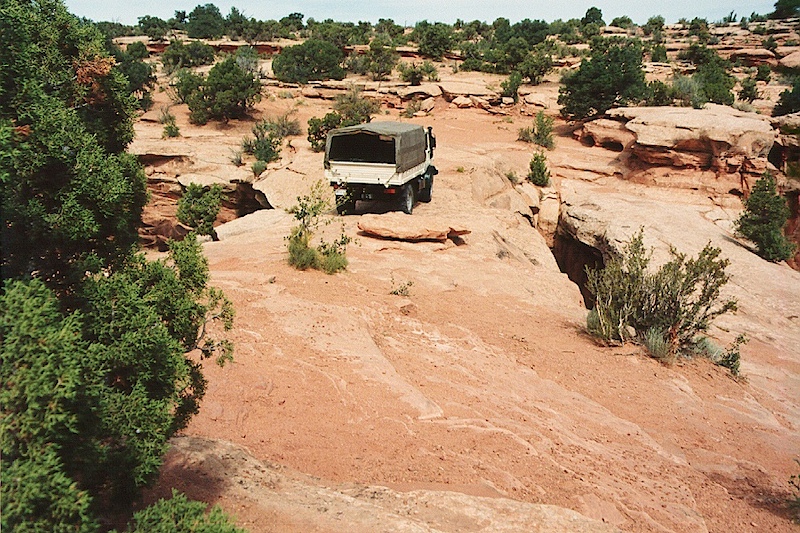
A view of the mog on Gemini Bridges. When you are on the bridge, you are a long, long way from the bottom of the canyon. If you slipped, you would die for sure.
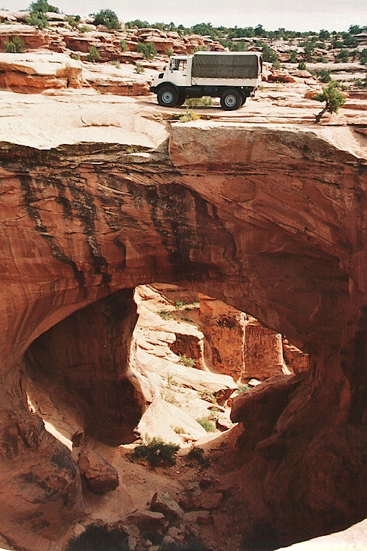
Another view of the bridges, but this one was taken from the opposite side of the canyon.
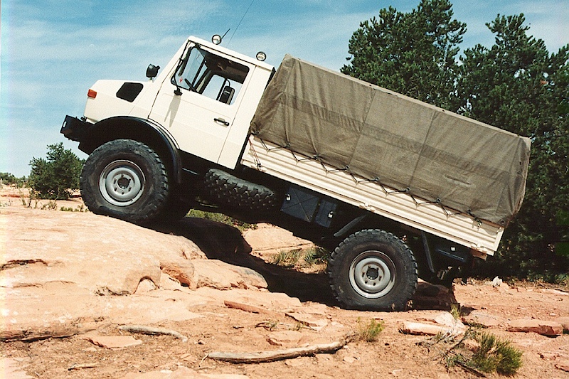
I couldn't resist taking a photo of the mog going up a little ledge. Well, not so little actually in that the whole ledge is higher than the height of the tire. Note the deformation of the rear tire due to low air pressure.
The next day after we did Gemini Bridges, we drove over to Dead Horse Point. Here is a view from the visitor center area.
 .
.
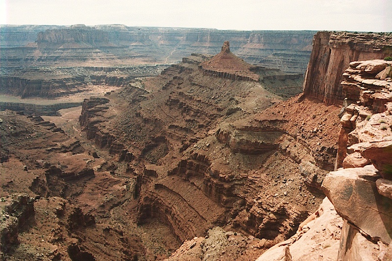
Looking east from Dead Horse Point. Visible in the distance is Horseshoe Loop. Also visible is the White Rim Trail on the next ledge.
A view of the potash mines that are to the east of Dead Horse Point. Also visible is an anticline which is an arching fold in the geologic strata.
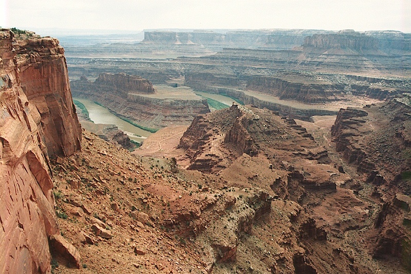
View down the canyon from Dead Horse Point.
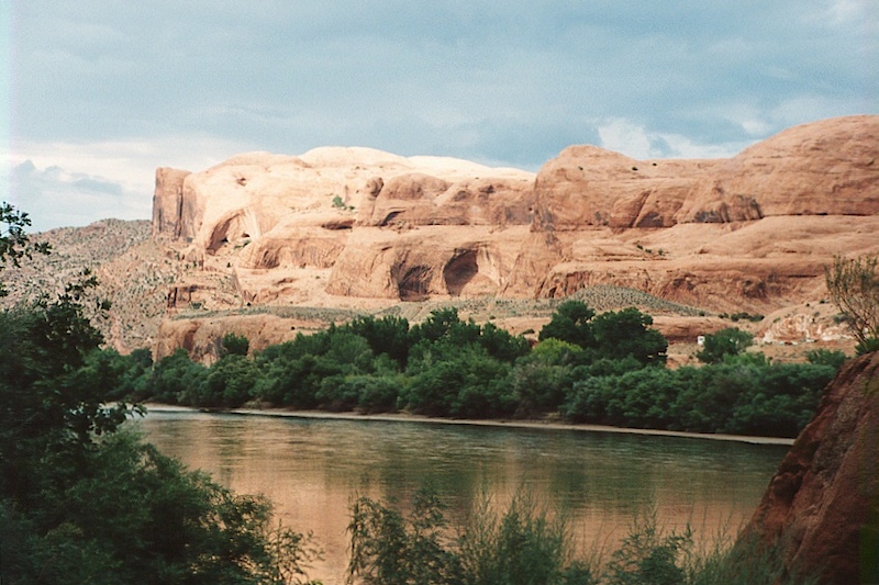
On the way back from DHP, we took the road that follows the Colorado river (north side) to the potash mine. Along the way, there were great views of the cliffs on the other side of the canyon.
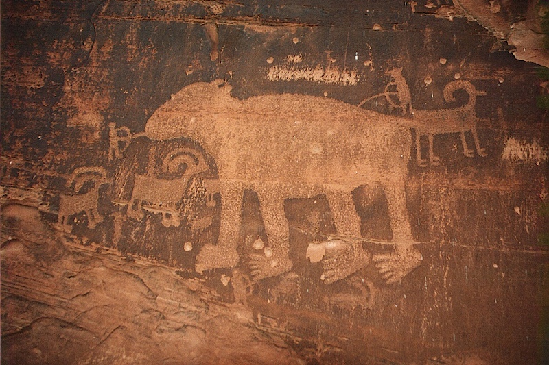
Also visible along the roadside were many petroglyphs. The one above appears to a bear being attacked by hunters. Also visible are desert sheep.
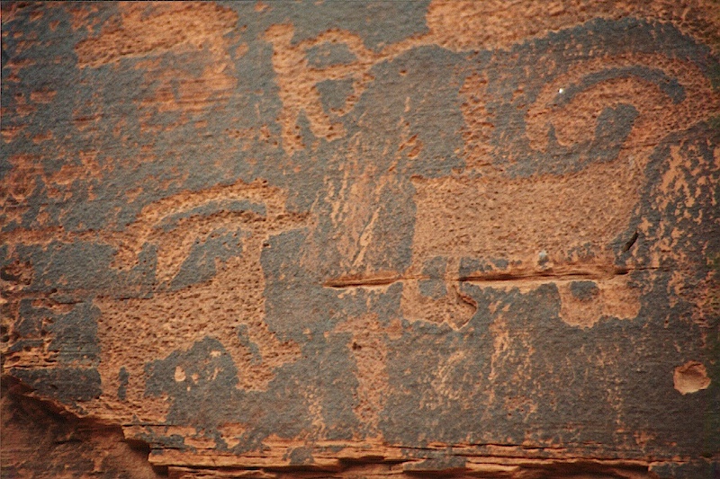
A close-up view of the sheep. Note the pecking marks that were used to erode the desert patina.
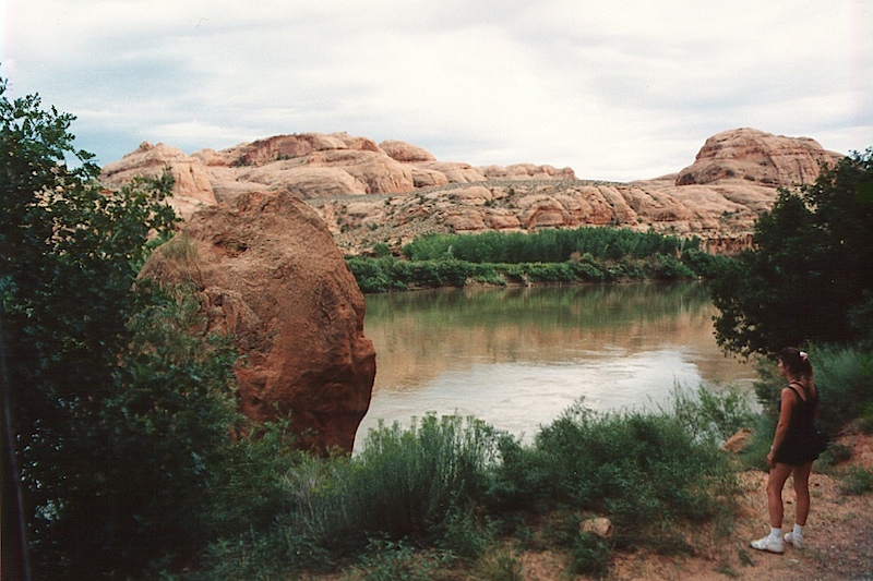
Kathleen inspects the river from the roadside pullout across from the petroglyph location.
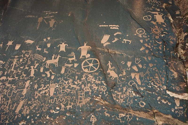
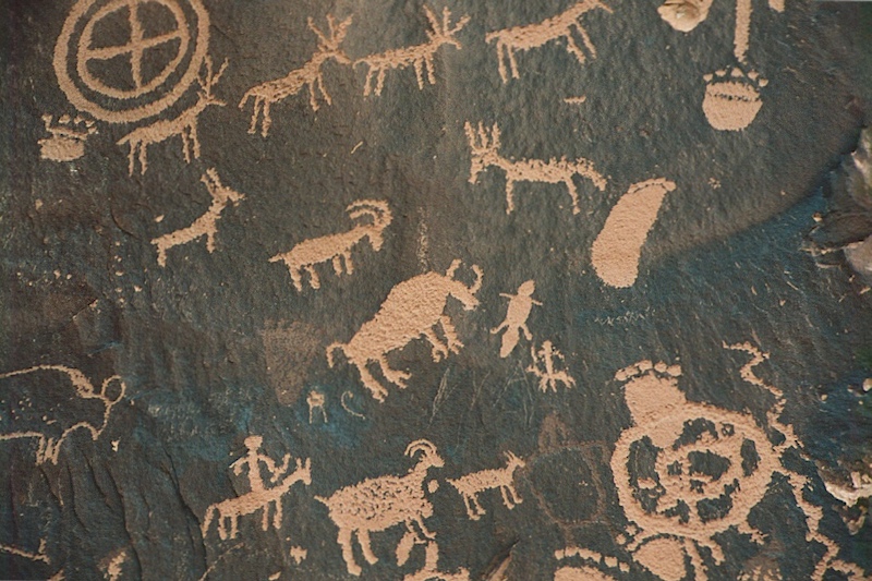
The following day we headed back to San Diego and went to Newspaper Rock on the way. This is an interesting site in that it contains a ton of indian petroglyphs in very good repair and with minimal exceptions, no recent graffiti.
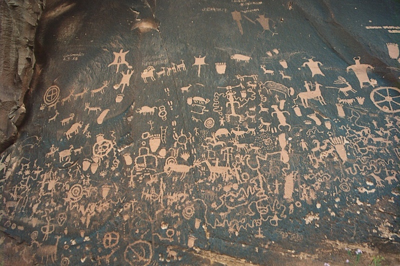
These images were produced by "pecking" or scraping the desert patina with small stone. The patina is the dark color and is caused by oxidation of chemicals in the underlying sandstone. The layer is thin and once you break the patina, it reveals the pink colored sandstone underneath.
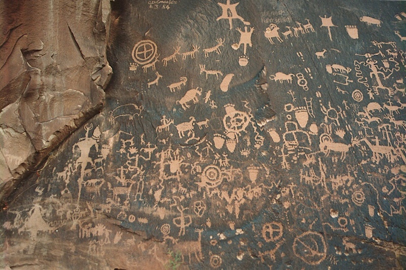
Look carefully. You will see many images of the animals that the locals encountered including sheep, buffalo, beaver, bear and snakes. Additionally, there is an image of a hunter on horseback as well as abstract images.
Note the figure on horseback at the bottom center.
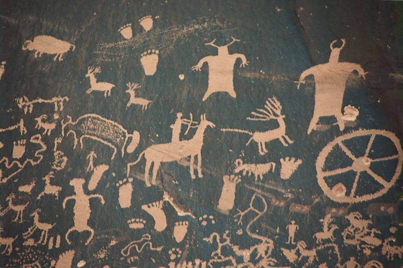
Some have suggested that these figures "prove" the existence of space aliens. I posit that they are images of the local shaman or religious figures. Note the wheel icon and the hunter using his bow and arrow against a deer or an elk.
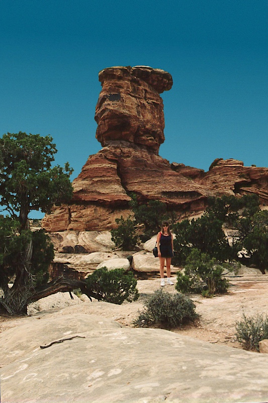
After Newspaper Rock, we headed south. Along the route, there were many scenic hoodoos. Here Kathleen poses beside one of them. Note the juniper trees and absence of ground cover.
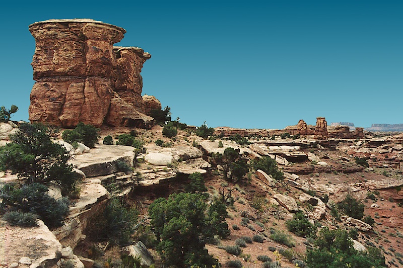
Another view of the hard cap rock that allows the hoodoos to form.
This was an excellent trip. Despite the drama at Bullfrog Creek and the very intense Moab Rim trail, this segment of the journey was pretty casual. The trip back to San Diego took a full two days at mog speed, but it was very scenic.